
(Оптимизирана за устройства с малък екран)
Lakeshore of the Balaton - Balatonalmádi, Унгария
Когато кликнете върху:
Кликнете върху снимките!
-
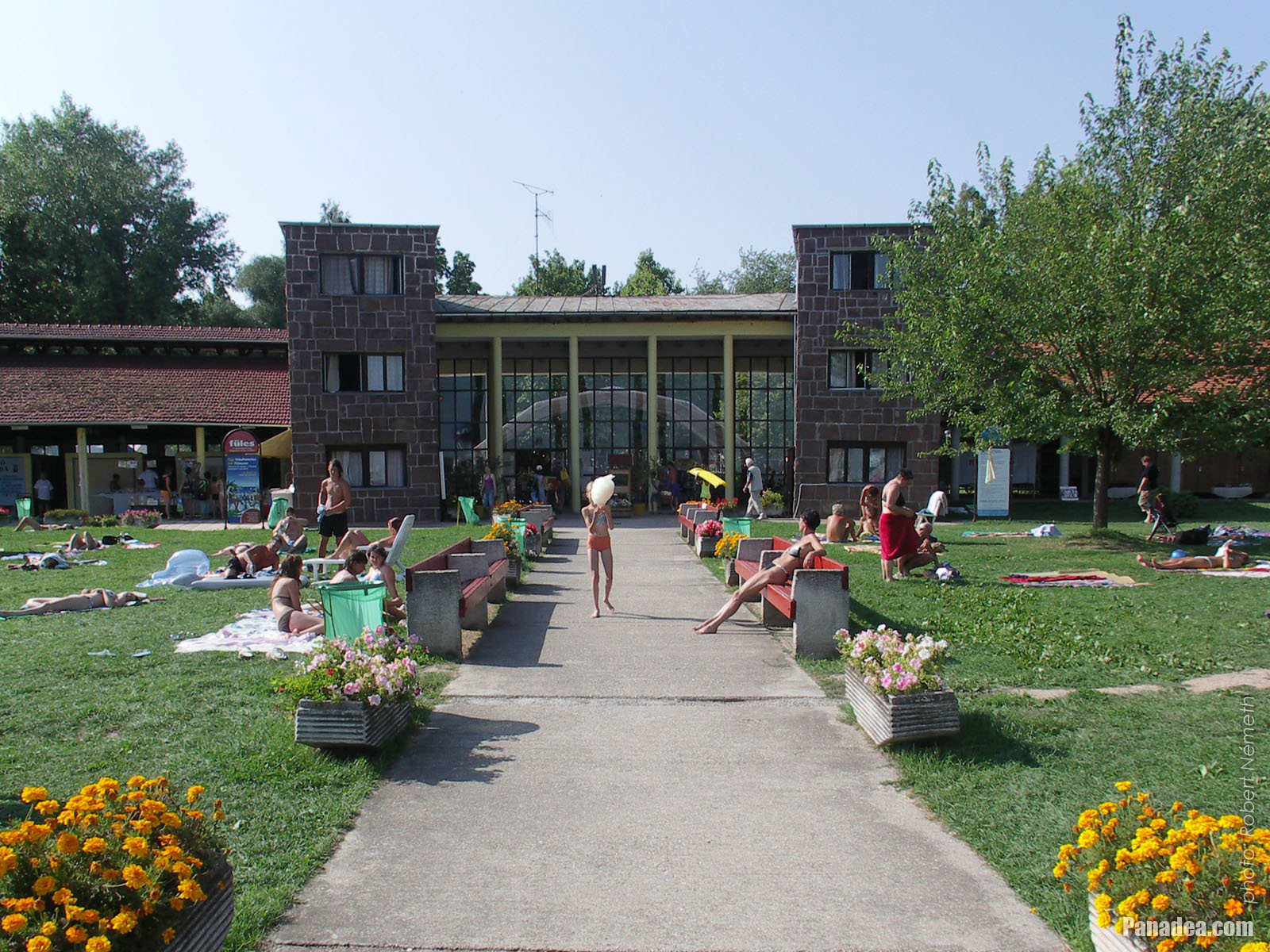
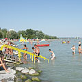
Wesselényi beach
дата на заснемане: 24.09.20102010
Създадено от: Роберт Немет
Модел на фотоапарата: Konica Minolta Dimage A200
Balatonalmádi, Унгария
-

Sailboats on the lake at the boat station of Balatonalmádi
дата на заснемане: 24.09.20102010
Създадено от: Роберт Немет
Модел на фотоапарата: Konica Minolta Dimage A200
Balatonalmádi, Унгария
-

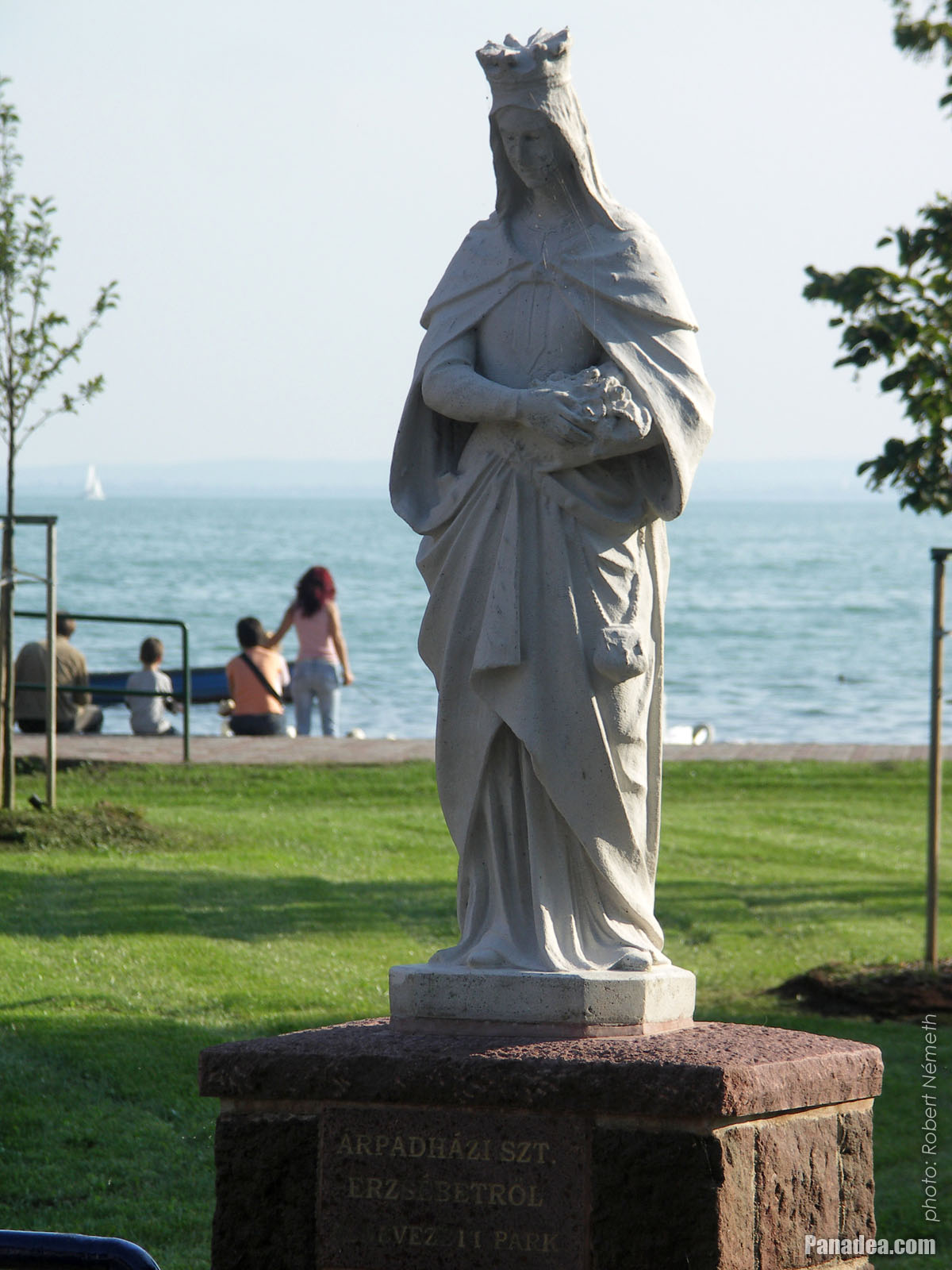
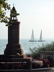
Statue of St. Elizabeth of Hungary
дата на заснемане: 24.09.20102010
Създадено от: Роберт Немет
Модел на фотоапарата: Konica Minolta Dimage A200
Balatonalmádi, Унгария
-

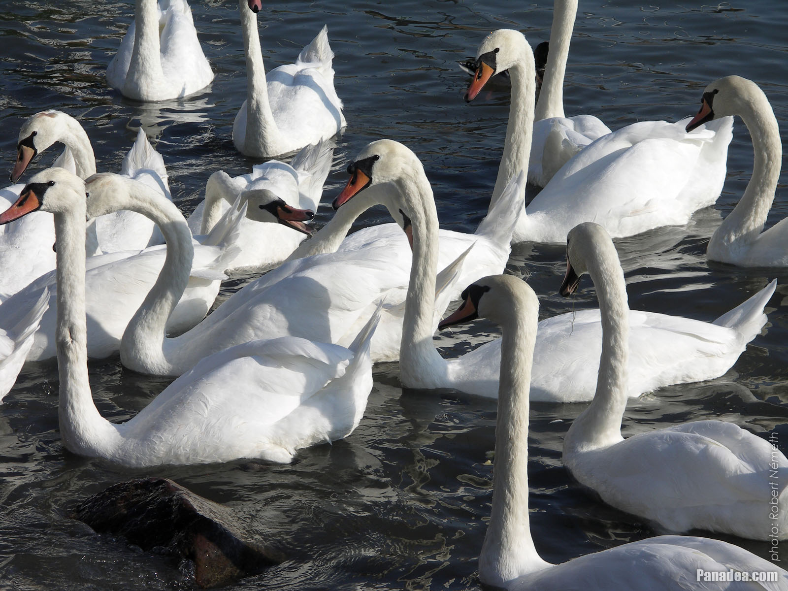
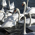
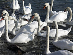
In exchange for some food these swans are very enthusiastic
дата на заснемане: 24.09.20102010
Създадено от: Роберт Немет
Модел на фотоапарата: Konica Minolta Dimage A200
Balatonalmádi, Унгария
-

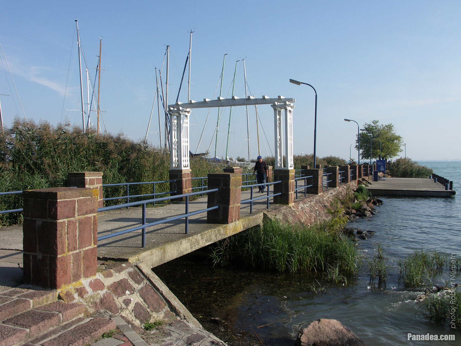
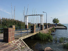
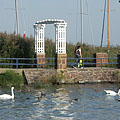
The red sandstone gate of Wesselényi beach
дата на заснемане: 24.09.20102010
Създадено от: Роберт Немет
Модел на фотоапарата: Konica Minolta Dimage A200
Balatonalmádi, Унгария
-

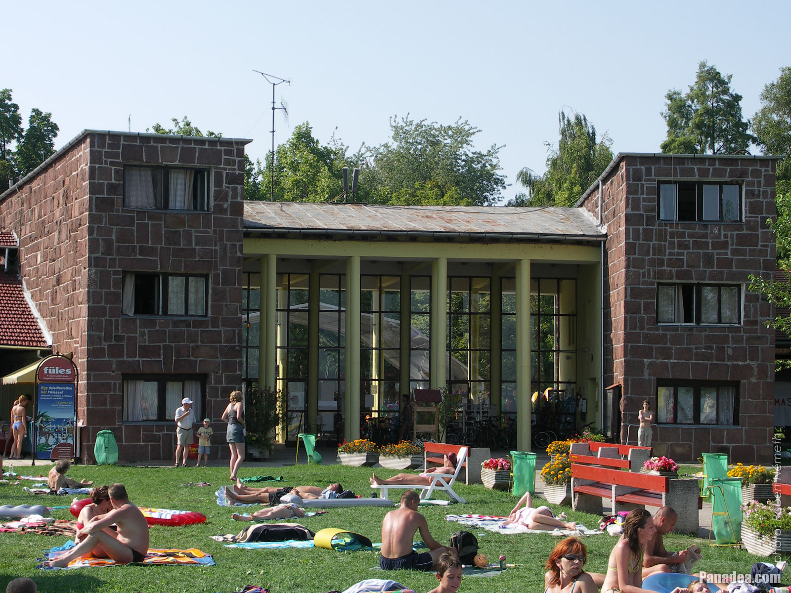
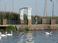
The distinctive gate of the Wesselényi beach
дата на заснемане: 17.08.20062006
Създадено от: Роберт Немет
Модел на фотоапарата: Konica Minolta Dimage A200
Balatonalmádi, Унгария
-

The characteristic gate of the Wesselényi beach
дата на заснемане: 17.08.20062006
Създадено от: Роберт Немет
Модел на фотоапарата: Konica Minolta Dimage A200
Balatonalmádi, Унгария
-

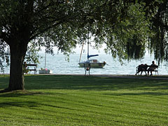
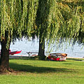
Grassy shore with willow trees on the Wesselényi beach
дата на заснемане: 17.08.20062006
Създадено от: Роберт Немет
Модел на фотоапарата: Konica Minolta Dimage A200
Balatonalmádi, Унгария
-

Wesselényi beach
дата на заснемане: 17.08.20062006
Създадено от: Роберт Немет
Модел на фотоапарата: Konica Minolta Dimage A200
Balatonalmádi, Унгария
-

The Wesselényi beach in Balatonalmádi, looking westwards (towards Balatonfüred)
дата на заснемане: 17.08.20062006
Създадено от: Роберт Немет
Модел на фотоапарата: Konica Minolta Dimage A200
Balatonalmádi, Унгария
-
The Wesselényi beach on the lakeshore of the Balaton
дата на заснемане: 17.08.20062006
Създадено от: Роберт Немет
Модел на фотоапарата: Konica Minolta Dimage A200
Balatonalmádi, Унгария
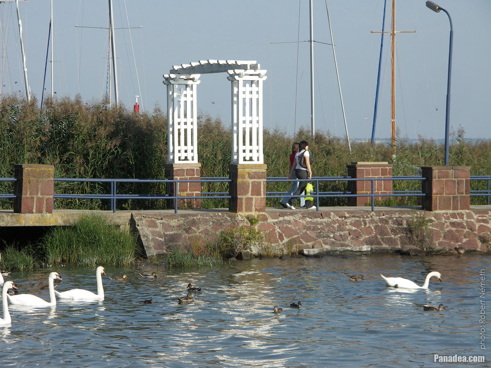
The Wesselényi beach on the lakeshore of the Balaton - Balatonalmádi, Унгария -
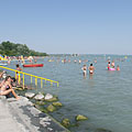
The lakeshore at the Wesselényi beach
дата на заснемане: 17.08.20062006
Създадено от: Роберт Немет
Модел на фотоапарата: Konica Minolta Dimage A200
Balatonalmádi, Унгария
The lakeshore at the Wesselényi beach - Balatonalmádi, Унгария -
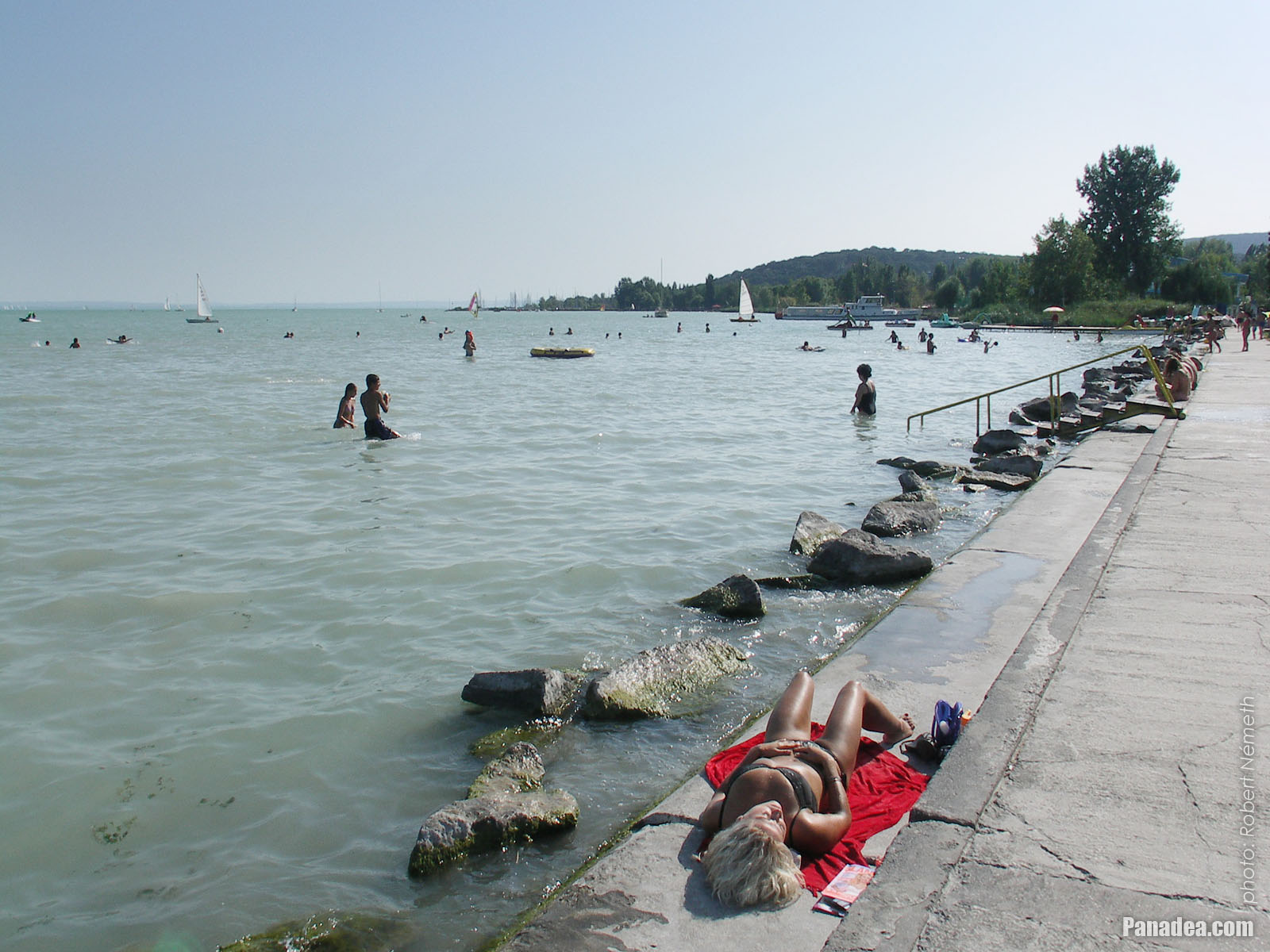
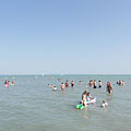
Lake Balaton is shallow and the water is pleasantly warm in summer at the Wesselényi beach
дата на заснемане: 17.08.20062006
Създадено от: Роберт Немет
Модел на фотоапарата: Konica Minolta Dimage A200
Balatonalmádi, Унгария
Lake Balaton is shallow and the water is pleasantly warm in summer at the Wesselényi beach - Balatonalmádi, Унгария -
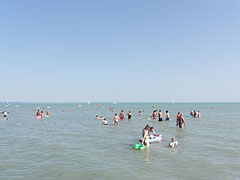
The view of Lake Balaton at the Wesselényi beach
дата на заснемане: 17.08.20062006
Създадено от: Роберт Немет
Модел на фотоапарата: Konica Minolta Dimage A200
Balatonalmádi, Унгария
The view of Lake Balaton at the Wesselényi beach - Balatonalmádi, Унгария -
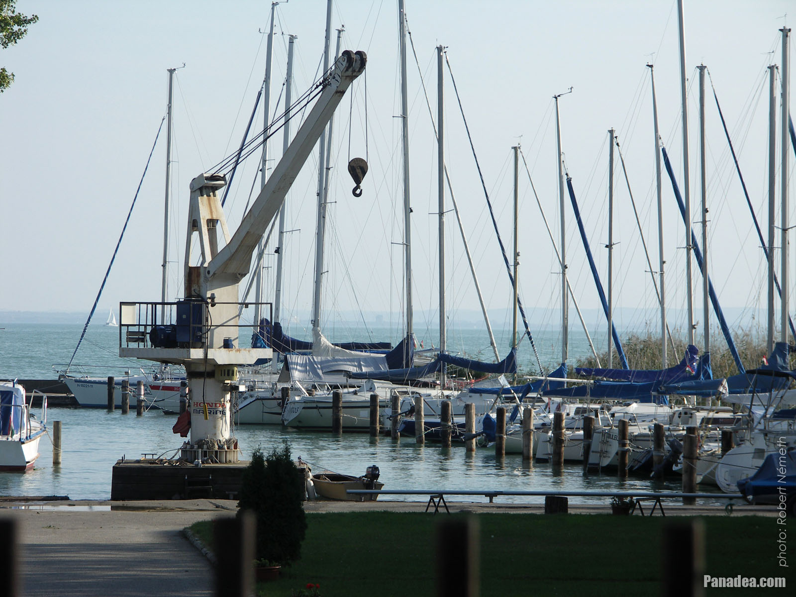
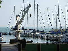
A boat-lifter crane at the marina (sailboat harbor)
дата на заснемане: 24.09.20102010
Създадено от: Роберт Немет
Модел на фотоапарата: Konica Minolta Dimage A200
Balatonalmádi, Унгария
A boat-lifter crane at the marina (sailboat harbor) - Balatonalmádi, Унгария -
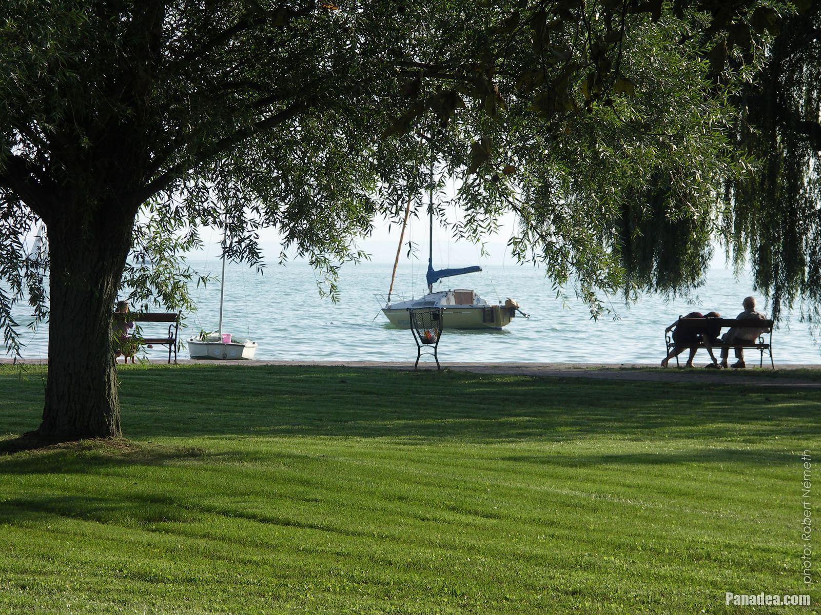
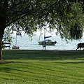
Fresh lawn and a willow tree in the park on the waterfront
дата на заснемане: 24.09.20102010
Създадено от: Роберт Немет
Модел на фотоапарата: Konica Minolta Dimage A200
Balatonalmádi, Унгария
Fresh lawn and a willow tree in the park on the waterfront - Balatonalmádi, Унгария -
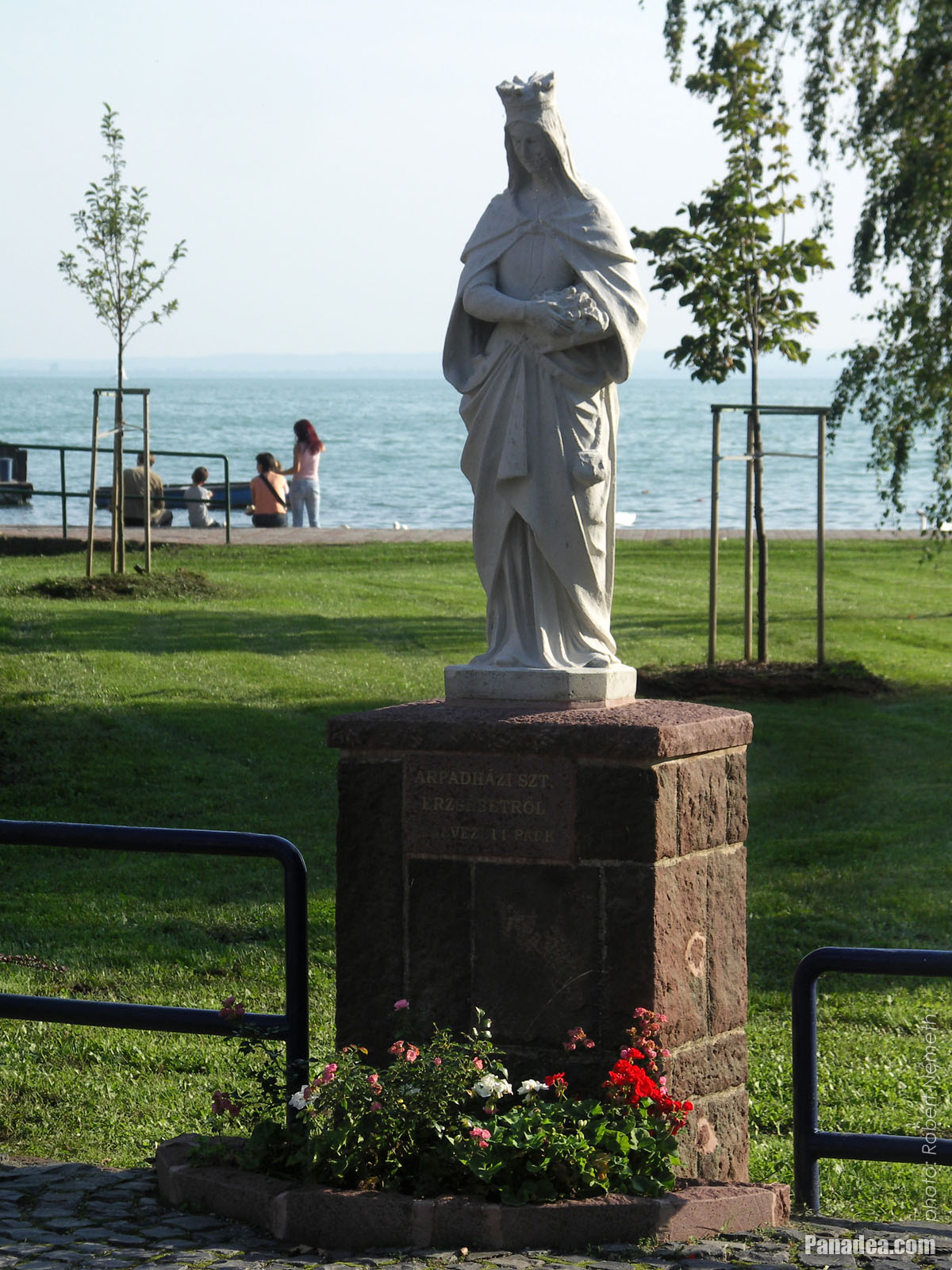
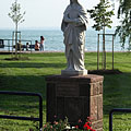
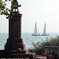
Statue of St. Elizabeth of Hungary
дата на заснемане: 24.09.20102010
Създадено от: Роберт Немет
Модел на фотоапарата: Konica Minolta Dimage A200
Balatonalmádi, Унгария
Statue of St. Elizabeth of Hungary - Balatonalmádi, Унгария -
Pier of the boat station
дата на заснемане: 24.09.20102010
Създадено от: Роберт Немет
Модел на фотоапарата: Konica Minolta Dimage A200
Balatonalmádi, Унгария
Pier of the boat station - Balatonalmádi, Унгария -
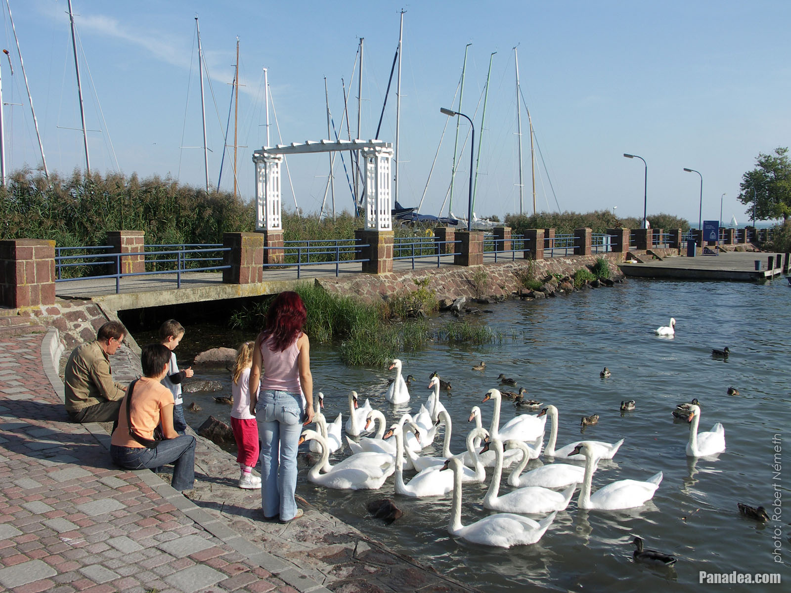
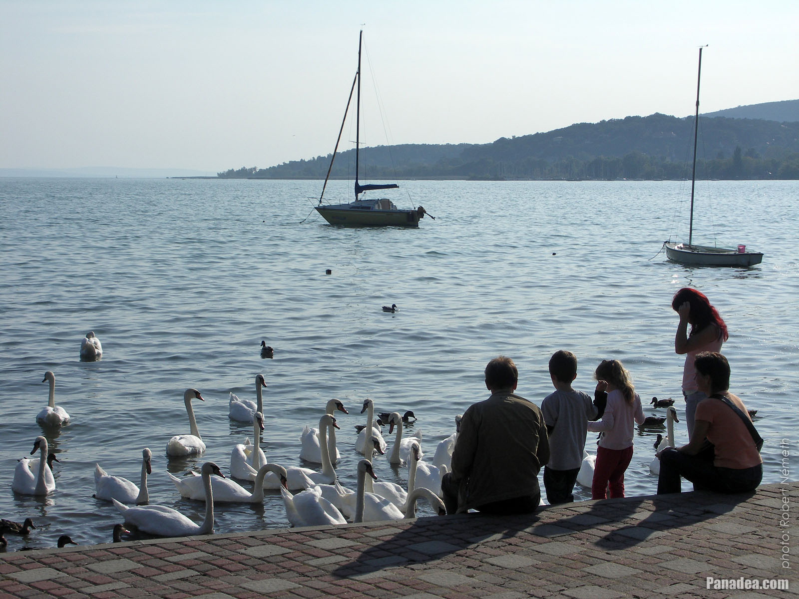
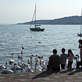
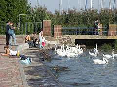
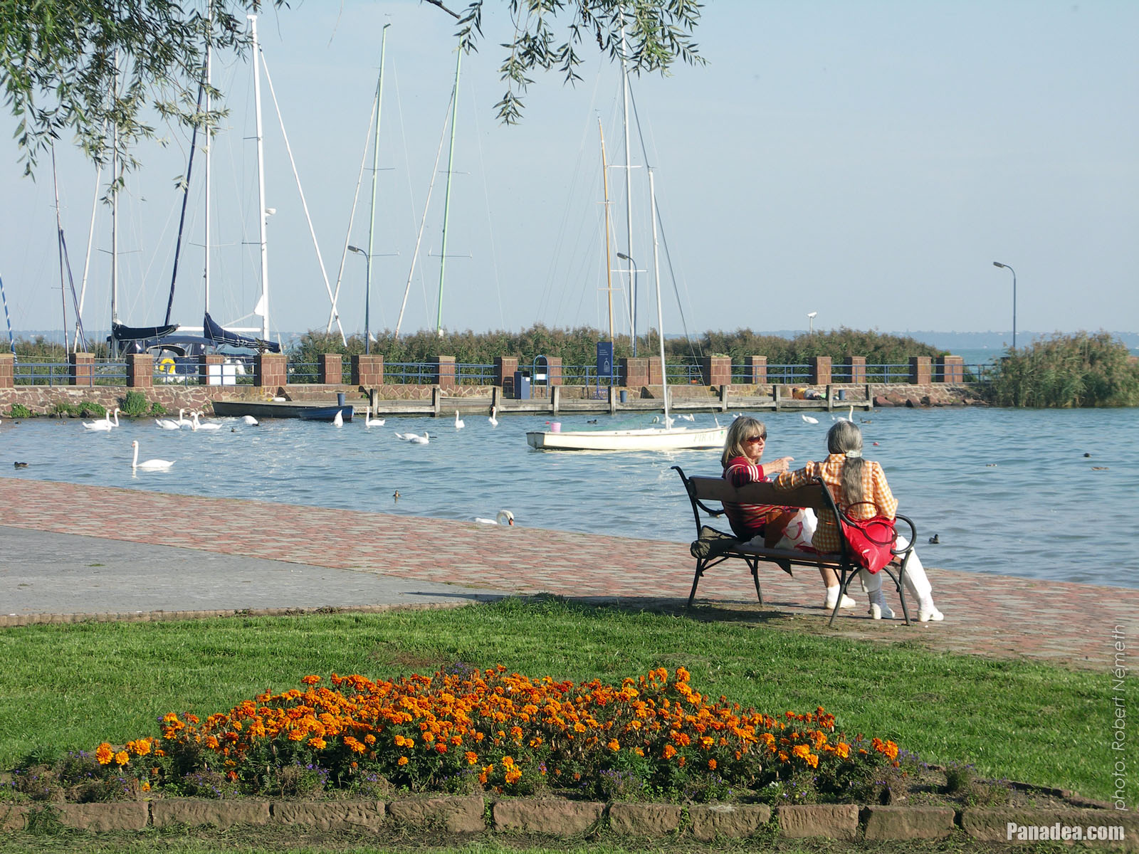
Swan feeding at the lakeshore of Balaton
дата на заснемане: 24.09.20102010
Създадено от: Роберт Немет
Модел на фотоапарата: Konica Minolta Dimage A200
Balatonalmádi, Унгария
Swan feeding at the lakeshore of Balaton - Balatonalmádi, Унгария -
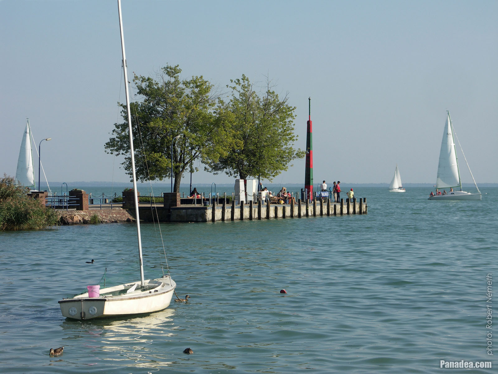
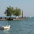
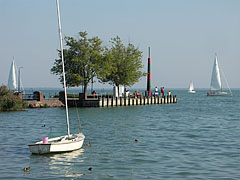
The pier leads the the boat station
дата на заснемане: 24.09.20102010
Създадено от: Роберт Немет
Модел на фотоапарата: Konica Minolta Dimage A200
Balatonalmádi, Унгария
The pier leads the the boat station - Balatonalmádi, Унгария -
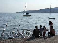
Mass of mute swans (Cygnus olor)
дата на заснемане: 24.09.20102010
Създадено от: Роберт Немет
Модел на фотоапарата: Konica Minolta Dimage A200
Balatonalmádi, Унгария
Mass of mute swans (Cygnus olor) - Balatonalmádi, Унгария -
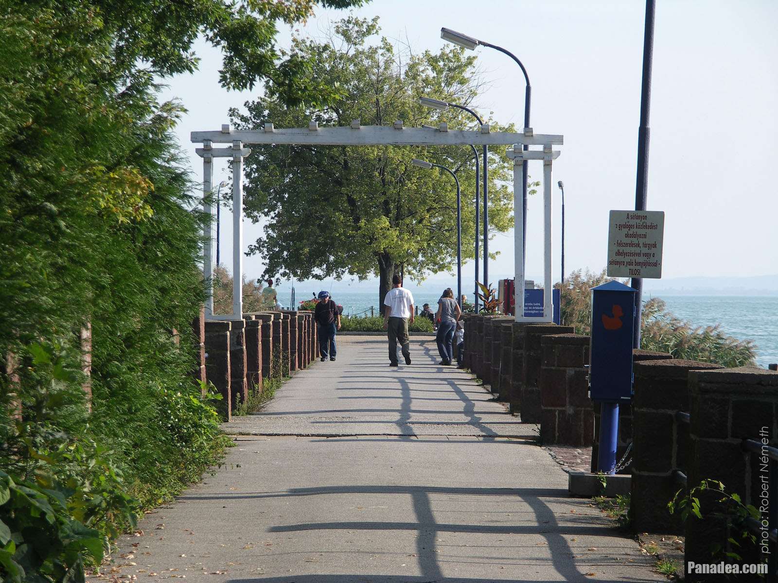
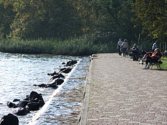
Lakeside promenade in the autumn sunshine
дата на заснемане: 24.09.20102010
Създадено от: Роберт Немет
Модел на фотоапарата: Konica Minolta Dimage A200
Balatonalmádi, Унгария
Lakeside promenade in the autumn sunshine - Balatonalmádi, Унгария -
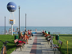
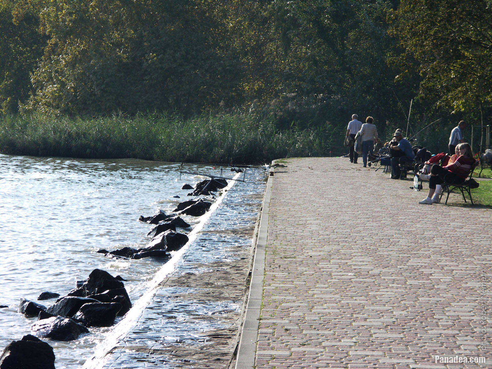
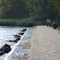
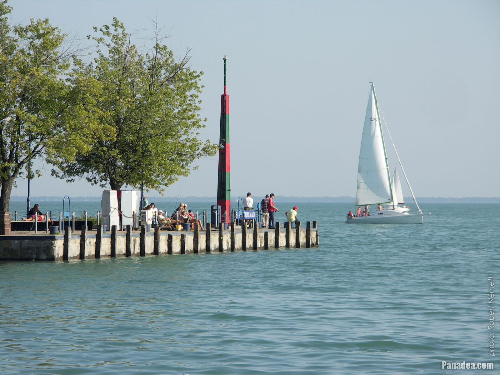
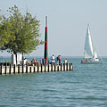
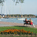
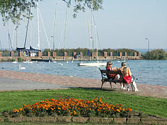
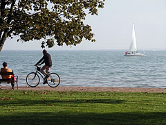
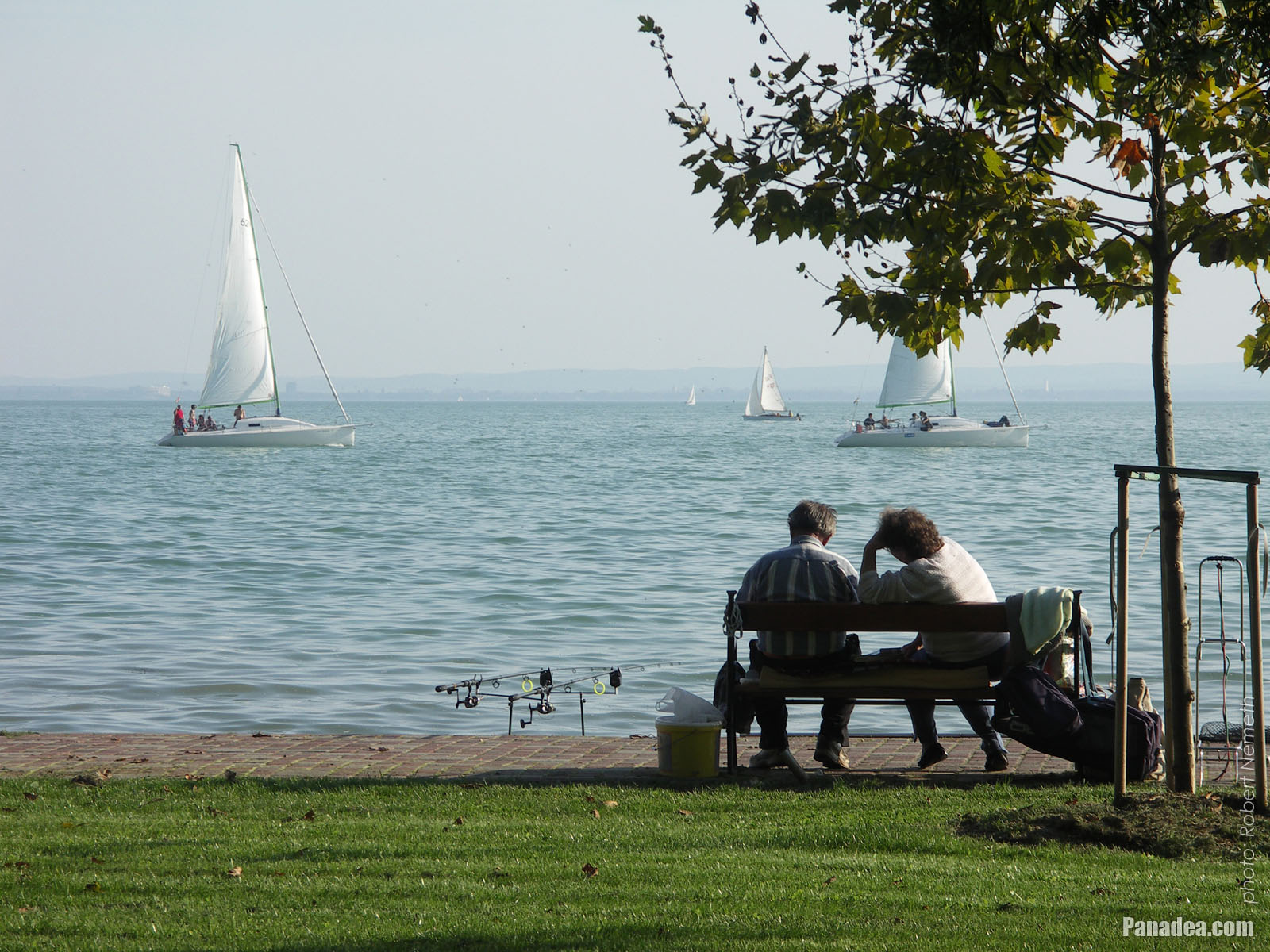
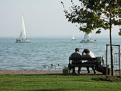
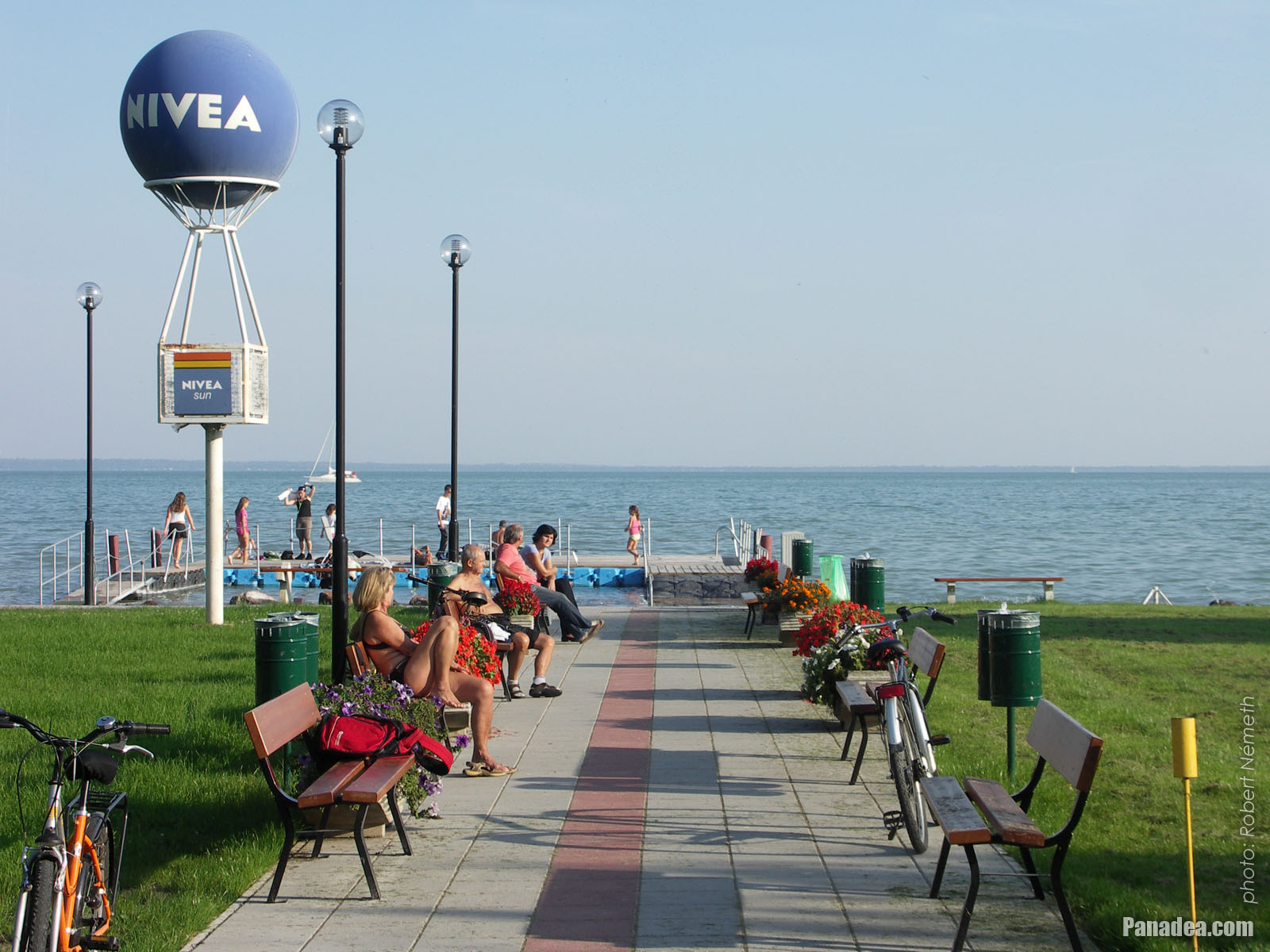
Lakeside walkway with relaxing people and some anglers
дата на заснемане: 24.09.20102010
Създадено от: Роберт Немет
Модел на фотоапарата: Konica Minolta Dimage A200
Balatonalmádi, Унгария
Lakeside walkway with relaxing people and some anglers - Balatonalmádi, Унгария -
Lakeside of Balaton at the Balatonalmádi boat station
дата на заснемане: 24.09.20102010
Създадено от: Роберт Немет
Модел на фотоапарата: Konica Minolta Dimage A200
Balatonalmádi, Унгария
Lakeside of Balaton at the Balatonalmádi boat station - Balatonalmádi, Унгария -
Pier
дата на заснемане: 24.09.20102010
Създадено от: Роберт Немет
Модел на фотоапарата: Konica Minolta Dimage A200
Balatonalmádi, Унгария
Pier - Balatonalmádi, Унгария -
Boat (ship) station of Balatonalmádi
дата на заснемане: 24.09.20102010
Създадено от: Роберт Немет
Модел на фотоапарата: Konica Minolta Dimage A200
Balatonalmádi, Унгария
Boat (ship) station of Balatonalmádi - Balatonalmádi, Унгария -
Boat station on the pier, and sailboats everywhere
дата на заснемане: 24.09.20102010
Създадено от: Роберт Немет
Модел на фотоапарата: Konica Minolta Dimage A200
Balatonalmádi, Унгария
Boat station on the pier, and sailboats everywhere - Balatonalmádi, Унгария -
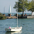
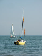
Moored tiny sailing boat is rocking on the water, and the boat station is behind
дата на заснемане: 24.09.20102010
Създадено от: Роберт Немет
Модел на фотоапарата: Konica Minolta Dimage A200
Balatonalmádi, Унгария
Moored tiny sailing boat is rocking on the water, and the boat station is behind - Balatonalmádi, Унгария -
Colors of late September by the lake shore, in the St. Elizabeth grove
дата на заснемане: 24.09.20102010
Създадено от: Роберт Немет
Модел на фотоапарата: Konica Minolta Dimage A200
Balatonalmádi, Унгария
Colors of late September by the lake shore, in the St. Elizabeth grove - Balatonalmádi, Унгария -
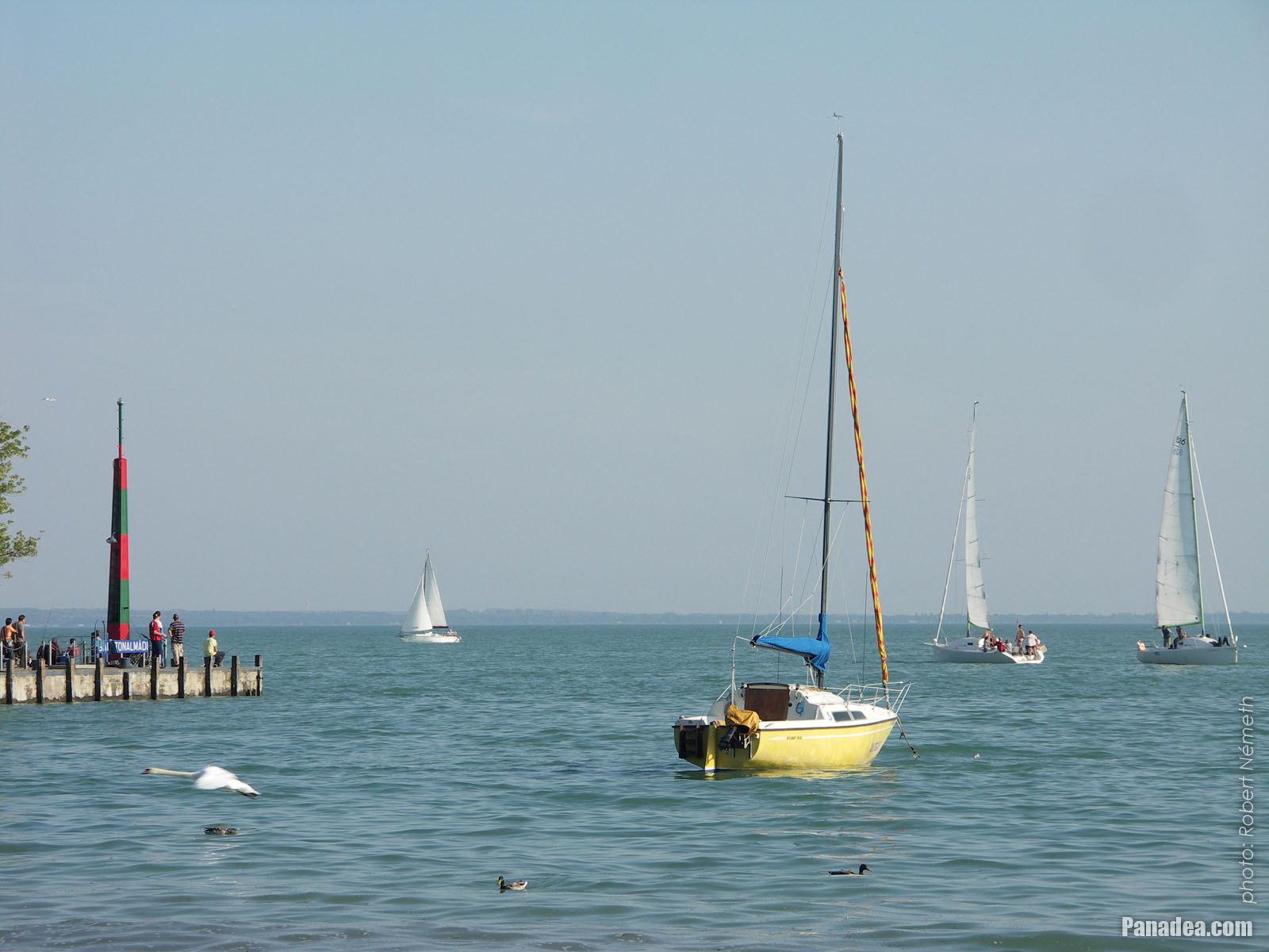
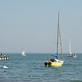
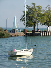
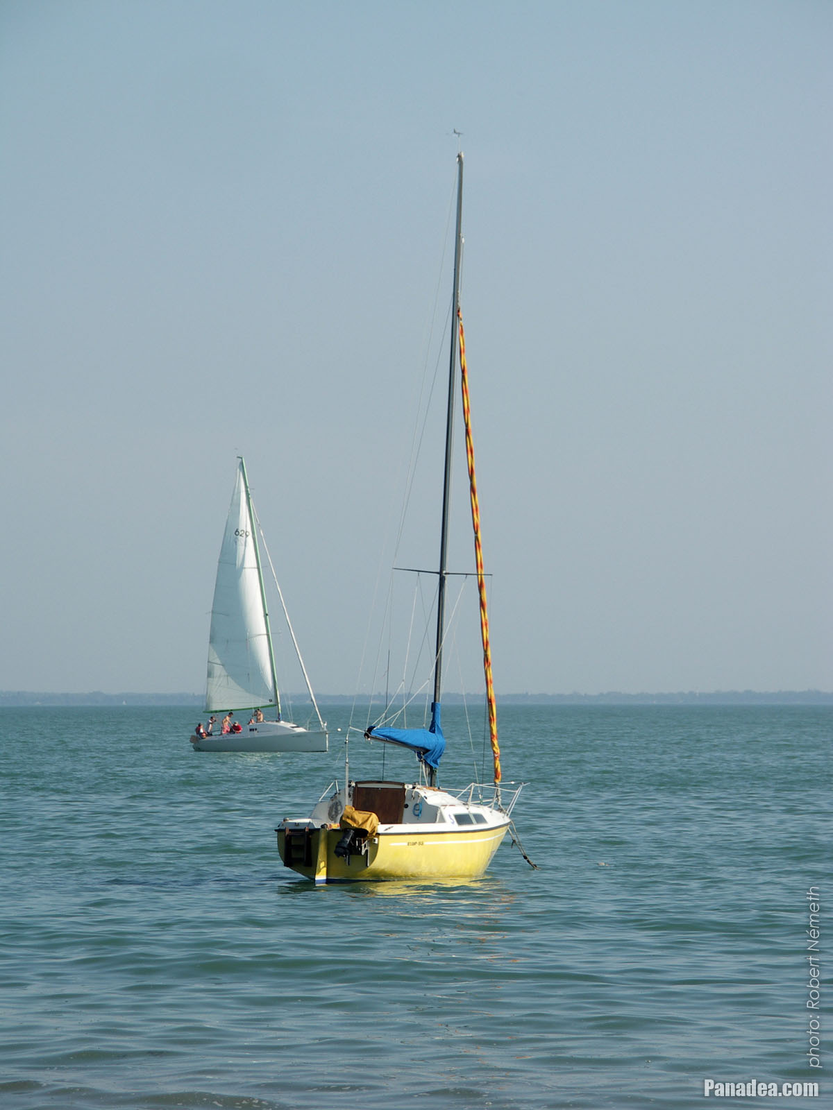
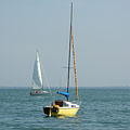
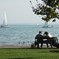
Sailboats on Lake Balaton
дата на заснемане: 24.09.20102010
Създадено от: Роберт Немет
Модел на фотоапарата: Konica Minolta Dimage A200
Balatonalmádi, Унгария
Sailboats on Lake Balaton - Balatonalmádi, Унгария -
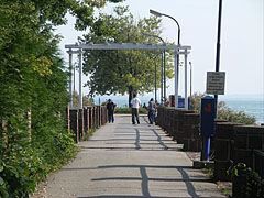
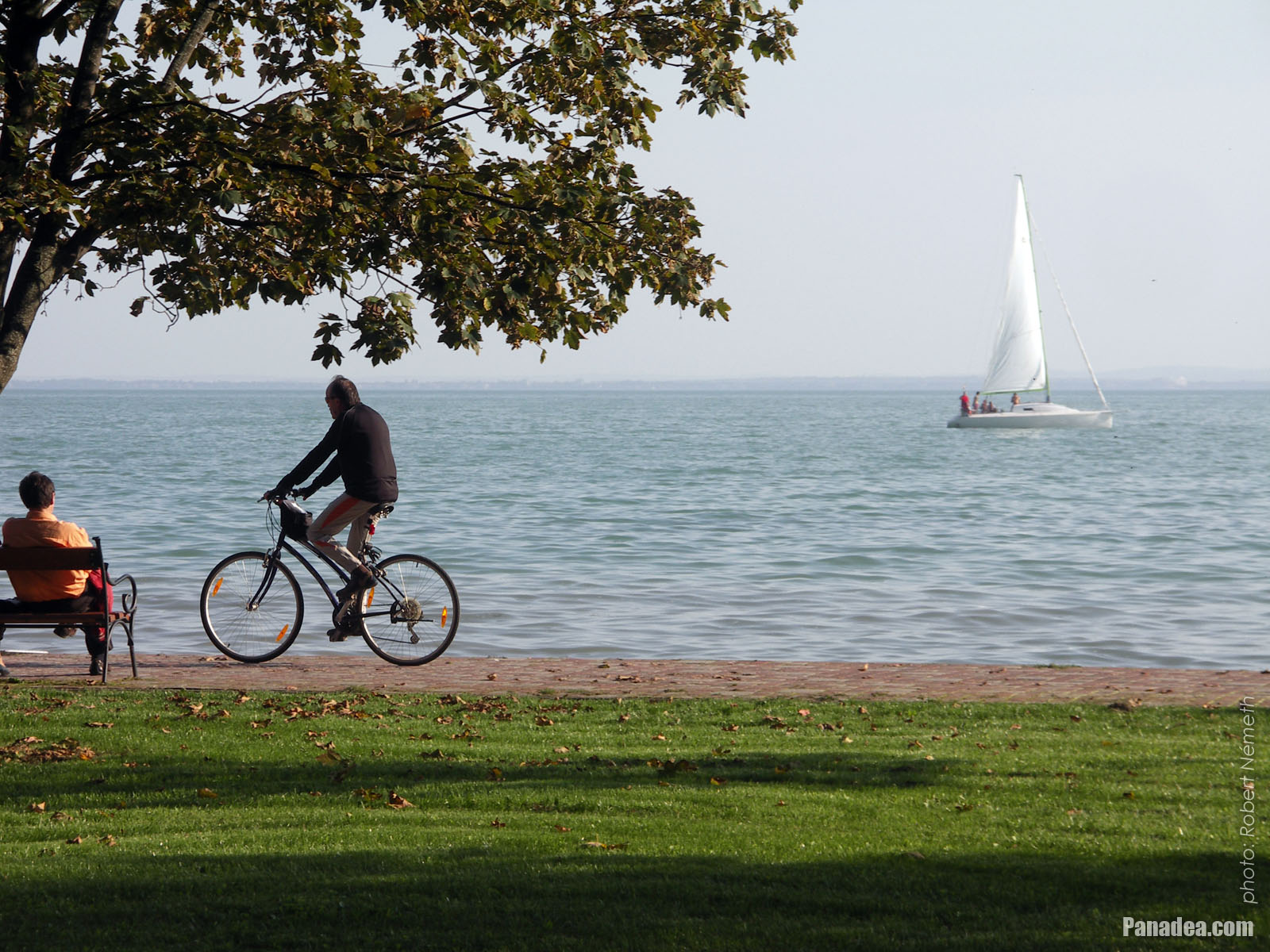
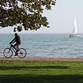
Lakeside promenade with some bikers
дата на заснемане: 24.09.20102010
Създадено от: Роберт Немет
Модел на фотоапарата: Konica Minolta Dimage A200
Balatonalmádi, Унгария
Lakeside promenade with some bikers - Balatonalmádi, Унгария -
Lakeside promenade
дата на заснемане: 24.09.20102010
Създадено от: Роберт Немет
Модел на фотоапарата: Konica Minolta Dimage A200
Balatonalmádi, Унгария
Lakeside promenade - Balatonalmádi, Унгария -
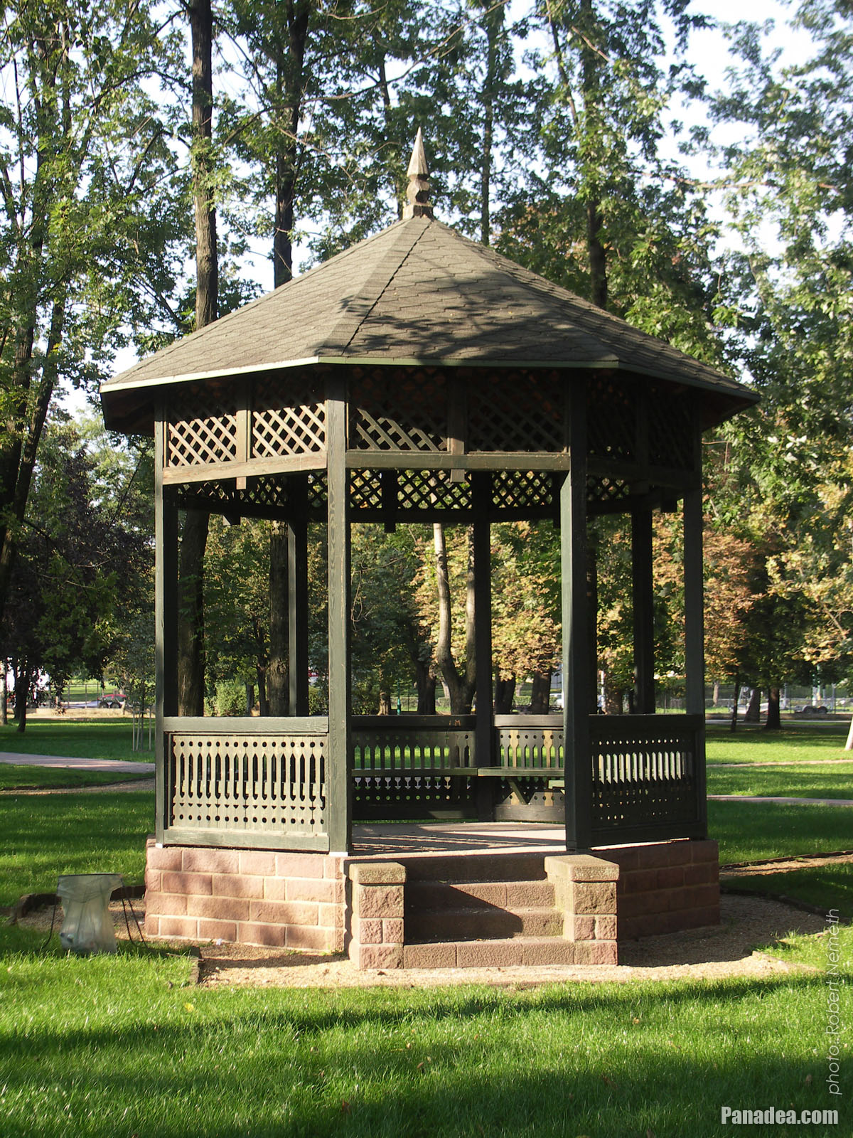
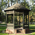
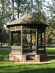
Authentic bandstand (music pavilion) in the "Old Park"
The park was established in 1902, today its entire area is a natural reserve.
дата на заснемане: 24.09.20102010
Създадено от: Роберт Немет
Модел на фотоапарата: Konica Minolta Dimage A200
Balatonalmádi, Унгария
Authentic bandstand (music pavilion) in the "Old Park" - Balatonalmádi, Унгария -
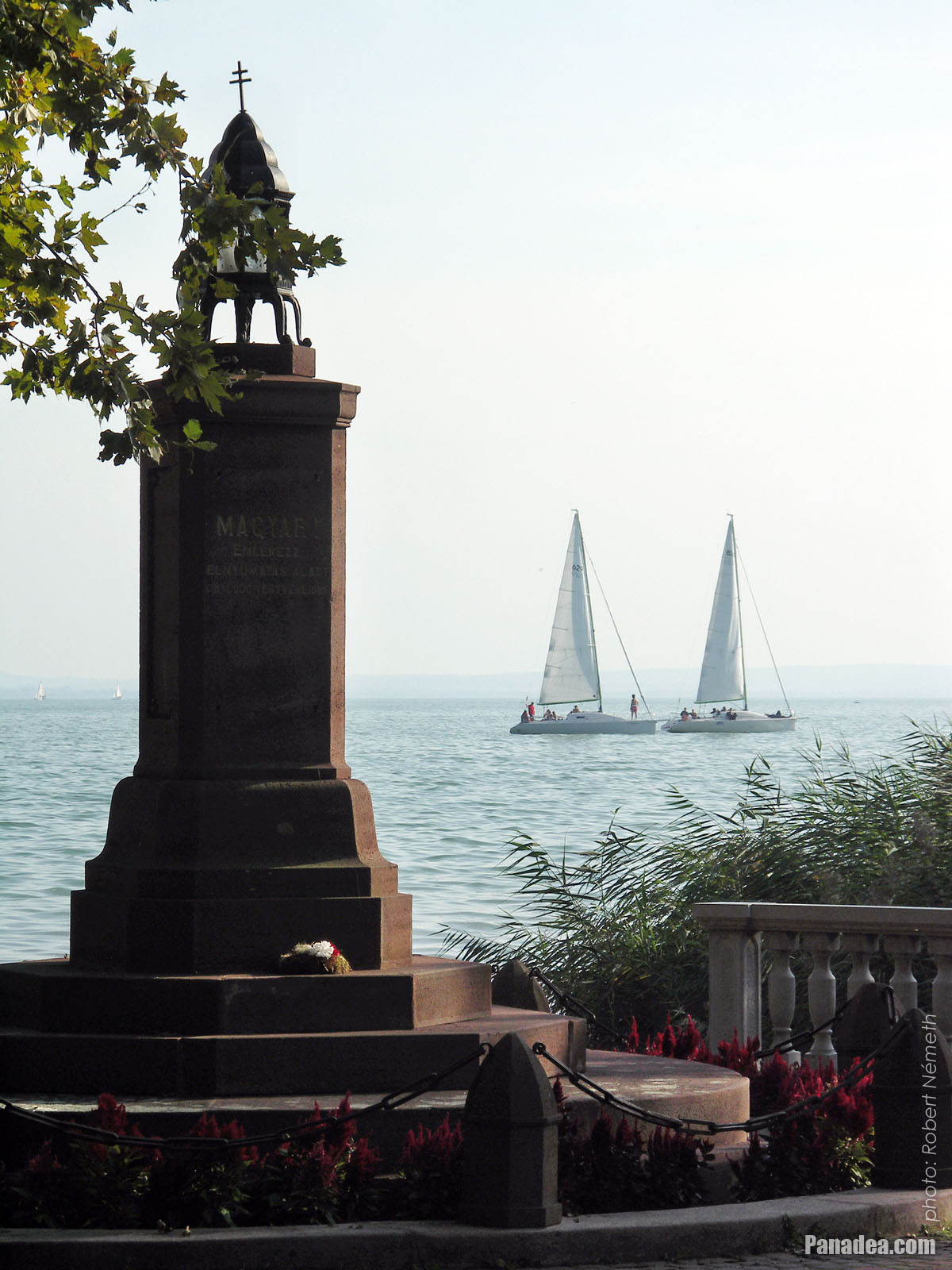
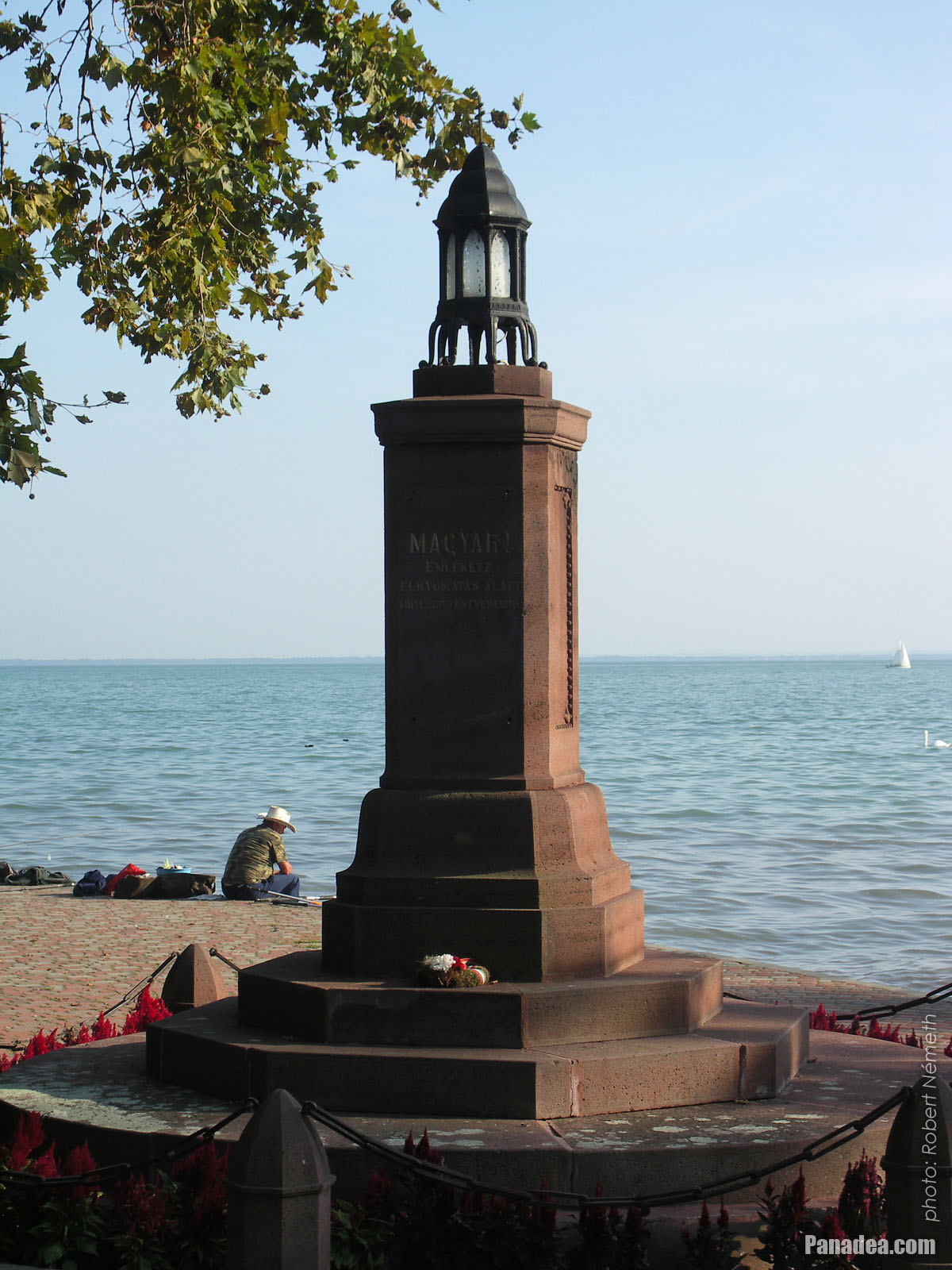
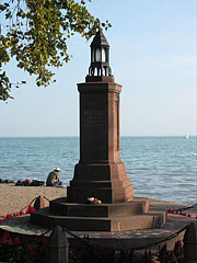
"Irredentist" eternal lamp (however some people think it's just a Trianon memorial)
дата на заснемане: 24.09.20102010
Създадено от: Роберт Немет
Модел на фотоапарата: Konica Minolta Dimage A200
Balatonalmádi, Унгария
"Irredentist" eternal lamp (however some people think it's just a Trianon memorial) - Balatonalmádi, Унгария -
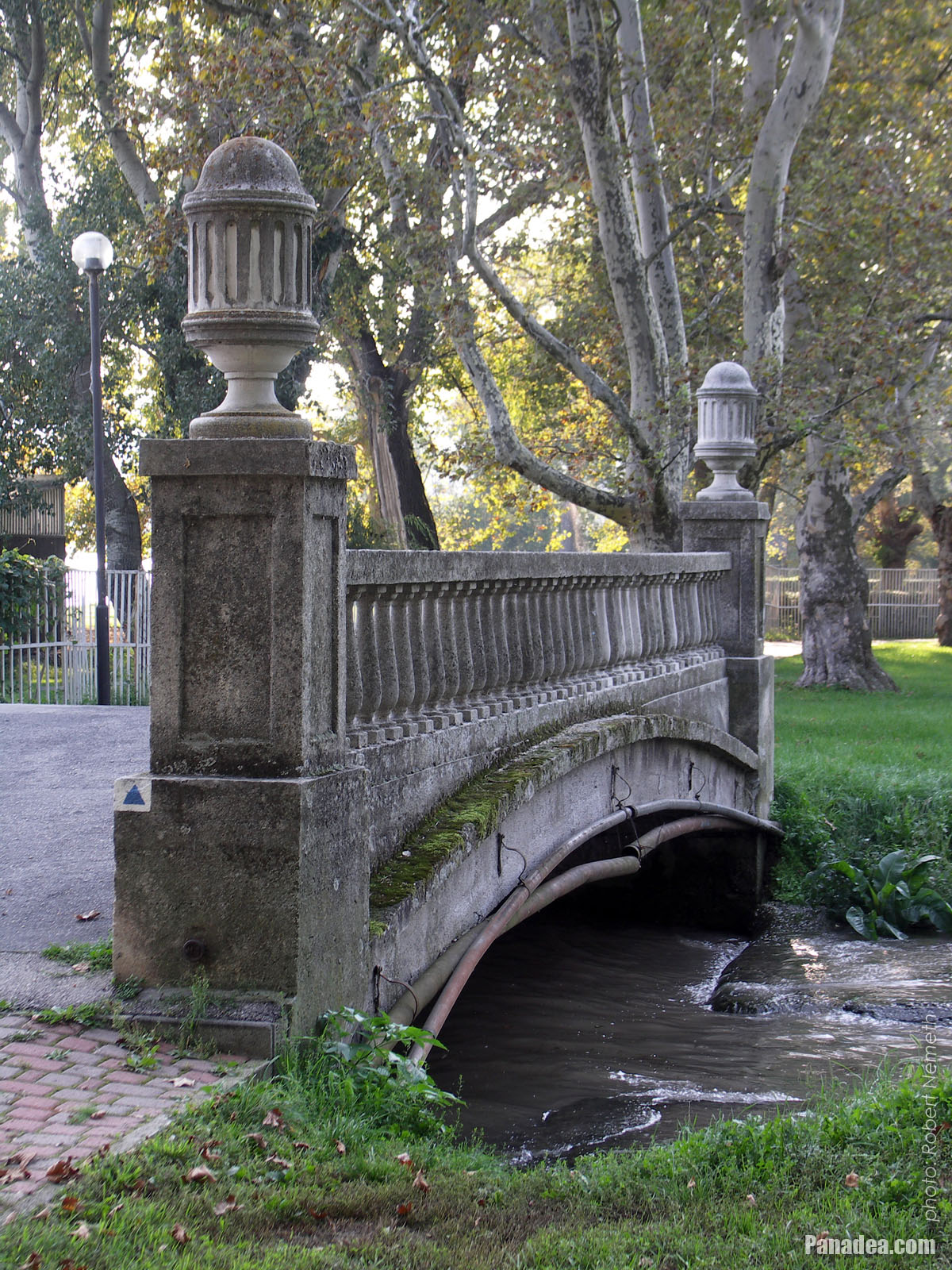
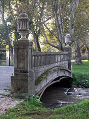
"Bridge of Sighs" in Balatonalmádi
дата на заснемане: 24.09.20102010
Създадено от: Роберт Немет
Модел на фотоапарата: Konica Minolta Dimage A200
Balatonalmádi, Унгария
"Bridge of Sighs" in Balatonalmádi - Balatonalmádi, Унгария -
"Irredentistic" eternal lamp
Created by architect László Lovas in 1928, for every Hungarian people abroad who became a minority in a violent way.
дата на заснемане: 24.09.20102010
Създадено от: Роберт Немет
Модел на фотоапарата: Konica Minolta Dimage A200
Balatonalmádi, Унгария
"Irredentistic" eternal lamp - Balatonalmádi, Унгария -
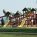
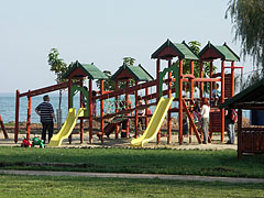
Playground by the lake
дата на заснемане: 24.09.20102010
Създадено от: Роберт Немет
Модел на фотоапарата: Konica Minolta Dimage A200
Balatonalmádi, Унгария
Playground by the lake - Balatonalmádi, Унгария -
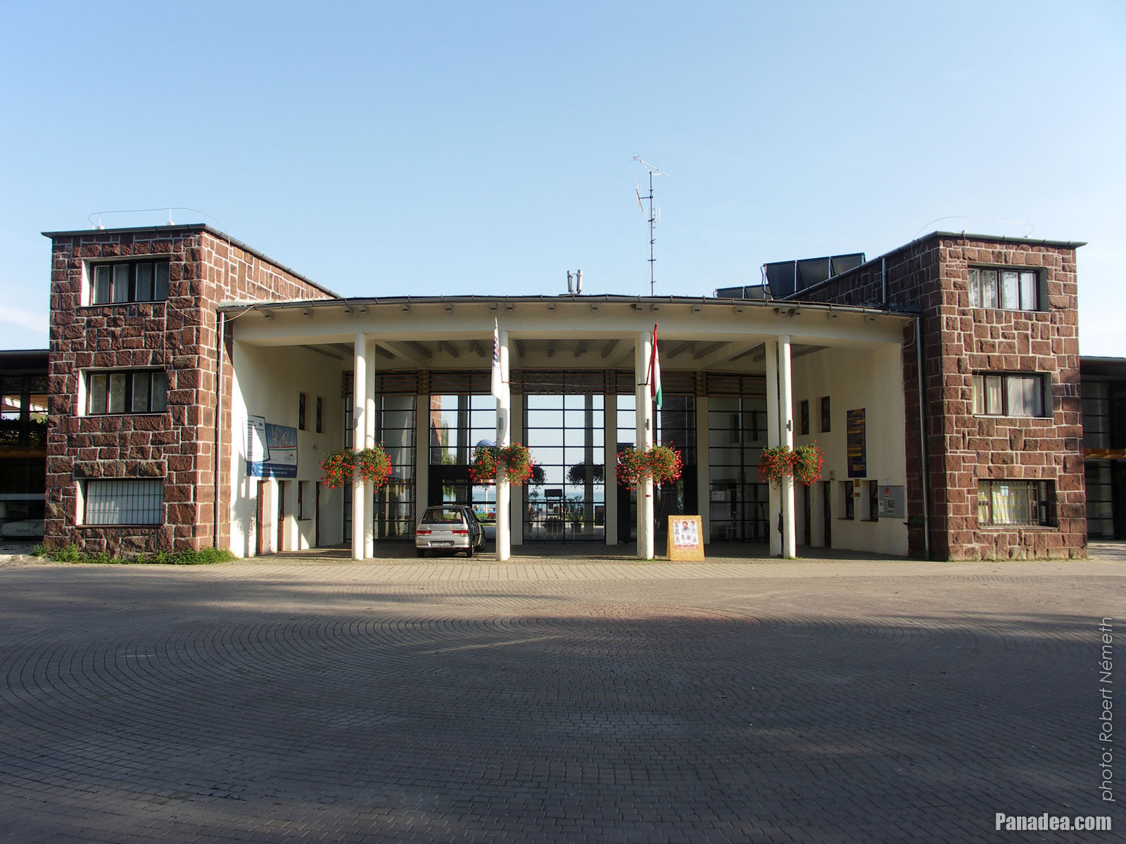
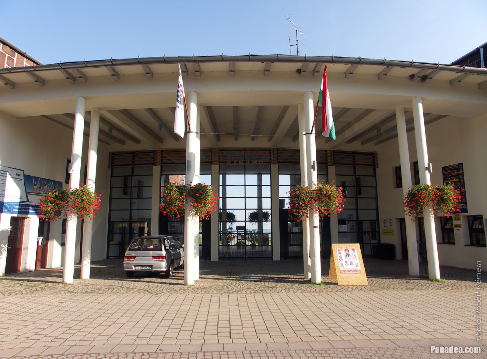
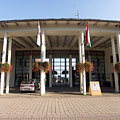
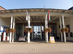
Main entrance of the Wesselényi beach
дата на заснемане: 24.09.20102010
Създадено от: Роберт Немет
Модел на фотоапарата: Konica Minolta Dimage A200
Balatonalmádi, Унгария
Main entrance of the Wesselényi beach - Balatonalmádi, Унгария -
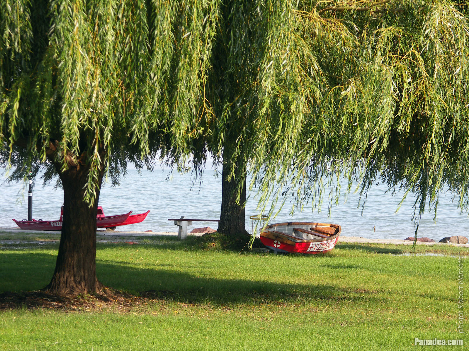
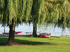
European weeping willow trees (Salix sepulcralis), and lifeguard boats on the beach
дата на заснемане: 24.09.20102010
Създадено от: Роберт Немет
Модел на фотоапарата: Konica Minolta Dimage A200
Balatonalmádi, Унгария
European weeping willow trees (Salix sepulcralis), and lifeguard boats on the beach - Balatonalmádi, Унгария

Кликнете върху снимките!
Особености, характеристики
Местоположение:
GPS координати: Ширина 47°1'36", Дължина 18°0'55" (N47 1.6 - E18 0.92)
Информация, къси разкази, интересни факти
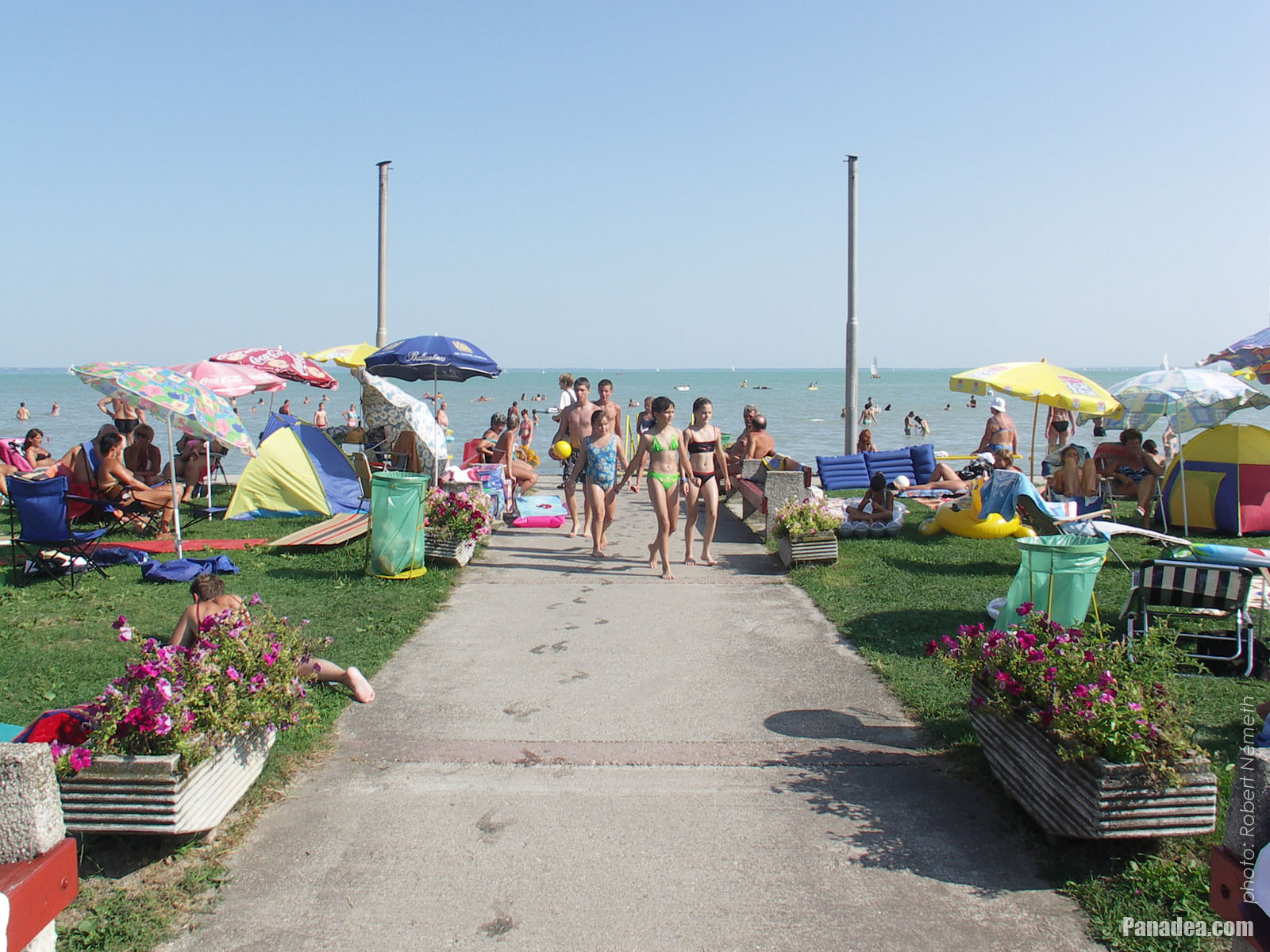
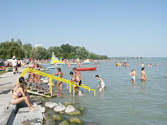
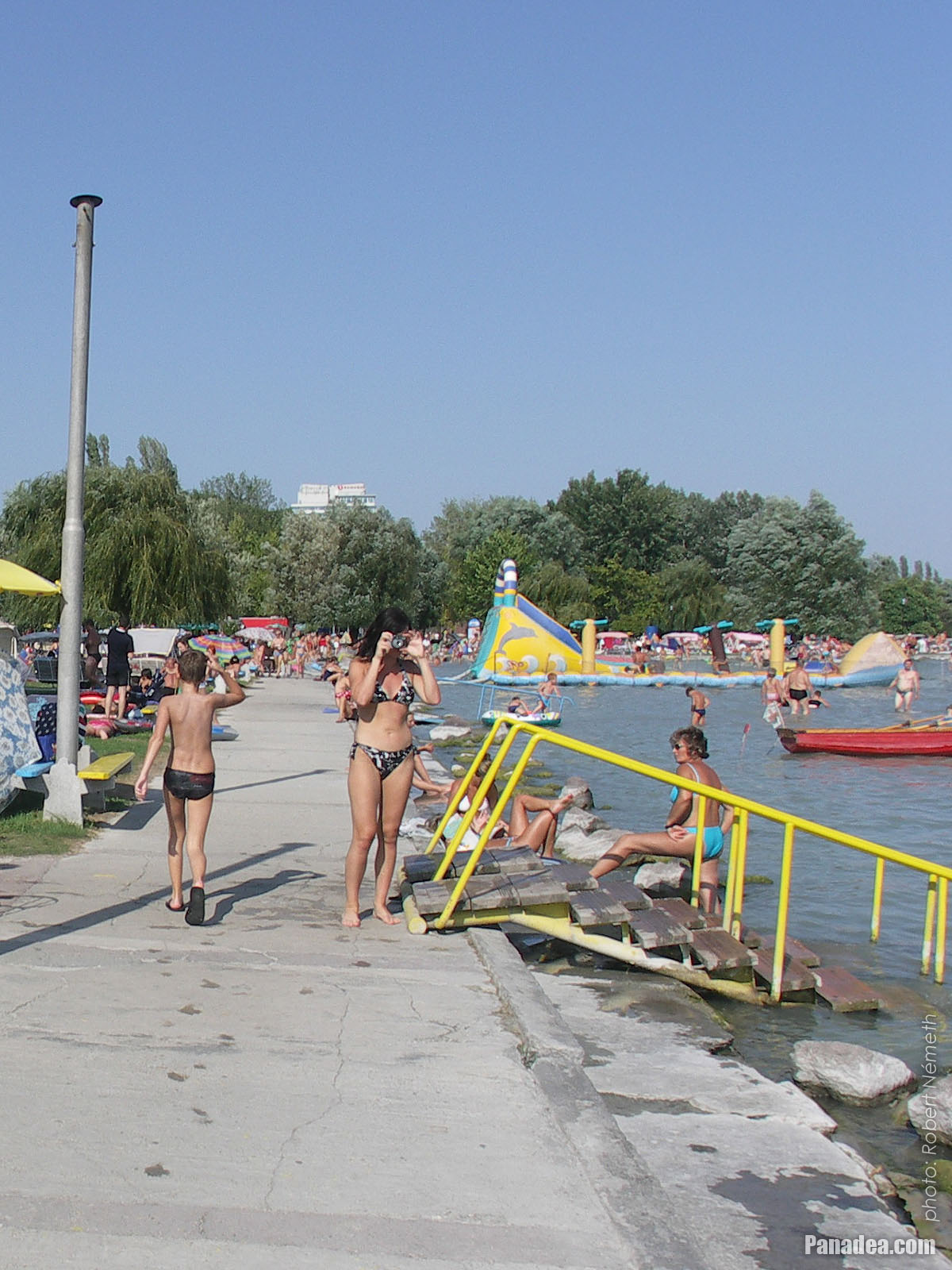
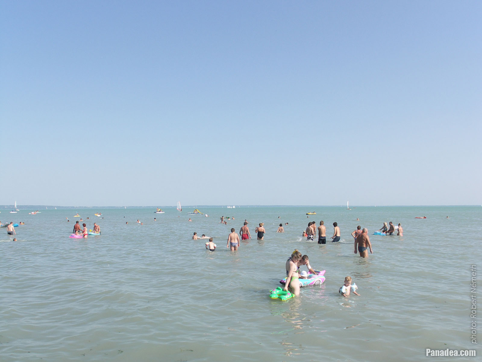
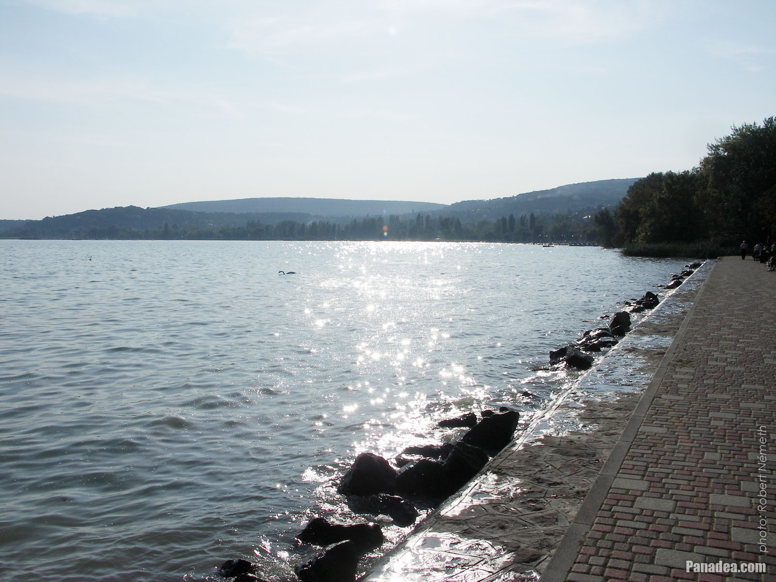
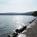
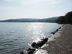
 The Wesselényi beach on the lakeshore of the Balaton
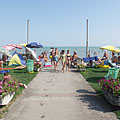
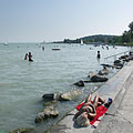
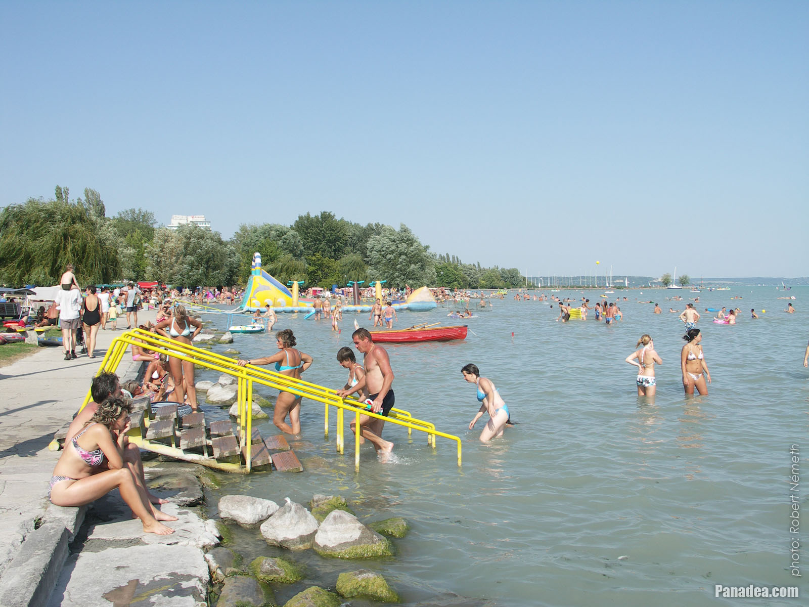
The position of Balatonalmádi is special, it is surrounded by hills and its like an amphitheater a little bit. Thanks to this the climate of the settlement is almost mediterranean. Although the town is situated on the north shore of Lake Balaton (where the water usually deepens more quickly than on the southern shore), the beach of Balatonalmádi is shallow even far from the shore and the water can warm up quickly to a pleasant temperature, so that's why it is highly recommended for families even with small children.
 Colors of late September by the lake shore, in the St. Elizabeth grove
The Öreg Park (literally "Old Park") or Szent Erzsébet Park ("St. Elizabeth's Park") is located in the town center of Balatonalmádi, between the railway tracks and the shore of Lake Balaton, near the Wesselényi Beach. The development of the park was begun at the end of the 1880s, initiated by Dezső Véghely natural scientist. It is situated on an area of 10 hectares and today the entire park is protected (nature reserve). There are special trees and valuable sculptures insite the park, as well as the so-called "Bridge of Sighs". By the way, the park is the last stop or station on the "Vörös Homokkő" (literally "Red sandstone") educational nature trail.
 Wesselényi beach
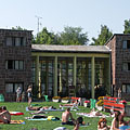
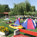
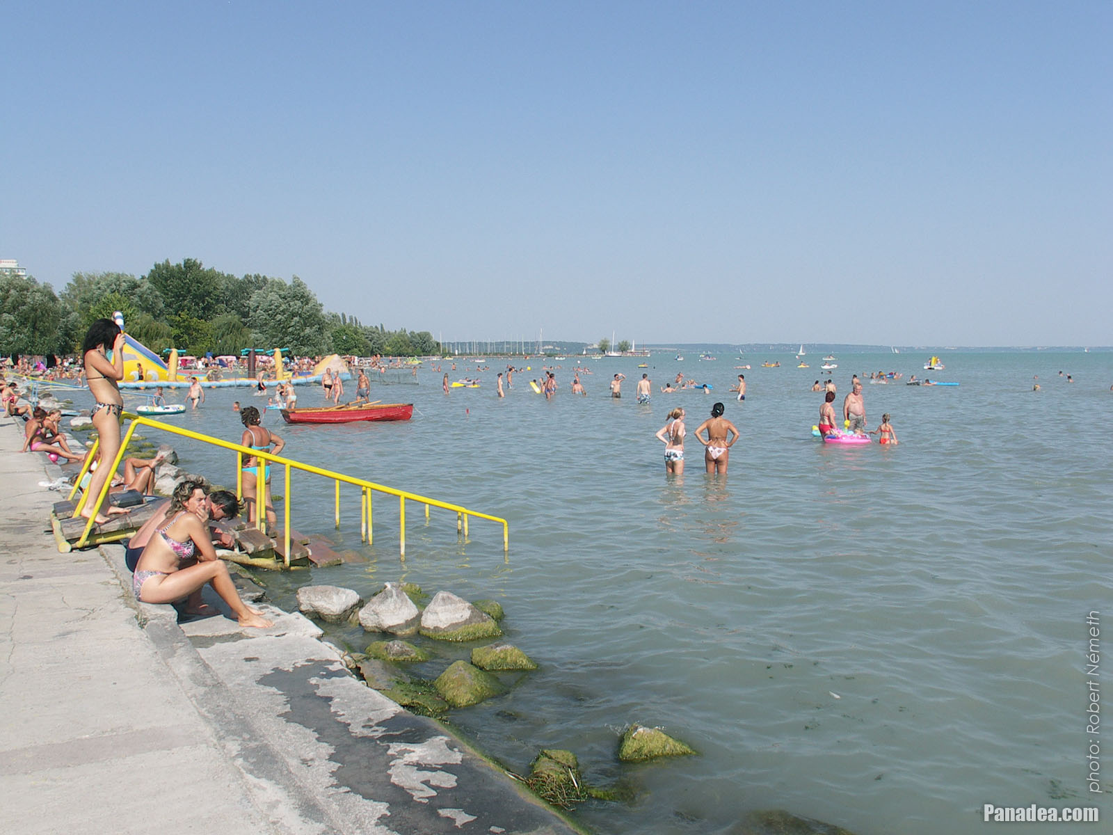
The Wesselényi Beach is the largest, most extensive beach on the northern shore of Lake Balaton. Even 10,000 people can relax and have fun comfortably at the same time on its half square kilometer of land. The area is landscaped, the willow and other trees provide shade for the guests who want to sleep or relax before or after bathing. The entrance building of the Wesselényi Beach is constructed from the typical building material of the region, the red sandstone from the Permian period (which was 299-252 million years ago).
Balatonalmádi - Повече фото галерии:
Можете също така да се интересуват от (Свързани страници):
Дестинации в пътеводителя:
Balatonalmádi (61 снимки + 2 панорамни изображения)
Веспрем медйе (983 снимки + 16 панорамни изображения)
Балатон (1 597 снимки + 35 панорамни изображения)
Унгария (27 287 снимки + 163 панорамни изображения)
и в допълнение:
(в рамките тук: Балатон и Веспрем медйе)
Balaton Uplands National Park (Balaton-felvidék) (440 снимки + 15 панорамни изображения)
Balaton Uplands (Balaton-felvidék) (123 снимки + 5 панорамни изображения)
Révfülöp (12 снимки + 1 панорамни изображения)
Révfülöp (12 снимки + 1 панорамни изображения)
Balatonfüred (252 снимки + 2 панорамни изображения)
Balatonboglár
Balatonlelle (13 снимки)
Zalakaros (43 снимки + 3 панорамни изображения)
Balatonföldvár (11 снимки)
Fonyód (290 снимки)
Siófok (388 снимки + 11 панорамни изображения)
Tapolca (37 снимки + 3 панорамни изображения)
Balatonfüred (252 снимки + 2 панорамни изображения)
Ajka (82 снимки)
Sümeg (39 снимки)
Várpalota (16 снимки + 2 панорамни изображения)
Zirc (46 снимки)
Zamárdi (16 снимки + 1 панорамни изображения)
Badacsonytomaj (4 снимки)
Balatonvilágos (26 снимки)
Nagyvázsony (45 снимки)
Szigliget (25 снимки + 2 панорамни изображения)
Balatonszőlős
Tihany (106 снимки + 1 панорамни изображения)
Szentbékkálla (10 снимки)
Nagyvázsony (45 снимки)
Csesznek (40 снимки)
Eplény (25 снимки)
Tés (15 снимки)
Veszprém (168 снимки + 3 панорамни изображения)
Всеки панорамна снимка тук:
Balatonalmádi (2 снимки)
Веспрем медйе (16 снимки)
Балатон (35 снимки)
Унгария (163 снимки)
Европа (165 снимки)
Всяка нормална снимка тук:
Balatonalmádi (61 снимки / 2 галерии)
Веспрем медйе (983 снимки / 27 галерии)
Балатон (1 597 снимки / 35 галерии)
Унгария (27 287 снимки / 462 галерии)
Европа (30 494 снимки / 523 галерии)
https://www.panadea.com/bg/guidebook/balatonalmadi/photos/gal-001

Добави към Любими Добави към Отметките
Споделете с вашите приятелите!
и т.н.


Нашият пътеводител съдържа:
Голям брой снимки и панорамни изображения, с много информация и интересни факти.
- 214 дестинации за пътуване
- 165 панорамни изображения
- 30 494 други снимки
Голяма колекция от подбрани снимки: отлично качество, висока резолюция и естествени цветове
Всички права запазени
- ©2010-2022
Neuronit Creative Studio - Mogyoród / Будапеща / Унгария