
(Оптимизован за уређаје са малим екранима)
Great Danube Flood of 2006, photos after the peaking - Будимпешта, Мађарска
Када кликнете:
Кликните на сликама!
-

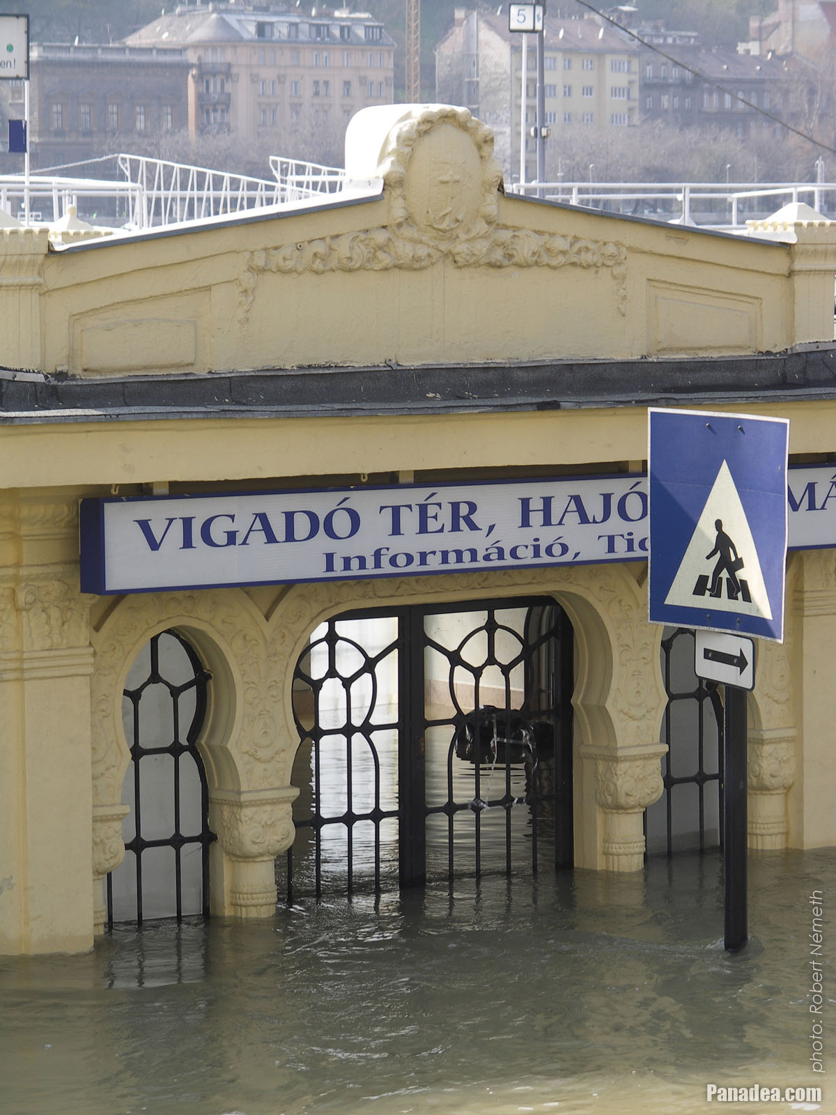
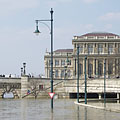
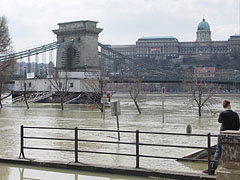
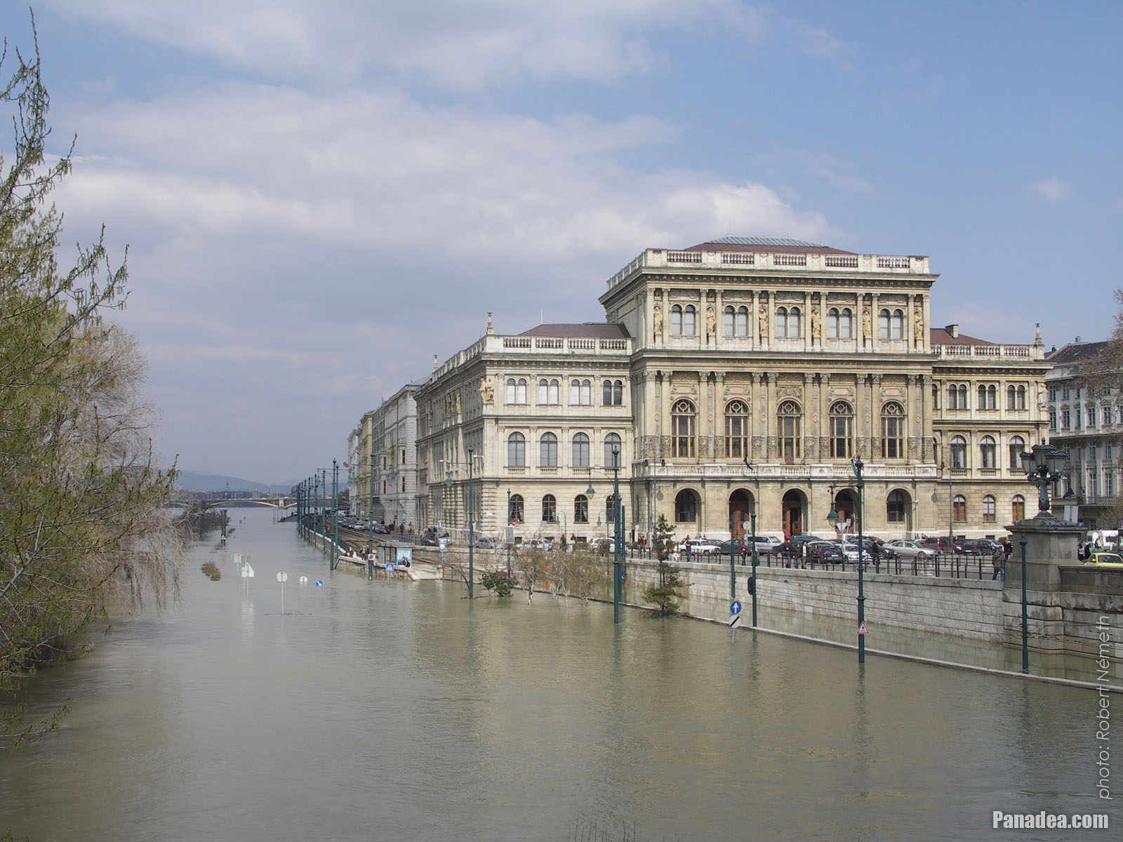
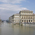
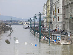
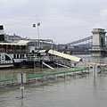
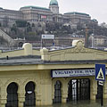
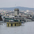
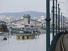
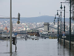
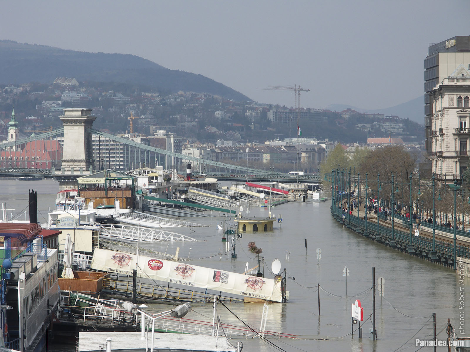
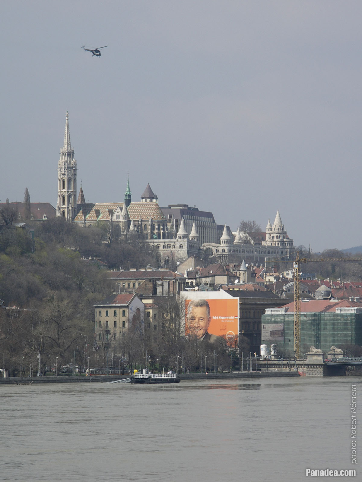
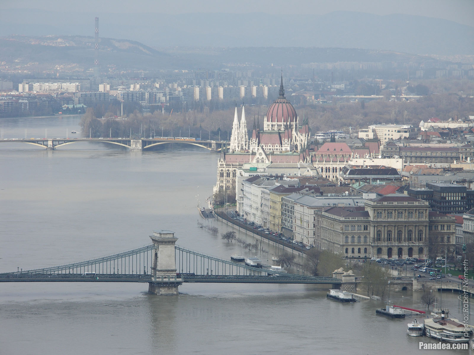
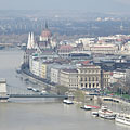
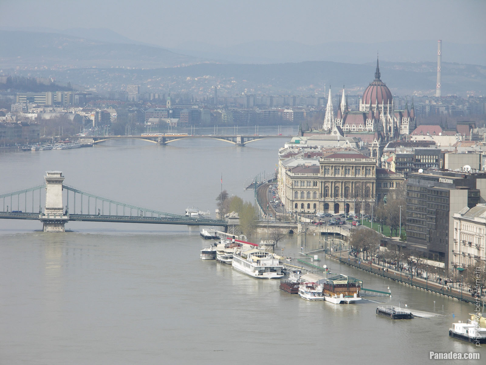
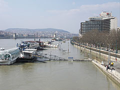
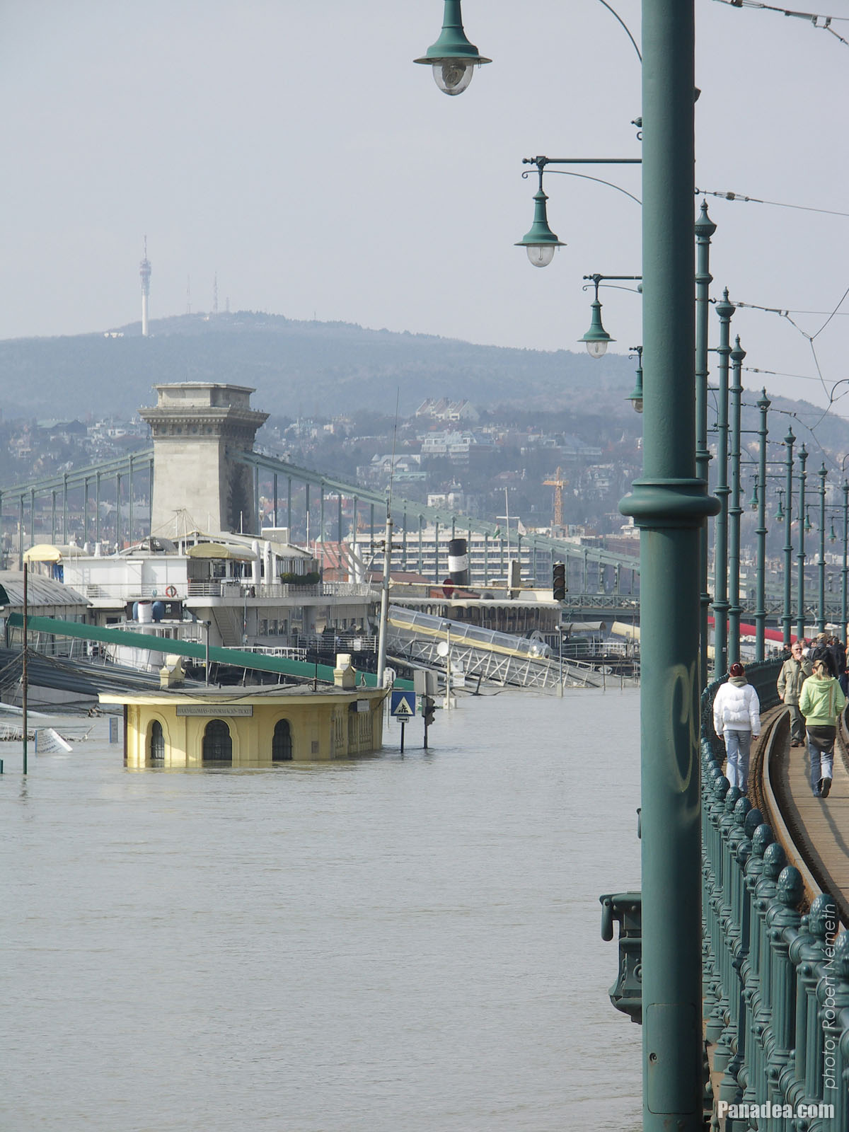
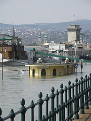
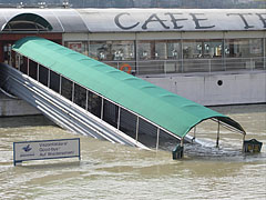
The Vigadó Square boat station is under the water, and on the other side of the Danube it is the Royal Palace of the Buda Castle
Датум фотографисања: 07. 04. 2006.2006
Цреатед би: Robert Németh
Модел фотоапарата: Konica Minolta Dimage A200
Будимпешта, Мађарска
-

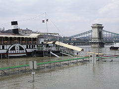
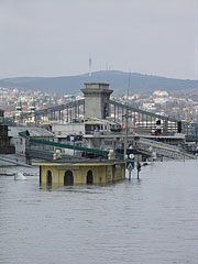
Boat station at Vigadó Square ("Vigadó tér")
Датум фотографисања: 07. 04. 2006.2006
Цреатед би: Robert Németh
Модел фотоапарата: Konica Minolta Dimage A200
Будимпешта, Мађарска
-

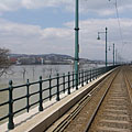
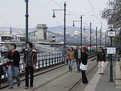
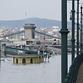
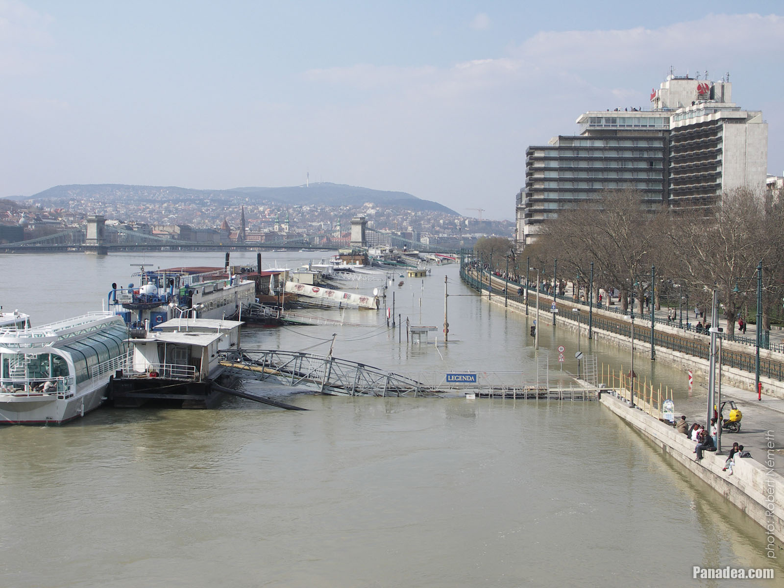
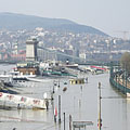
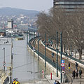
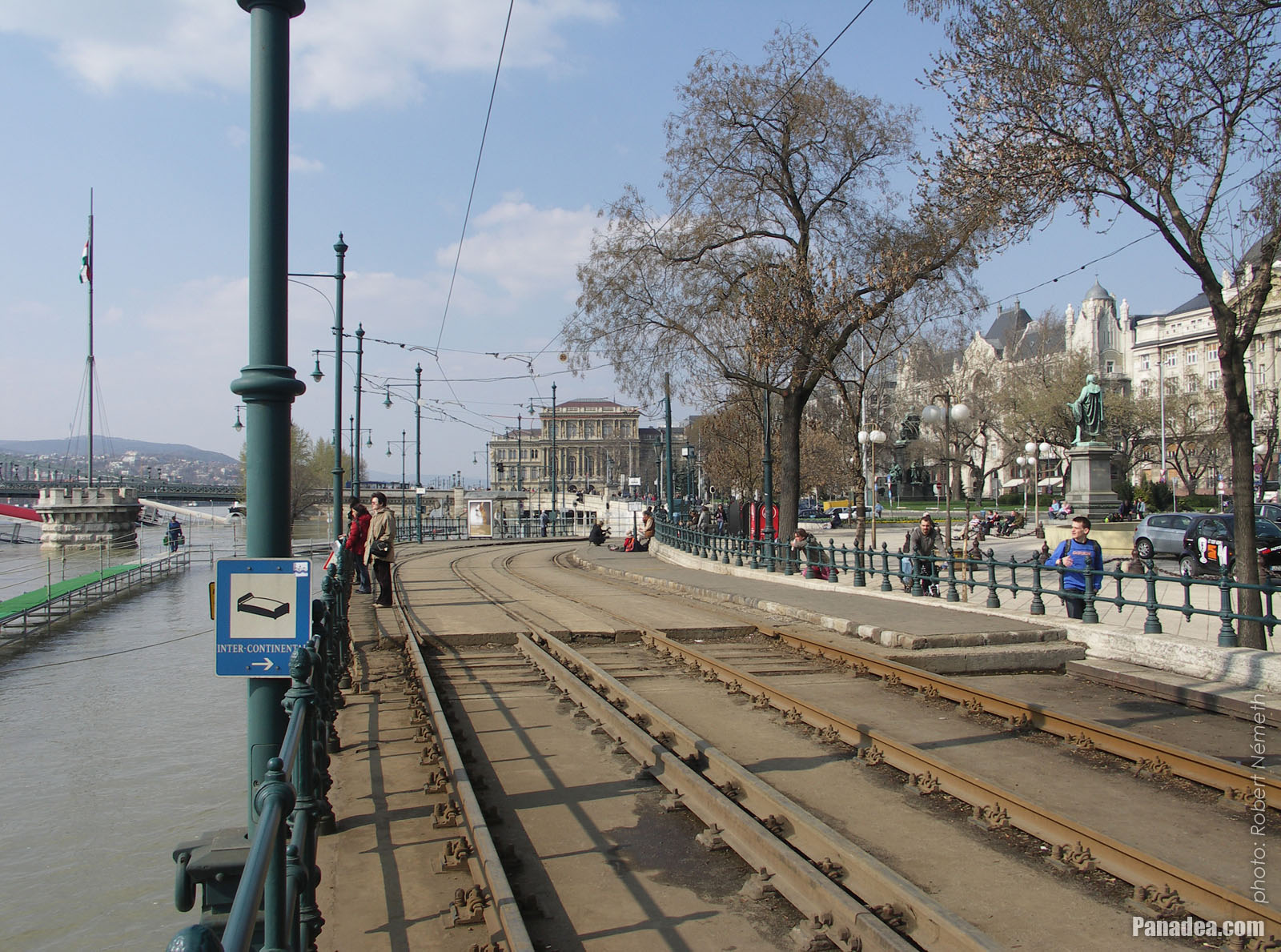
The Duna Korzó promenade and the riverside in the downtown
Датум фотографисања: 07. 04. 2006.2006
Цреатед би: Robert Németh
Модел фотоапарата: Konica Minolta Dimage A200
Будимпешта, Мађарска
-

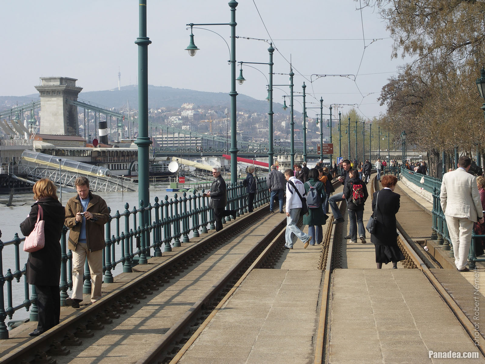
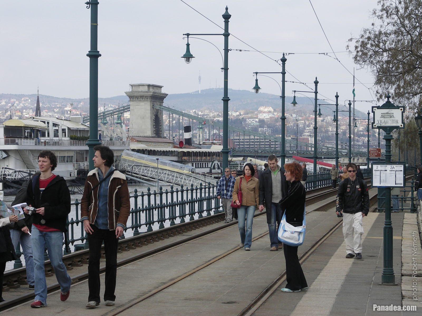
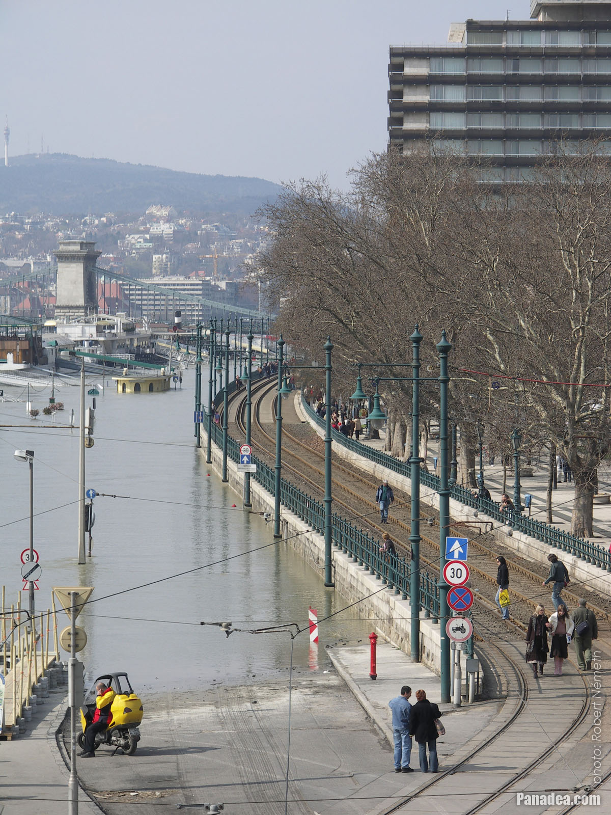
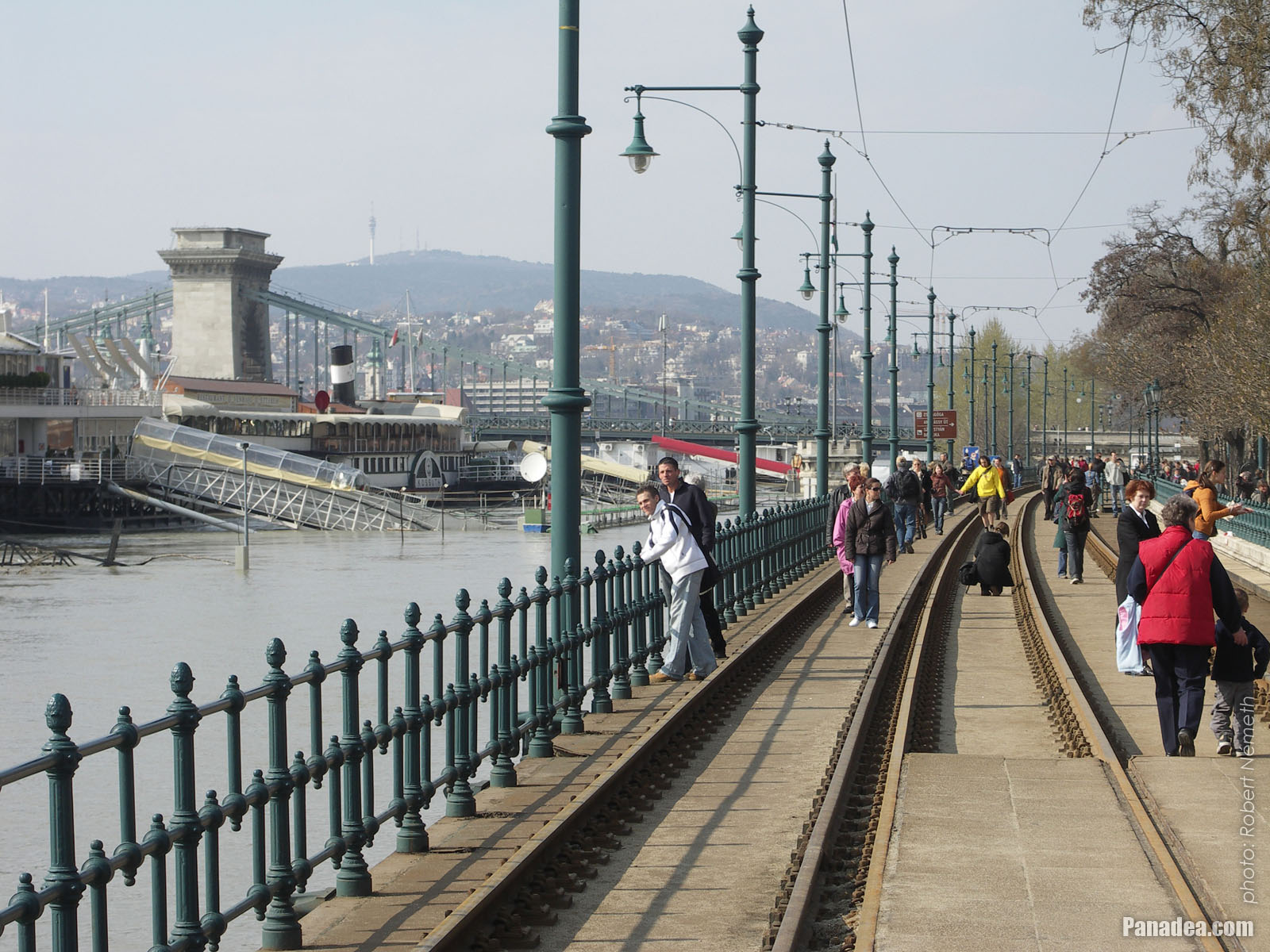
Promenading and picnic atmosphere on the tram rails, right beside the Duna Korzó promenade
But don't need to worry, the tram service is suspended thanks to the flood.
Датум фотографисања: 07. 04. 2006.2006
Цреатед би: Robert Németh
Модел фотоапарата: Konica Minolta Dimage A200
Будимпешта, Мађарска
-

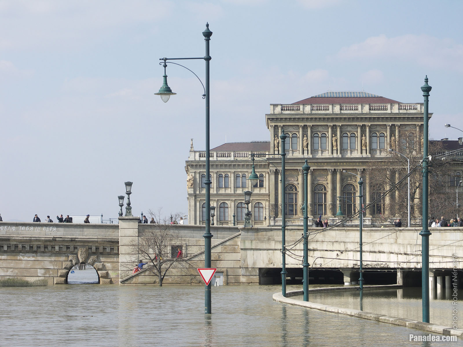
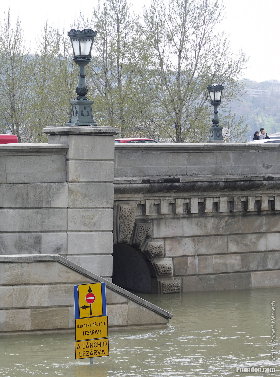
The Pest-side abutment of the Chain Bridge, and the headquarters building of the Hungarian Academy of Sciences (MTA)
Датум фотографисања: 07. 04. 2006.2006
Цреатед би: Robert Németh
Модел фотоапарата: Konica Minolta Dimage A200
Будимпешта, Мађарска
-

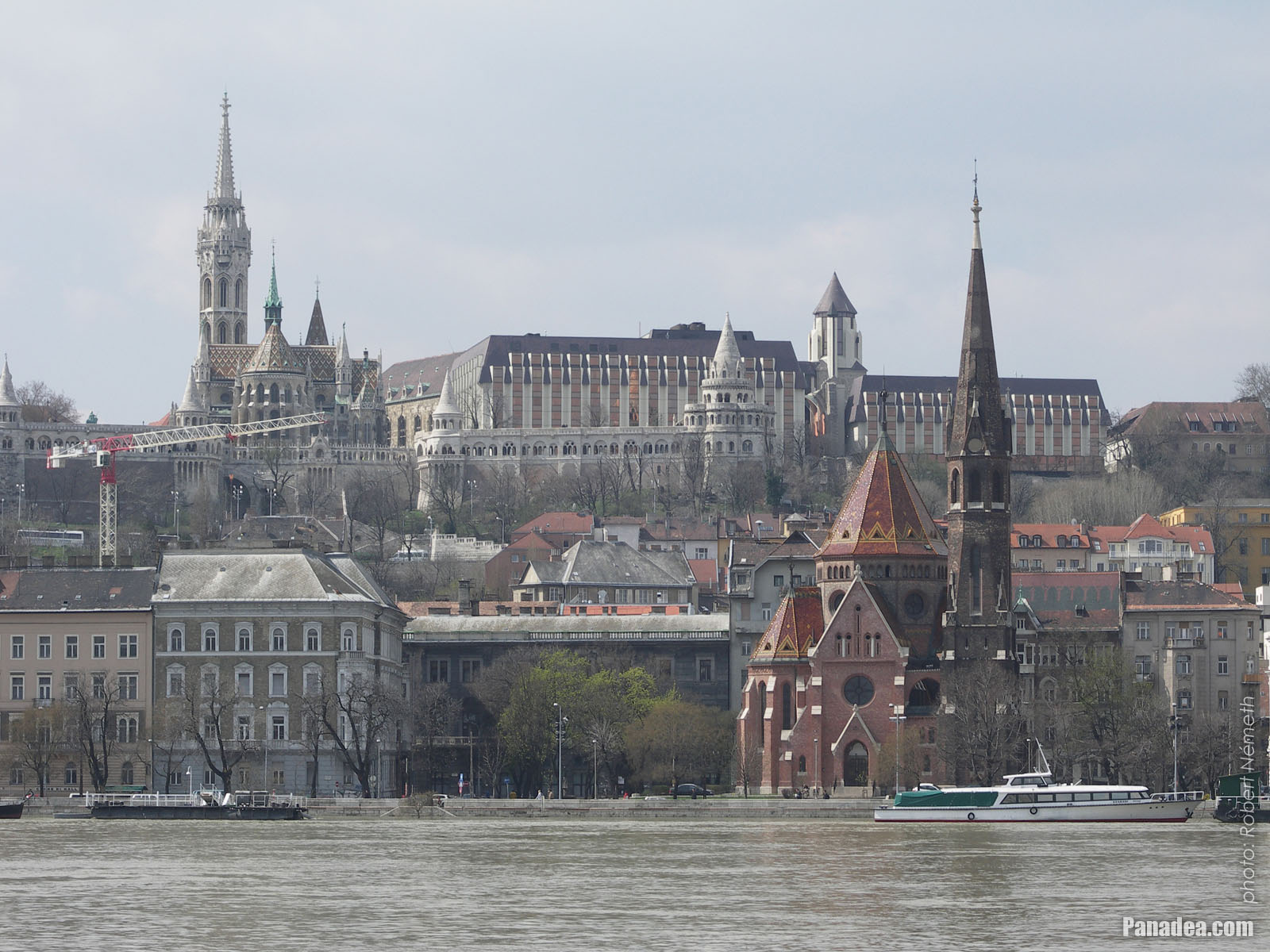
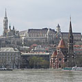
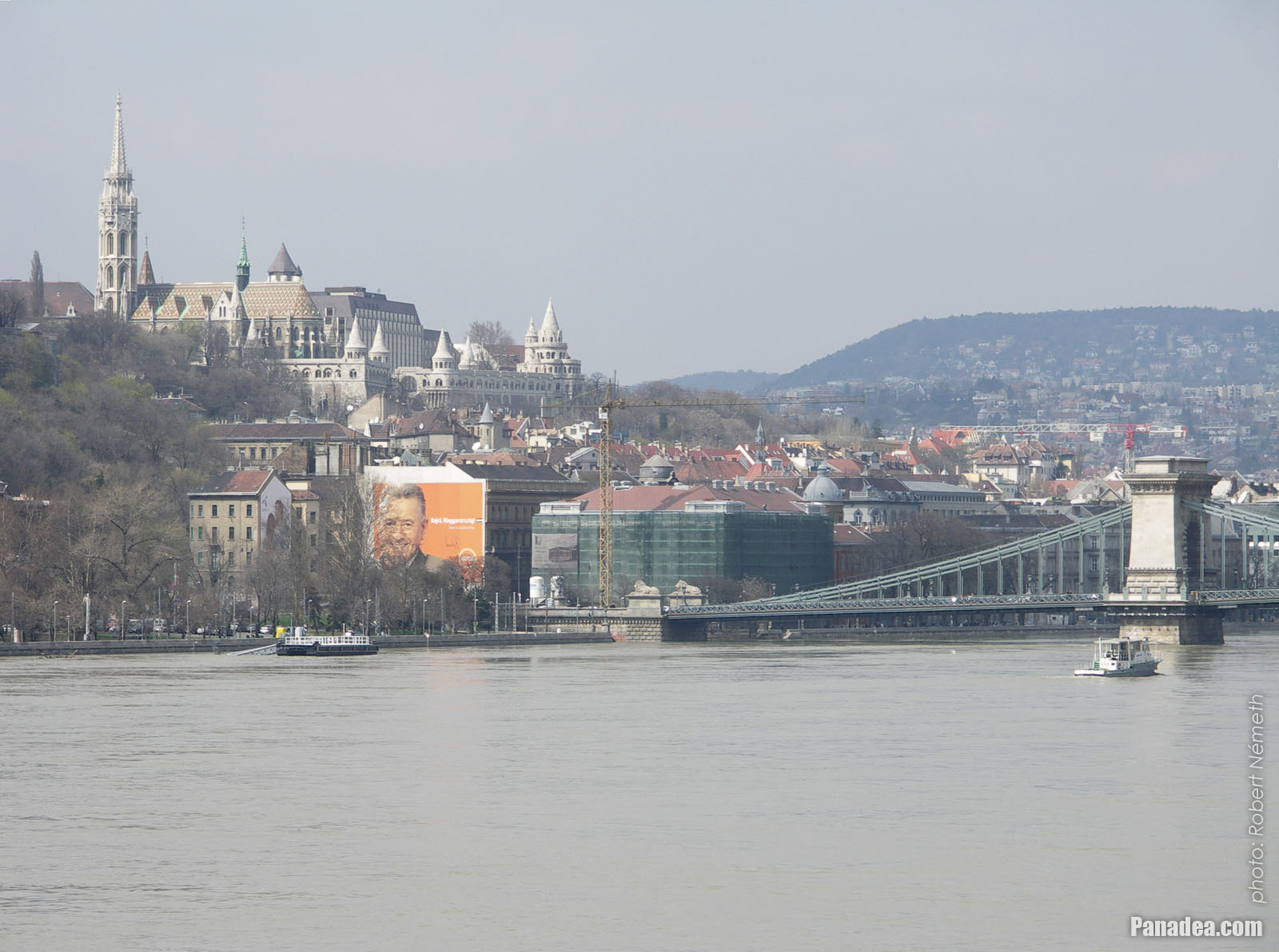
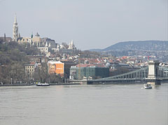
The Danube bank in Buda and the Szilágyi Dezső Square Reformed Church, as well as the Matthias Church, the Fisherman's Bastion and the Hotel Hilton on the castle hill
Датум фотографисања: 07. 04. 2006.2006
Цреатед би: Robert Németh
Модел фотоапарата: Konica Minolta Dimage A200
Будимпешта, Мађарска
-

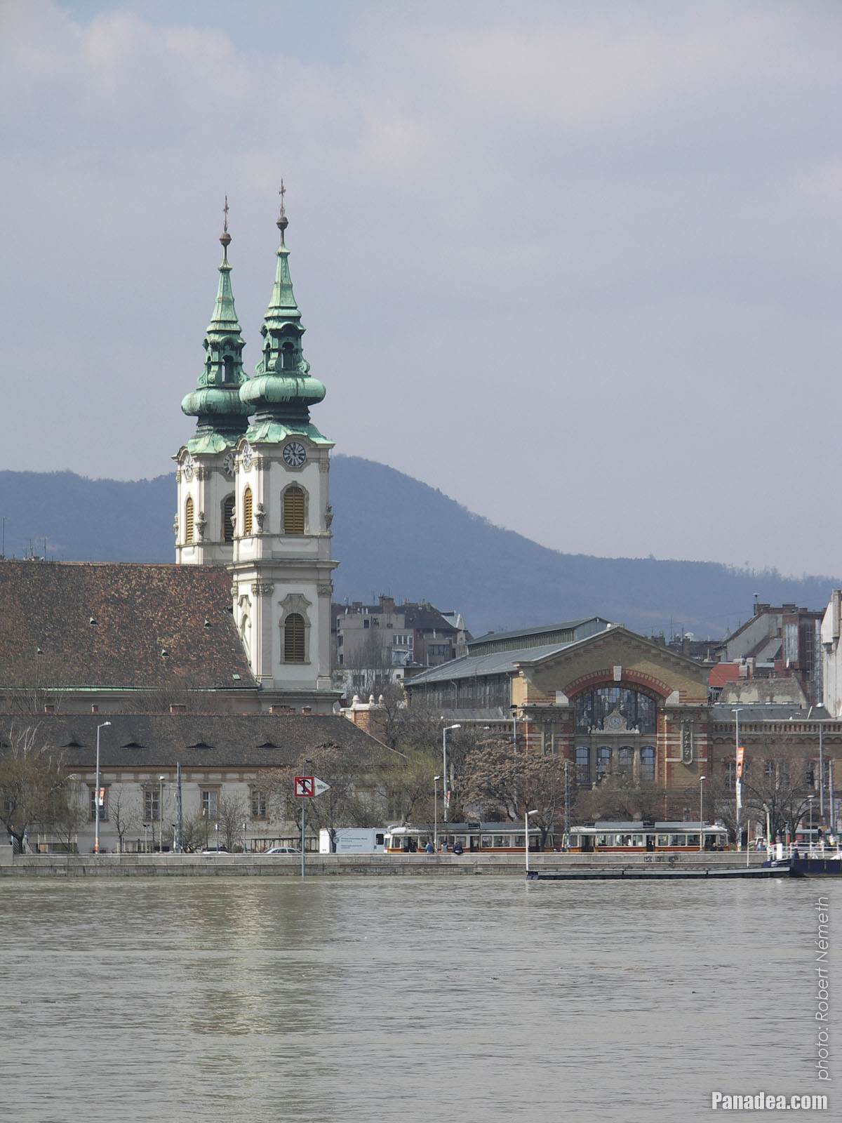
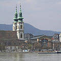
The Batthyány Square in Buda (including the the St. Anne's Church and the Market Hall), viewed from the riverbank in Pest
Датум фотографисања: 07. 04. 2006.2006
Цреатед би: Robert Németh
Модел фотоапарата: Konica Minolta Dimage A200
Будимпешта, Мађарска
-

Reformed Church at Szilágyi Dezső Square
Датум фотографисања: 07. 04. 2006.2006
Цреатед би: Robert Németh
Модел фотоапарата: Konica Minolta Dimage A200
Будимпешта, Мађарска
-

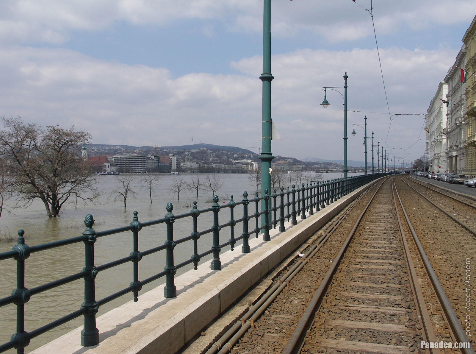
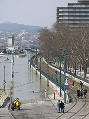
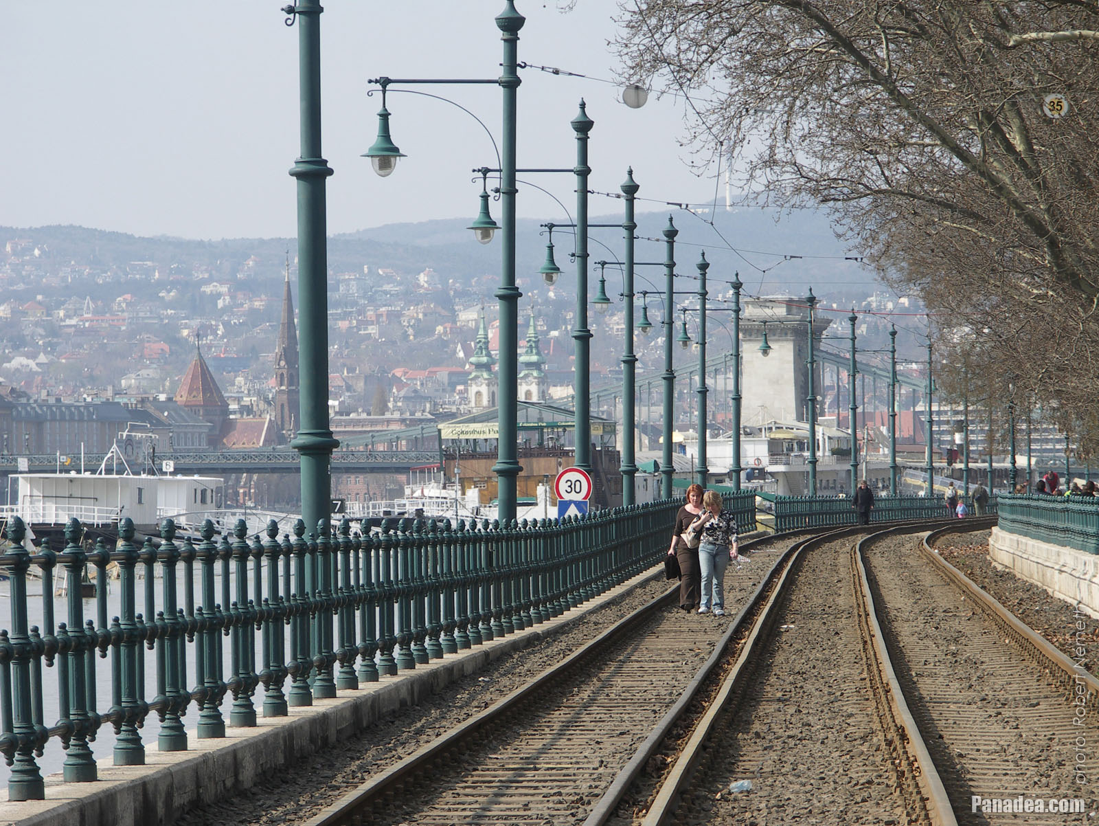
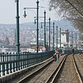
Tram rail on the Pest-side riverbank
Датум фотографисања: 07. 04. 2006.2006
Цреатед би: Robert Németh
Модел фотоапарата: Konica Minolta Dimage A200
Будимпешта, Мађарска
-

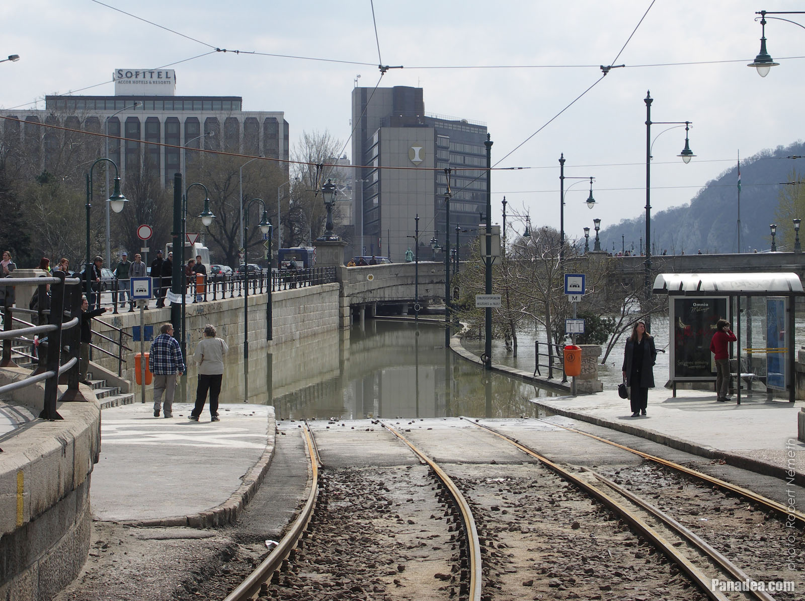
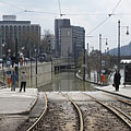
By tram so far and no further! (the surrounding of the Széchenyi Chain Bridge on the Pest side of the river)
Датум фотографисања: 07. 04. 2006.2006
Цреатед би: Robert Németh
Модел фотоапарата: Konica Minolta Dimage A200
Будимпешта, Мађарска
-
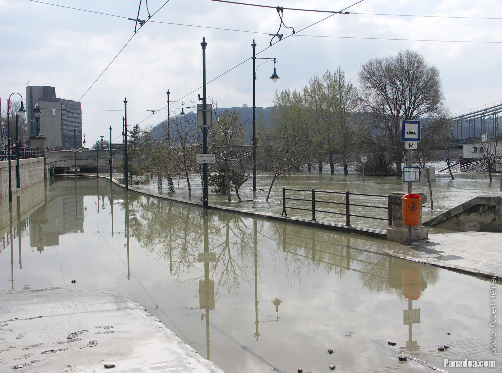
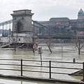
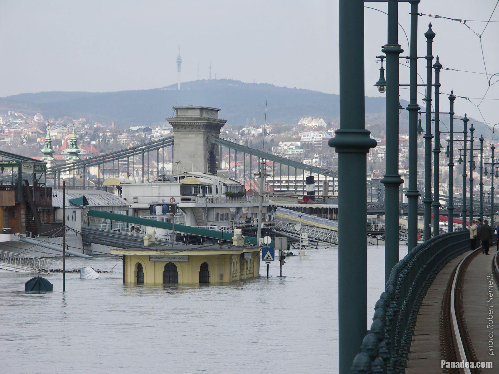
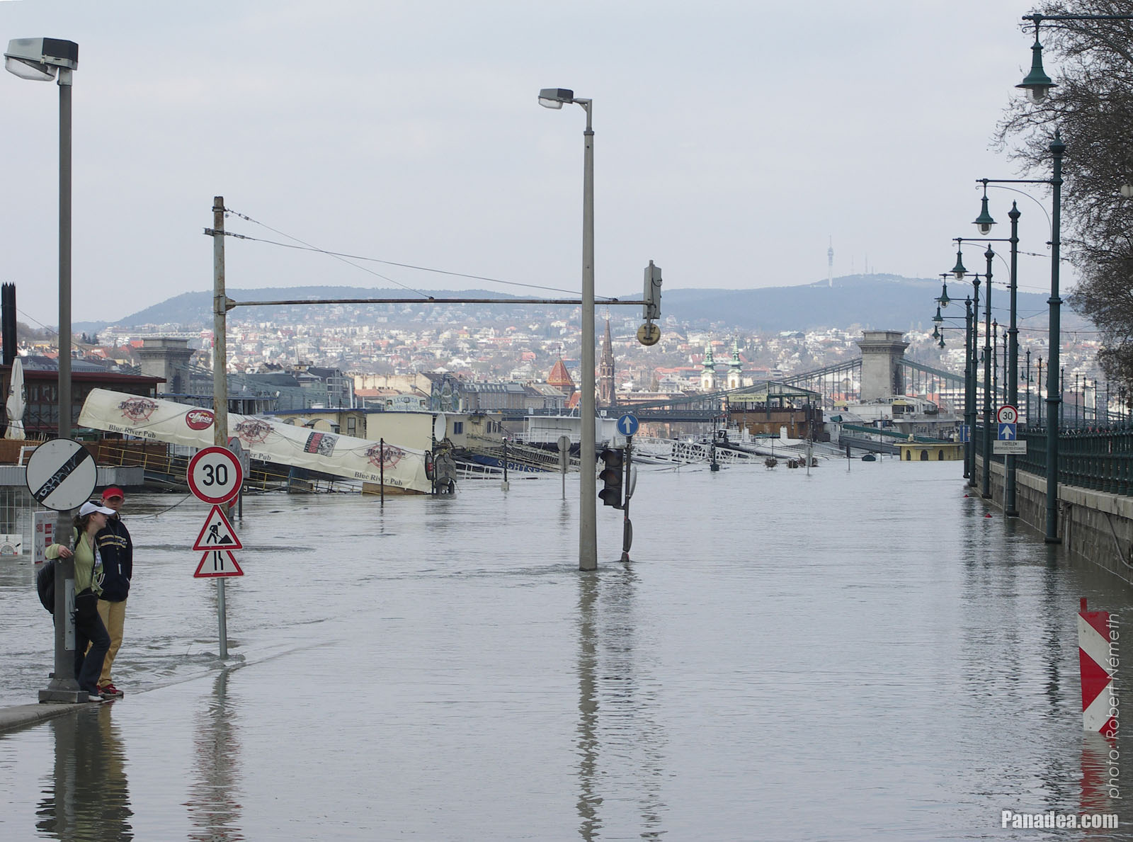
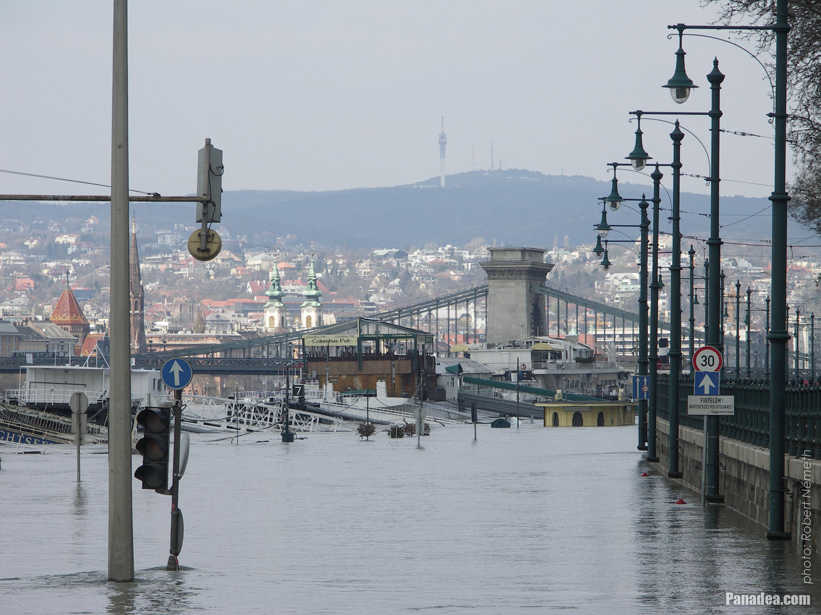
The surroundings of the Pest-side end of the Chain Bridge, the tram tracks look like a lake
Датум фотографисања: 07. 04. 2006.2006
Цреатед би: Robert Németh
Модел фотоапарата: Konica Minolta Dimage A200
Будимпешта, Мађарска
The surroundings of the Pest-side end of the Chain Bridge, the tram tracks look like a lake - Будимпешта, Мађарска -
The park at the foot of the Chain Bridge is under the water
Датум фотографисања: 07. 04. 2006.2006
Цреатед би: Robert Németh
Модел фотоапарата: Konica Minolta Dimage A200
Будимпешта, Мађарска
The park at the foot of the Chain Bridge is under the water - Будимпешта, Мађарска -
The Chain Bridge and the Buda Castle, but now the photo could be shot only from a a few steps farther than usual (thanks to the flooding river)
Датум фотографисања: 07. 04. 2006.2006
Цреатед би: Robert Németh
Модел фотоапарата: Konica Minolta Dimage A200
Будимпешта, Мађарска
The Chain Bridge and the Buda Castle, but now the photo could be shot only from a a few steps farther than usual (thanks to the flooding river) - Будимпешта, Мађарска -
The Pest end of the Széchenyi Chain Bridge
Датум фотографисања: 07. 04. 2006.2006
Цреатед би: Robert Németh
Модел фотоапарата: Konica Minolta Dimage A200
Будимпешта, Мађарска
The Pest end of the Széchenyi Chain Bridge - Будимпешта, Мађарска -
The surroundings of the Chain Bridge on the Pest side, including the headquarters of the Hungarian Academy of Sciences (MTA), the quay cannot be seen due to the high water
Датум фотографисања: 07. 04. 2006.2006
Цреатед би: Robert Németh
Модел фотоапарата: Konica Minolta Dimage A200
Будимпешта, Мађарска
The surroundings of the Chain Bridge on the Pest side, including the headquarters of the Hungarian Academy of Sciences (MTA), the quay cannot be seen due to the high water - Будимпешта, Мађарска -
The most of the Pest-side lower embankment is under the water
Датум фотографисања: 07. 04. 2006.2006
Цреатед би: Robert Németh
Модел фотоапарата: Konica Minolta Dimage A200
Будимпешта, Мађарска
The most of the Pest-side lower embankment is under the water - Будимпешта, Мађарска -
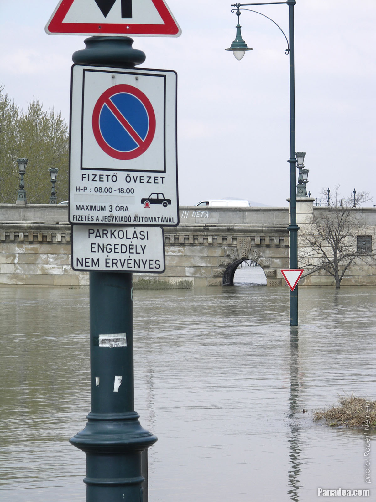
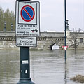
Regulated parking zone, but maybe not now
Датум фотографисања: 07. 04. 2006.2006
Цреатед би: Robert Németh
Модел фотоапарата: Konica Minolta Dimage A200
Будимпешта, Мађарска
Regulated parking zone, but maybe not now - Будимпешта, Мађарска -
Széchenyi Chain Bridge, Pest-side connection
Датум фотографисања: 07. 04. 2006.2006
Цреатед би: Robert Németh
Модел фотоапарата: Konica Minolta Dimage A200
Будимпешта, Мађарска
Széchenyi Chain Bridge, Pest-side connection - Будимпешта, Мађарска -
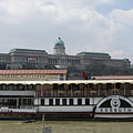
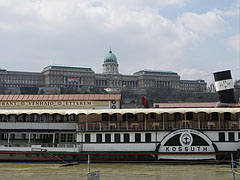
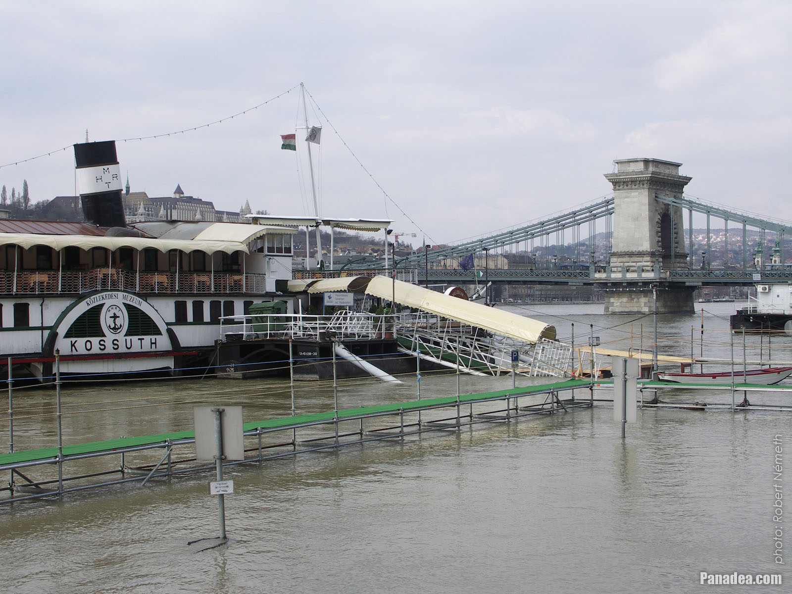
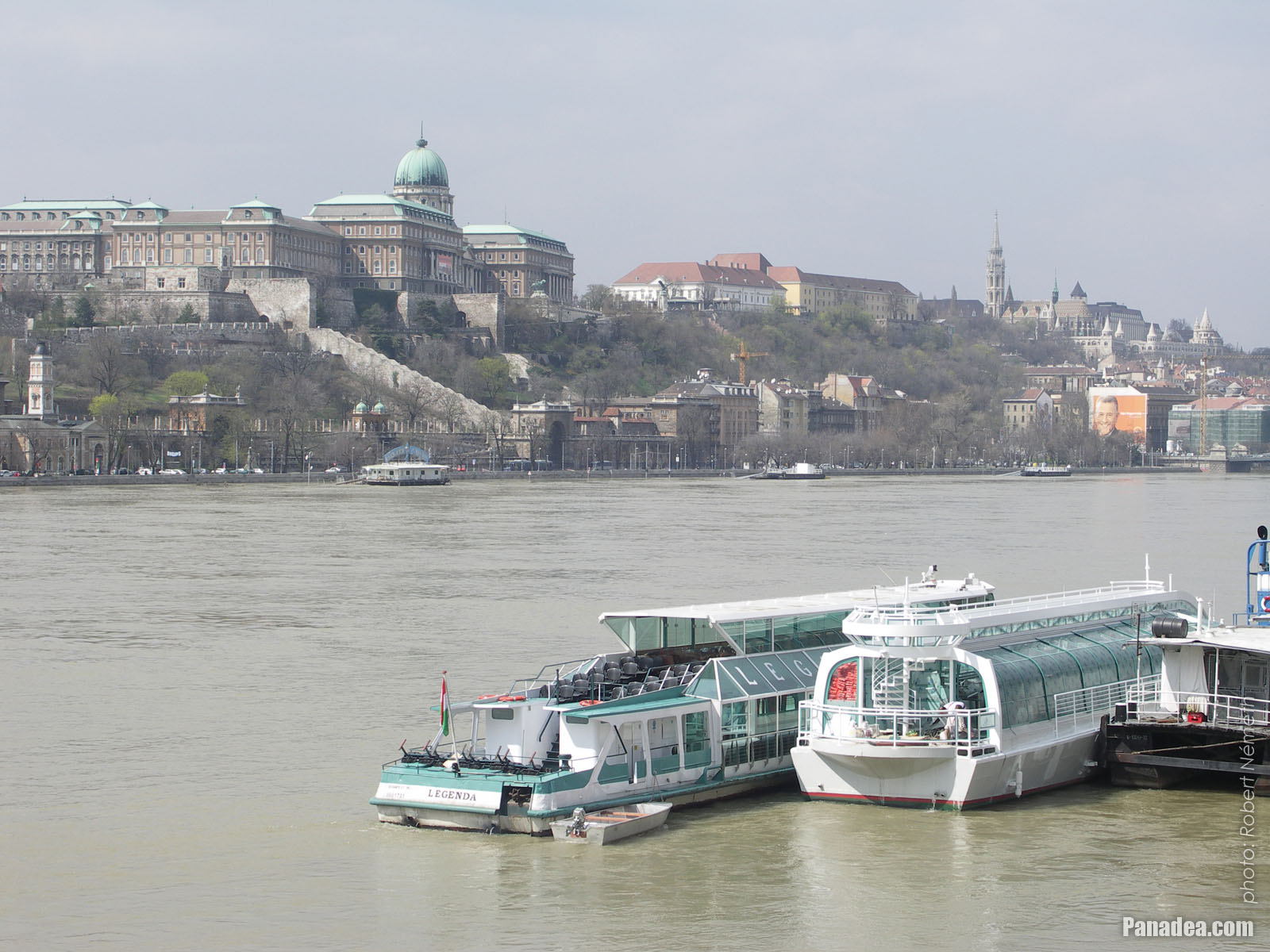
The "Kossuth" museum and restaurant boat, including the "Vénhajó" Restaurant, the background of the photo is filled with the huge Royal Palace in the Buda Castle
Датум фотографисања: 07. 04. 2006.2006
Цреатед би: Robert Németh
Модел фотоапарата: Konica Minolta Dimage A200
Будимпешта, Мађарска
The "Kossuth" museum and restaurant boat, including the "Vénhajó" Restaurant, the background of the photo is filled with the huge Royal Palace in the Buda Castle - Будимпешта, Мађарска -
The Pest-side lower embankment at the "Kossuth" museum boat
Датум фотографисања: 07. 04. 2006.2006
Цреатед би: Robert Németh
Модел фотоапарата: Konica Minolta Dimage A200
Будимпешта, Мађарска
The Pest-side lower embankment at the "Kossuth" museum boat - Будимпешта, Мађарска -
The tram tracks now used only by the people
Датум фотографисања: 07. 04. 2006.2006
Цреатед би: Robert Németh
Модел фотоапарата: Konica Minolta Dimage A200
Будимпешта, Мађарска
The tram tracks now used only by the people - Будимпешта, Мађарска -
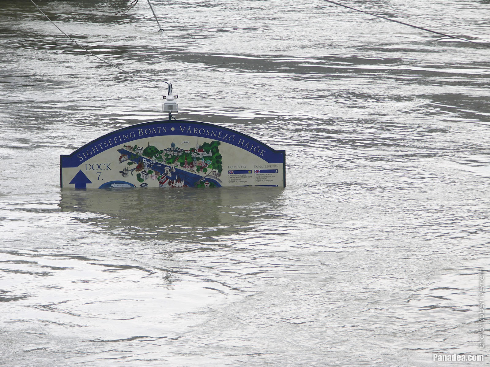
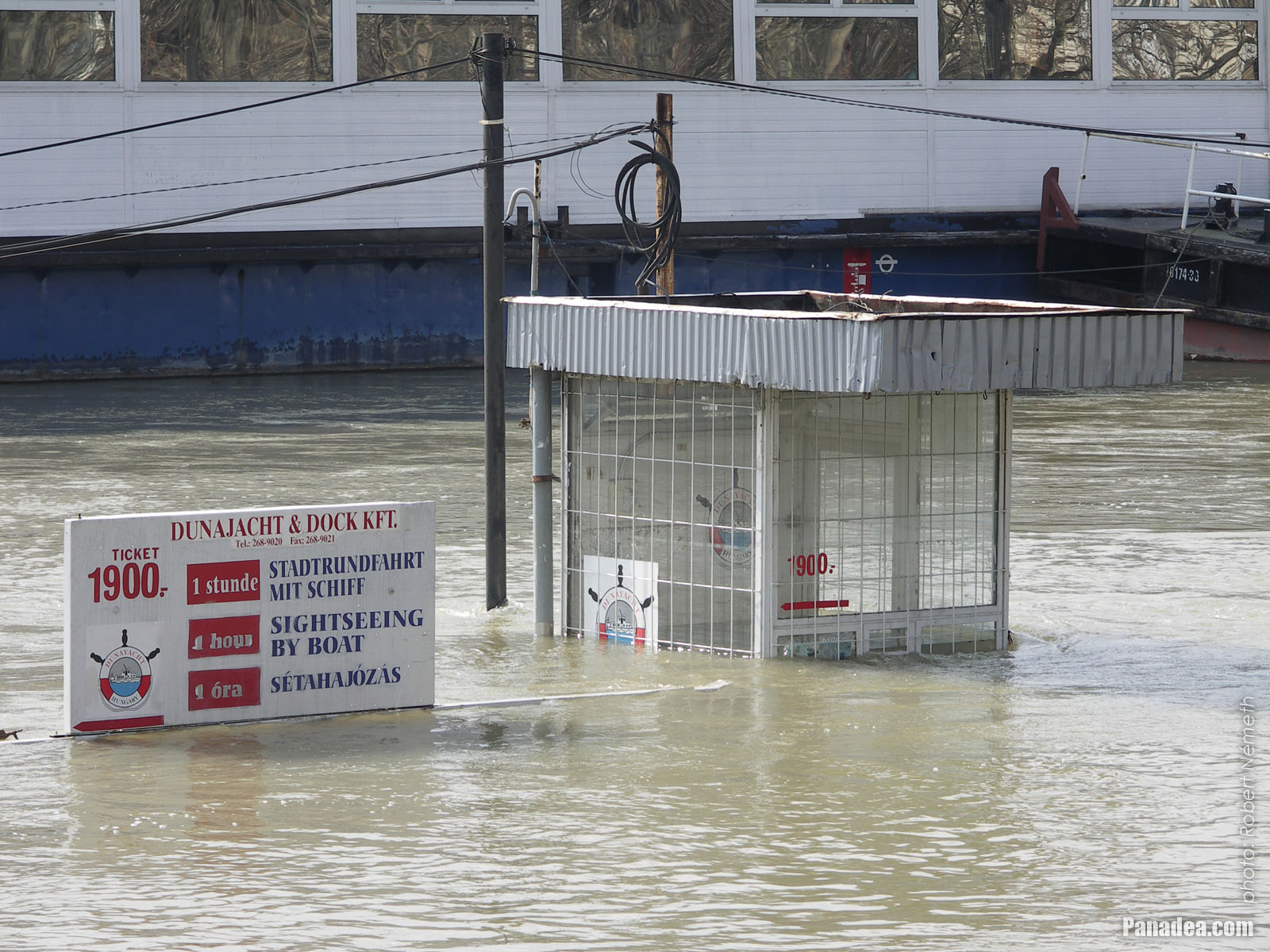
The plate of the sightseeing vessels' harbour in the water
Датум фотографисања: 07. 04. 2006.2006
Цреатед би: Robert Németh
Модел фотоапарата: Konica Minolta Dimage A200
Будимпешта, Мађарска
The plate of the sightseeing vessels' harbour in the water - Будимпешта, Мађарска -
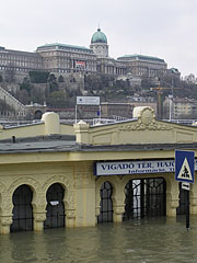
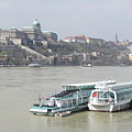
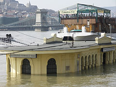
The boat station at Vigadó Square and the Buda Castle Palace
Датум фотографисања: 07. 04. 2006.2006
Цреатед би: Robert Németh
Модел фотоапарата: Konica Minolta Dimage A200
Будимпешта, Мађарска
The boat station at Vigadó Square and the Buda Castle Palace - Будимпешта, Мађарска -
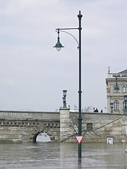
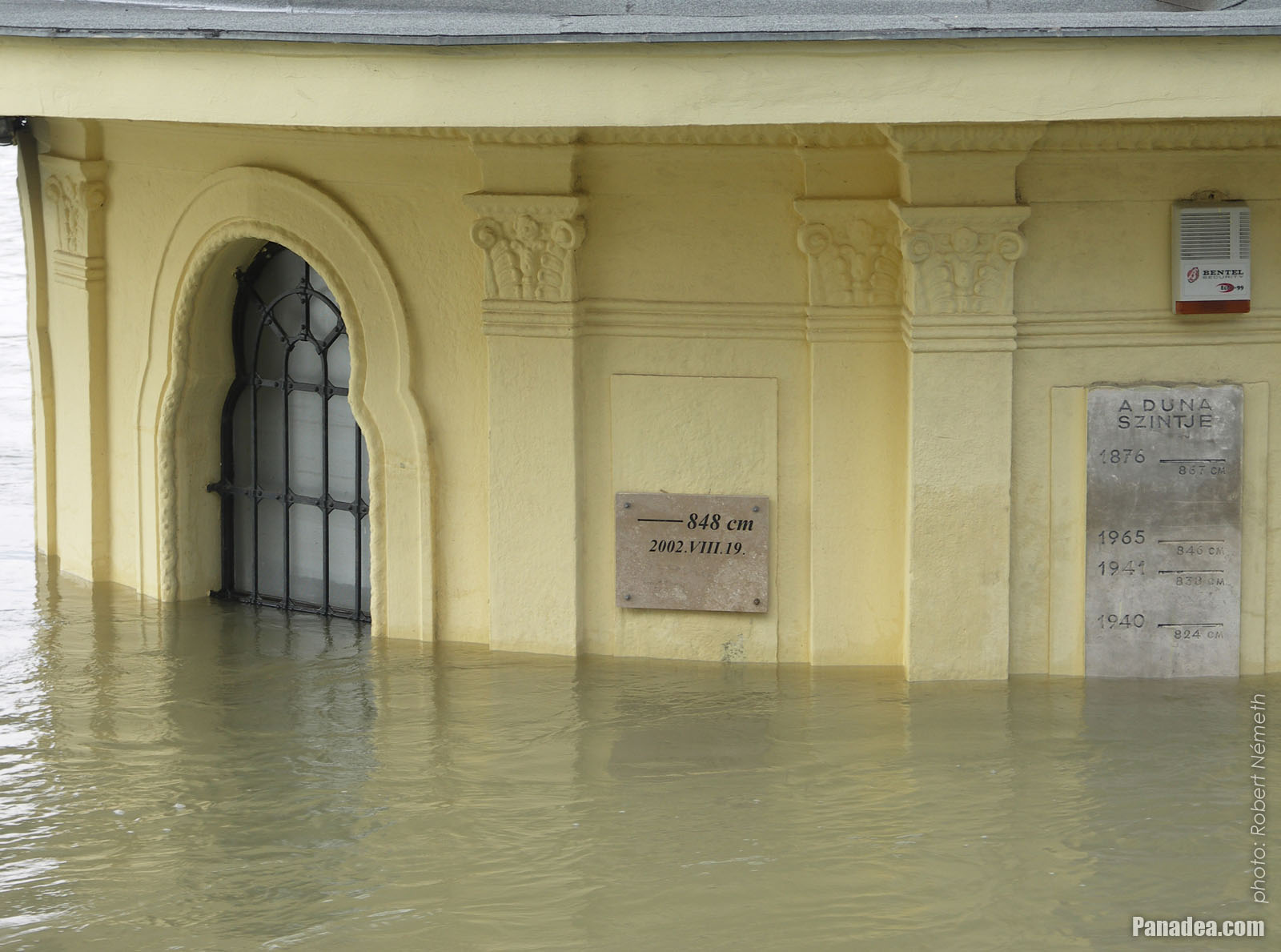
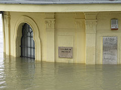
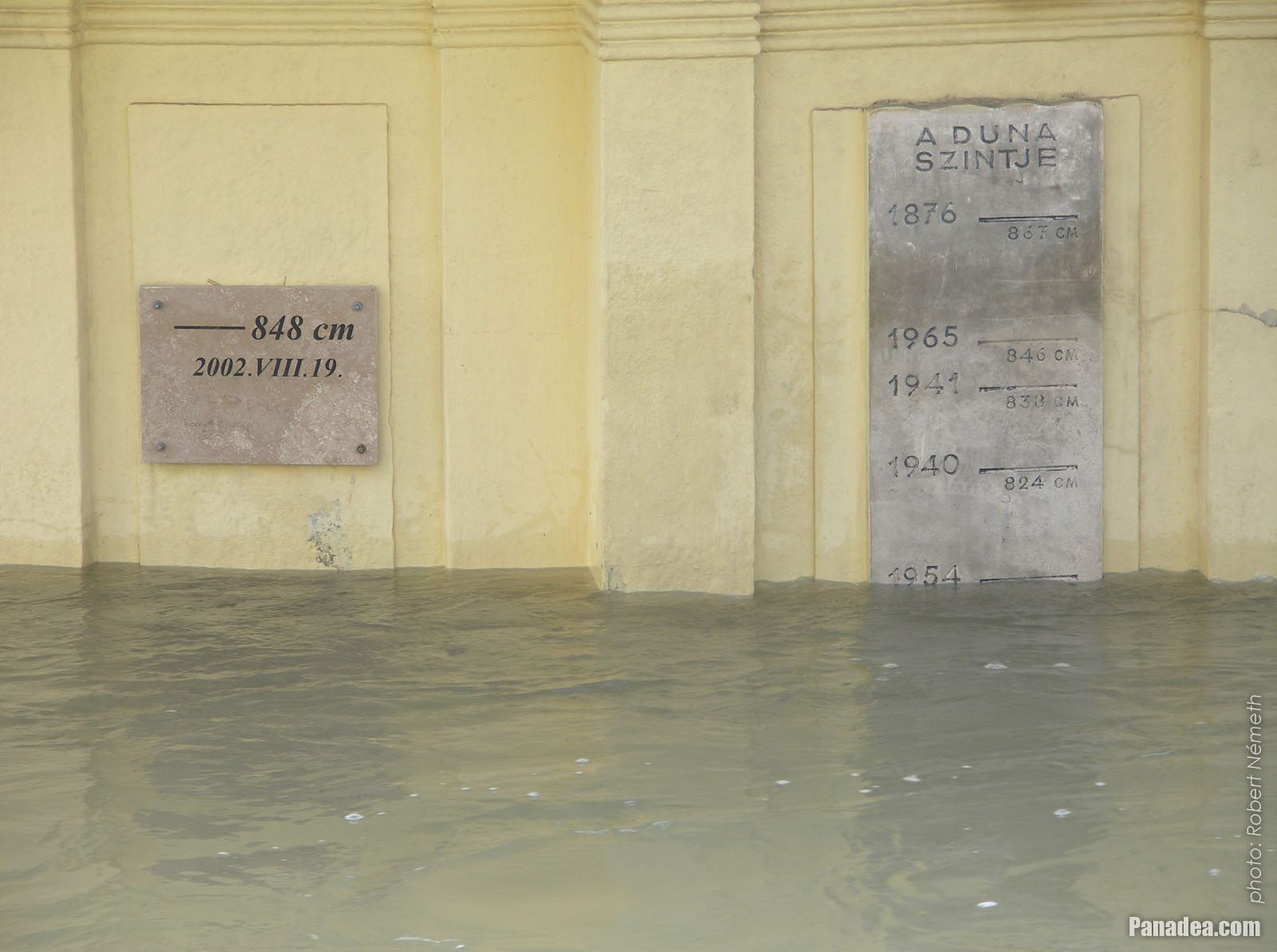
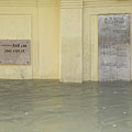
Marble plaques on the wall of the Vigadó Square boat station, displaying the water levels of the highest floods
The flood of 2006 was finally peaked at 860 cm, the wet line on the wall roughly show this level.
Датум фотографисања: 07. 04. 2006.2006
Цреатед би: Robert Németh
Модел фотоапарата: Konica Minolta Dimage A200
Будимпешта, Мађарска
Marble plaques on the wall of the Vigadó Square boat station, displaying the water levels of the highest floods - Будимпешта, Мађарска -
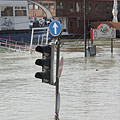
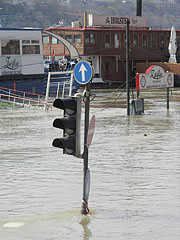
Traffic light and port
Датум фотографисања: 07. 04. 2006.2006
Цреатед би: Robert Németh
Модел фотоапарата: Konica Minolta Dimage A200
Будимпешта, Мађарска
Traffic light and port - Будимпешта, Мађарска -
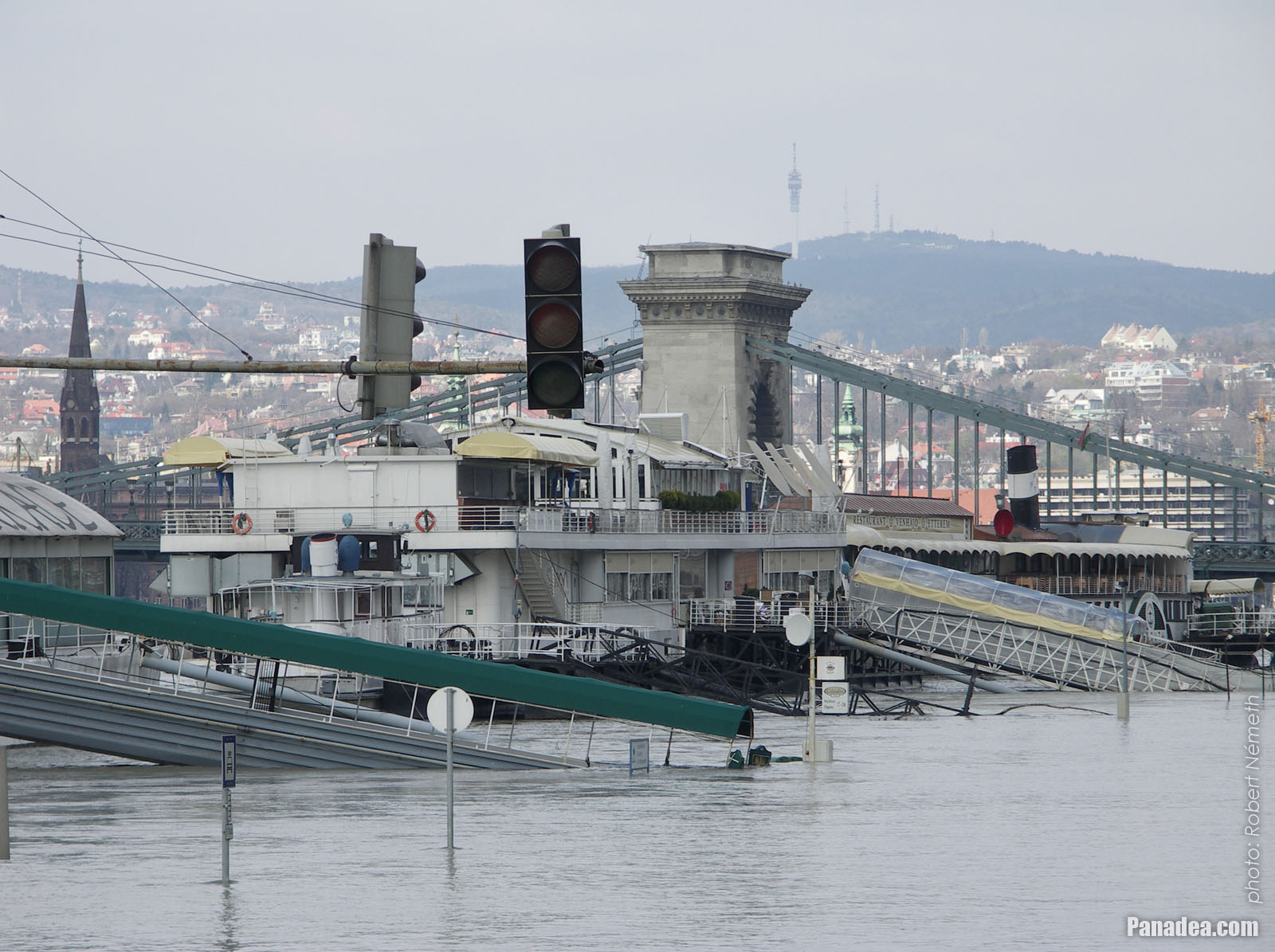
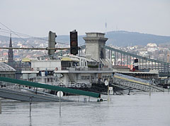
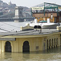
The characteristic building of the Vigadó Square boat station, and the Chain Bridge
Датум фотографисања: 07. 04. 2006.2006
Цреатед би: Robert Németh
Модел фотоапарата: Konica Minolta Dimage A200
Будимпешта, Мађарска
The characteristic building of the Vigadó Square boat station, and the Chain Bridge - Будимпешта, Мађарска -
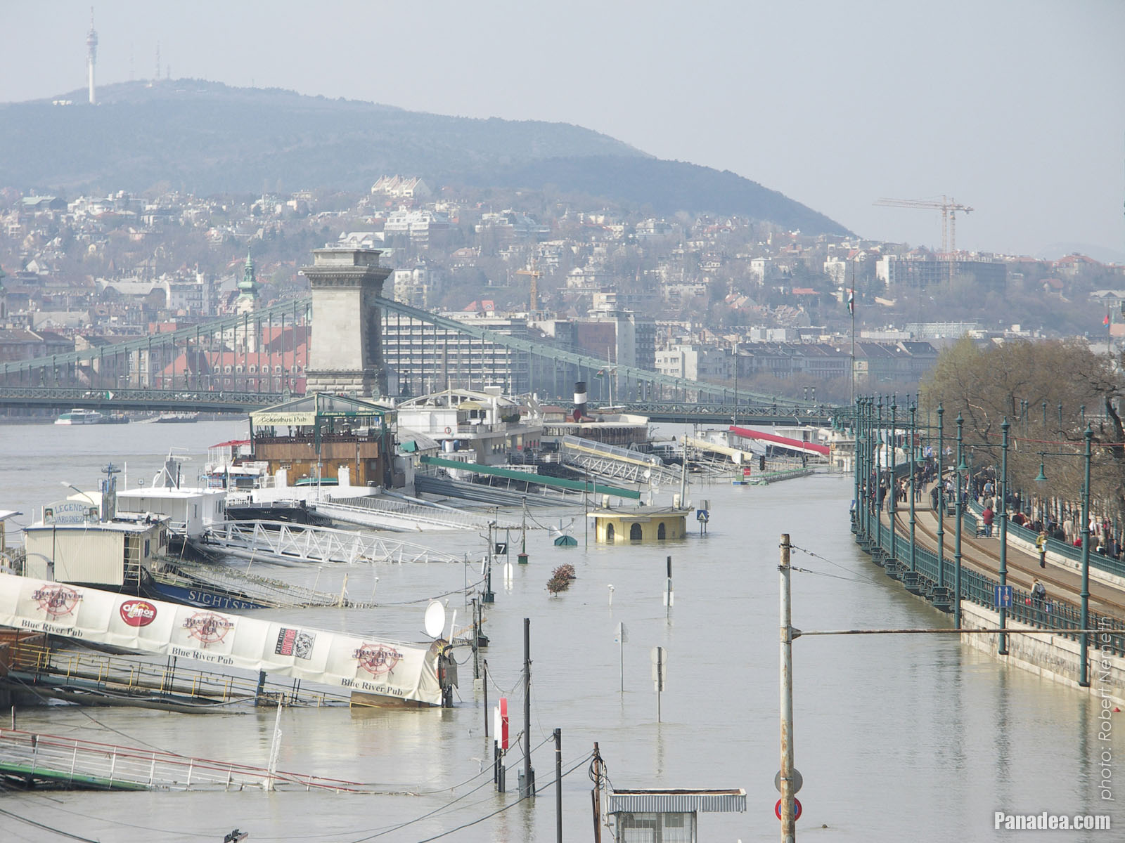
The riverbank of the Danube in the downtown around the Vigadó Square
Датум фотографисања: 07. 04. 2006.2006
Цреатед би: Robert Németh
Модел фотоапарата: Konica Minolta Dimage A200
Будимпешта, Мађарска
The riverbank of the Danube in the downtown around the Vigadó Square - Будимпешта, Мађарска -
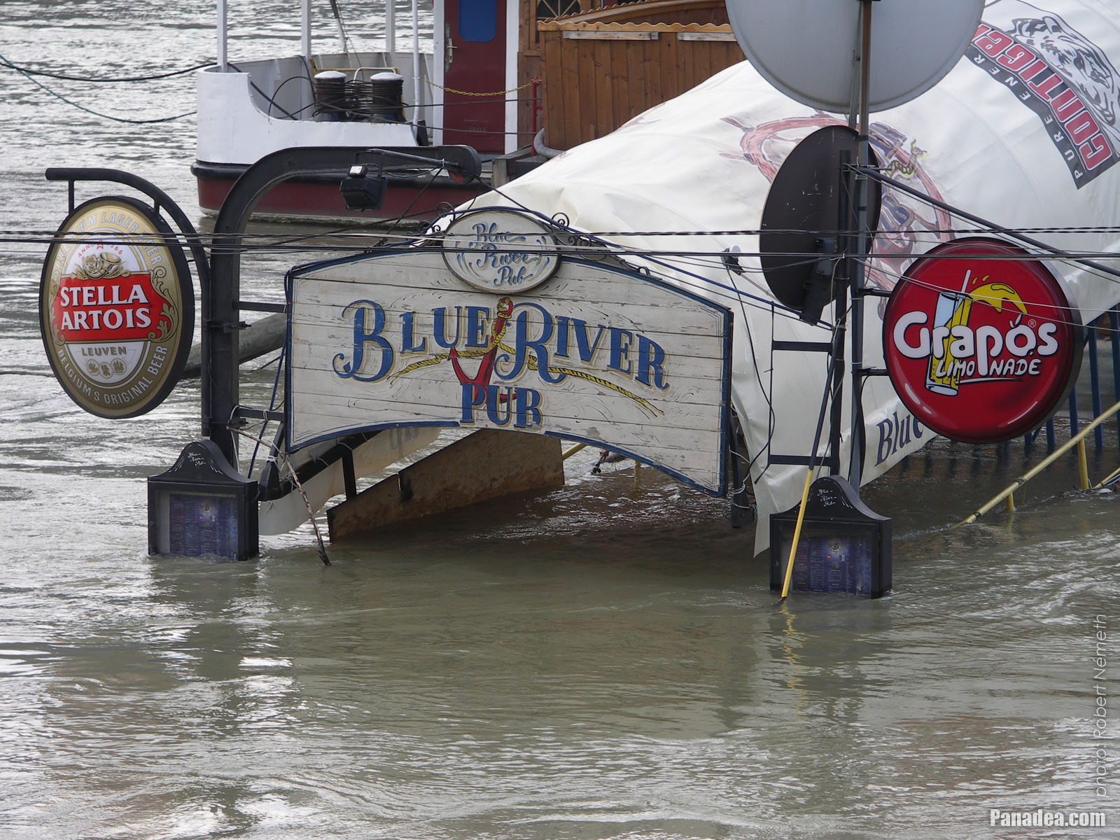
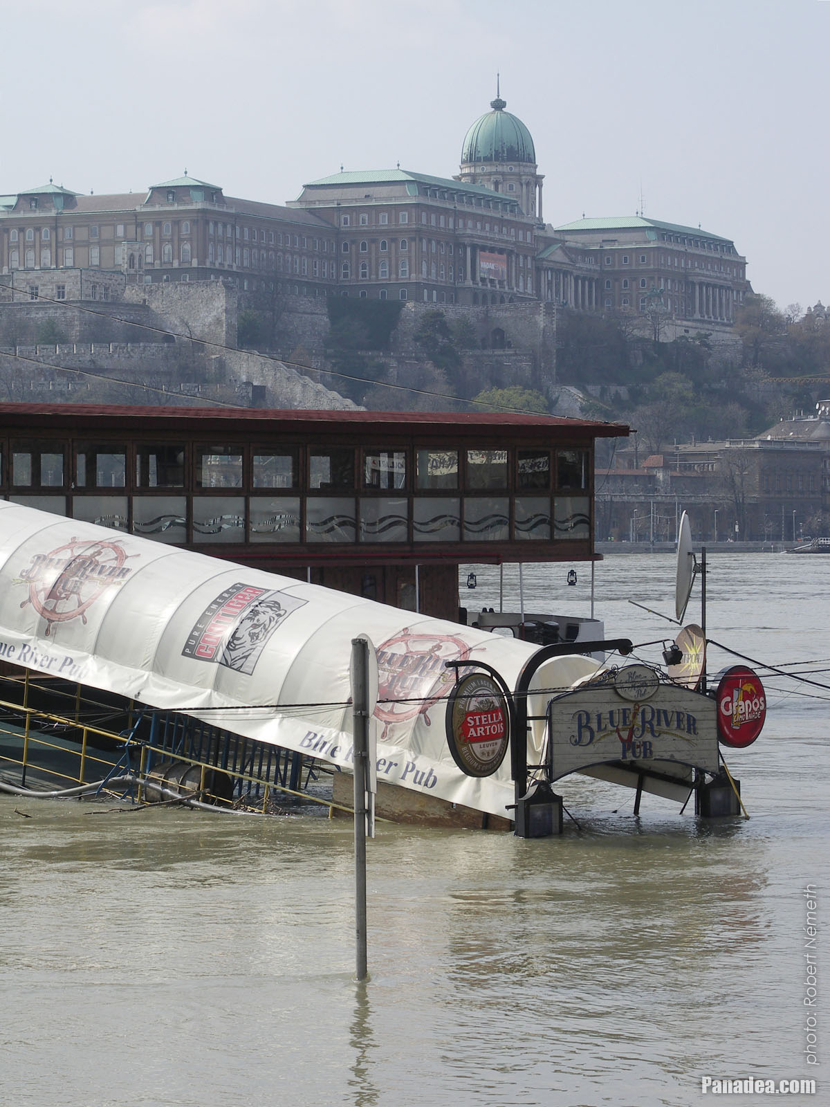
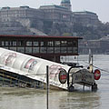
Now the Blue River Pub restaurant boat can be accessed only throught the water
Датум фотографисања: 07. 04. 2006.2006
Цреатед би: Robert Németh
Модел фотоапарата: Konica Minolta Dimage A200
Будимпешта, Мађарска
Now the Blue River Pub restaurant boat can be accessed only throught the water - Будимпешта, Мађарска -
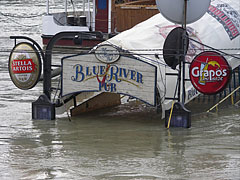
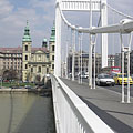
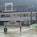
Riverboats are hanging in the harbor at the Pest-side foot of the Elizabeth Bridge
Датум фотографисања: 07. 04. 2006.2006
Цреатед би: Robert Németh
Модел фотоапарата: Konica Minolta Dimage A200
Будимпешта, Мађарска
Riverboats are hanging in the harbor at the Pest-side foot of the Elizabeth Bridge - Будимпешта, Мађарска -
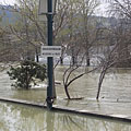
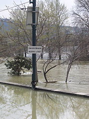
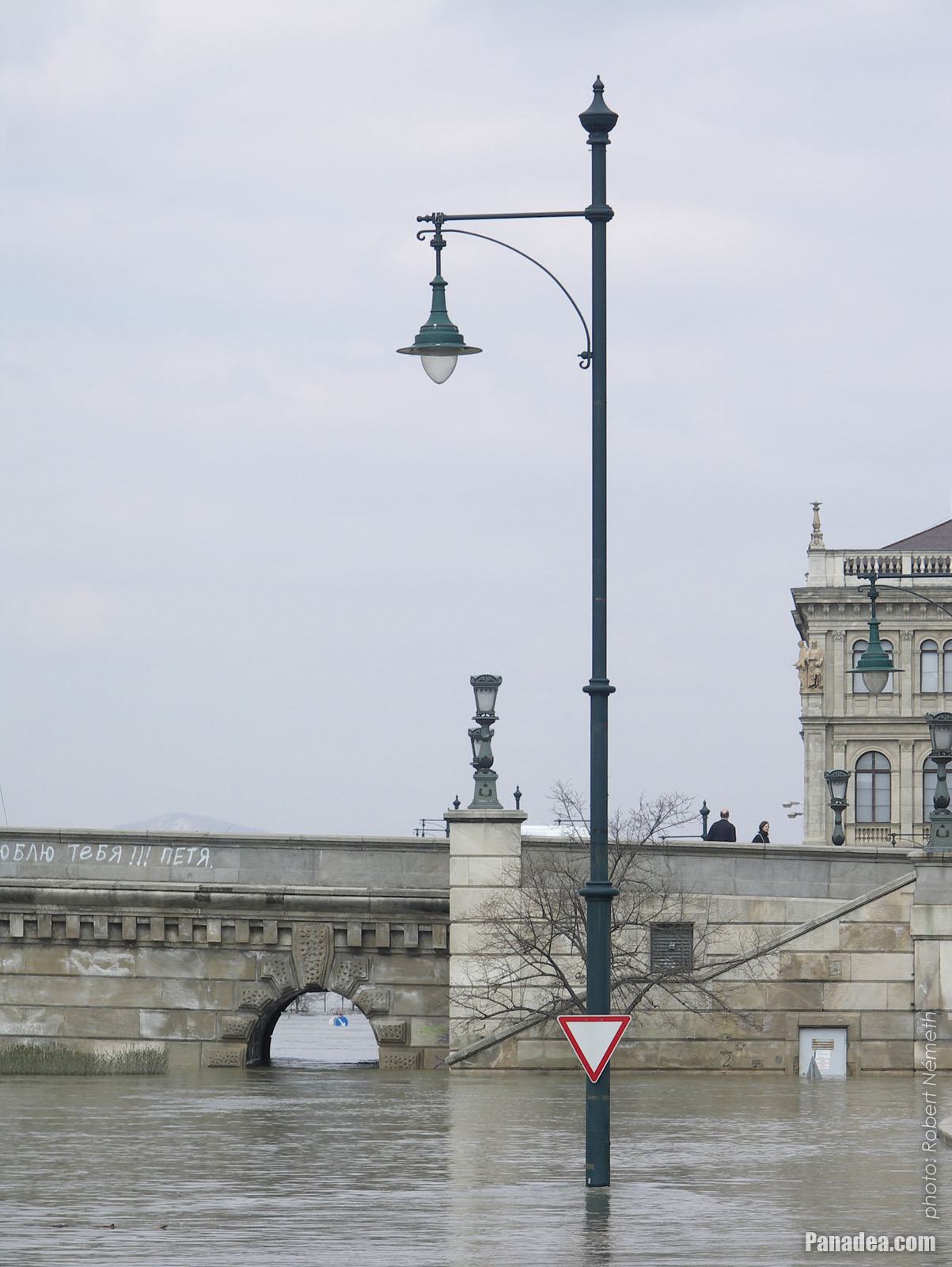
The lower embankment in Pest in Belváros (Downtown) district, but now only some lamp posts above the water level reveal this fact
Датум фотографисања: 07. 04. 2006.2006
Цреатед би: Robert Németh
Модел фотоапарата: Konica Minolta Dimage A200
Будимпешта, Мађарска
The lower embankment in Pest in Belváros (Downtown) district, but now only some lamp posts above the water level reveal this fact - Будимпешта, Мађарска -
The inner city lower embankment
Датум фотографисања: 07. 04. 2006.2006
Цреатед би: Robert Németh
Модел фотоапарата: Konica Minolta Dimage A200
Будимпешта, Мађарска
The inner city lower embankment - Будимпешта, Мађарска -
The surroundings of the Chain Bridge on the Buda side, as well as the Matthias Church and the Fisherman's Bastion in the Buda Castle, viewed from the other side of the Danube River
Датум фотографисања: 07. 04. 2006.2006
Цреатед би: Robert Németh
Модел фотоапарата: Konica Minolta Dimage A200
Будимпешта, Мађарска
The surroundings of the Chain Bridge on the Buda side, as well as the Matthias Church and the Fisherman's Bastion in the Buda Castle, viewed from the other side of the Danube River - Будимпешта, Мађарска -
Port on the Pest-side river bank
Датум фотографисања: 07. 04. 2006.2006
Цреатед би: Robert Németh
Модел фотоапарата: Konica Minolta Dimage A200
Будимпешта, Мађарска
Port on the Pest-side river bank - Будимпешта, Мађарска -
Harbour with berths on the downtown section of the Pest-side embankment
Датум фотографисања: 07. 04. 2006.2006
Цреатед би: Robert Németh
Модел фотоапарата: Konica Minolta Dimage A200
Будимпешта, Мађарска
Harbour with berths on the downtown section of the Pest-side embankment - Будимпешта, Мађарска -
The Fisherman's Bastion and the Matthias Church, viewed from the Pest side of the Danube River
Датум фотографисања: 07. 04. 2006.2006
Цреатед би: Robert Németh
Модел фотоапарата: Konica Minolta Dimage A200
Будимпешта, Мађарска
The Fisherman's Bastion and the Matthias Church, viewed from the Pest side of the Danube River - Будимпешта, Мађарска -
Riverboats in the harbour and the Danube bank in Buda with the Buda Castle
Датум фотографисања: 07. 04. 2006.2006
Цреатед би: Robert Németh
Модел фотоапарата: Konica Minolta Dimage A200
Будимпешта, Мађарска
Riverboats in the harbour and the Danube bank in Buda with the Buda Castle - Будимпешта, Мађарска -
Berths and boats in the downtown, none of them can be reached on dry foot
Датум фотографисања: 07. 04. 2006.2006
Цреатед би: Robert Németh
Модел фотоапарата: Konica Minolta Dimage A200
Будимпешта, Мађарска
Berths and boats in the downtown, none of them can be reached on dry foot - Будимпешта, Мађарска -
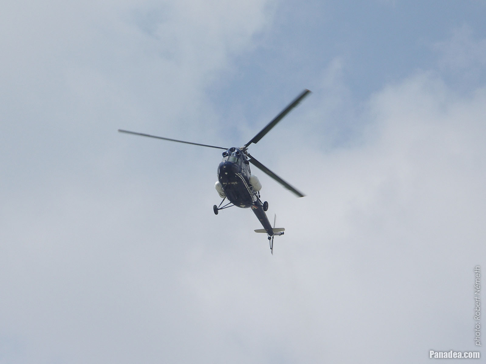
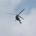
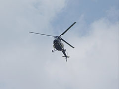
A police helicopter above the Danube River
The helicopter is a soviet Mi-2 model, its registration number is R-14 and has the nickname "Kék Botond", it was manufactured in 1979.
Датум фотографисања: 07. 04. 2006.2006
Цреатед би: Robert Németh
Модел фотоапарата: Konica Minolta Dimage A200
Будимпешта, Мађарска
A police helicopter above the Danube River - Будимпешта, Мађарска -
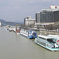
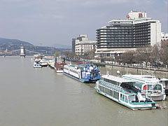
Boats in a queue in the harbor along the promenade and the hotels on the Pest-side riverbank
Датум фотографисања: 07. 04. 2006.2006
Цреатед би: Robert Németh
Модел фотоапарата: Konica Minolta Dimage A200
Будимпешта, Мађарска
Boats in a queue in the harbor along the promenade and the hotels on the Pest-side riverbank - Будимпешта, Мађарска -
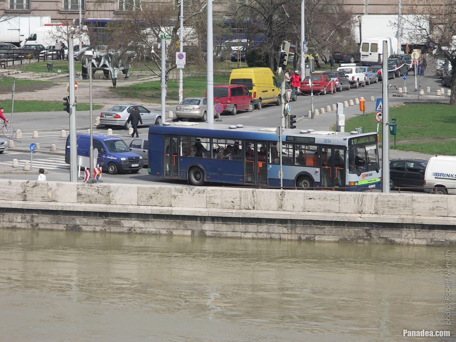
A blue autobus on the Pest riverbank at the Elizabeth Bridge
Датум фотографисања: 07. 04. 2006.2006
Цреатед би: Robert Németh
Модел фотоапарата: Konica Minolta Dimage A200
Будимпешта, Мађарска
A blue autobus on the Pest riverbank at the Elizabeth Bridge - Будимпешта, Мађарска -
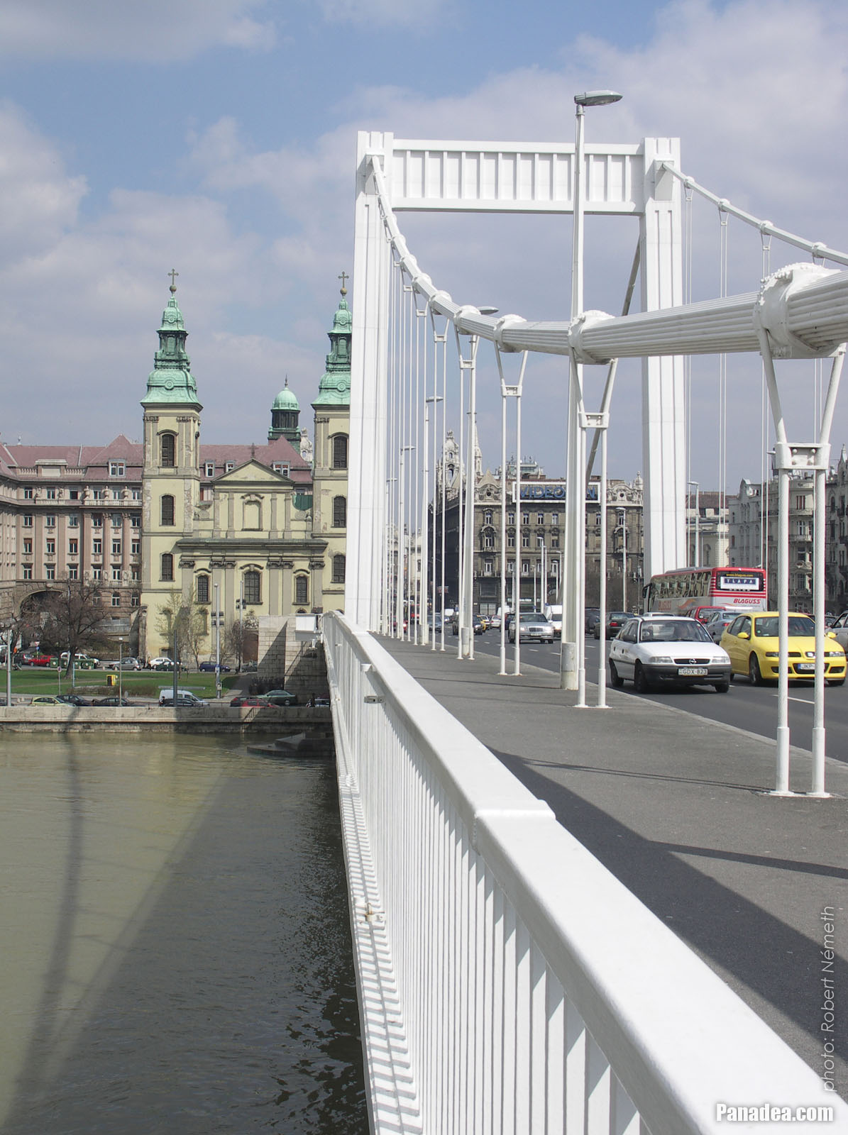
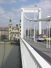
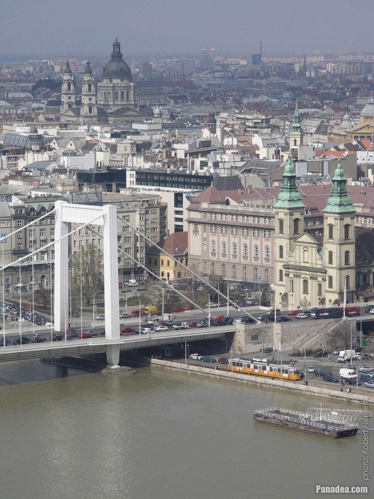
Elizabeth Bridge with the Downtown Parish Church ("Belvárosi Plébániatemplom") at the Pest end of the bridge
Датум фотографисања: 07. 04. 2006.2006
Цреатед би: Robert Németh
Модел фотоапарата: Konica Minolta Dimage A200
Будимпешта, Мађарска
Elizabeth Bridge with the Downtown Parish Church ("Belvárosi Plébániatemplom") at the Pest end of the bridge - Будимпешта, Мађарска -
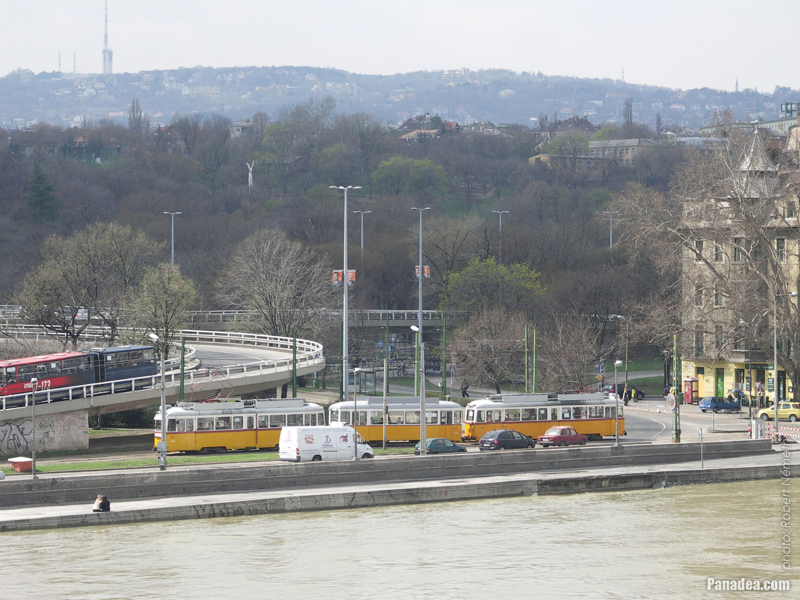
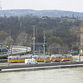
A yellow tram on the Buda-side riverbank of the Danube, at the foot of the Elizabeth Bridge
Датум фотографисања: 07. 04. 2006.2006
Цреатед би: Robert Németh
Модел фотоапарата: Konica Minolta Dimage A200
Будимпешта, Мађарска
A yellow tram on the Buda-side riverbank of the Danube, at the foot of the Elizabeth Bridge - Будимпешта, Мађарска -
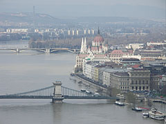
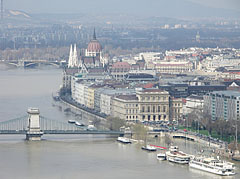
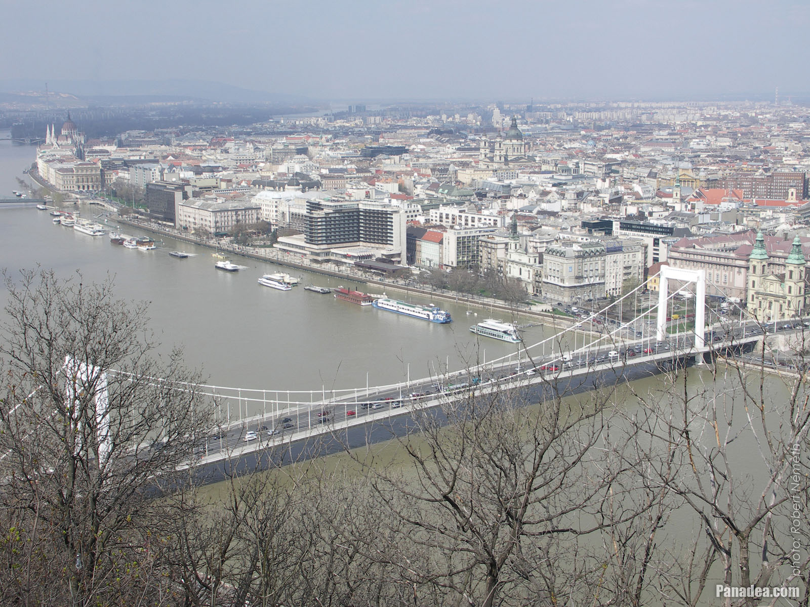
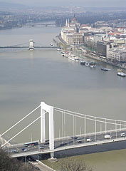
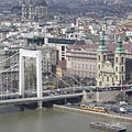
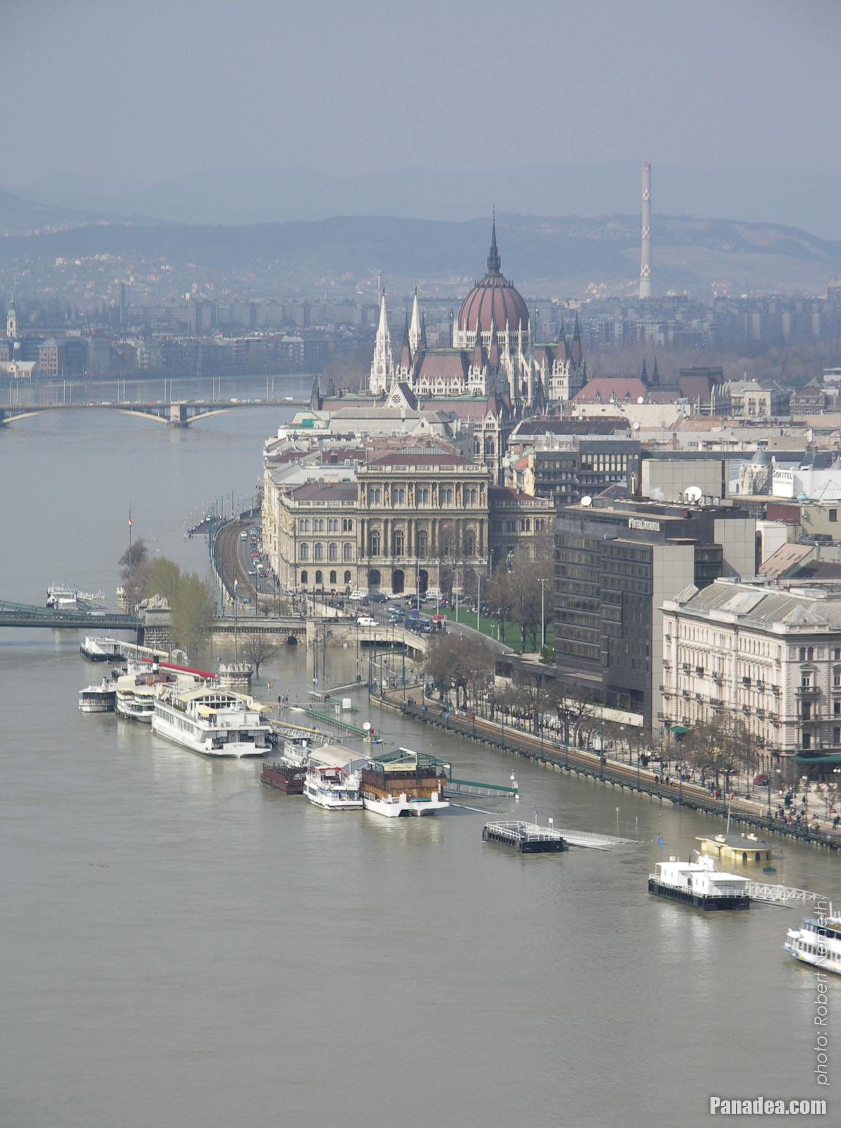
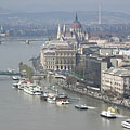
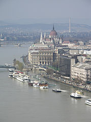
The view of Pest downtown, the Chain Bridge and the Hungarian Parliament Building from the Gellért Hill
Датум фотографисања: 07. 04. 2006.2006
Цреатед би: Robert Németh
Модел фотоапарата: Konica Minolta Dimage A200
Будимпешта, Мађарска
The view of Pest downtown, the Chain Bridge and the Hungarian Parliament Building from the Gellért Hill - Будимпешта, Мађарска -
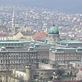
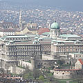
The Buda Castle Quarter (including the Royal Palace and the Matthias Church) and the Hármashatár Mountain as seen from the Gellért Hill
Датум фотографисања: 07. 04. 2006.2006
Цреатед би: Robert Németh
Модел фотоапарата: Konica Minolta Dimage A200
Будимпешта, Мађарска
The Buda Castle Quarter (including the Royal Palace and the Matthias Church) and the Hármashatár Mountain as seen from the Gellért Hill - Будимпешта, Мађарска -
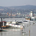
The view of the flooded Danube bank and the Inner City from the Gellért Hill
Датум фотографисања: 07. 04. 2006.2006
Цреатед би: Robert Németh
Модел фотоапарата: Konica Minolta Dimage A200
Будимпешта, Мађарска
The view of the flooded Danube bank and the Inner City from the Gellért Hill - Будимпешта, Мађарска -
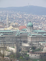
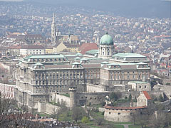
The Buda Castle including the Royal Palace, viewed from the Gellért Hill
Датум фотографисања: 07. 04. 2006.2006
Цреатед би: Robert Németh
Модел фотоапарата: Konica Minolta Dimage A200
Будимпешта, Мађарска
The Buda Castle including the Royal Palace, viewed from the Gellért Hill - Будимпешта, Мађарска -
The view of the flooding Danube River from the Gellért Hill
Датум фотографисања: 07. 04. 2006.2006
Цреатед би: Robert Németh
Модел фотоапарата: Konica Minolta Dimage A200
Будимпешта, Мађарска
The view of the flooding Danube River from the Gellért Hill - Будимпешта, Мађарска -
The view of the flooding River Danube from the Gellért Hill
Датум фотографисања: 07. 04. 2006.2006
Цреатед би: Robert Németh
Модел фотоапарата: Konica Minolta Dimage A200
Будимпешта, Мађарска
The view of the flooding River Danube from the Gellért Hill - Будимпешта, Мађарска -
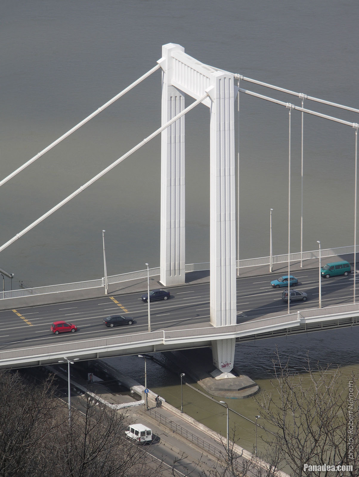
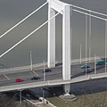
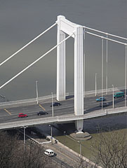
The Buda side of the Elizabeth Bridge with the tower (pylon), viewed from the Gellért Hill
Датум фотографисања: 07. 04. 2006.2006
Цреатед би: Robert Németh
Модел фотоапарата: Konica Minolta Dimage A200
Будимпешта, Мађарска
The Buda side of the Elizabeth Bridge with the tower (pylon), viewed from the Gellért Hill - Будимпешта, Мађарска -
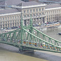
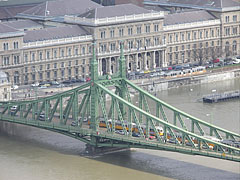
The eastern, Pest-side pylon of the Liberty Bridge (in Hungarain "Szabadság híd"), and the main building of the Corvinus University of Budapest
Датум фотографисања: 07. 04. 2006.2006
Цреатед би: Robert Németh
Модел фотоапарата: Konica Minolta Dimage A200
Будимпешта, Мађарска
The eastern, Pest-side pylon of the Liberty Bridge (in Hungarain "Szabadság híd"), and the main building of the Corvinus University of Budapest - Будимпешта, Мађарска -
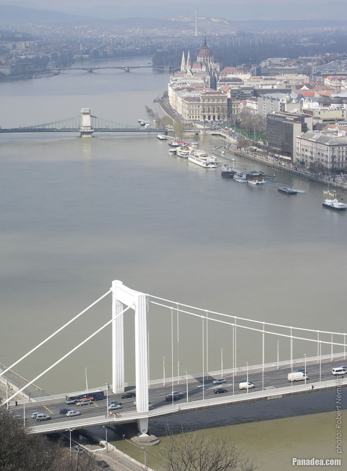
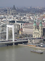
The Pest side of the Elizabeth Bridge with the pylon, as well as the Inner City Parish Church and some distance away the St. Stephen's Basilica
Датум фотографисања: 07. 04. 2006.2006
Цреатед би: Robert Németh
Модел фотоапарата: Konica Minolta Dimage A200
Будимпешта, Мађарска
The Pest side of the Elizabeth Bridge with the pylon, as well as the Inner City Parish Church and some distance away the St. Stephen's Basilica - Будимпешта, Мађарска -
The floode lower quay of the inner city Danube bank
Датум фотографисања: 07. 04. 2006.2006
Цреатед би: Robert Németh
Модел фотоапарата: Konica Minolta Dimage A200
Будимпешта, Мађарска
The floode lower quay of the inner city Danube bank - Будимпешта, Мађарска -
The view of the river flood from the Gellért Hill
Датум фотографисања: 07. 04. 2006.2006
Цреатед би: Robert Németh
Модел фотоапарата: Konica Minolta Dimage A200
Будимпешта, Мађарска
The view of the river flood from the Gellért Hill - Будимпешта, Мађарска -
The Pest-side riverbank of the Danube, viewed from the Elizabeth Bridge
Датум фотографисања: 07. 04. 2006.2006
Цреатед би: Robert Németh
Модел фотоапарата: Konica Minolta Dimage A200
Будимпешта, Мађарска
The Pest-side riverbank of the Danube, viewed from the Elizabeth Bridge - Будимпешта, Мађарска -
The Pest-side Danube bank, viewed from the Elizabeth Bridge, the riverbank is many tens of meters further out than as usual, due to the flood
Датум фотографисања: 07. 04. 2006.2006
Цреатед би: Robert Németh
Модел фотоапарата: Konica Minolta Dimage A200
Будимпешта, Мађарска
The Pest-side Danube bank, viewed from the Elizabeth Bridge, the riverbank is many tens of meters further out than as usual, due to the flood - Будимпешта, Мађарска -
The downtown Danube bank with the promenade
Датум фотографисања: 07. 04. 2006.2006
Цреатед би: Robert Németh
Модел фотоапарата: Konica Minolta Dimage A200
Будимпешта, Мађарска
The downtown Danube bank with the promenade - Будимпешта, Мађарска -
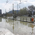
Despite the situation the tram tracks on the Danube bank not in the least deserted (even though the tram line 2 is now suspended)
Датум фотографисања: 07. 04. 2006.2006
Цреатед би: Robert Németh
Модел фотоапарата: Konica Minolta Dimage A200
Будимпешта, Мађарска
Despite the situation the tram tracks on the Danube bank not in the least deserted (even though the tram line 2 is now suspended) - Будимпешта, Мађарска -
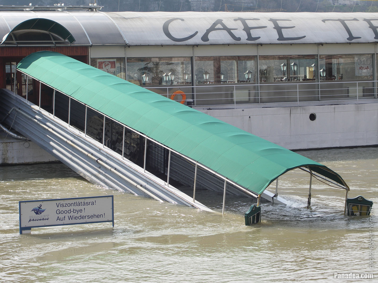
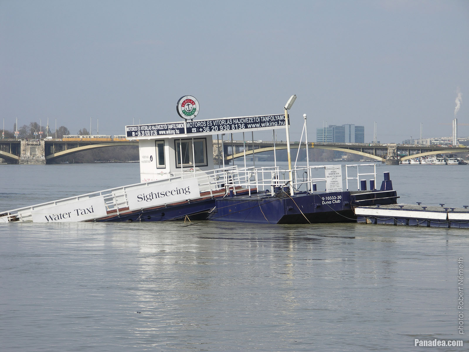
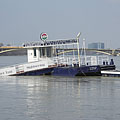
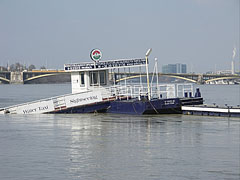
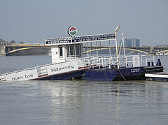
The now semi-underwater ticked office of the boat station
Датум фотографисања: 07. 04. 2006.2006
Цреатед би: Robert Németh
Модел фотоапарата: Konica Minolta Dimage A200
Будимпешта, Мађарска
The now semi-underwater ticked office of the boat station - Будимпешта, Мађарска -
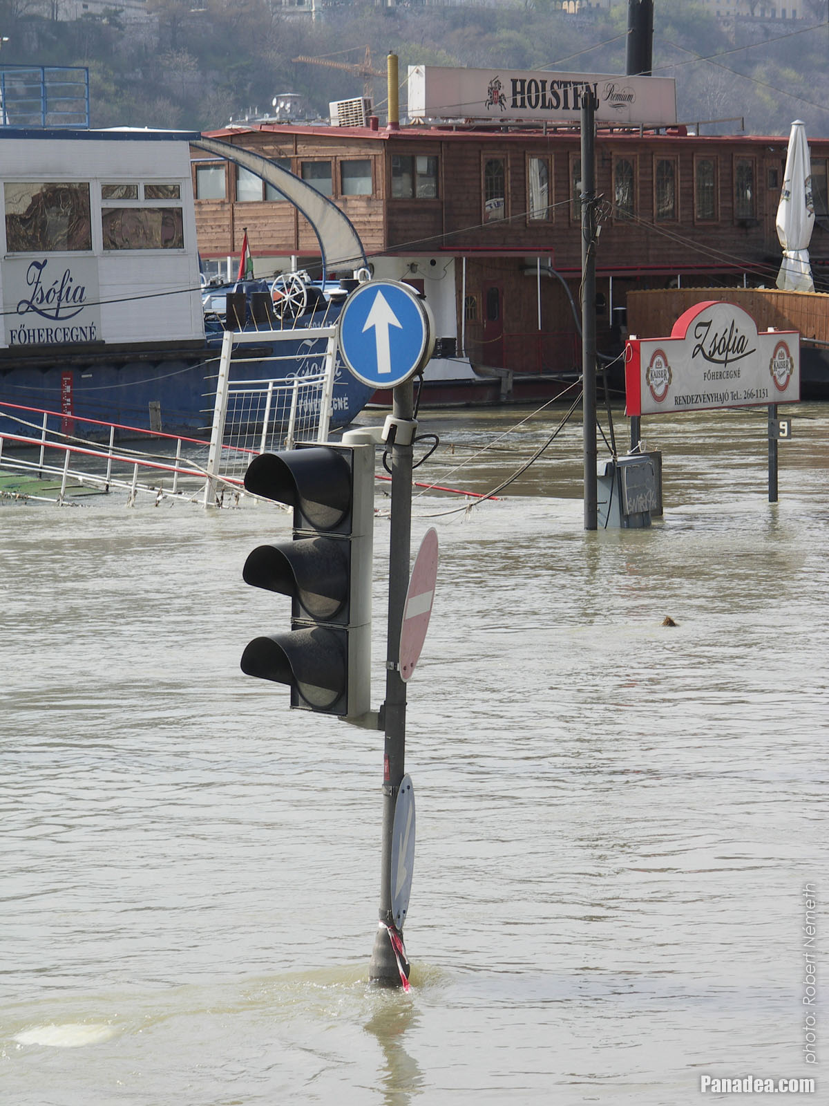
Traffic light in the Danube River
Датум фотографисања: 07. 04. 2006.2006
Цреатед би: Robert Németh
Модел фотоапарата: Konica Minolta Dimage A200
Будимпешта, Мађарска
Traffic light in the Danube River - Будимпешта, Мађарска -
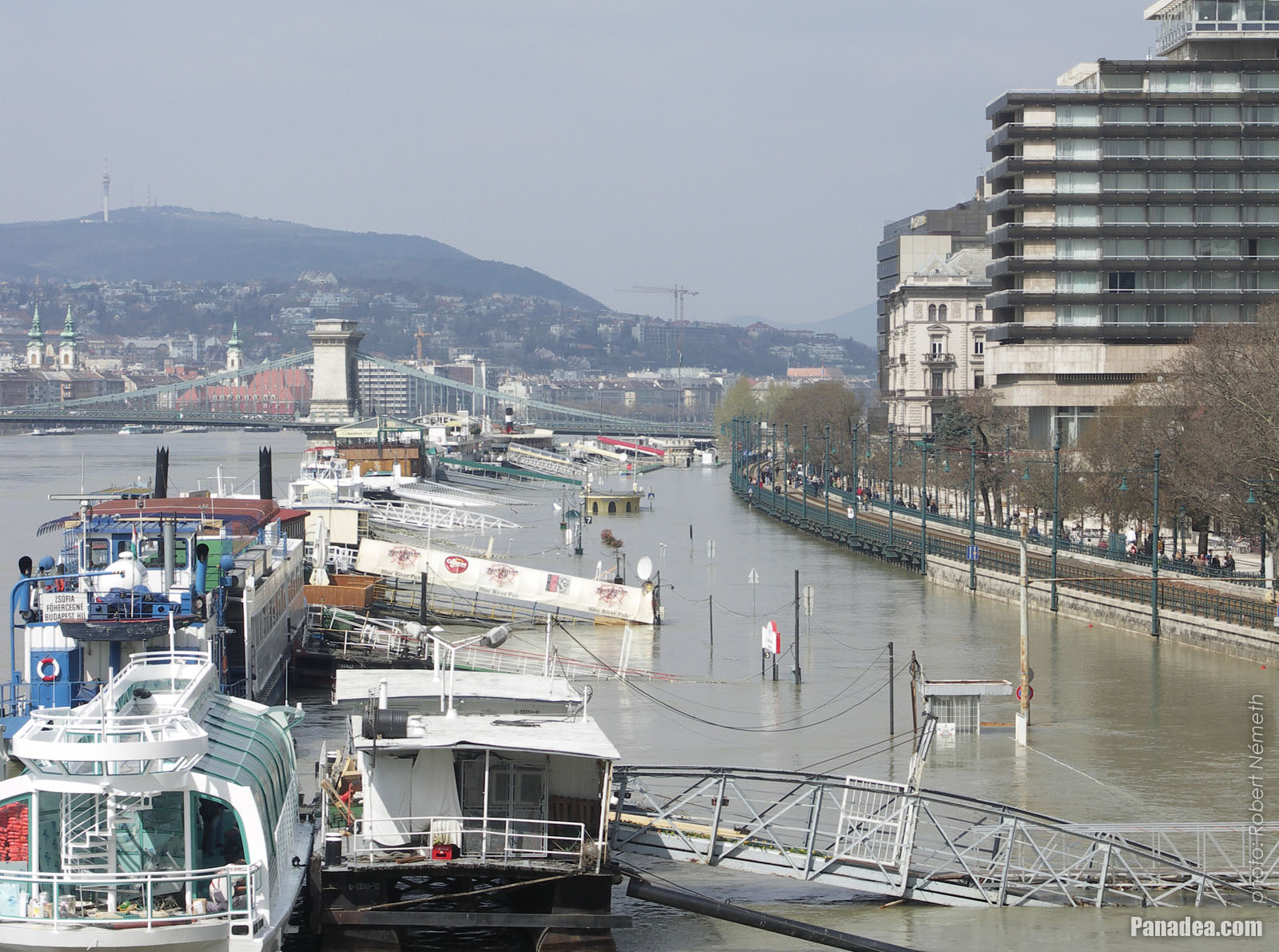
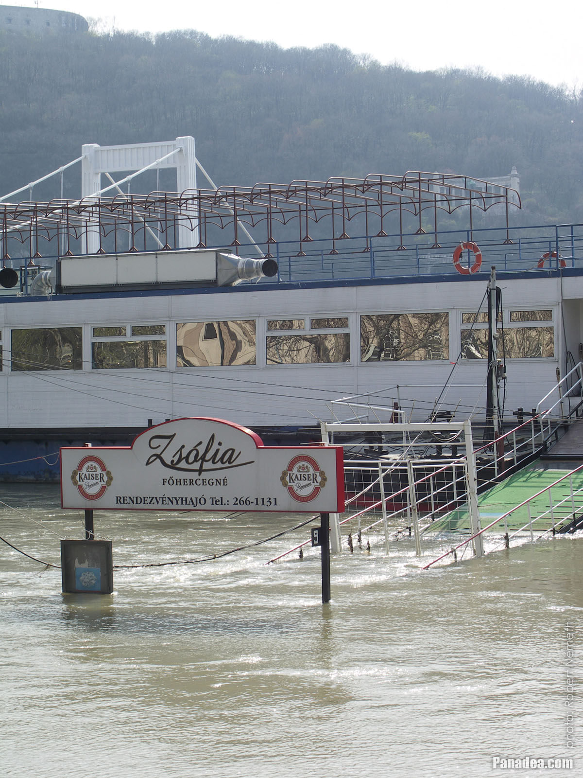
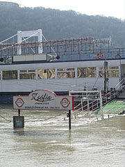
The "Zsófia főhercegné" venue boat in its berth
This self-propelled boat was constructed in Balatonfüred, Hungary in the 1970s.
Датум фотографисања: 07. 04. 2006.2006
Цреатед би: Robert Németh
Модел фотоапарата: Konica Minolta Dimage A200
Будимпешта, Мађарска
The "Zsófia főhercegné" venue boat in its berth - Будимпешта, Мађарска -
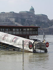
The berth of the Blue River Pub boat restaurant
Датум фотографисања: 07. 04. 2006.2006
Цреатед би: Robert Németh
Модел фотоапарата: Konica Minolta Dimage A200
Будимпешта, Мађарска
The berth of the Blue River Pub boat restaurant - Будимпешта, Мађарска -
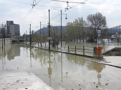
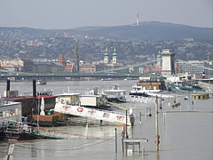
This is how the downtown Danube bank looks like when it is flooded by the Danube River
Датум фотографисања: 07. 04. 2006.2006
Цреатед би: Robert Németh
Модел фотоапарата: Konica Minolta Dimage A200
Будимпешта, Мађарска
This is how the downtown Danube bank looks like when it is flooded by the Danube River - Будимпешта, Мађарска -
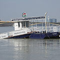
The Vigadó Square boat station and its surroundings are under the flooding river
Датум фотографисања: 07. 04. 2006.2006
Цреатед би: Robert Németh
Модел фотоапарата: Konica Minolta Dimage A200
Будимпешта, Мађарска
The Vigadó Square boat station and its surroundings are under the flooding river - Будимпешта, Мађарска -
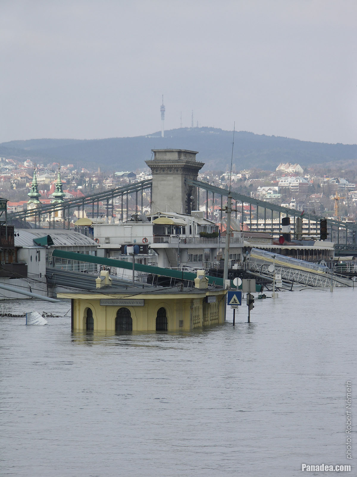
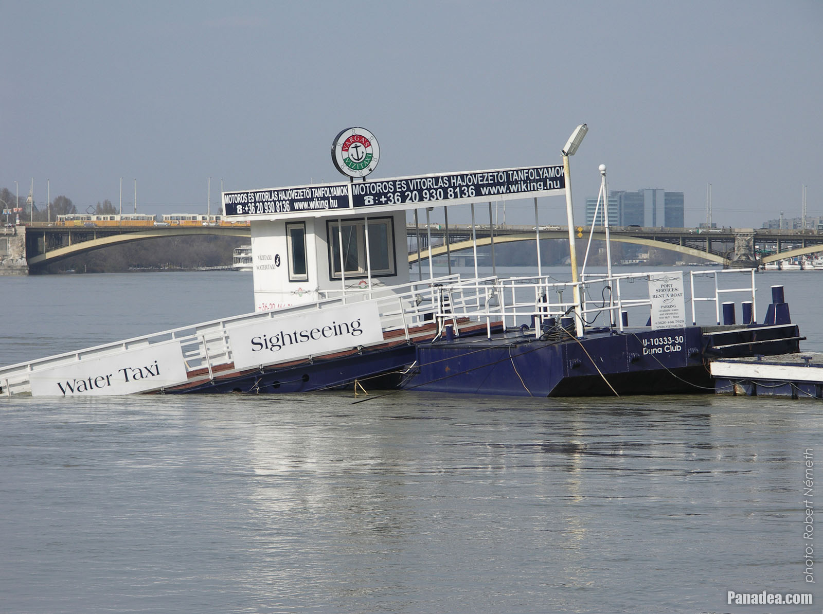
The yellow building of the Vigadó Square boat station is almost submerged in the water
Датум фотографисања: 07. 04. 2006.2006
Цреатед би: Robert Németh
Модел фотоапарата: Konica Minolta Dimage A200
Будимпешта, Мађарска
The yellow building of the Vigadó Square boat station is almost submerged in the water - Будимпешта, Мађарска -
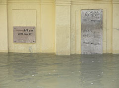
Vigadó Square boat station, the water level marks with year numbers of the greatest floods on the wall of the building
The Danube flood of 2006 was peaked here at 860 cm.
Датум фотографисања: 07. 04. 2006.2006
Цреатед би: Robert Németh
Модел фотоапарата: Konica Minolta Dimage A200
Будимпешта, Мађарска
Vigadó Square boat station, the water level marks with year numbers of the greatest floods on the wall of the building - Будимпешта, Мађарска -
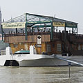
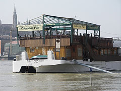
Columbus Pub venue and restaurant boat
Датум фотографисања: 07. 04. 2006.2006
Цреатед би: Robert Németh
Модел фотоапарата: Konica Minolta Dimage A200
Будимпешта, Мађарска
Columbus Pub venue and restaurant boat - Будимпешта, Мађарска -
People on the tram tracks, the disaster tourism is thriving also on bank of River Danube in the downtown
It may thanks to the fine weather as well.
Датум фотографисања: 07. 04. 2006.2006
Цреатед би: Robert Németh
Модел фотоапарата: Konica Minolta Dimage A200
Будимпешта, Мађарска
People on the tram tracks, the disaster tourism is thriving also on bank of River Danube in the downtown - Будимпешта, Мађарска -
Entrance of a restaurant vessel, but to enter now at least a boat is needed
Датум фотографисања: 07. 04. 2006.2006
Цреатед би: Robert Németh
Модел фотоапарата: Konica Minolta Dimage A200
Будимпешта, Мађарска
Entrance of a restaurant vessel, but to enter now at least a boat is needed - Будимпешта, Мађарска -
The track of tram line 2 at Eötvös Square, the traffic service is suspended due to the flood
Датум фотографисања: 07. 04. 2006.2006
Цреатед би: Robert Németh
Модел фотоапарата: Konica Minolta Dimage A200
Будимпешта, Мађарска
The track of tram line 2 at Eötvös Square, the traffic service is suspended due to the flood - Будимпешта, Мађарска -
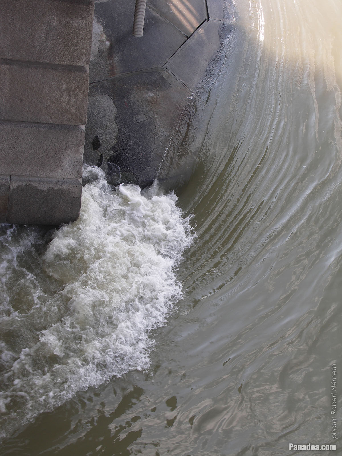
Swirling water around a piers of the Széchenyi Chain Bridge
Датум фотографисања: 07. 04. 2006.2006
Цреатед би: Robert Németh
Модел фотоапарата: Konica Minolta Dimage A200
Будимпешта, Мађарска
Swirling water around a piers of the Széchenyi Chain Bridge - Будимпешта, Мађарска -
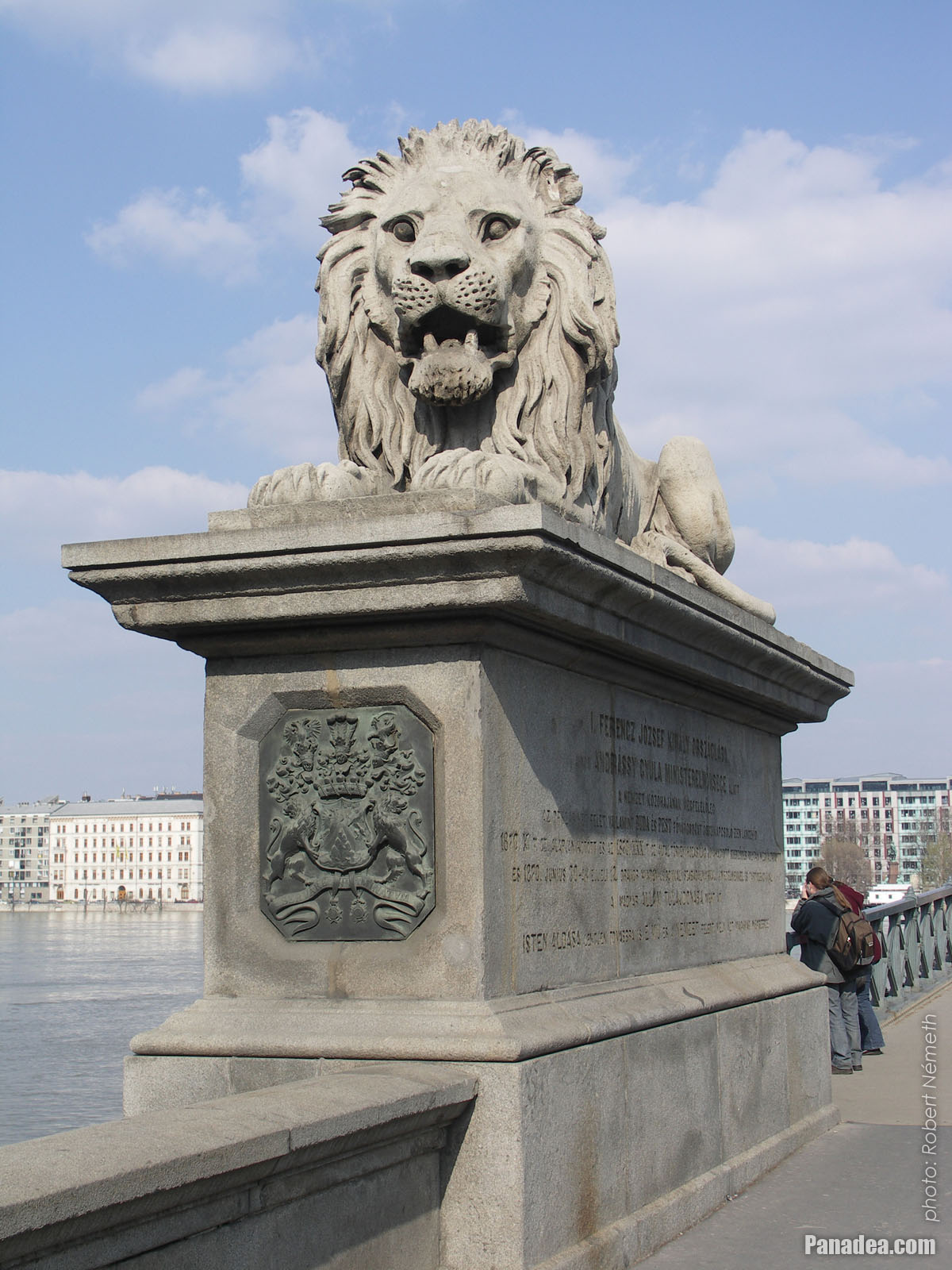
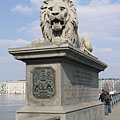
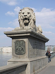
One of the stone lions of the Széchenyi Chain Bridge on the Buda-side bridge connection
Датум фотографисања: 07. 04. 2006.2006
Цреатед би: Robert Németh
Модел фотоапарата: Konica Minolta Dimage A200
Будимпешта, Мађарска
One of the stone lions of the Széchenyi Chain Bridge on the Buda-side bridge connection - Будимпешта, Мађарска -
The port of a sightseeing boat
Датум фотографисања: 07. 04. 2006.2006
Цреатед би: Robert Németh
Модел фотоапарата: Konica Minolta Dimage A200
Будимпешта, Мађарска
The port of a sightseeing boat - Будимпешта, Мађарска -
The port of a sightseeing boat
Датум фотографисања: 07. 04. 2006.2006
Цреатед би: Robert Németh
Модел фотоапарата: Konica Minolta Dimage A200
Будимпешта, Мађарска
The port of a sightseeing boat - Будимпешта, Мађарска -
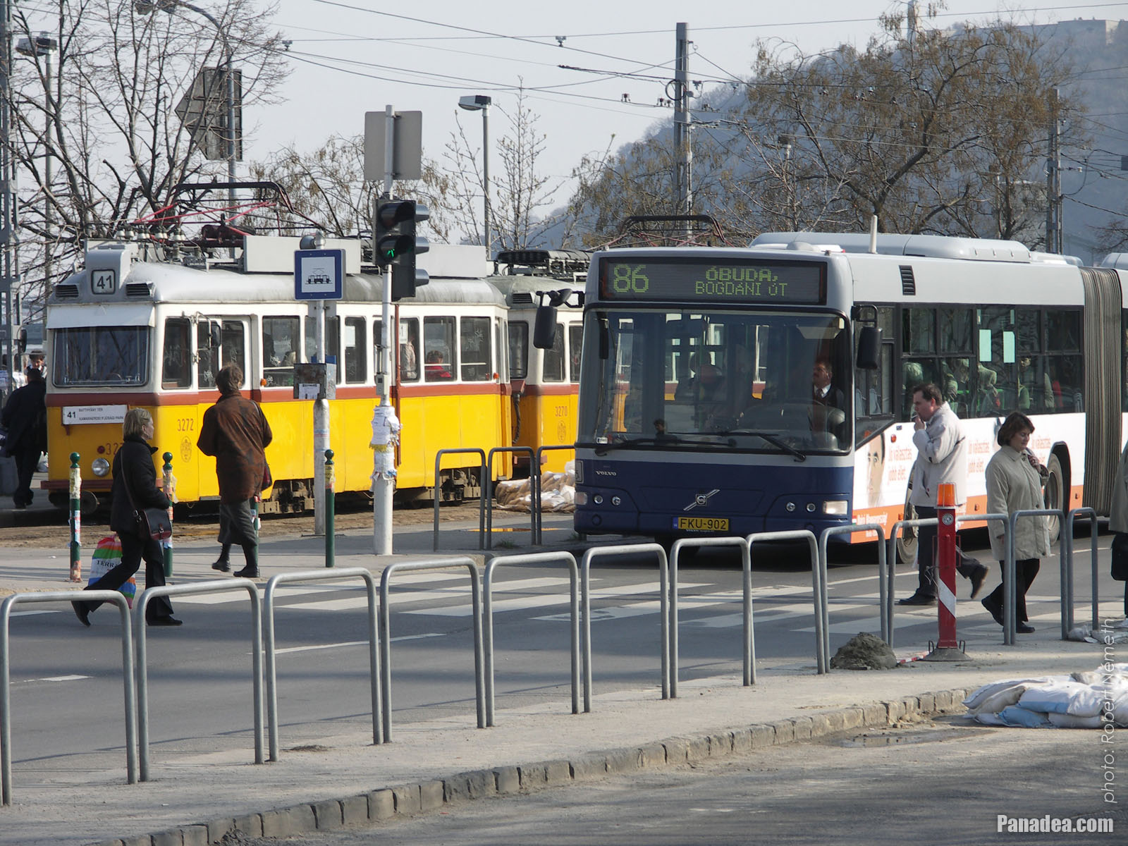
A yellow tram and a blue autobus on the Batthyány Square
Датум фотографисања: 07. 04. 2006.2006
Цреатед би: Robert Németh
Модел фотоапарата: Konica Minolta Dimage A200
Будимпешта, Мађарска
A yellow tram and a blue autobus on the Batthyány Square - Будимпешта, Мађарска -
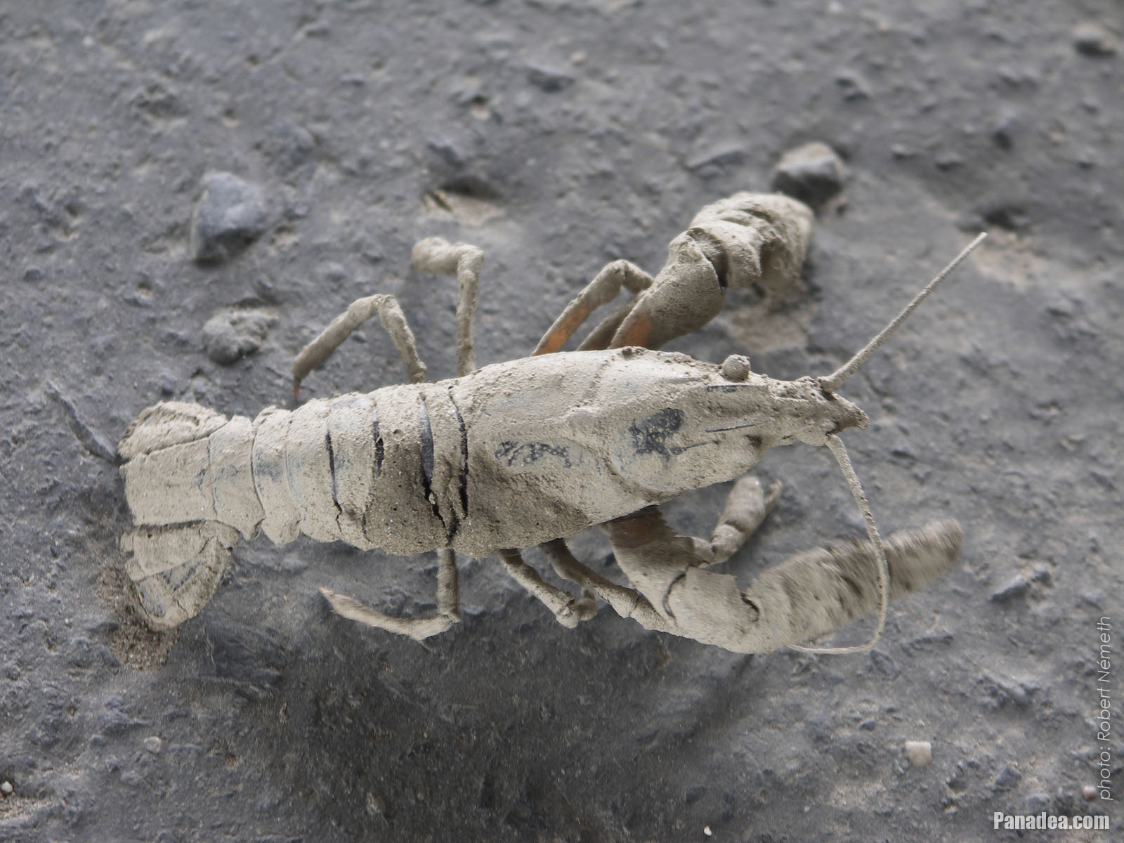
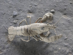
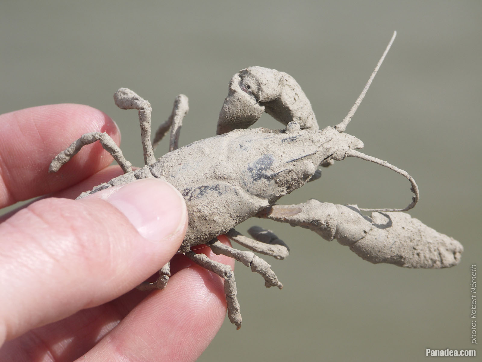
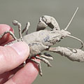
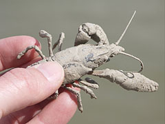
The muddy European crayfish or noble crayfish (Astacus astacus) came ashore during the retreat of the river
Датум фотографисања: 10. 04. 2006.2006
Цреатед би: Robert Németh
Модел фотоапарата: Konica Minolta Dimage A200
Будимпешта, Мађарска
The muddy European crayfish or noble crayfish (Astacus astacus) came ashore during the retreat of the river - Будимпешта, Мађарска -
European crayfish or noble crayfish (Astacus astacus)
Датум фотографисања: 10. 04. 2006.2006
Цреатед би: Robert Németh
Модел фотоапарата: Konica Minolta Dimage A200
Будимпешта, Мађарска
European crayfish or noble crayfish (Astacus astacus) - Будимпешта, Мађарска -
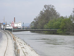
The shrinking Danube River after the flood at the Óbudai Island
Датум фотографисања: 10. 04. 2006.2006
Цреатед би: Robert Németh
Модел фотоапарата: Konica Minolta Dimage A200
Будимпешта, Мађарска
The shrinking Danube River after the flood at the Óbudai Island - Будимпешта, Мађарска

Кликните на сликама!
Карактеристике, особине
Положај:
ГПС координате: Ширина 47°29'35", Дужина 19°2'45" (N47 29.58 - E19 2.75)
Информације, кратке приче, занимљивих чињеница
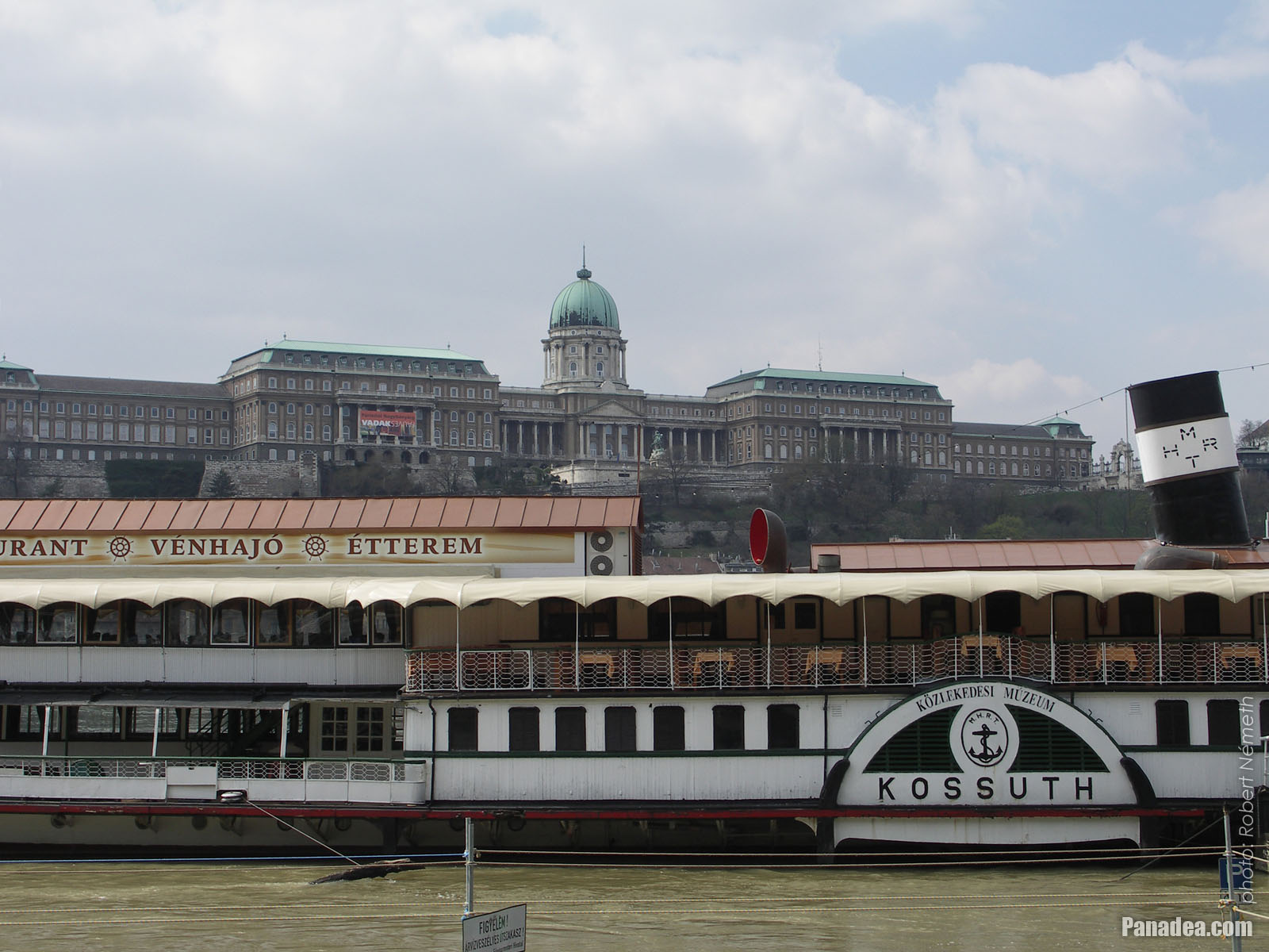 The "Kossuth" museum and restaurant boat, including the "Vénhajó" Restaurant, the background of the photo is filled with the huge Royal Palace in the Buda Castle
The old "Kossuth" riverboat was originally a side wheel passenger steamer (steamboat), it was constructed in 1913 in the Ganz Danubius shipbuilding factory in Újpest. Now it is berthed in front of the Hotel InterContinental, close to the Pest-side end of the Széchenyi Chain Bridge. Initially it was named as "Ferencz Ferdinánd főherczeg" (after Archduke Franz Ferdinand of Austria), then it was renamed to "Rigó" ("Thrush", the bird species) in 1919 probably due to the short-lived communist Hungarian Soviet Republic ("Tanácsköztársaság"), and to "Leányfalu" in 1930. It was rebuilt in Újpest in 1953 and received its new name: "Kossuth" (after Lajos Kossuth Hungarian politician in the 19th century). Withdrawn from traffic in 1978, renovated and since 1984 it is a stationary vessel in Budapest. The museum boat was operated by the Hungarian Technical and Transportation Museum ("Budapesti Közlekedési Múzeum") until 2005. The elegant "Vénhajó" (literally "Old boat") restaurant is situated on the boat, from here a marvelous panoramic view reveals to the Buda Castle.
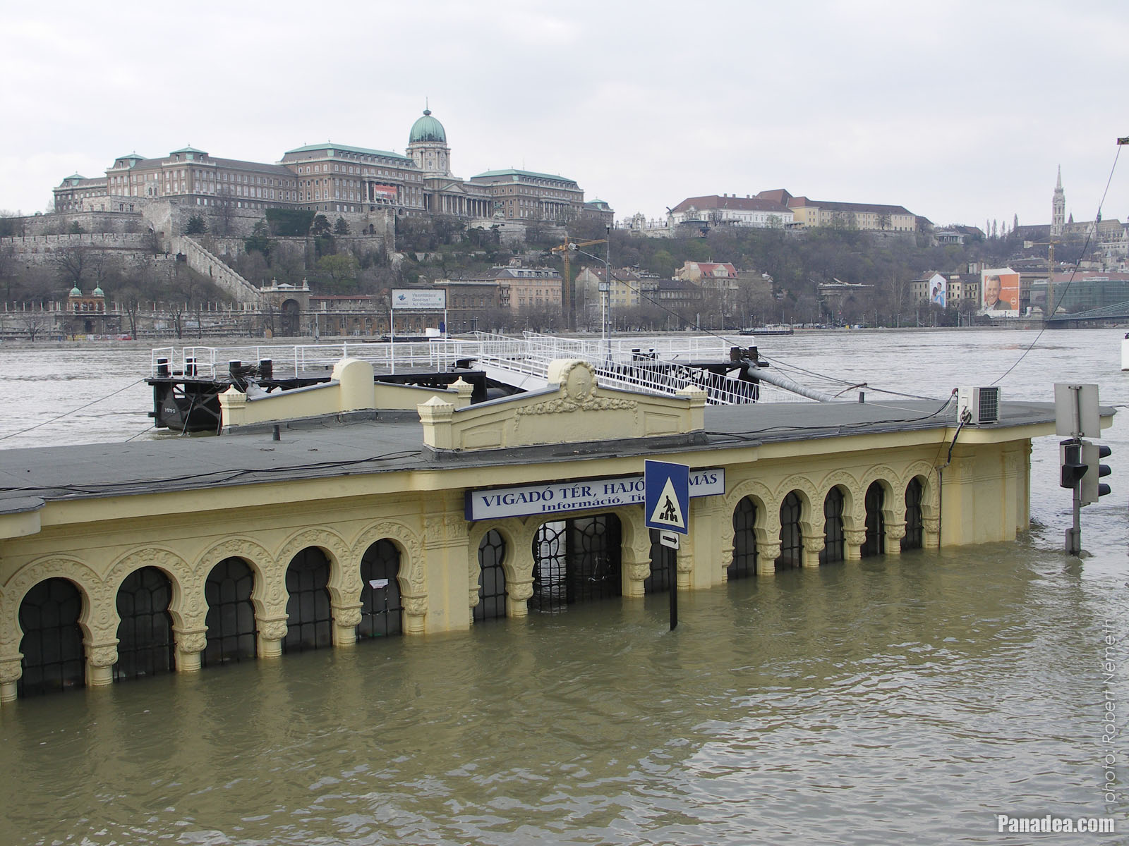 The Vigadó Square boat station is under the water, and on the other side of the Danube it is the Royal Palace of the Buda Castle
The early-spring riverine flood of 2006 had the second highest peak water level in Budapest immediately after the icy flood of 1876. The latter in the 19th century was proved fatal for Pest downtown, where the the water level marks still can be seen on some buildings, for example on the wall of the Franciscan Church on the Ferenciek tere (square). In 4 April 2006 the Danube River reached the peak of 860 centimeters at Budapest, then the water level is started to decrease slowly.
Nevertheless, later both records were breaked by the Danube flood wave of the Central European big floods of 2013: in 9 June the river reached the absolute record 891 cm peak at Budapest, but fortunately the river defenses of the capital city (the embankments, levees, dikes, etc.) stood the siege of the water properly again. In 2013 the flooding river almost completely covered the boat station building at the Vigadó Square, the water level reached the top of the windows, so just the very top of the building was above the surface.
Будимпешта - Више фото галерије:
Можете такође бити заинтересовани (Повезане странице):
Дестинације у туристичком водичу:
Будимпешта (8 468 фотографије + 21 панорамске слике)
Buda Hills (Budai-hegység) (8 632 фотографије + 21 панорамске слике)
Pest megye (county) (15 122 фотографије + 50 панорамске слике)
Будимпешта и њена околина (Централна Мађарска) (15 989 фотографије + 52 панорамске слике)
Мађарска (27 287 фотографије + 163 панорамске слике)
и додатно:
(у овде: Buda Hills)
Budakeszi (88 фотографије)
Pilisszentiván (76 фотографије)
Свака панорамска слика овде:
Будимпешта (21 фотографије)
Pest megye (county) (50 фотографије)
Будимпешта и њена околина (Централна Мађарска) (52 фотографије)
Мађарска (163 фотографије)
Европа (165 фотографије)
Сваки нормални фото овде:
Будимпешта (8 468 фотографије / 122 галерије)
Buda Hills (Budai-hegység) (8 632 фотографије / 124 галерије)
Pest megye (county) (15 122 фотографије / 221 галерије)
Будимпешта и њена околина (Централна Мађарска) (15 989 фотографије / 234 галерије)
Мађарска (27 287 фотографије / 462 галерије)
Европа (30 494 фотографије / 523 галерије)
https://www.panadea.com/sr/guidebook/budimpeshta/photos/gal-017

Додај у Фаворите Додај у Омиљене
Подели са својим пријатељима!
итд


Наш туристички водич садржи:
Многе фотографије и панорамски снимци, са пуно информација и занимљивих чињеница.
- 214 туристичке дестинације
- 165 панорамске слике
- 30 494 остале фотографије
Велика колекција изабраних фотографија: одличан квалитет, висока резолуција и природне боје
О нама - Одрицање одговорности -
Сва права задржана
- ©2010-2022
Neuronit Creative Studio - Mogyoród / Будимпешта / Мађарска