
(Optimoitu pieni näyttö laitteisiin)
Lakeshore of the Balaton - Balatonalmádi, Unkari
Kun klikkaat:
Klikkaa kuvia!
-
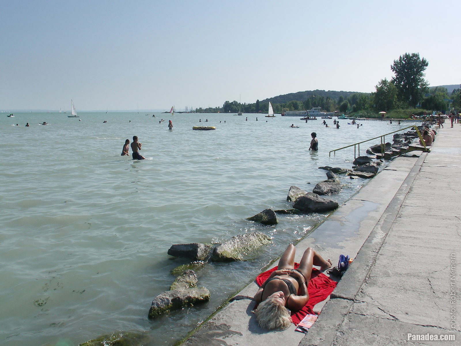
Wesselényi beach
Kuvauspäivämäärän: 24.9.20102010
Luonut: Robert Németh
Kameran malli: Konica Minolta Dimage A200
Balatonalmádi, Unkari
-

Sailboats on the lake at the boat station of Balatonalmádi
Kuvauspäivämäärän: 24.9.20102010
Luonut: Robert Németh
Kameran malli: Konica Minolta Dimage A200
Balatonalmádi, Unkari
-

Statue of St. Elizabeth of Hungary
Kuvauspäivämäärän: 24.9.20102010
Luonut: Robert Németh
Kameran malli: Konica Minolta Dimage A200
Balatonalmádi, Unkari
-

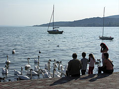
In exchange for some food these swans are very enthusiastic
Kuvauspäivämäärän: 24.9.20102010
Luonut: Robert Németh
Kameran malli: Konica Minolta Dimage A200
Balatonalmádi, Unkari
-
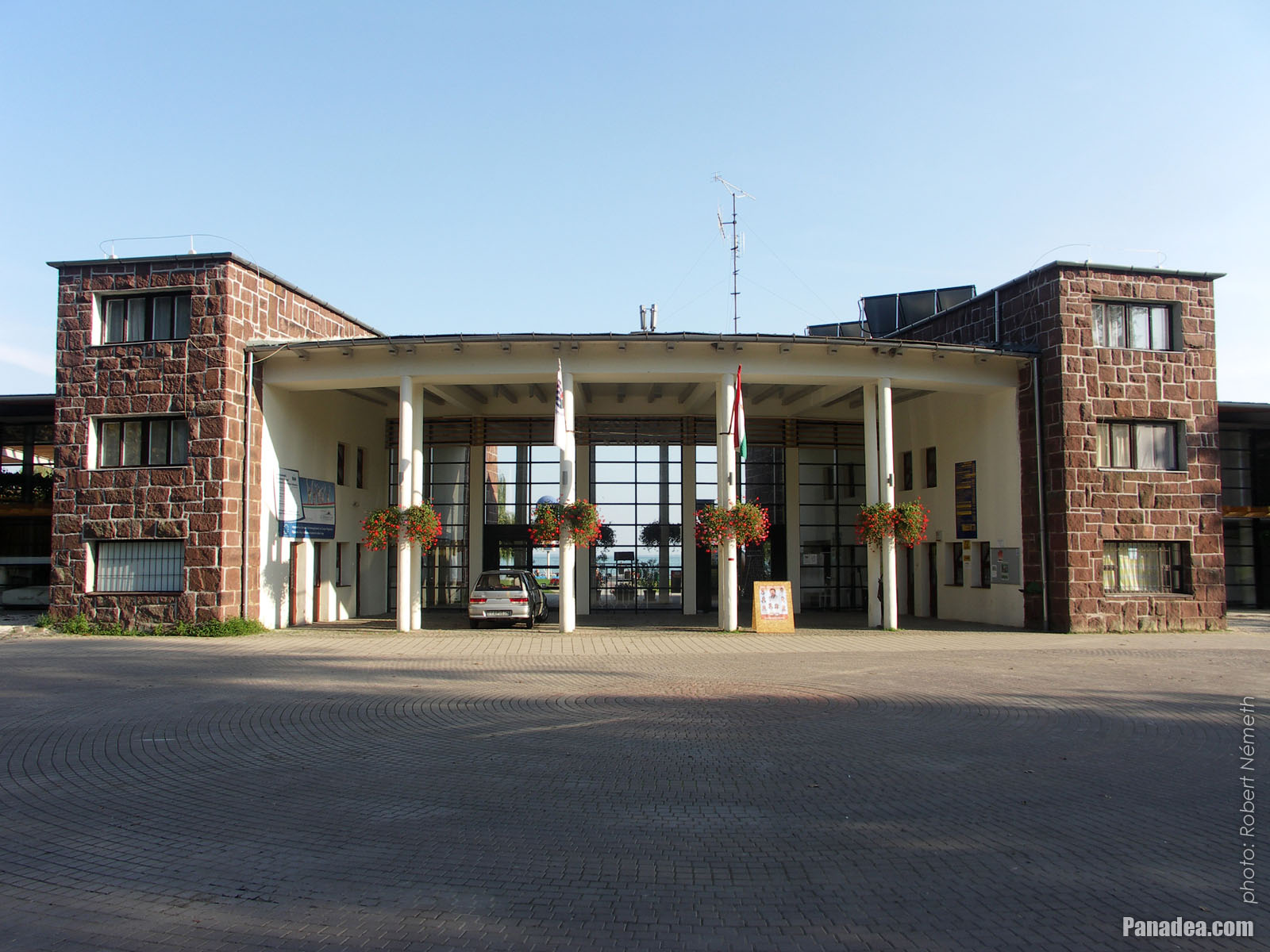
The red sandstone gate of Wesselényi beach
Kuvauspäivämäärän: 24.9.20102010
Luonut: Robert Németh
Kameran malli: Konica Minolta Dimage A200
Balatonalmádi, Unkari
-

The distinctive gate of the Wesselényi beach
Kuvauspäivämäärän: 17.8.20062006
Luonut: Robert Németh
Kameran malli: Konica Minolta Dimage A200
Balatonalmádi, Unkari
-

The characteristic gate of the Wesselényi beach
Kuvauspäivämäärän: 17.8.20062006
Luonut: Robert Németh
Kameran malli: Konica Minolta Dimage A200
Balatonalmádi, Unkari
-

Grassy shore with willow trees on the Wesselényi beach
Kuvauspäivämäärän: 17.8.20062006
Luonut: Robert Németh
Kameran malli: Konica Minolta Dimage A200
Balatonalmádi, Unkari
-

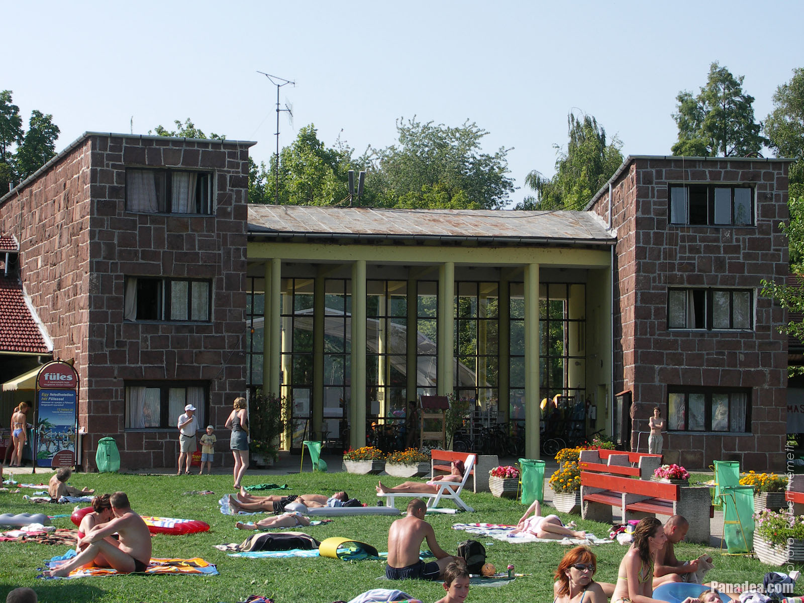
Wesselényi beach
Kuvauspäivämäärän: 17.8.20062006
Luonut: Robert Németh
Kameran malli: Konica Minolta Dimage A200
Balatonalmádi, Unkari
-

The Wesselényi beach in Balatonalmádi, looking westwards (towards Balatonfüred)
Kuvauspäivämäärän: 17.8.20062006
Luonut: Robert Németh
Kameran malli: Konica Minolta Dimage A200
Balatonalmádi, Unkari
-
The Wesselényi beach on the lakeshore of the Balaton
Kuvauspäivämäärän: 17.8.20062006
Luonut: Robert Németh
Kameran malli: Konica Minolta Dimage A200
Balatonalmádi, Unkari
The Wesselényi beach on the lakeshore of the Balaton - Balatonalmádi, Unkari -
The lakeshore at the Wesselényi beach
Kuvauspäivämäärän: 17.8.20062006
Luonut: Robert Németh
Kameran malli: Konica Minolta Dimage A200
Balatonalmádi, Unkari
The lakeshore at the Wesselényi beach - Balatonalmádi, Unkari -
Lake Balaton is shallow and the water is pleasantly warm in summer at the Wesselényi beach
Kuvauspäivämäärän: 17.8.20062006
Luonut: Robert Németh
Kameran malli: Konica Minolta Dimage A200
Balatonalmádi, Unkari
Lake Balaton is shallow and the water is pleasantly warm in summer at the Wesselényi beach - Balatonalmádi, Unkari -
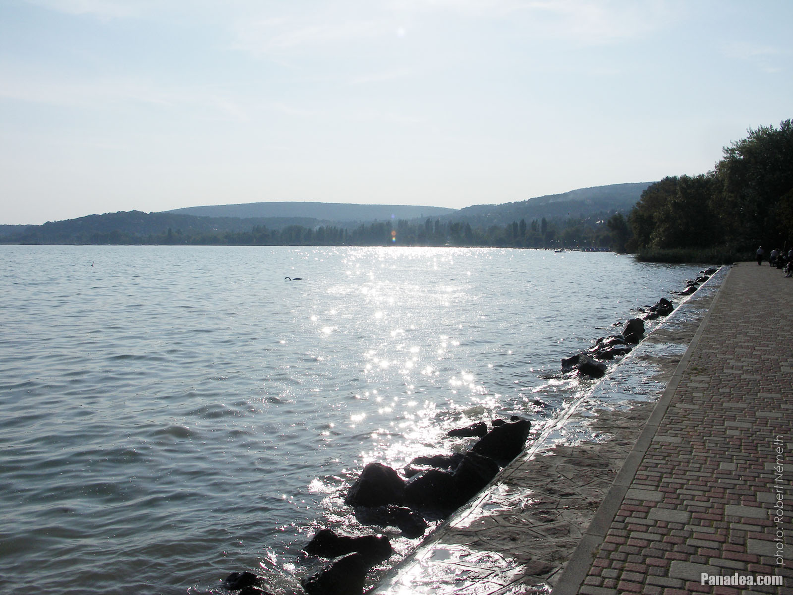
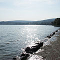
The view of Lake Balaton at the Wesselényi beach
Kuvauspäivämäärän: 17.8.20062006
Luonut: Robert Németh
Kameran malli: Konica Minolta Dimage A200
Balatonalmádi, Unkari
The view of Lake Balaton at the Wesselényi beach - Balatonalmádi, Unkari -
A boat-lifter crane at the marina (sailboat harbor)
Kuvauspäivämäärän: 24.9.20102010
Luonut: Robert Németh
Kameran malli: Konica Minolta Dimage A200
Balatonalmádi, Unkari
A boat-lifter crane at the marina (sailboat harbor) - Balatonalmádi, Unkari -
Fresh lawn and a willow tree in the park on the waterfront
Kuvauspäivämäärän: 24.9.20102010
Luonut: Robert Németh
Kameran malli: Konica Minolta Dimage A200
Balatonalmádi, Unkari
Fresh lawn and a willow tree in the park on the waterfront - Balatonalmádi, Unkari -
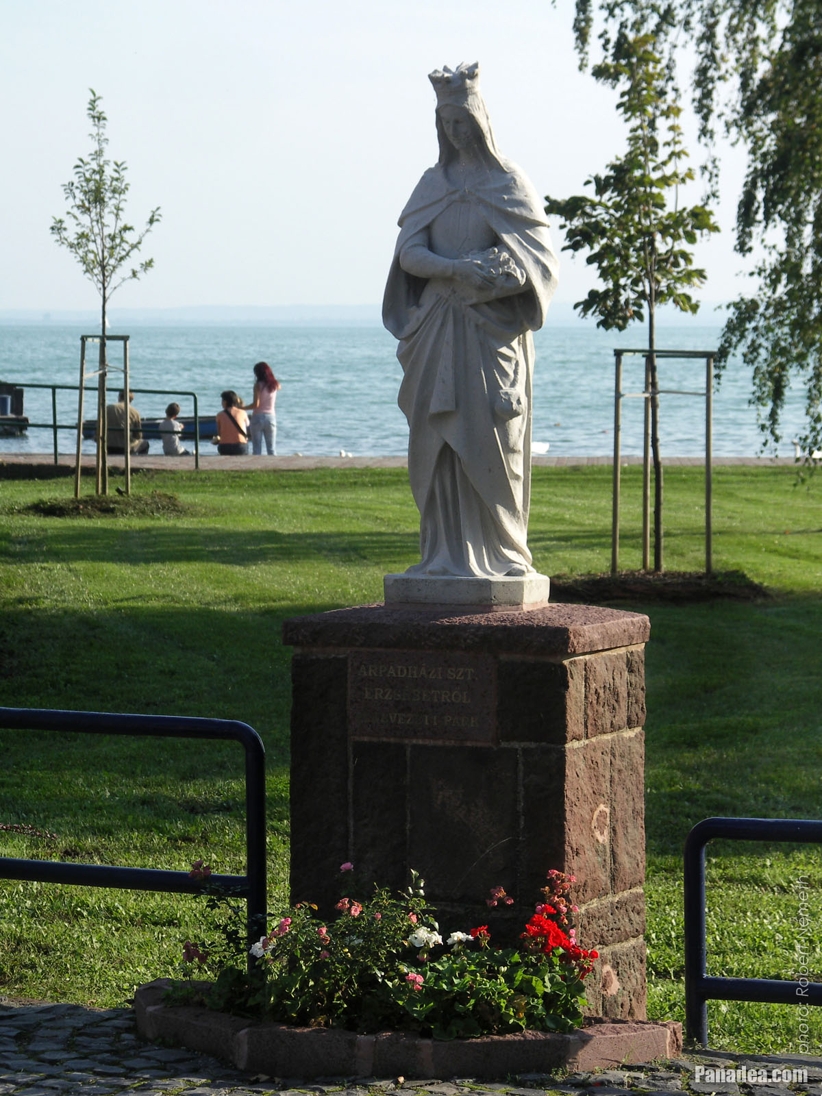
Statue of St. Elizabeth of Hungary
Kuvauspäivämäärän: 24.9.20102010
Luonut: Robert Németh
Kameran malli: Konica Minolta Dimage A200
Balatonalmádi, Unkari
Statue of St. Elizabeth of Hungary - Balatonalmádi, Unkari -
Pier of the boat station
Kuvauspäivämäärän: 24.9.20102010
Luonut: Robert Németh
Kameran malli: Konica Minolta Dimage A200
Balatonalmádi, Unkari
Pier of the boat station - Balatonalmádi, Unkari -
Swan feeding at the lakeshore of Balaton
Kuvauspäivämäärän: 24.9.20102010
Luonut: Robert Németh
Kameran malli: Konica Minolta Dimage A200
Balatonalmádi, Unkari
Swan feeding at the lakeshore of Balaton - Balatonalmádi, Unkari -
The pier leads the the boat station
Kuvauspäivämäärän: 24.9.20102010
Luonut: Robert Németh
Kameran malli: Konica Minolta Dimage A200
Balatonalmádi, Unkari
The pier leads the the boat station - Balatonalmádi, Unkari -
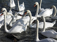
Mass of mute swans (Cygnus olor)
Kuvauspäivämäärän: 24.9.20102010
Luonut: Robert Németh
Kameran malli: Konica Minolta Dimage A200
Balatonalmádi, Unkari
Mass of mute swans (Cygnus olor) - Balatonalmádi, Unkari -
Lakeside promenade in the autumn sunshine
Kuvauspäivämäärän: 24.9.20102010
Luonut: Robert Németh
Kameran malli: Konica Minolta Dimage A200
Balatonalmádi, Unkari
Lakeside promenade in the autumn sunshine - Balatonalmádi, Unkari -
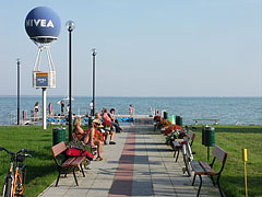
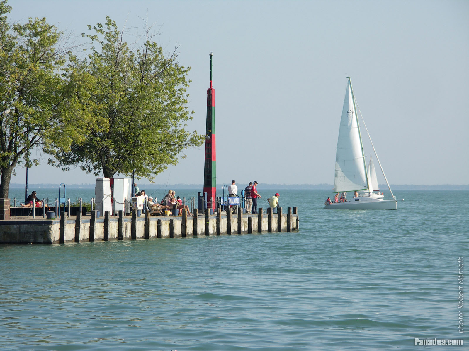
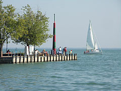
Lakeside walkway with relaxing people and some anglers
Kuvauspäivämäärän: 24.9.20102010
Luonut: Robert Németh
Kameran malli: Konica Minolta Dimage A200
Balatonalmádi, Unkari
Lakeside walkway with relaxing people and some anglers - Balatonalmádi, Unkari -
Lakeside of Balaton at the Balatonalmádi boat station
Kuvauspäivämäärän: 24.9.20102010
Luonut: Robert Németh
Kameran malli: Konica Minolta Dimage A200
Balatonalmádi, Unkari
Lakeside of Balaton at the Balatonalmádi boat station - Balatonalmádi, Unkari -
Pier
Kuvauspäivämäärän: 24.9.20102010
Luonut: Robert Németh
Kameran malli: Konica Minolta Dimage A200
Balatonalmádi, Unkari
Pier - Balatonalmádi, Unkari -
Boat (ship) station of Balatonalmádi
Kuvauspäivämäärän: 24.9.20102010
Luonut: Robert Németh
Kameran malli: Konica Minolta Dimage A200
Balatonalmádi, Unkari
Boat (ship) station of Balatonalmádi - Balatonalmádi, Unkari -
Boat station on the pier, and sailboats everywhere
Kuvauspäivämäärän: 24.9.20102010
Luonut: Robert Németh
Kameran malli: Konica Minolta Dimage A200
Balatonalmádi, Unkari
Boat station on the pier, and sailboats everywhere - Balatonalmádi, Unkari -
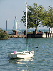
Moored tiny sailing boat is rocking on the water, and the boat station is behind
Kuvauspäivämäärän: 24.9.20102010
Luonut: Robert Németh
Kameran malli: Konica Minolta Dimage A200
Balatonalmádi, Unkari
Moored tiny sailing boat is rocking on the water, and the boat station is behind - Balatonalmádi, Unkari -
Colors of late September by the lake shore, in the St. Elizabeth grove
Kuvauspäivämäärän: 24.9.20102010
Luonut: Robert Németh
Kameran malli: Konica Minolta Dimage A200
Balatonalmádi, Unkari
Colors of late September by the lake shore, in the St. Elizabeth grove - Balatonalmádi, Unkari -
Sailboats on Lake Balaton
Kuvauspäivämäärän: 24.9.20102010
Luonut: Robert Németh
Kameran malli: Konica Minolta Dimage A200
Balatonalmádi, Unkari
Sailboats on Lake Balaton - Balatonalmádi, Unkari -
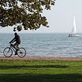
Lakeside promenade with some bikers
Kuvauspäivämäärän: 24.9.20102010
Luonut: Robert Németh
Kameran malli: Konica Minolta Dimage A200
Balatonalmádi, Unkari
Lakeside promenade with some bikers - Balatonalmádi, Unkari -
Lakeside promenade
Kuvauspäivämäärän: 24.9.20102010
Luonut: Robert Németh
Kameran malli: Konica Minolta Dimage A200
Balatonalmádi, Unkari
Lakeside promenade - Balatonalmádi, Unkari -
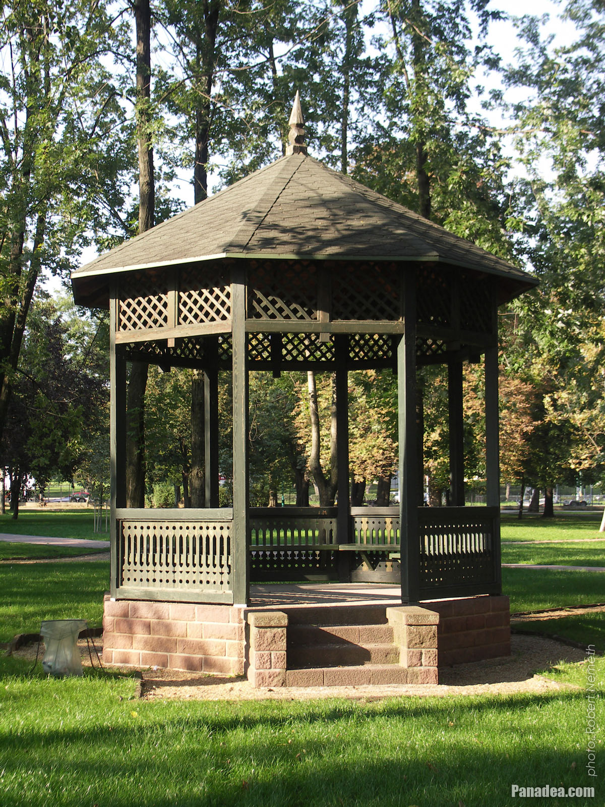
Authentic bandstand (music pavilion) in the "Old Park"
The park was established in 1902, today its entire area is a natural reserve.
Kuvauspäivämäärän: 24.9.20102010
Luonut: Robert Németh
Kameran malli: Konica Minolta Dimage A200
Balatonalmádi, Unkari
Authentic bandstand (music pavilion) in the "Old Park" - Balatonalmádi, Unkari -
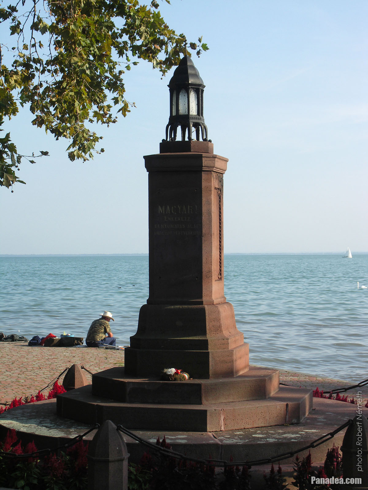
"Irredentist" eternal lamp (however some people think it's just a Trianon memorial)
Kuvauspäivämäärän: 24.9.20102010
Luonut: Robert Németh
Kameran malli: Konica Minolta Dimage A200
Balatonalmádi, Unkari
"Irredentist" eternal lamp (however some people think it's just a Trianon memorial) - Balatonalmádi, Unkari -
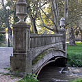
"Bridge of Sighs" in Balatonalmádi
Kuvauspäivämäärän: 24.9.20102010
Luonut: Robert Németh
Kameran malli: Konica Minolta Dimage A200
Balatonalmádi, Unkari
"Bridge of Sighs" in Balatonalmádi - Balatonalmádi, Unkari -
"Irredentistic" eternal lamp
Created by architect László Lovas in 1928, for every Hungarian people abroad who became a minority in a violent way.
Kuvauspäivämäärän: 24.9.20102010
Luonut: Robert Németh
Kameran malli: Konica Minolta Dimage A200
Balatonalmádi, Unkari
"Irredentistic" eternal lamp - Balatonalmádi, Unkari -
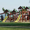
Playground by the lake
Kuvauspäivämäärän: 24.9.20102010
Luonut: Robert Németh
Kameran malli: Konica Minolta Dimage A200
Balatonalmádi, Unkari
Playground by the lake - Balatonalmádi, Unkari -
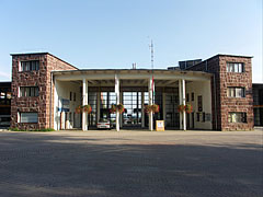
Main entrance of the Wesselényi beach
Kuvauspäivämäärän: 24.9.20102010
Luonut: Robert Németh
Kameran malli: Konica Minolta Dimage A200
Balatonalmádi, Unkari
Main entrance of the Wesselényi beach - Balatonalmádi, Unkari -
European weeping willow trees (Salix sepulcralis), and lifeguard boats on the beach
Kuvauspäivämäärän: 24.9.20102010
Luonut: Robert Németh
Kameran malli: Konica Minolta Dimage A200
Balatonalmádi, Unkari
European weeping willow trees (Salix sepulcralis), and lifeguard boats on the beach - Balatonalmádi, Unkari


Klikkaa kuvia!
Ominaisuudet, piirteet
Sijainti:
GPS-koordinaatit: Leveysaste 47°1'36", Pituusaste 18°0'55" (N47 1.6 - E18 0.92)
Yhteystiedot, lyhyitä tarinoita, mielenkiintoiset
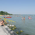
 The Wesselényi beach on the lakeshore of the Balaton
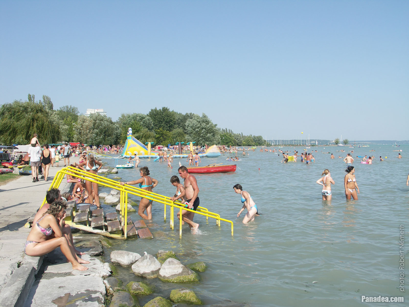
The position of Balatonalmádi is special, it is surrounded by hills and its like an amphitheater a little bit. Thanks to this the climate of the settlement is almost mediterranean. Although the town is situated on the north shore of Lake Balaton (where the water usually deepens more quickly than on the southern shore), the beach of Balatonalmádi is shallow even far from the shore and the water can warm up quickly to a pleasant temperature, so that's why it is highly recommended for families even with small children.
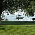
 Colors of late September by the lake shore, in the St. Elizabeth grove
The Öreg Park (literally "Old Park") or Szent Erzsébet Park ("St. Elizabeth's Park") is located in the town center of Balatonalmádi, between the railway tracks and the shore of Lake Balaton, near the Wesselényi Beach. The development of the park was begun at the end of the 1880s, initiated by Dezső Véghely natural scientist. It is situated on an area of 10 hectares and today the entire park is protected (nature reserve). There are special trees and valuable sculptures insite the park, as well as the so-called "Bridge of Sighs". By the way, the park is the last stop or station on the "Vörös Homokkő" (literally "Red sandstone") educational nature trail.
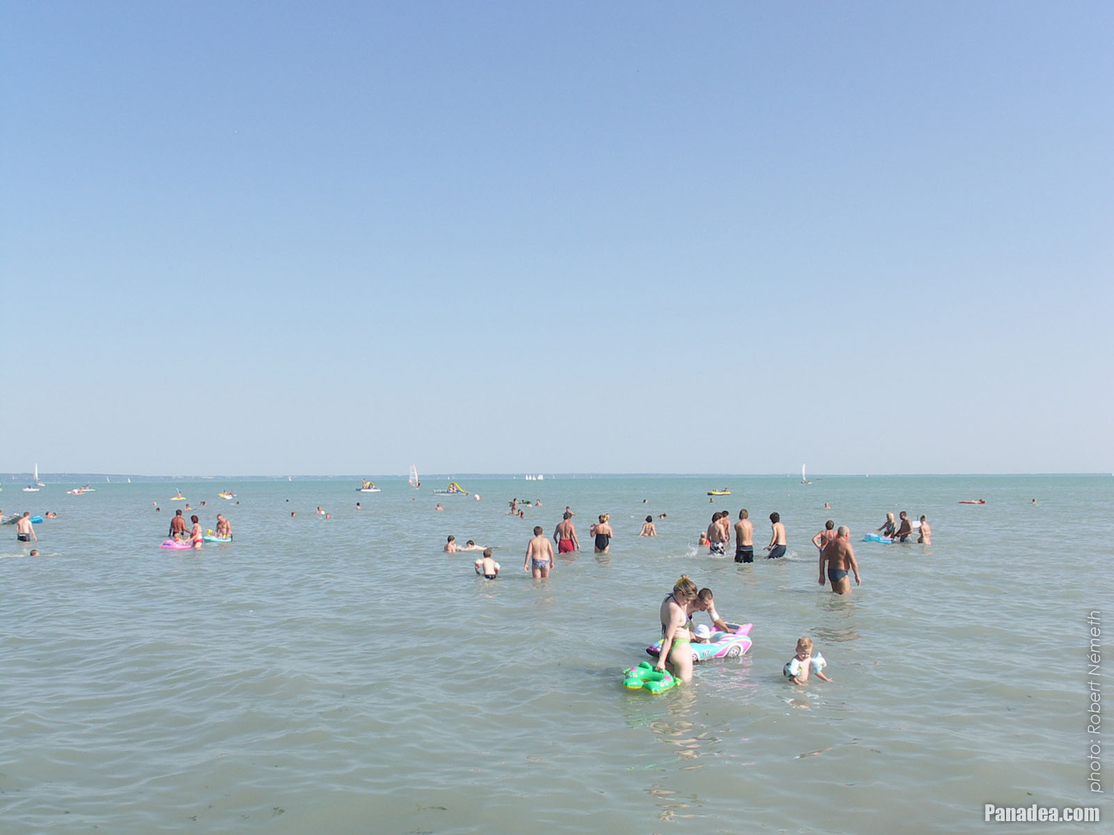
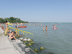
 Wesselényi beach
The Wesselényi Beach is the largest, most extensive beach on the northern shore of Lake Balaton. Even 10,000 people can relax and have fun comfortably at the same time on its half square kilometer of land. The area is landscaped, the willow and other trees provide shade for the guests who want to sleep or relax before or after bathing. The entrance building of the Wesselényi Beach is constructed from the typical building material of the region, the red sandstone from the Permian period (which was 299-252 million years ago).
Balatonalmádi - Lisää kuvagallerioita:
Saatat myös olla kiinnostunut (Liittyviä sivuja):
Kohteet matkaopas:
Balatonalmádi (61 valokuvaa + 2 panoraamakuvia)
Veszprém megye (county) (983 valokuvaa + 16 panoraamakuvia)
Balaton (1 597 valokuvaa + 35 panoraamakuvia)
Unkari (27 287 valokuvaa + 163 panoraamakuvia)
ja lisäksi:
(sisällä tässä: Balaton ja Veszprém megye)
Balaton Uplands National Park (Balaton-felvidék) (440 valokuvaa + 15 panoraamakuvia)
Balaton Uplands (Balaton-felvidék) (123 valokuvaa + 5 panoraamakuvia)
Révfülöp (12 valokuvaa + 1 panoraamakuvia)
Révfülöp (12 valokuvaa + 1 panoraamakuvia)
Balatonfüred (252 valokuvaa + 2 panoraamakuvia)
Balatonboglár
Balatonlelle (13 valokuvaa)
Zalakaros (43 valokuvaa + 3 panoraamakuvia)
Balatonföldvár (11 valokuvaa)
Fonyód (290 valokuvaa)
Siófok (388 valokuvaa + 11 panoraamakuvia)
Tapolca (37 valokuvaa + 3 panoraamakuvia)
Balatonfüred (252 valokuvaa + 2 panoraamakuvia)
Ajka (82 valokuvaa)
Sümeg (39 valokuvaa)
Várpalota (16 valokuvaa + 2 panoraamakuvia)
Zirc (46 valokuvaa)
Zamárdi (16 valokuvaa + 1 panoraamakuvia)
Badacsonytomaj (4 valokuvaa)
Balatonvilágos (26 valokuvaa)
Nagyvázsony (45 valokuvaa)
Szigliget (25 valokuvaa + 2 panoraamakuvia)
Balatonszőlős
Tihany (106 valokuvaa + 1 panoraamakuvia)
Szentbékkálla (10 valokuvaa)
Nagyvázsony (45 valokuvaa)
Csesznek (40 valokuvaa)
Eplény (25 valokuvaa)
Tés (15 valokuvaa)
Veszprém (168 valokuvaa + 3 panoraamakuvia)
Kaikki panoraamakuva tästä:
Balatonalmádi (2 valokuvaa)
Veszprém megye (county) (16 valokuvaa)
Balaton (35 valokuvaa)
Unkari (163 valokuvaa)
Eurooppa (165 valokuvaa)
Jokainen normaali valokuva tästä:
Balatonalmádi (61 valokuvaa / 2 galleriat)
Veszprém megye (county) (983 valokuvaa / 27 galleriat)
Balaton (1 597 valokuvaa / 35 galleriat)
Unkari (27 287 valokuvaa / 462 galleriat)
Eurooppa (30 494 valokuvaa / 523 galleriat)
https://www.panadea.com/fi/guidebook/balatonalmadi/photos/gal-001

Lisää Suosikkeihin Lisää Kirjanmerkkeihin
Jaa ystäviesi kanssa!
jne.


Meidän matkaopas sisältää:
Suuri määrä valokuvia ja panoraamakuvia, jossa on paljon tietoa ja mielenkiintoisia faktoja.
- 214 matkakohteet
- 165 panoraamakuvia
- 30 494 muut kuvaa
Suuri kokoelma valittu kuvia: erinomainen laatu, korkea resoluutio ja luonnolliset värit
Tietoa meistä - Yleiset ehdot ja Tietosuoja -
Kaikki oikeudet pidätetään
- ©2010-2022
Neuronit Creative Studio - Mogyoród / Budapest / Unkari