
(Küçük ekranlı cihazlar için optimize)
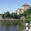
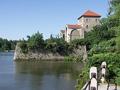
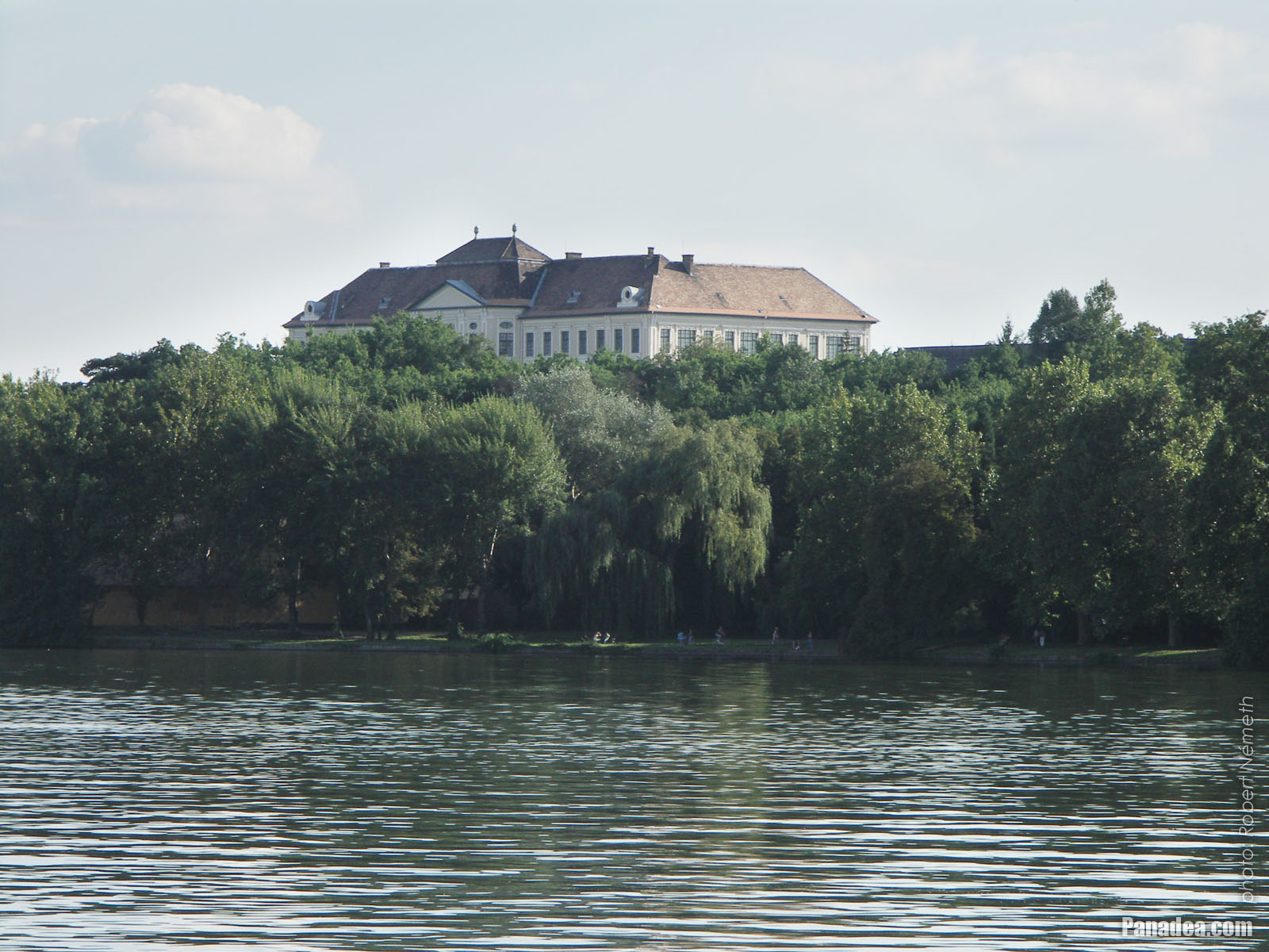
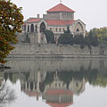
Lake Öreg and the Tata Castle - Tata, Macaristan
Tıkladığınızda:
Resimlerin üzerine tıklayın!
-

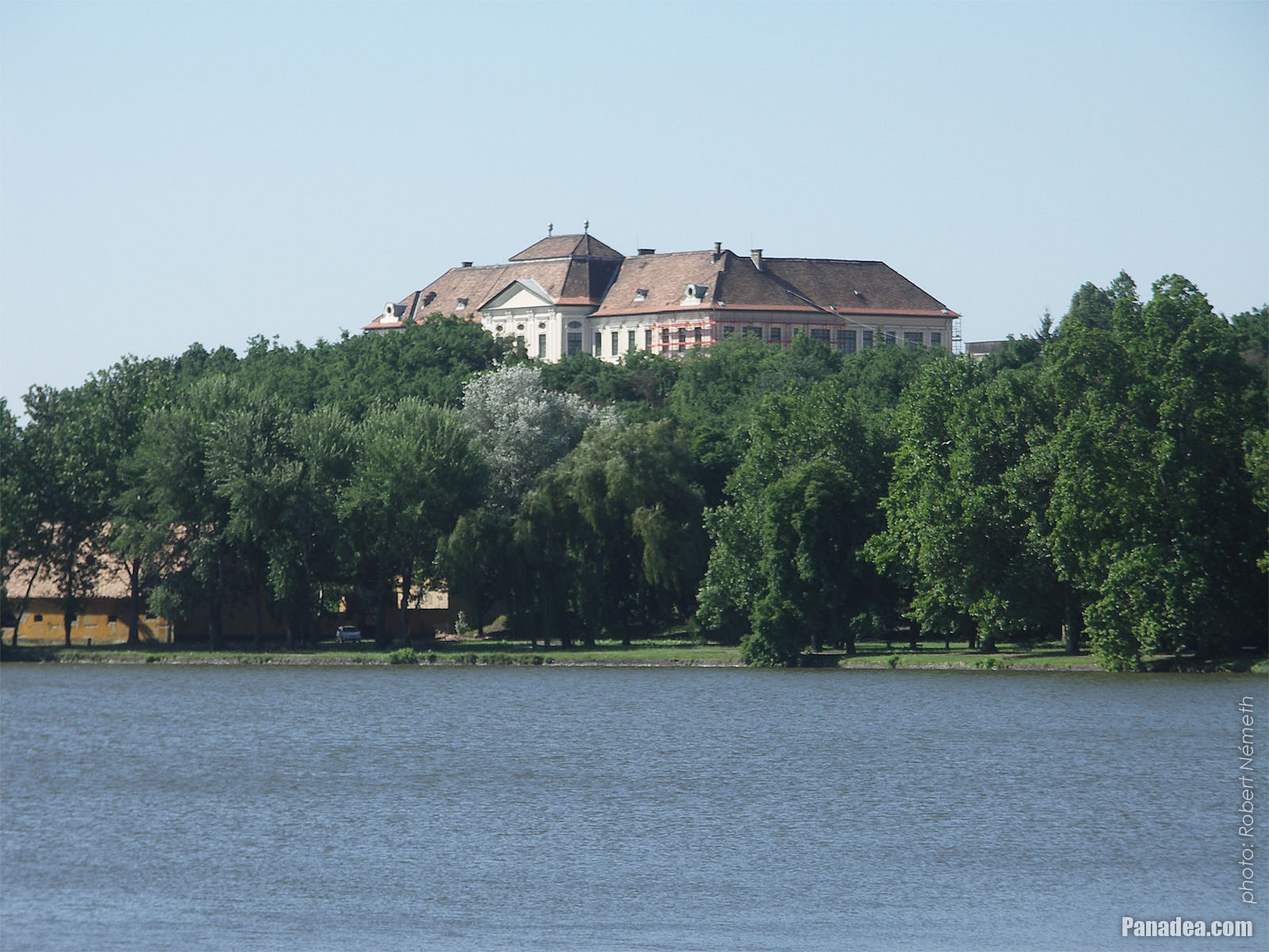
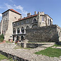
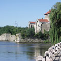
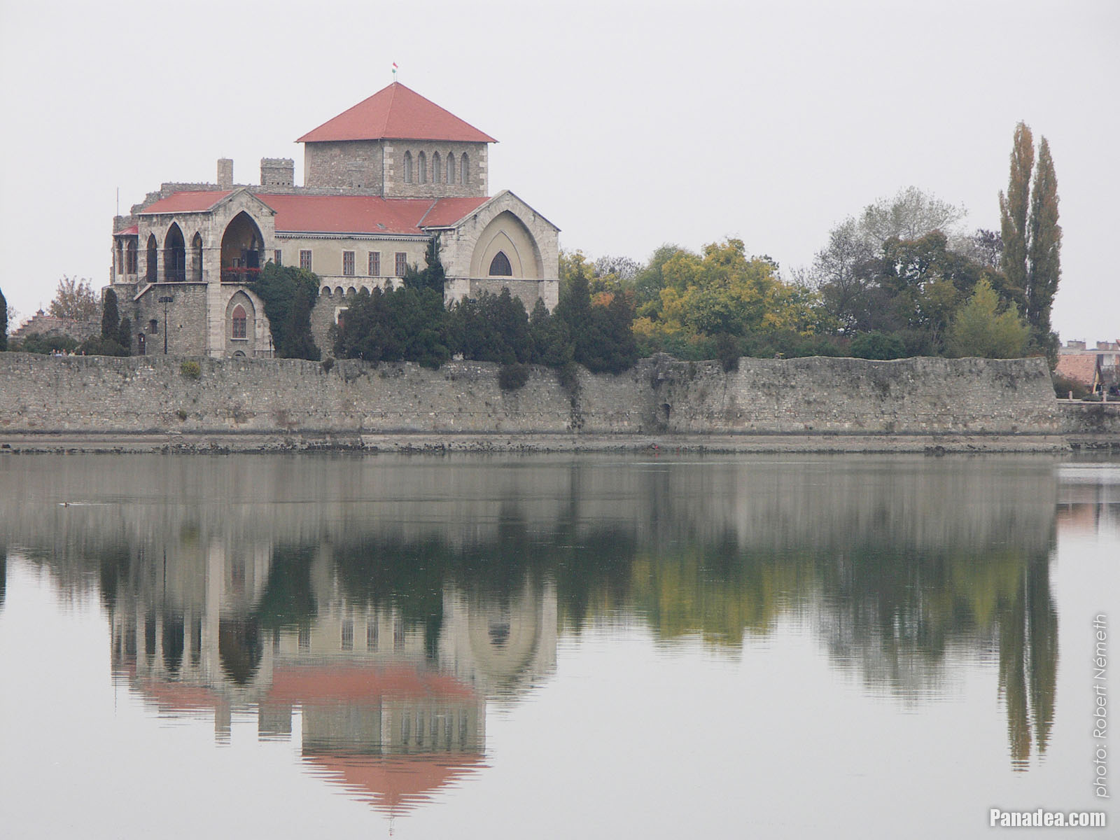
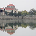
The Öreg Lake (Old Lake) and the Castle of Tata, which can be categorized as a water castle
Fotoğrafçılığın tarihi: 15/07/20062006
Tarafından yaratılan: Robert Németh
Fotoğraf makinesi model: Konica Minolta Dimage A200
Tata, Macaristan
-

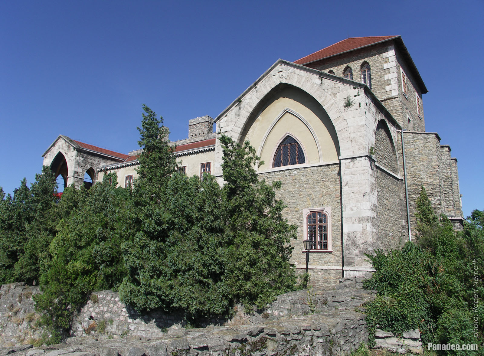
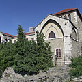
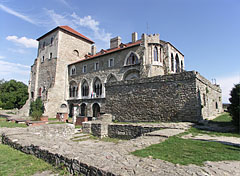
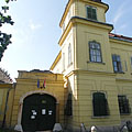
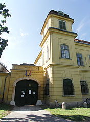
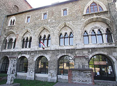
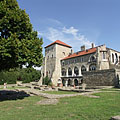
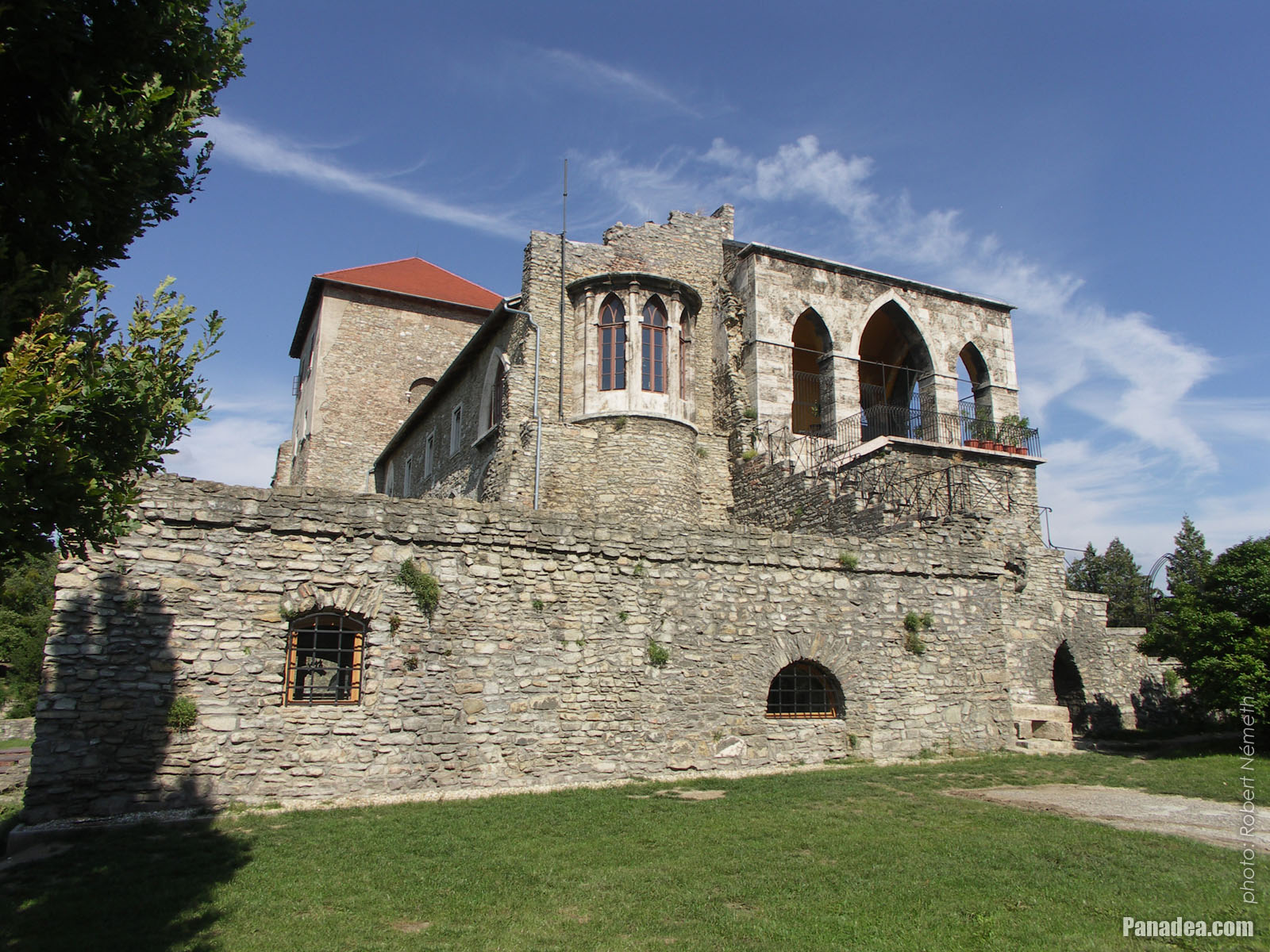
The sunny southern side of the Tata Castle
Fotoğrafçılığın tarihi: 02/09/20062006
Tarafından yaratılan: Robert Németh
Fotoğraf makinesi model: Konica Minolta Dimage A200
Tata, Macaristan
-

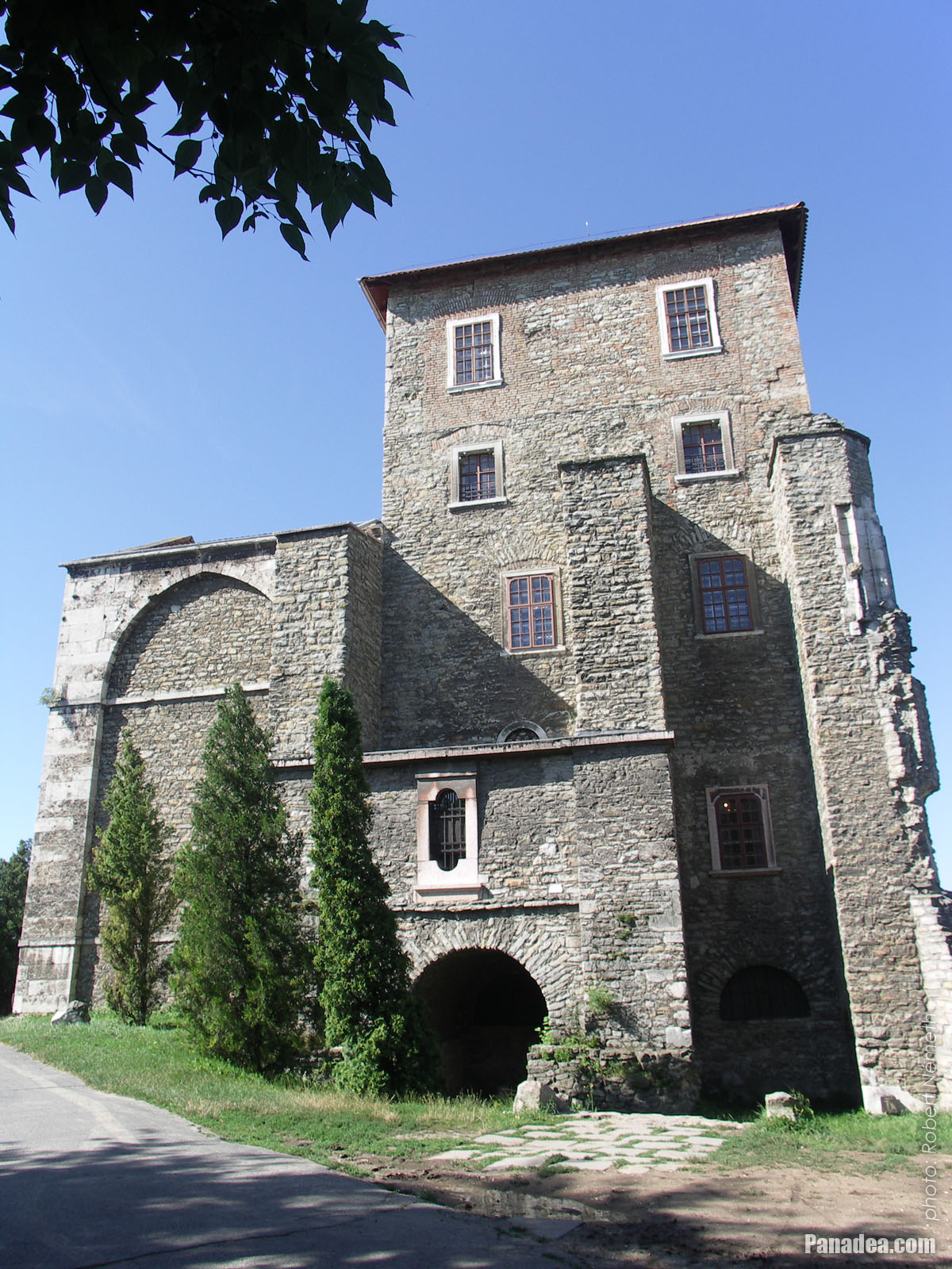
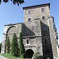
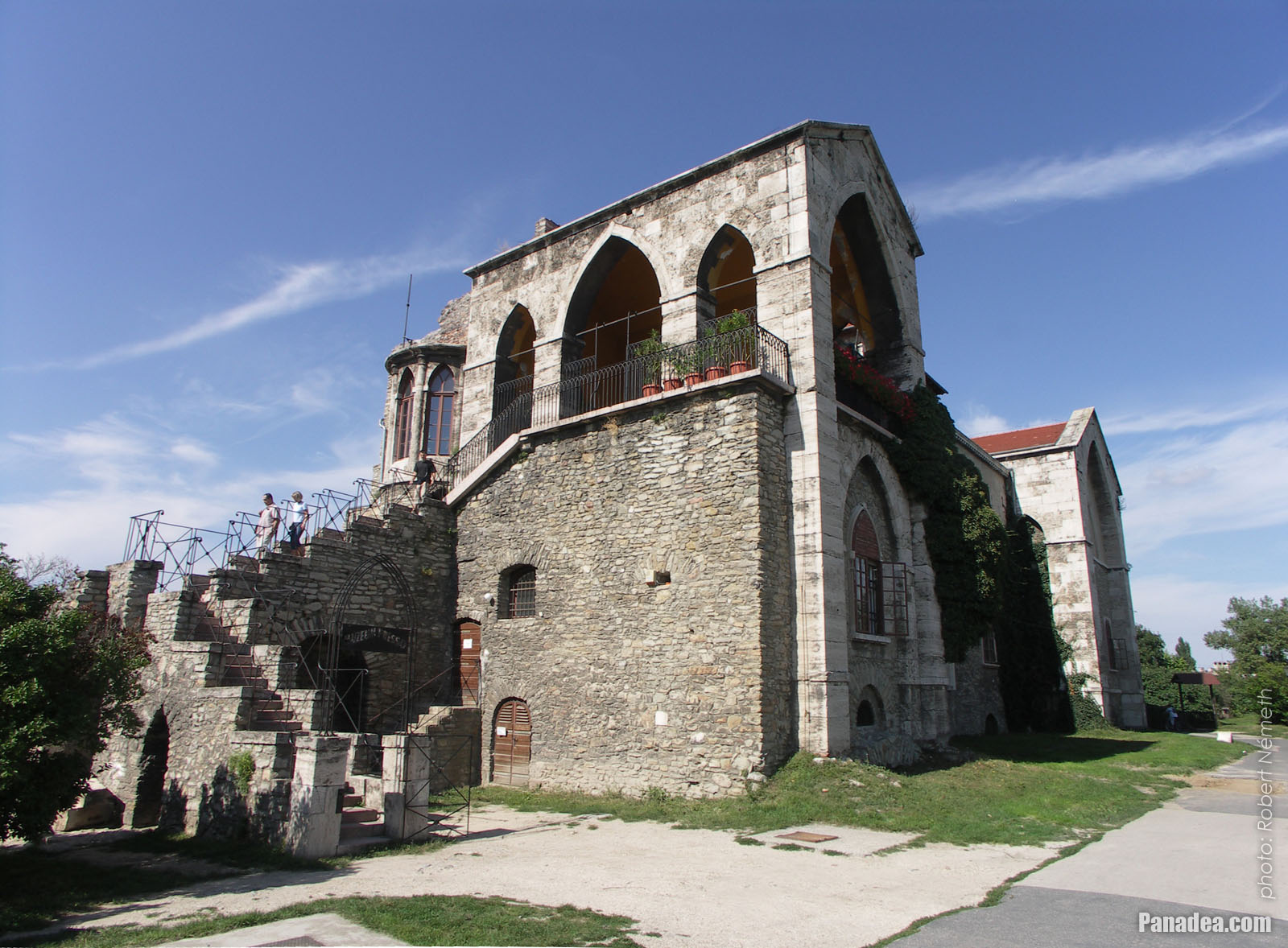
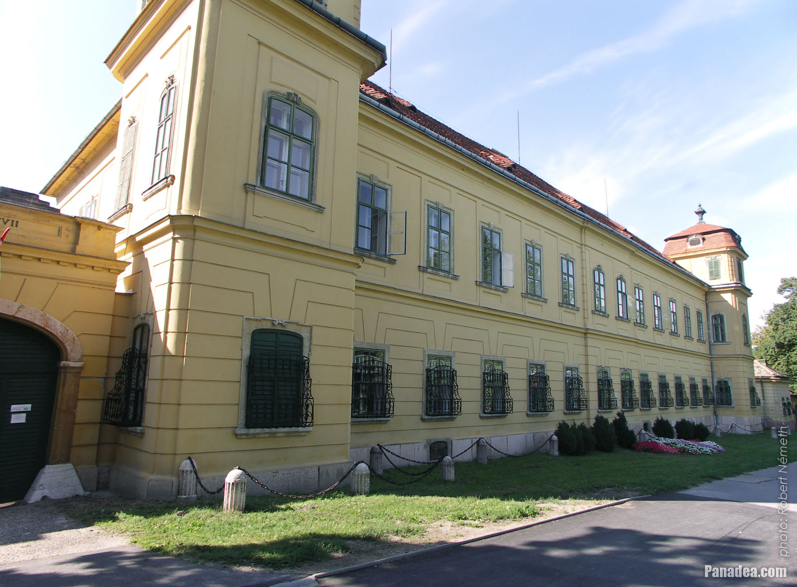
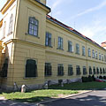
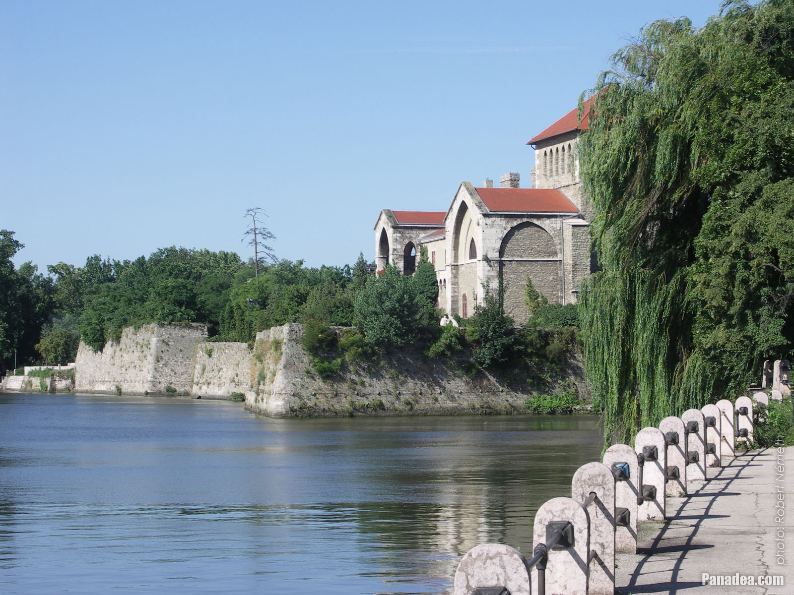
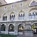
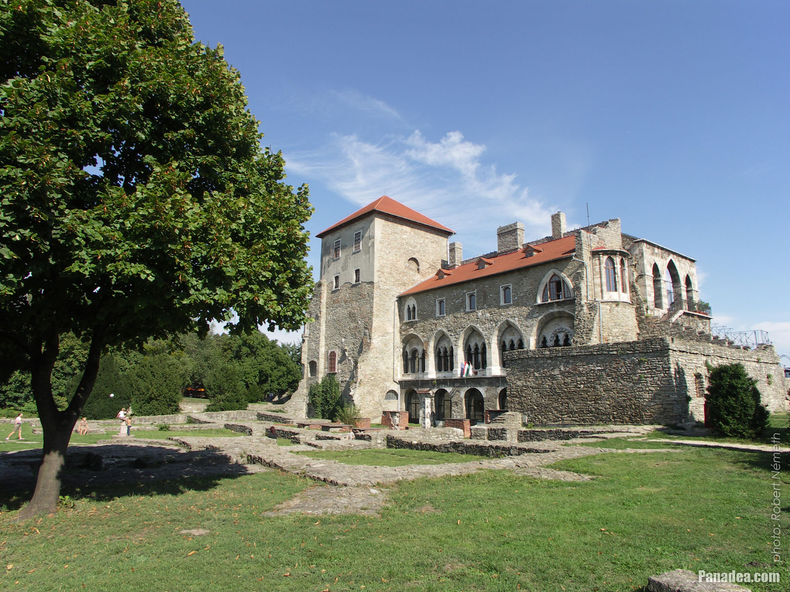
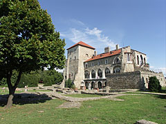
Tower of the Tata Castle (in reality it is the inner castle itself), including the Kuny Domokos County Museum
Fotoğrafçılığın tarihi: 02/09/20062006
Tarafından yaratılan: Robert Németh
Fotoğraf makinesi model: Konica Minolta Dimage A200
Tata, Macaristan
-

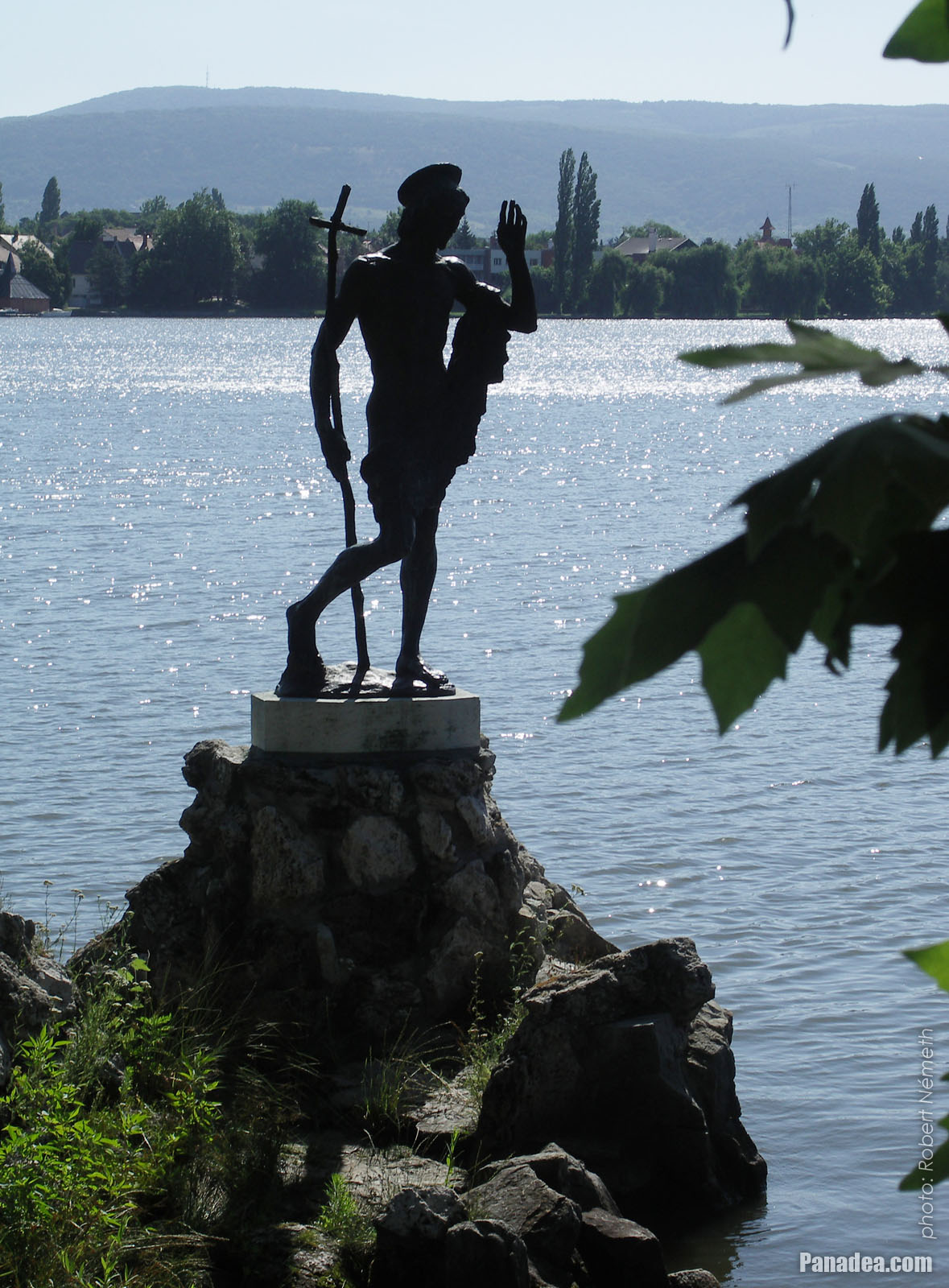
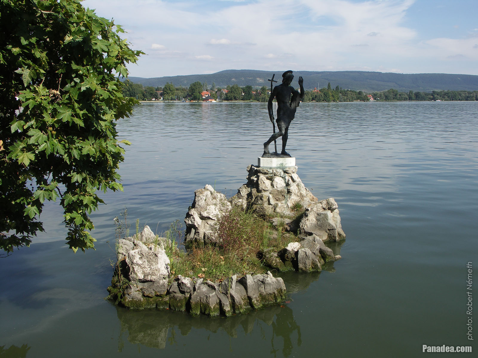
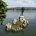
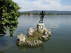
Statue of Saint John the Baptist in lake on a rock, behind the sculpture on the lakeshore the Hamary House can be seen
Fotoğrafçılığın tarihi: 02/09/20062006
Tarafından yaratılan: Robert Németh
Fotoğraf makinesi model: Konica Minolta Dimage A200
Tata, Macaristan
-

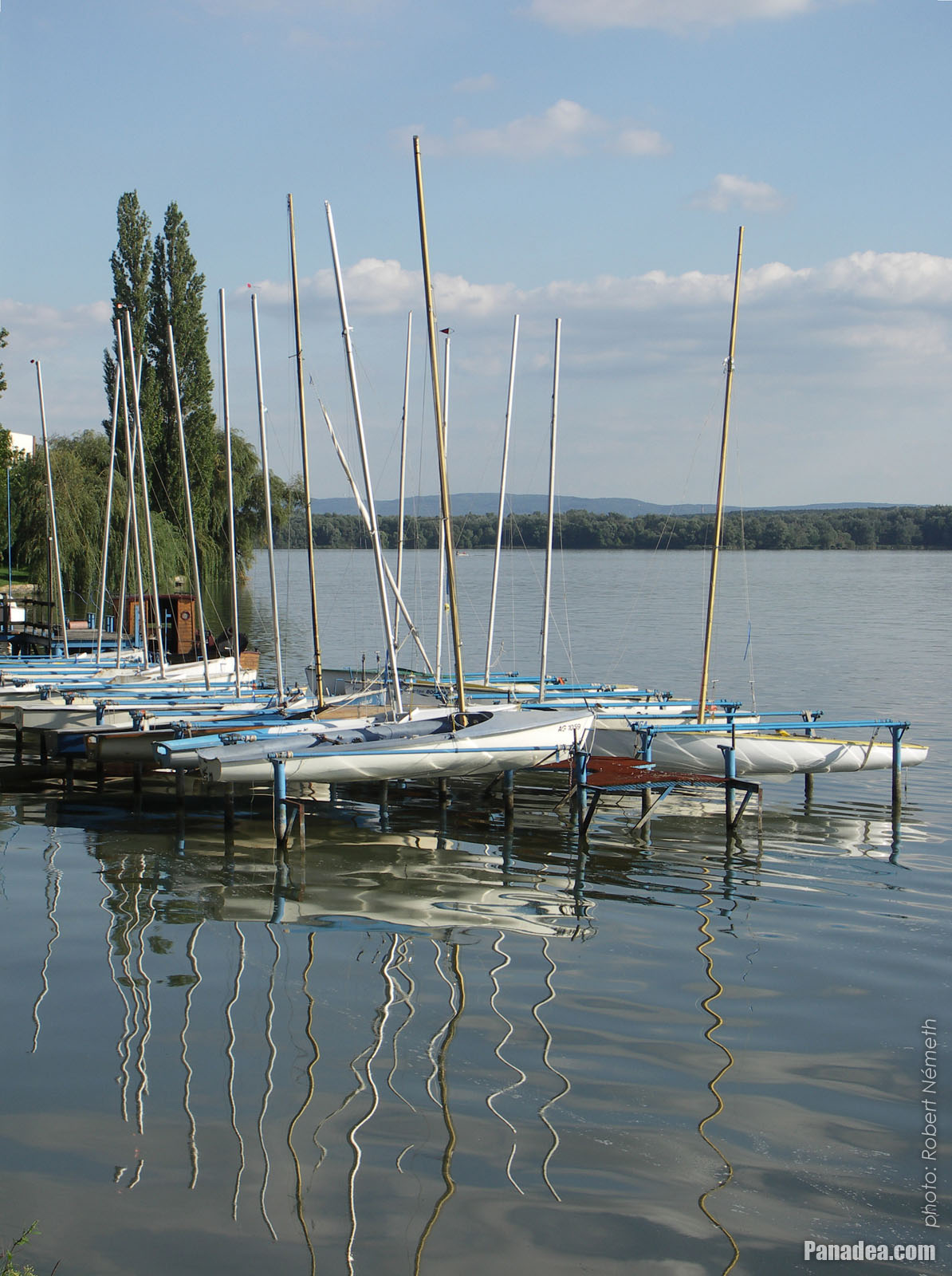
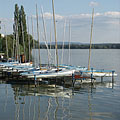
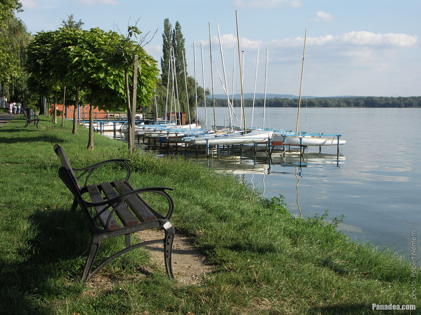
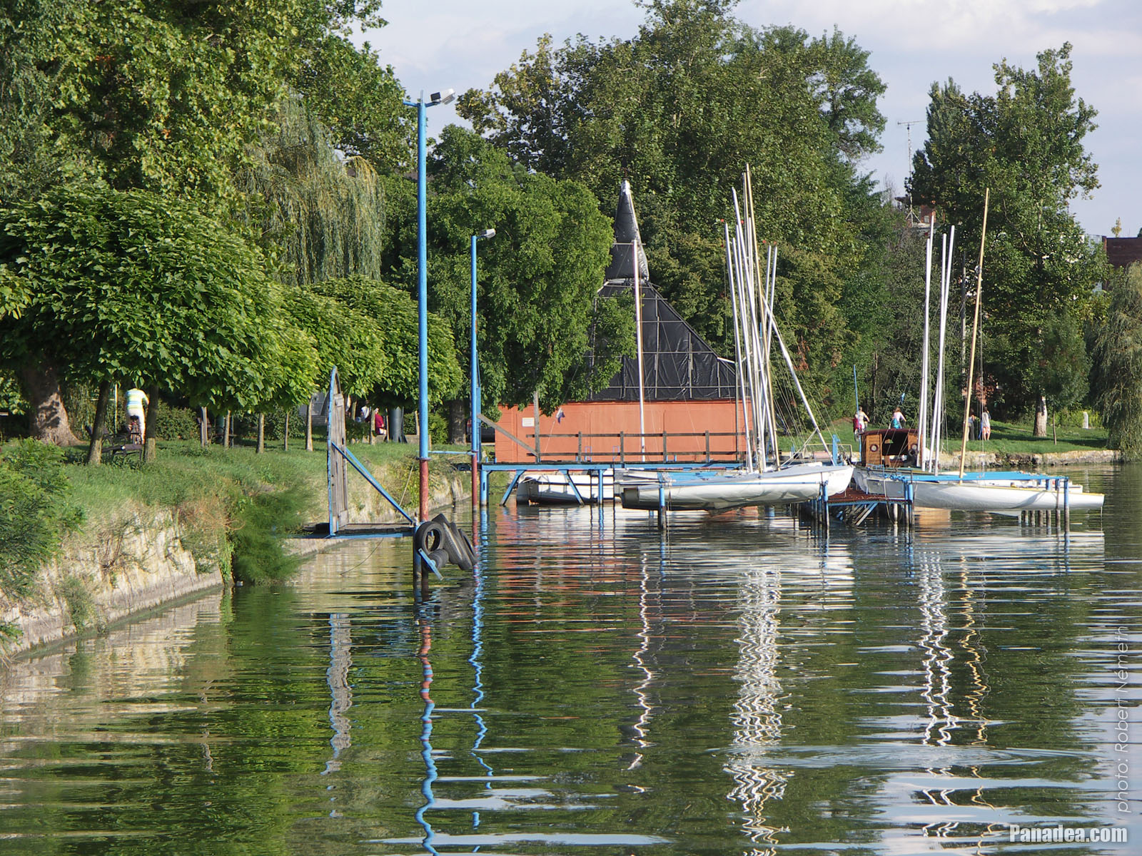
Small sailboat harbour
Fotoğrafçılığın tarihi: 02/09/20062006
Tarafından yaratılan: Robert Németh
Fotoğraf makinesi model: Konica Minolta Dimage A200
Tata, Macaristan
-

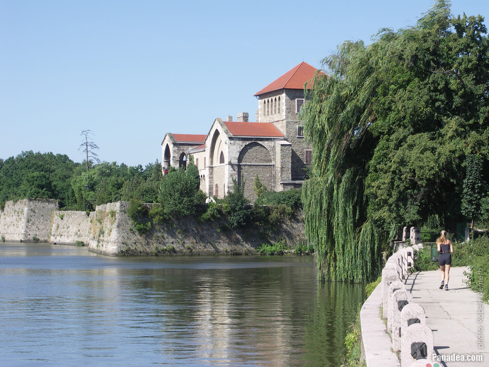
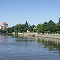
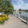
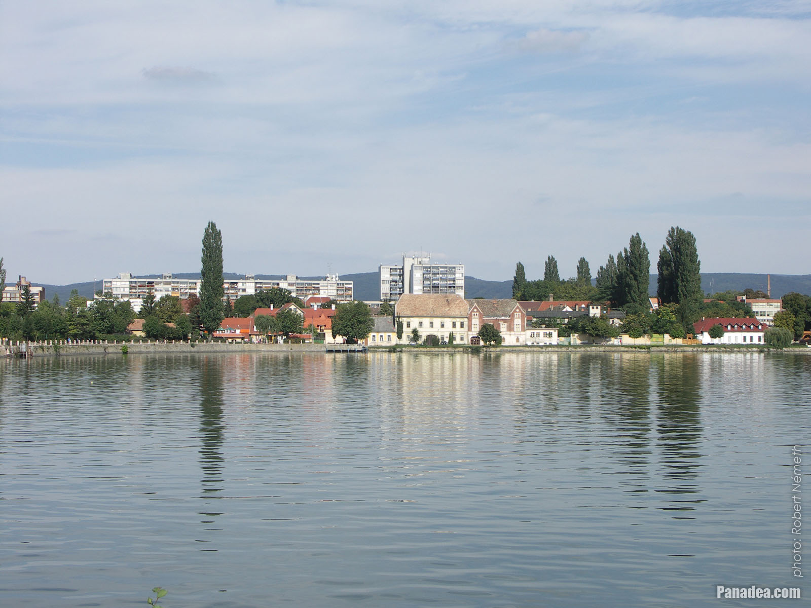
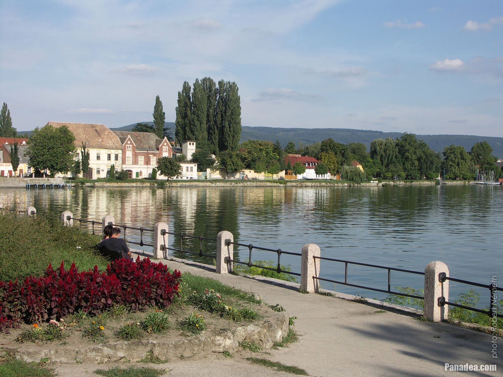
View of Lake Öreg (Old Lake) in the morning: blue plain water, waterfront promenade and some distance away the Castle of Tata
Fotoğrafçılığın tarihi: 15/07/20062006
Tarafından yaratılan: Robert Németh
Fotoğraf makinesi model: Konica Minolta Dimage A200
Tata, Macaristan
-

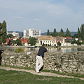
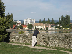
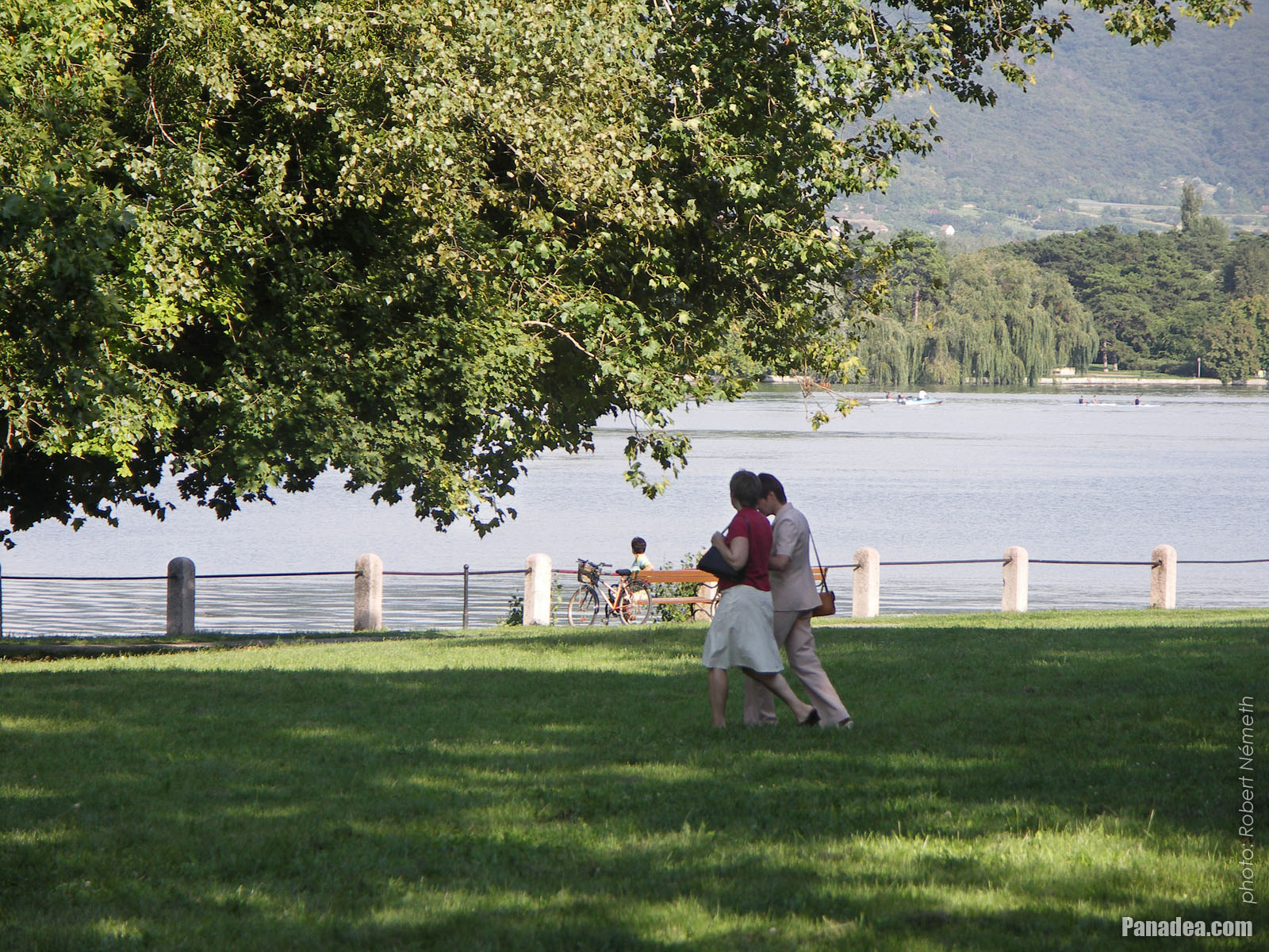
Jogging in the morning by the Lake Öreg on the promenade beside the Tata Castle
Fotoğrafçılığın tarihi: 15/07/20062006
Tarafından yaratılan: Robert Németh
Fotoğraf makinesi model: Konica Minolta Dimage A200
Tata, Macaristan
-

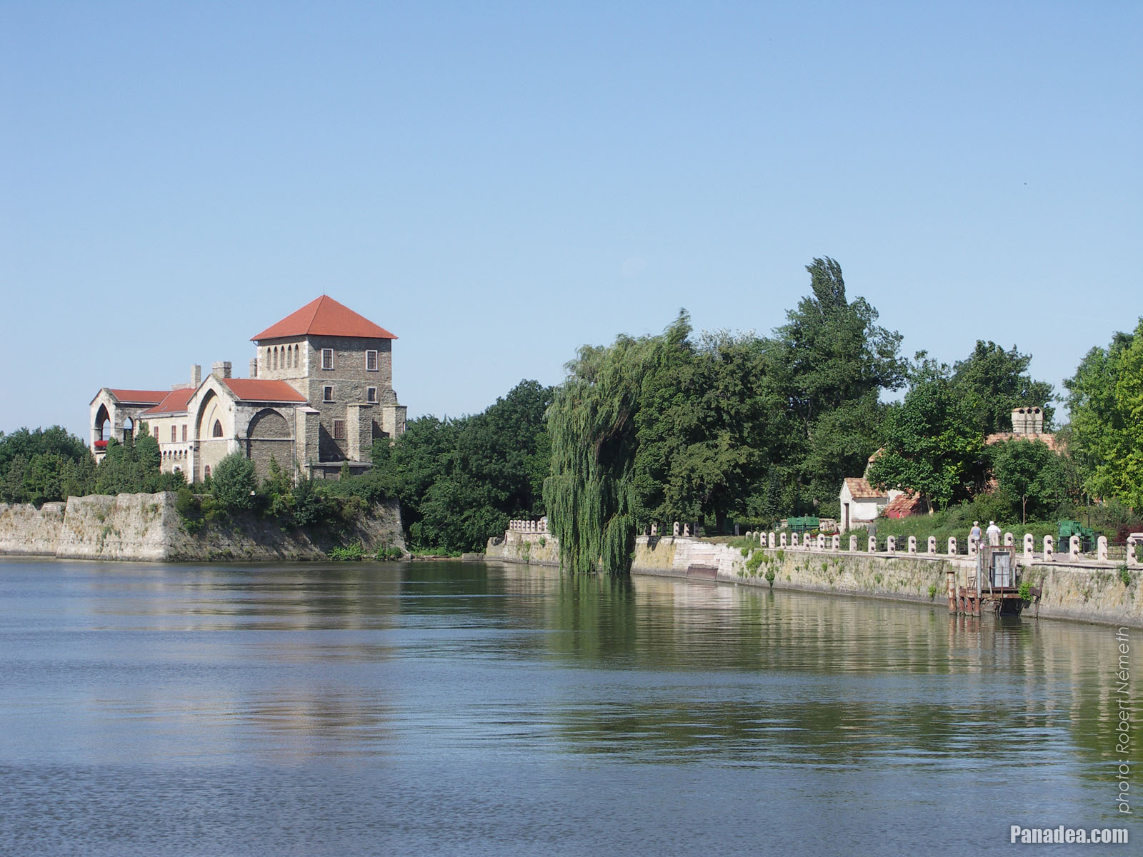
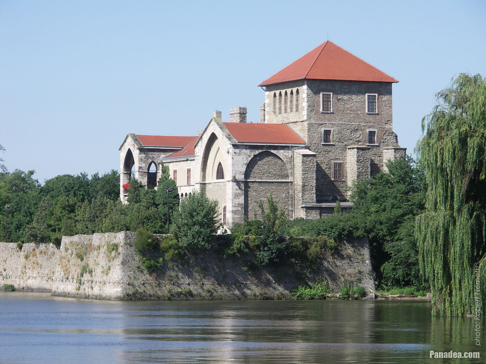
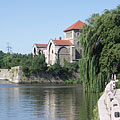
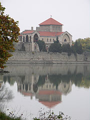
The Tata Castle on the shore of Lake Öreg (or Old Lake, in Hungarian "Öreg-tó")
Fotoğrafçılığın tarihi: 15/07/20062006
Tarafından yaratılan: Robert Németh
Fotoğraf makinesi model: Konica Minolta Dimage A200
Tata, Macaristan
-

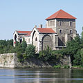
The current tower of the Tata Castle
It was developed from the remains of the inner castle in 1815.
Fotoğrafçılığın tarihi: 15/07/20062006
Tarafından yaratılan: Robert Németh
Fotoğraf makinesi model: Konica Minolta Dimage A200
Tata, Macaristan
-

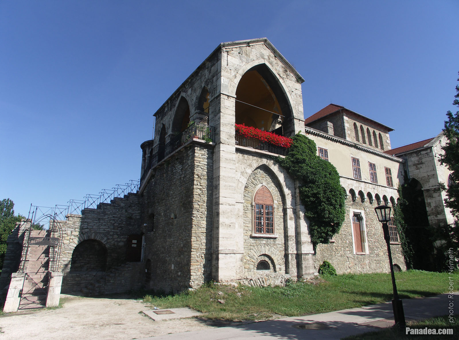
Castle of Tata
Fotoğrafçılığın tarihi: 15/07/20062006
Tarafından yaratılan: Robert Németh
Fotoğraf makinesi model: Konica Minolta Dimage A200
Tata, Macaristan
-
Tower of the Tata Castle (the so-called "Old Tower")
Fotoğrafçılığın tarihi: 15/07/20062006
Tarafından yaratılan: Robert Németh
Fotoğraf makinesi model: Konica Minolta Dimage A200
Tata, Macaristan
Tower of the Tata Castle (the so-called "Old Tower") - Tata, Macaristan -
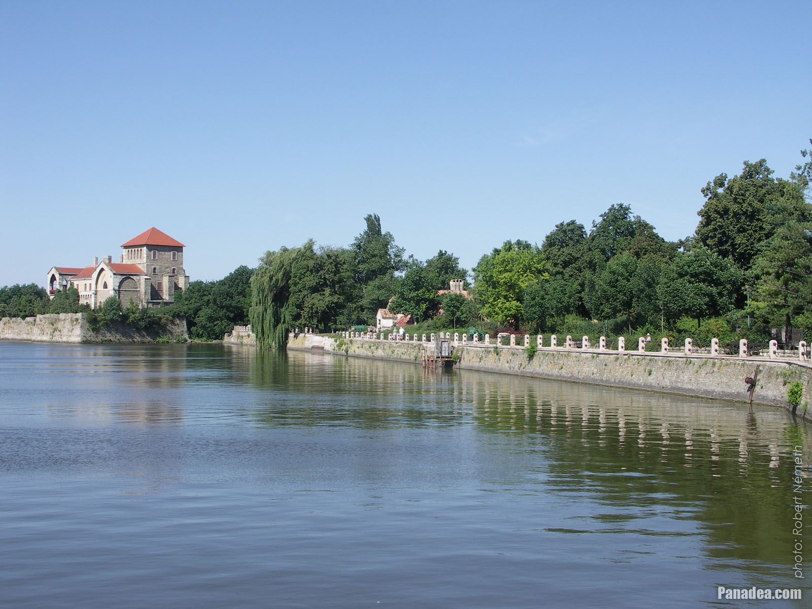
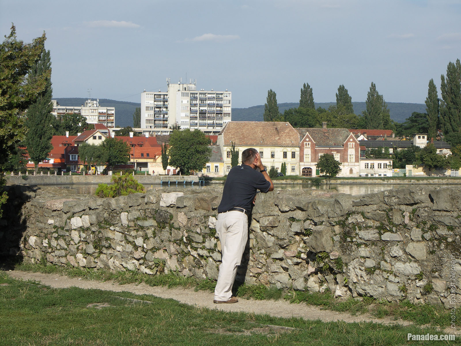
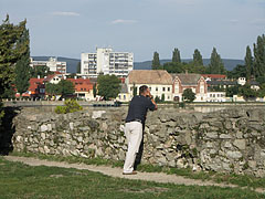
View to the town and the Old Lake (in Hungarian "Öreg-tó") from the castle wall
Fotoğrafçılığın tarihi: 02/09/20062006
Tarafından yaratılan: Robert Németh
Fotoğraf makinesi model: Konica Minolta Dimage A200
Tata, Macaristan
View to the town and the Old Lake (in Hungarian "Öreg-tó") from the castle wall - Tata, Macaristan -
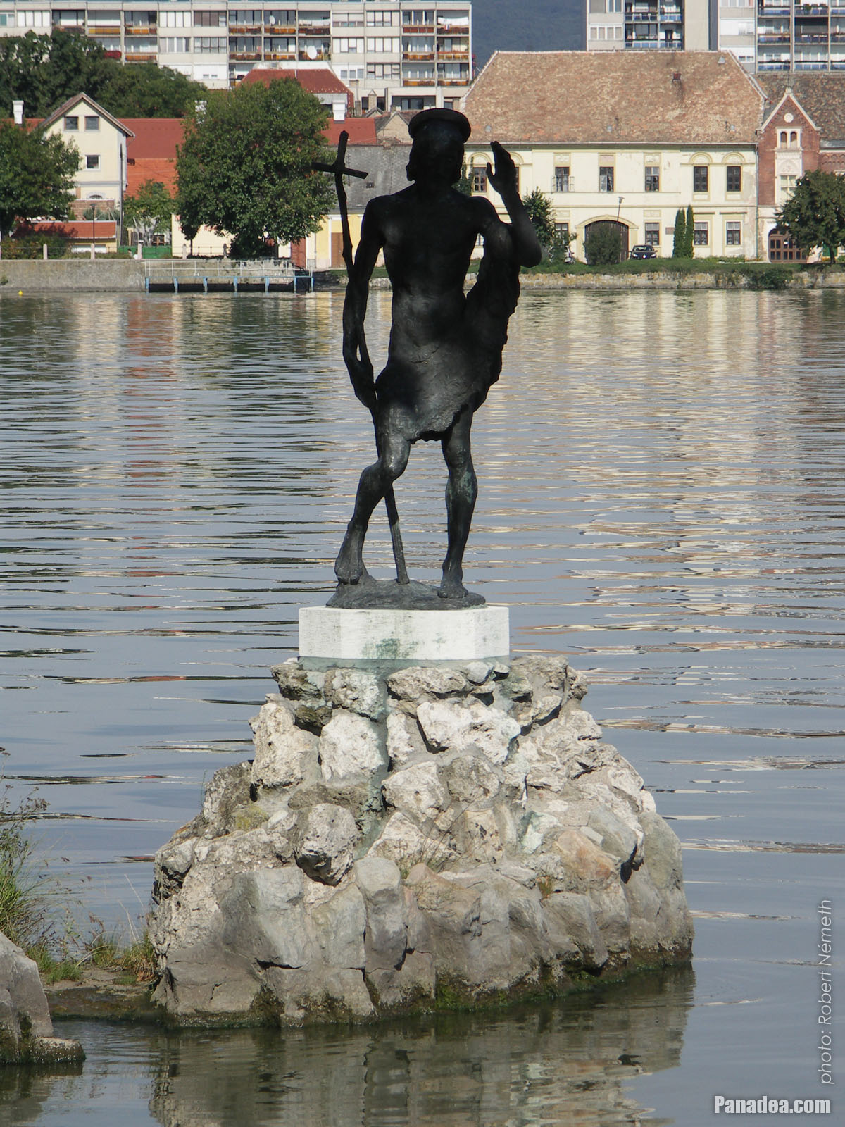
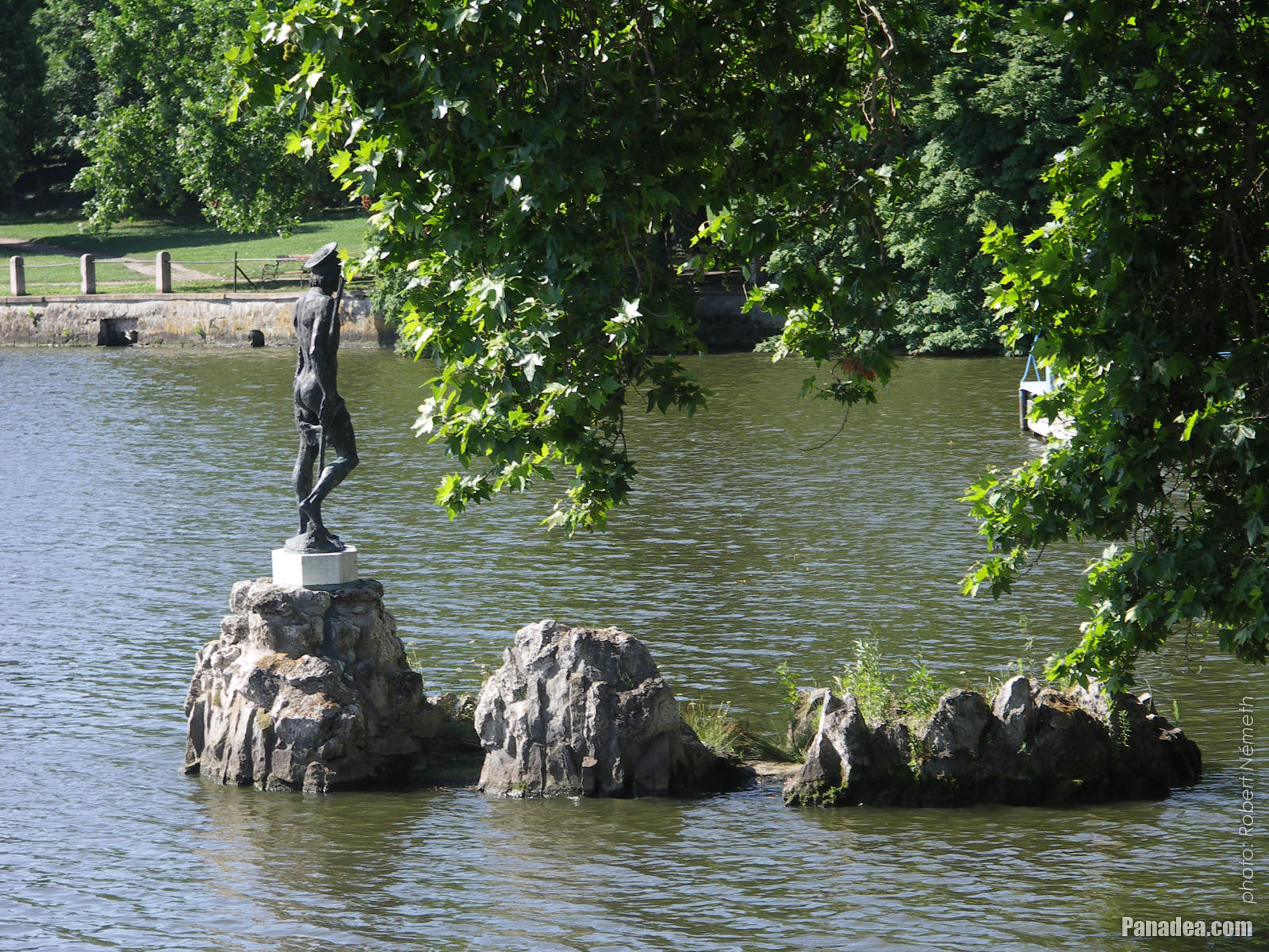
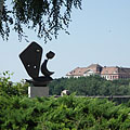
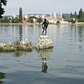
Statue of Saint John the Baptist in the Tata Lake (also known as Öreg Lake or Old Lake)
Fotoğrafçılığın tarihi: 15/07/20062006
Tarafından yaratılan: Robert Németh
Fotoğraf makinesi model: Konica Minolta Dimage A200
Tata, Macaristan
Statue of Saint John the Baptist in the Tata Lake (also known as Öreg Lake or Old Lake) - Tata, Macaristan -
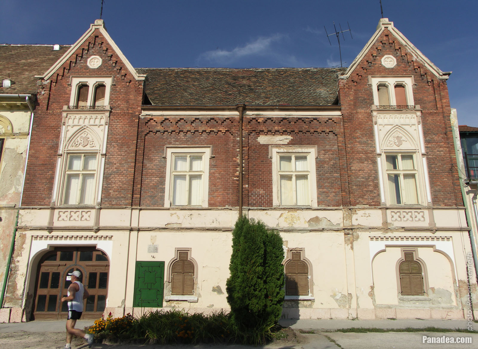
Eötvös József High School, the former Piarist secondary school
The school building was built in 1912.
Fotoğrafçılığın tarihi: 15/07/20062006
Tarafından yaratılan: Robert Németh
Fotoğraf makinesi model: Konica Minolta Dimage A200
Tata, Macaristan
Eötvös József High School, the former Piarist secondary school - Tata, Macaristan -
Stairs up to the small Múzeum Presso restaurant on the storey of the castle tower
Fotoğrafçılığın tarihi: 02/09/20062006
Tarafından yaratılan: Robert Németh
Fotoğraf makinesi model: Konica Minolta Dimage A200
Tata, Macaristan
Stairs up to the small Múzeum Presso restaurant on the storey of the castle tower - Tata, Macaristan -
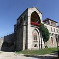
The restored part ("tower") and the wall remains of the Tata Castle
The castle built between 1397-1409
Fotoğrafçılığın tarihi: 02/09/20062006
Tarafından yaratılan: Robert Németh
Fotoğraf makinesi model: Konica Minolta Dimage A200
Tata, Macaristan
The restored part ("tower") and the wall remains of the Tata Castle - Tata, Macaristan -
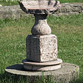
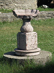
A broken stone bowl of vase in the castle garden
Fotoğrafçılığın tarihi: 15/07/20062006
Tarafından yaratılan: Robert Németh
Fotoğraf makinesi model: Konica Minolta Dimage A200
Tata, Macaristan
A broken stone bowl of vase in the castle garden - Tata, Macaristan -
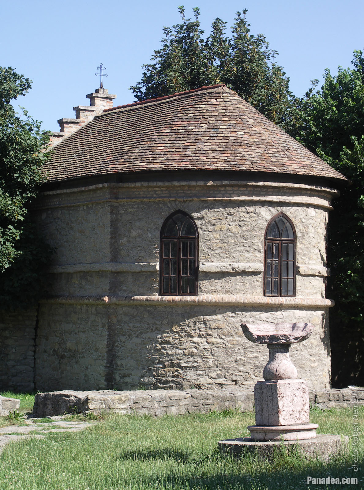
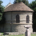
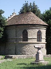
Prison chapel of the so-called seneschal's house (senechal = officer of the noble), built into the castle wall
Built in 1755, designed by Jakab Fellner
Fotoğrafçılığın tarihi: 15/07/20062006
Tarafından yaratılan: Robert Németh
Fotoğraf makinesi model: Konica Minolta Dimage A200
Tata, Macaristan
Prison chapel of the so-called seneschal's house (senechal = officer of the noble), built into the castle wall - Tata, Macaristan -
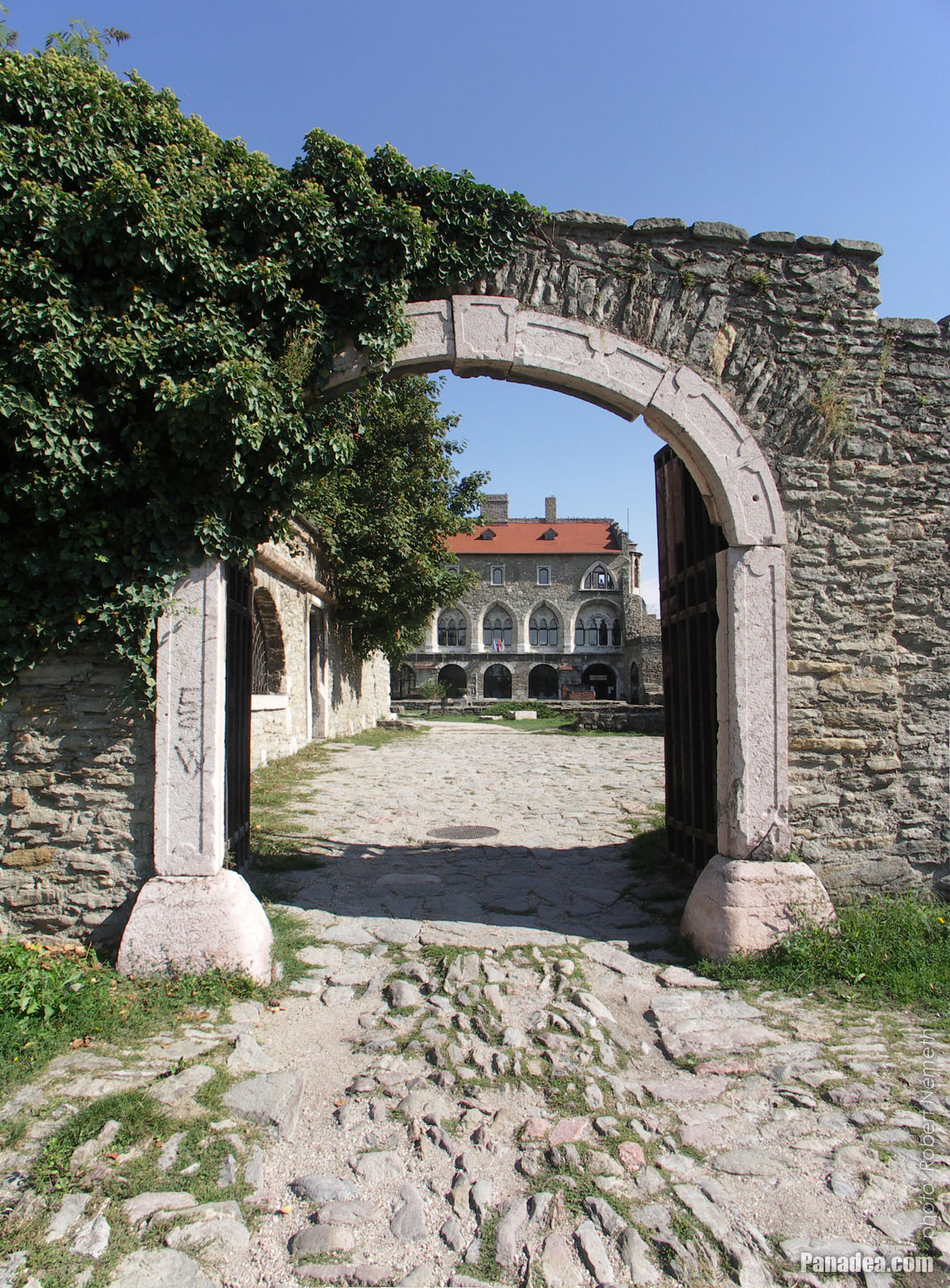
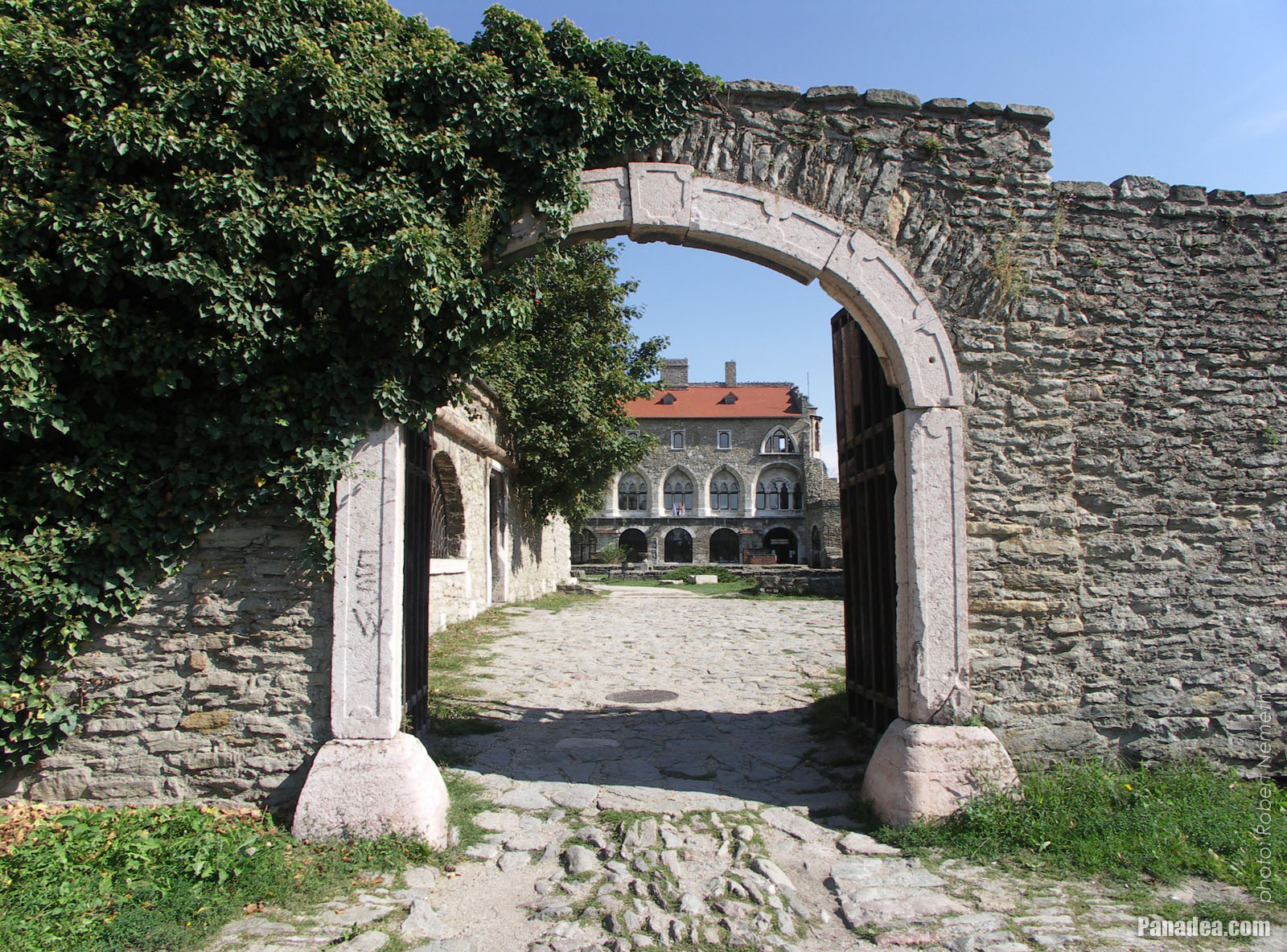
Castle of Tata, the vaulted stone gate with red marble frame on the north-westernd castle wall
Designed by Jakab Fellner, built in 1755
Fotoğrafçılığın tarihi: 02/09/20062006
Tarafından yaratılan: Robert Németh
Fotoğraf makinesi model: Konica Minolta Dimage A200
Tata, Macaristan
Castle of Tata, the vaulted stone gate with red marble frame on the north-westernd castle wall - Tata, Macaristan -
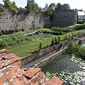
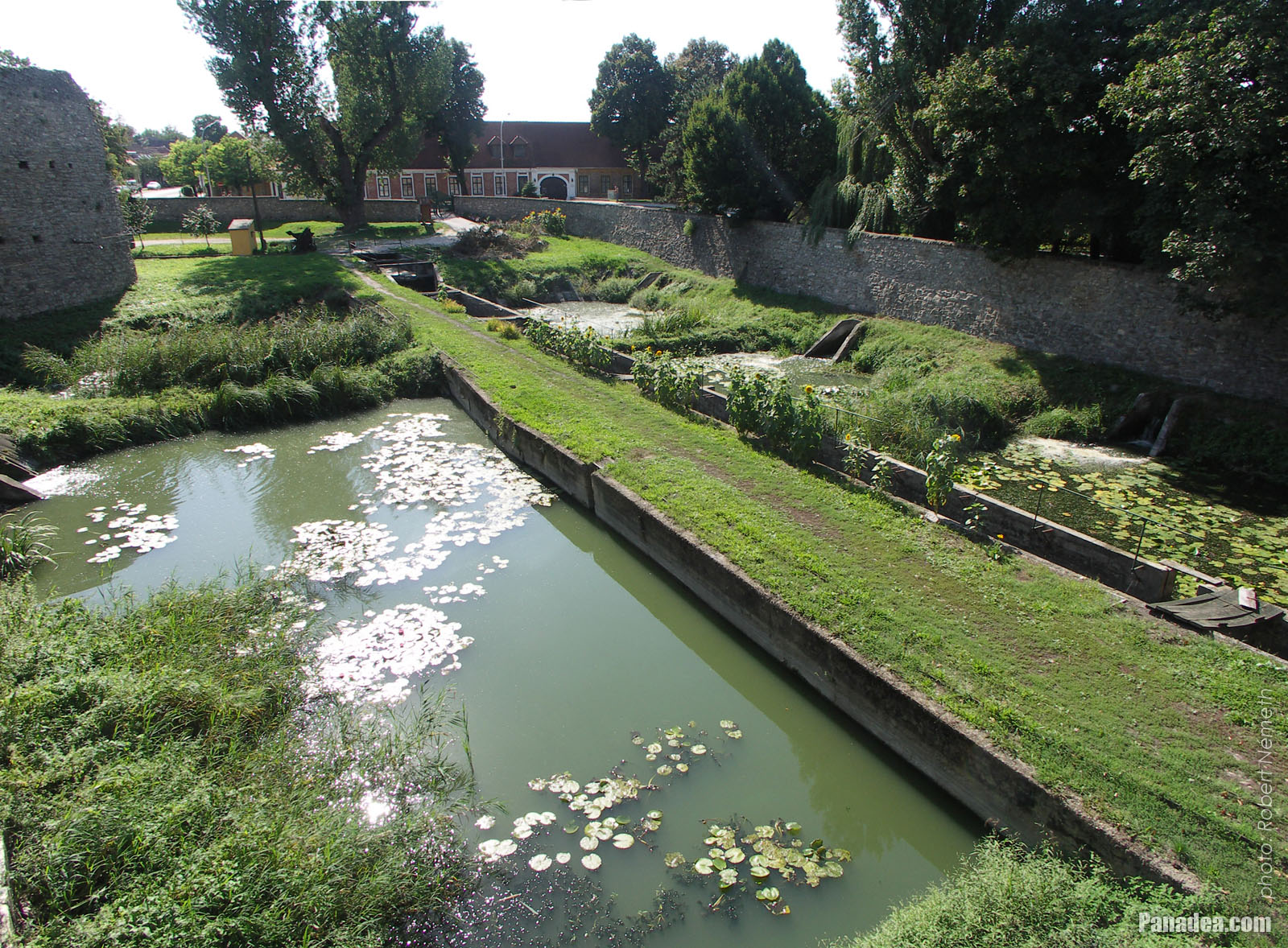
The north-western wall of Tata Castle, the western circular bastion (rondella) and the moat ("water ditch"), viewed from the castle bridge
The four-span bridge and the castle gate was built by Jakab Fellner in 1755.
Fotoğrafçılığın tarihi: 02/09/20062006
Tarafından yaratılan: Robert Németh
Fotoğraf makinesi model: Konica Minolta Dimage A200
Tata, Macaristan
The north-western wall of Tata Castle, the western circular bastion (rondella) and the moat ("water ditch"), viewed from the castle bridge - Tata, Macaristan -
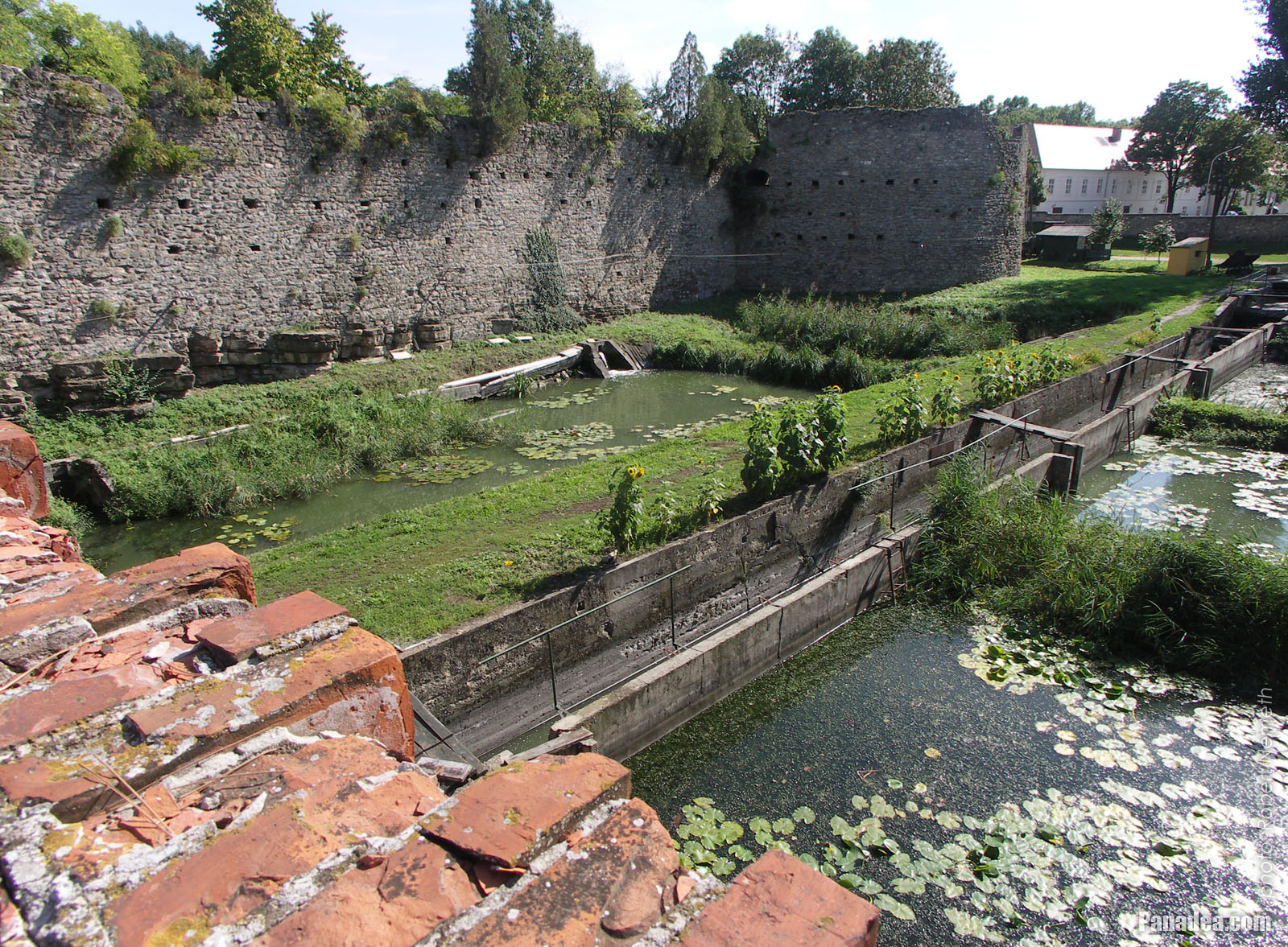
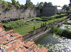
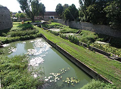
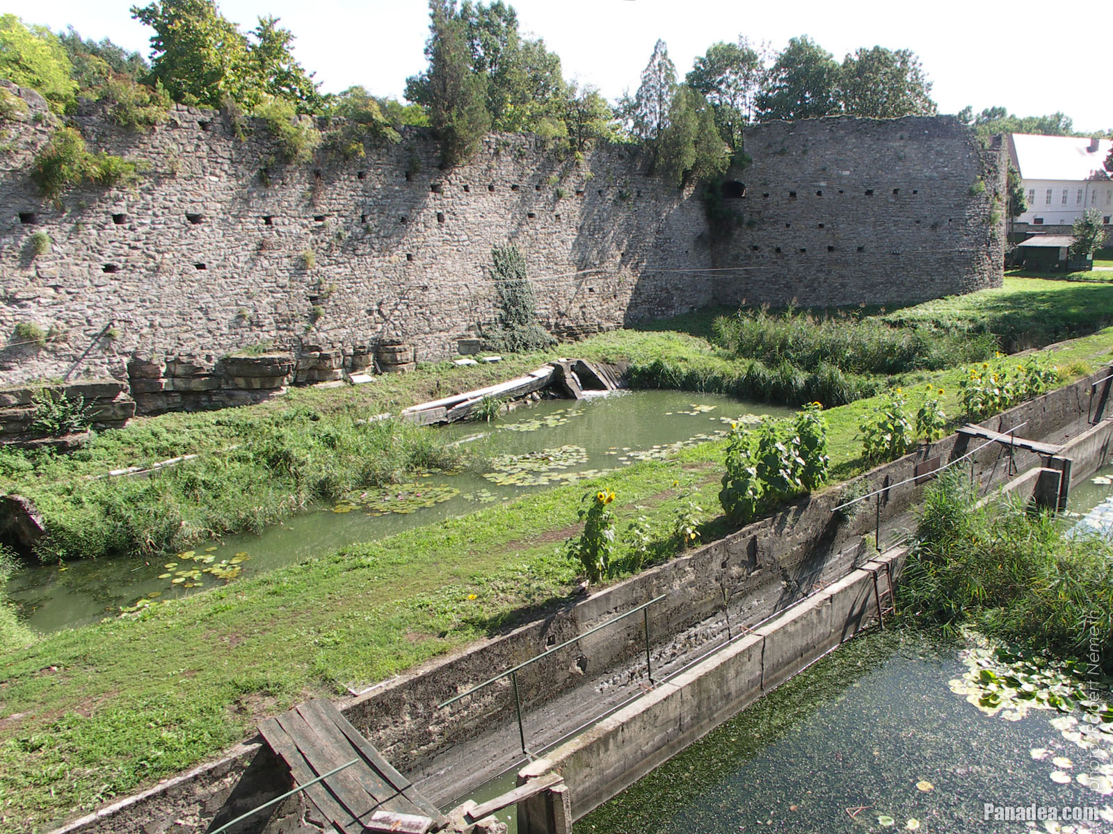
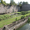
The former moat (broad defence ditch, filled with water) along the castle wall
Fotoğrafçılığın tarihi: 02/09/20062006
Tarafından yaratılan: Robert Németh
Fotoğraf makinesi model: Konica Minolta Dimage A200
Tata, Macaristan
The former moat (broad defence ditch, filled with water) along the castle wall - Tata, Macaristan -
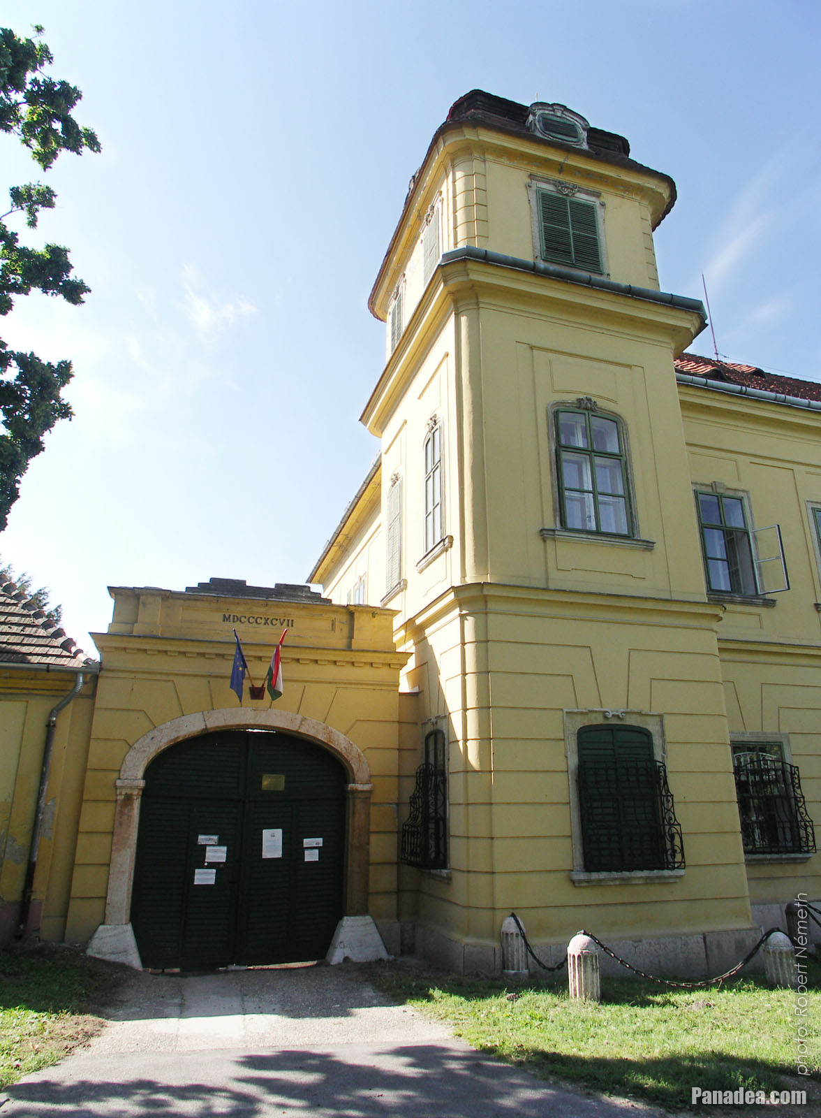
The yellow-painted Esterházy Palace (or Esterházy Mansion)
Fotoğrafçılığın tarihi: 02/09/20062006
Tarafından yaratılan: Robert Németh
Fotoğraf makinesi model: Konica Minolta Dimage A200
Tata, Macaristan
The yellow-painted Esterházy Palace (or Esterházy Mansion) - Tata, Macaristan -
Esterházy Palace
Built between 1760 and 1776, designed by Jakab Fellner
Fotoğrafçılığın tarihi: 02/09/20062006
Tarafından yaratılan: Robert Németh
Fotoğraf makinesi model: Konica Minolta Dimage A200
Tata, Macaristan
Esterházy Palace - Tata, Macaristan -
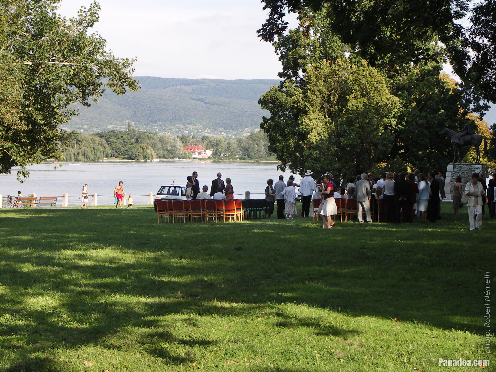
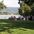
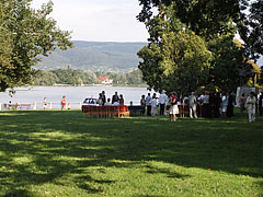
Preparing for a wedding ceremony by the Lake Öreg, on the grassy meadow beside the Esterházy Mansion
Fotoğrafçılığın tarihi: 02/09/20062006
Tarafından yaratılan: Robert Németh
Fotoğraf makinesi model: Konica Minolta Dimage A200
Tata, Macaristan
Preparing for a wedding ceremony by the Lake Öreg, on the grassy meadow beside the Esterházy Mansion - Tata, Macaristan -
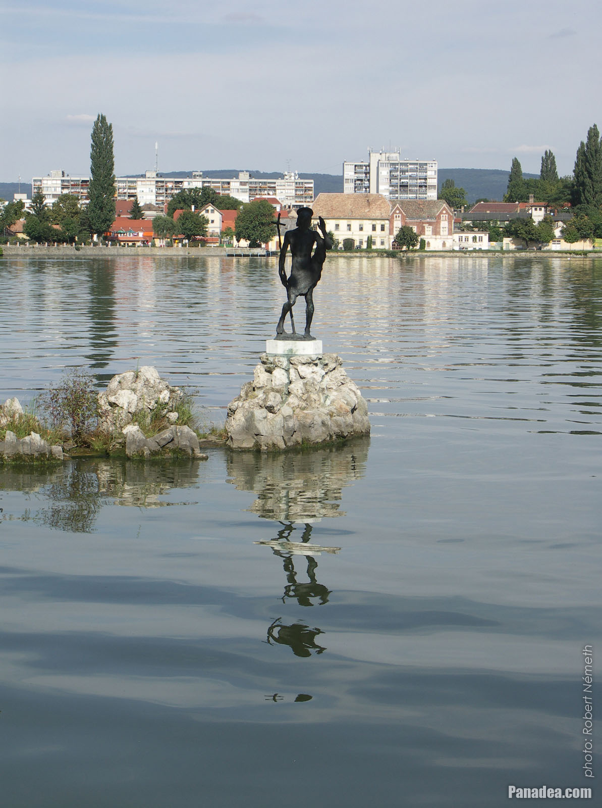
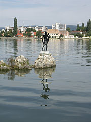
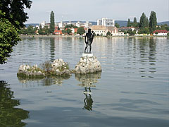
Statue of St. John the Baptist in the middle of Lake Öreg or Old Lake, on a rock
Created by Mária N. Kovács in 1943, stands on its present location since 1989.
Fotoğrafçılığın tarihi: 02/09/20062006
Tarafından yaratılan: Robert Németh
Fotoğraf makinesi model: Konica Minolta Dimage A200
Tata, Macaristan
Statue of St. John the Baptist in the middle of Lake Öreg or Old Lake, on a rock - Tata, Macaristan -
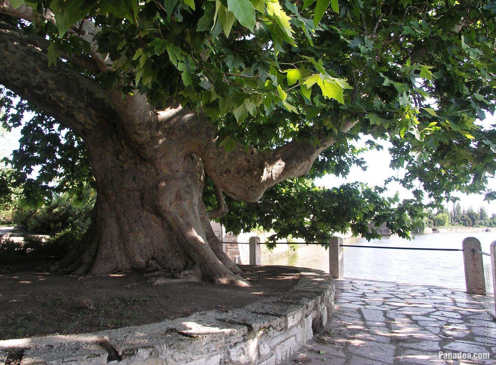
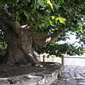
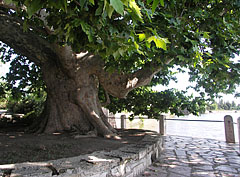
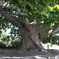
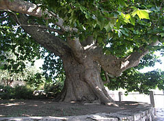
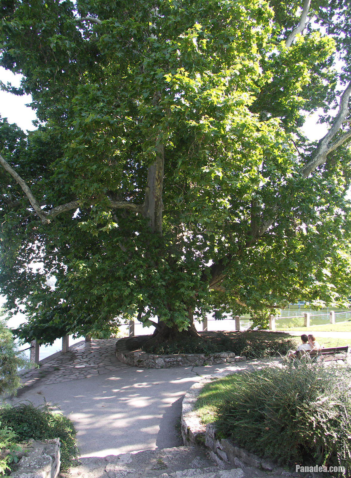
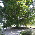
An incredibly thick-trunked old plane tree (sycamore tree or platan) which is considerably more than 300 years old, surprisingly on the shore of the Old Lake (Lake Öreg)
Fotoğrafçılığın tarihi: 15/07/20062006
Tarafından yaratılan: Robert Németh
Fotoğraf makinesi model: Konica Minolta Dimage A200
Tata, Macaristan
An incredibly thick-trunked old plane tree (sycamore tree or platan) which is considerably more than 300 years old, surprisingly on the shore of the Old Lake (Lake Öreg) - Tata, Macaristan -
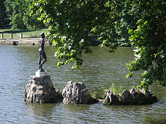
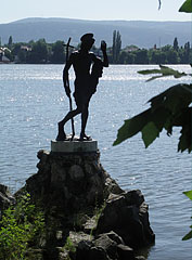
Statue of St. John the Baptist in the lake
Fotoğrafçılığın tarihi: 15/07/20062006
Tarafından yaratılan: Robert Németh
Fotoğraf makinesi model: Konica Minolta Dimage A200
Tata, Macaristan
Statue of St. John the Baptist in the lake - Tata, Macaristan -
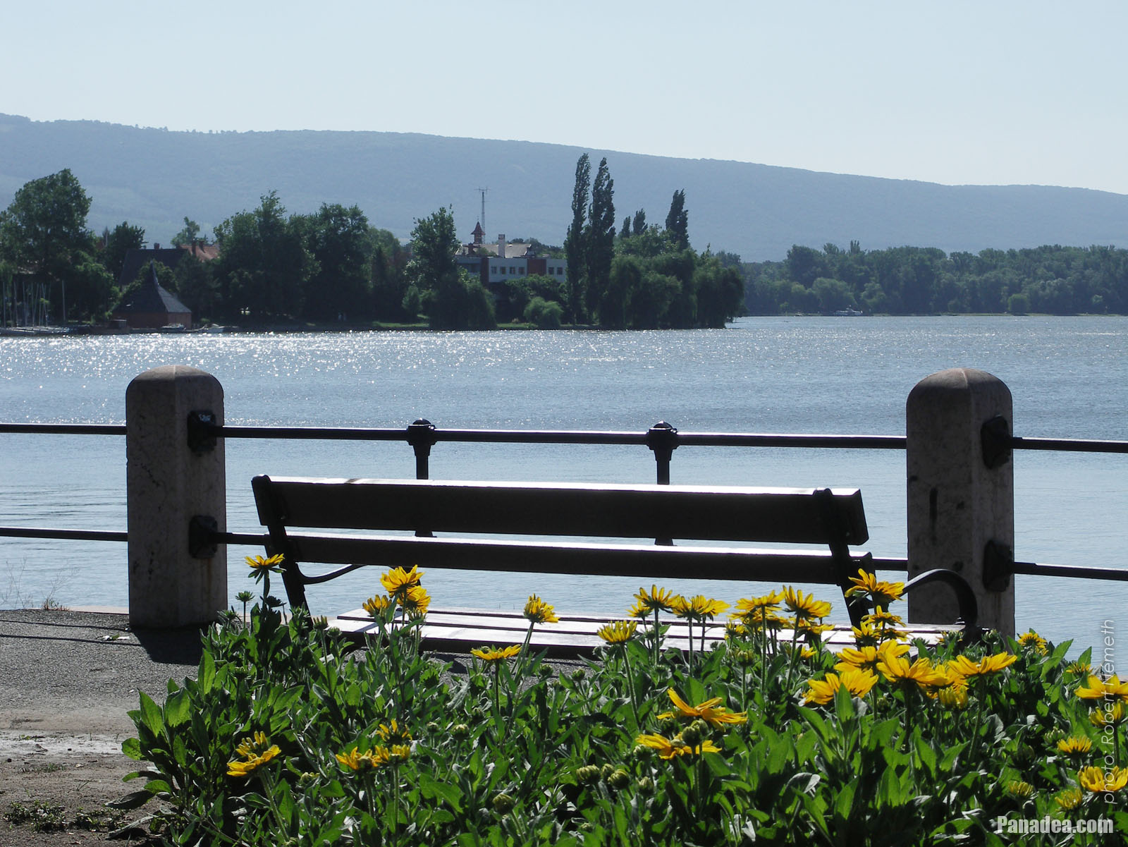
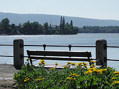
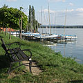
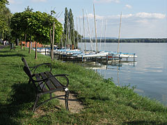
Lakeside tranquility, a bench, flowers and the shining water
Fotoğrafçılığın tarihi: 15/07/20062006
Tarafından yaratılan: Robert Németh
Fotoğraf makinesi model: Konica Minolta Dimage A200
Tata, Macaristan
Lakeside tranquility, a bench, flowers and the shining water - Tata, Macaristan -
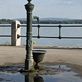
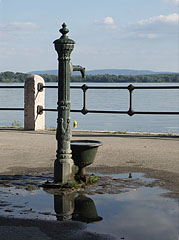
Cast iron water well at the Öreg Lake or Old Lake
It was placed here maybe together with the nearby "Csurgó" water well in 1999 (the latter is standing on the place of a former fountain).
Fotoğrafçılığın tarihi: 02/09/20062006
Tarafından yaratılan: Robert Németh
Fotoğraf makinesi model: Konica Minolta Dimage A200
Tata, Macaristan
Cast iron water well at the Öreg Lake or Old Lake - Tata, Macaristan -
Lakeside promenade and park
Fotoğrafçılığın tarihi: 02/09/20062006
Tarafından yaratılan: Robert Németh
Fotoğraf makinesi model: Konica Minolta Dimage A200
Tata, Macaristan
Lakeside promenade and park - Tata, Macaristan -
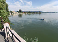
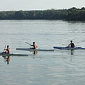
Kayakers on the lake
Fotoğrafçılığın tarihi: 02/09/20062006
Tarafından yaratılan: Robert Németh
Fotoğraf makinesi model: Konica Minolta Dimage A200
Tata, Macaristan
Kayakers on the lake - Tata, Macaristan -
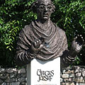
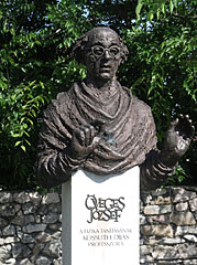
Bust sculpture of the Kossuth Prize awarded József Öveges professor of physics
Created by Béla Tóth in 2002
Fotoğrafçılığın tarihi: 15/07/20062006
Tarafından yaratılan: Robert Németh
Fotoğraf makinesi model: Konica Minolta Dimage A200
Tata, Macaristan
Bust sculpture of the Kossuth Prize awarded József Öveges professor of physics - Tata, Macaristan -
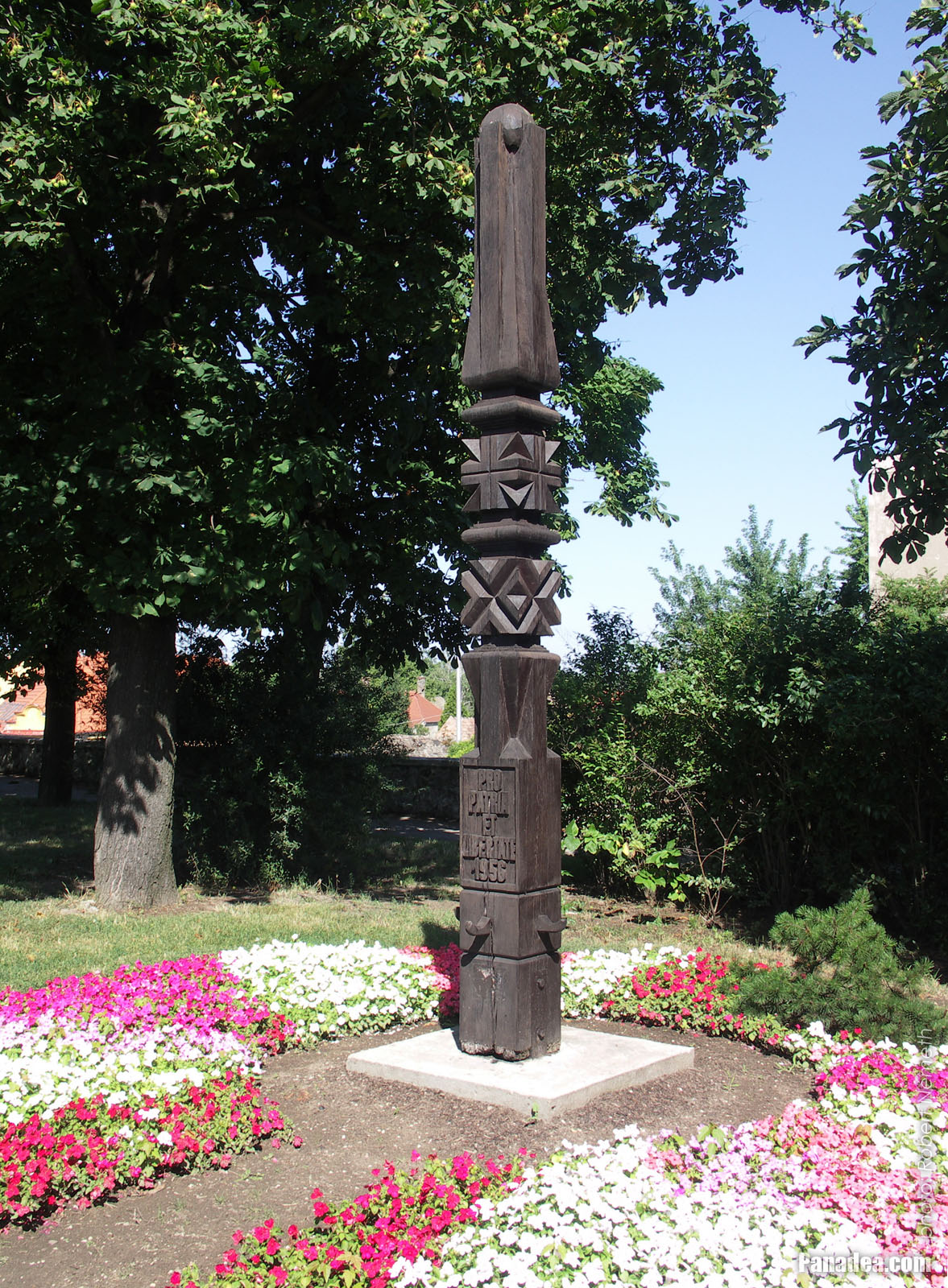
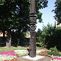
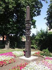
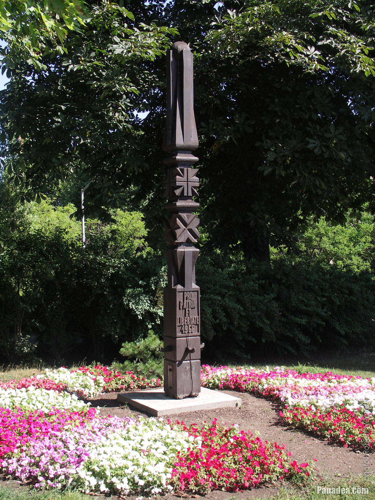
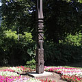
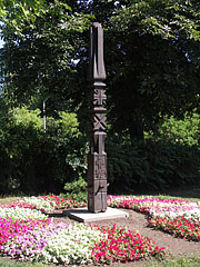
Wooden memorial column in the park between flowers (memorial of the Hungarian Uprising and Revolution of 1956)
Fotoğrafçılığın tarihi: 15/07/20062006
Tarafından yaratılan: Robert Németh
Fotoğraf makinesi model: Konica Minolta Dimage A200
Tata, Macaristan
Wooden memorial column in the park between flowers (memorial of the Hungarian Uprising and Revolution of 1956) - Tata, Macaristan -
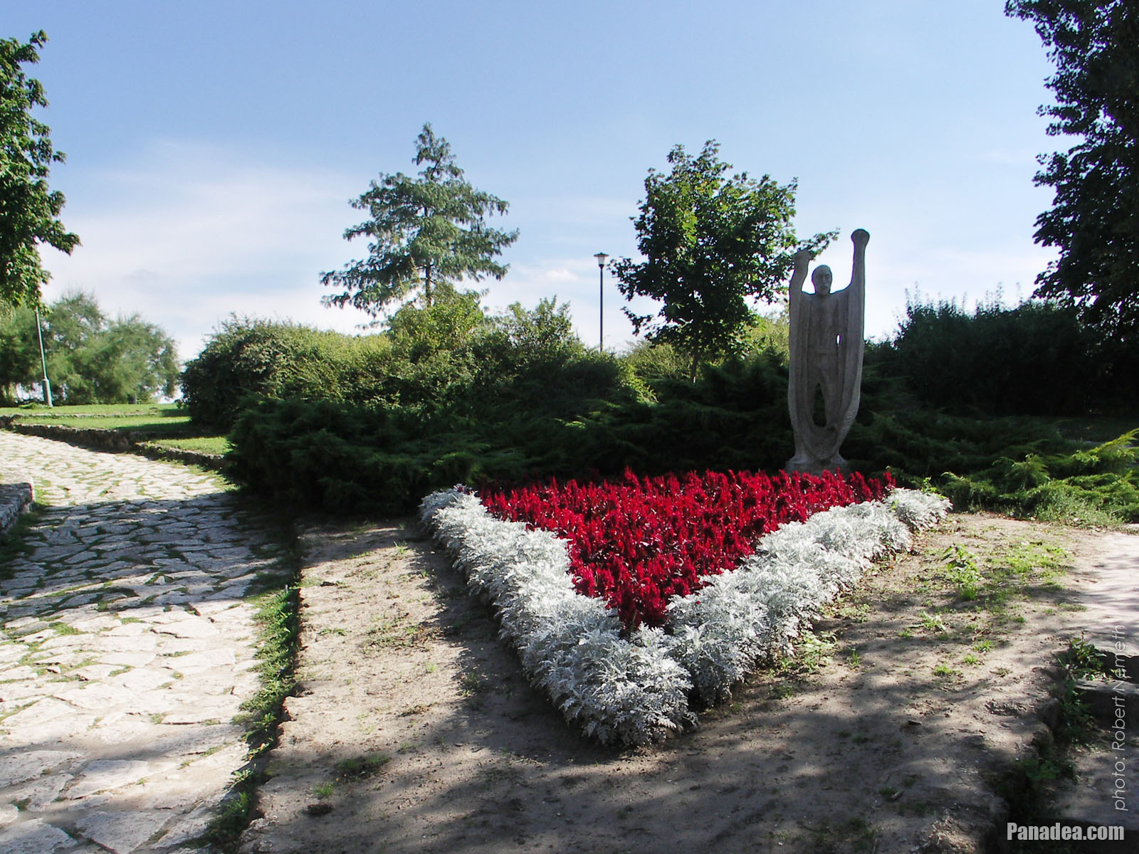
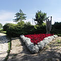
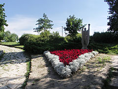
Old fisherman holds his net, a stone statue in the park
Created by Tibor Borbás in 1974
Fotoğrafçılığın tarihi: 02/09/20062006
Tarafından yaratılan: Robert Németh
Fotoğraf makinesi model: Konica Minolta Dimage A200
Tata, Macaristan
Old fisherman holds his net, a stone statue in the park - Tata, Macaristan -
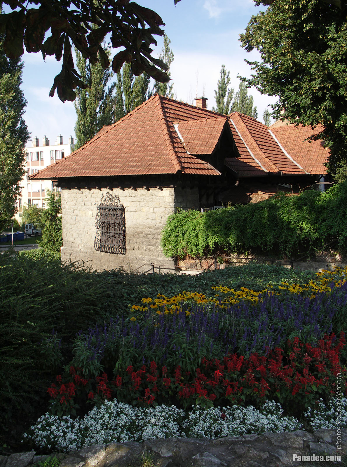
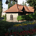
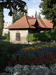
Flowered park and a cozy stone-walled dwelling house
Fotoğrafçılığın tarihi: 02/09/20062006
Tarafından yaratılan: Robert Németh
Fotoğraf makinesi model: Konica Minolta Dimage A200
Tata, Macaristan
Flowered park and a cozy stone-walled dwelling house - Tata, Macaristan -
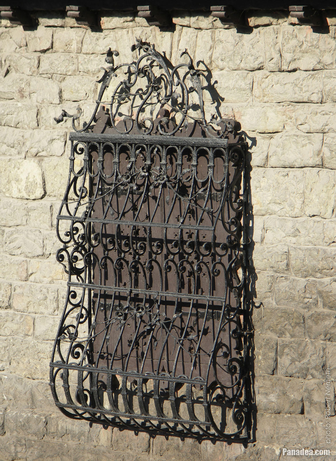
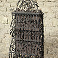
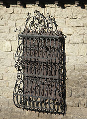
Ornate wrought iron grille on the window of a dwelling house
Fotoğrafçılığın tarihi: 02/09/20062006
Tarafından yaratılan: Robert Németh
Fotoğraf makinesi model: Konica Minolta Dimage A200
Tata, Macaristan
Ornate wrought iron grille on the window of a dwelling house - Tata, Macaristan -
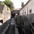
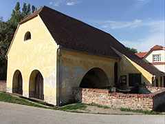
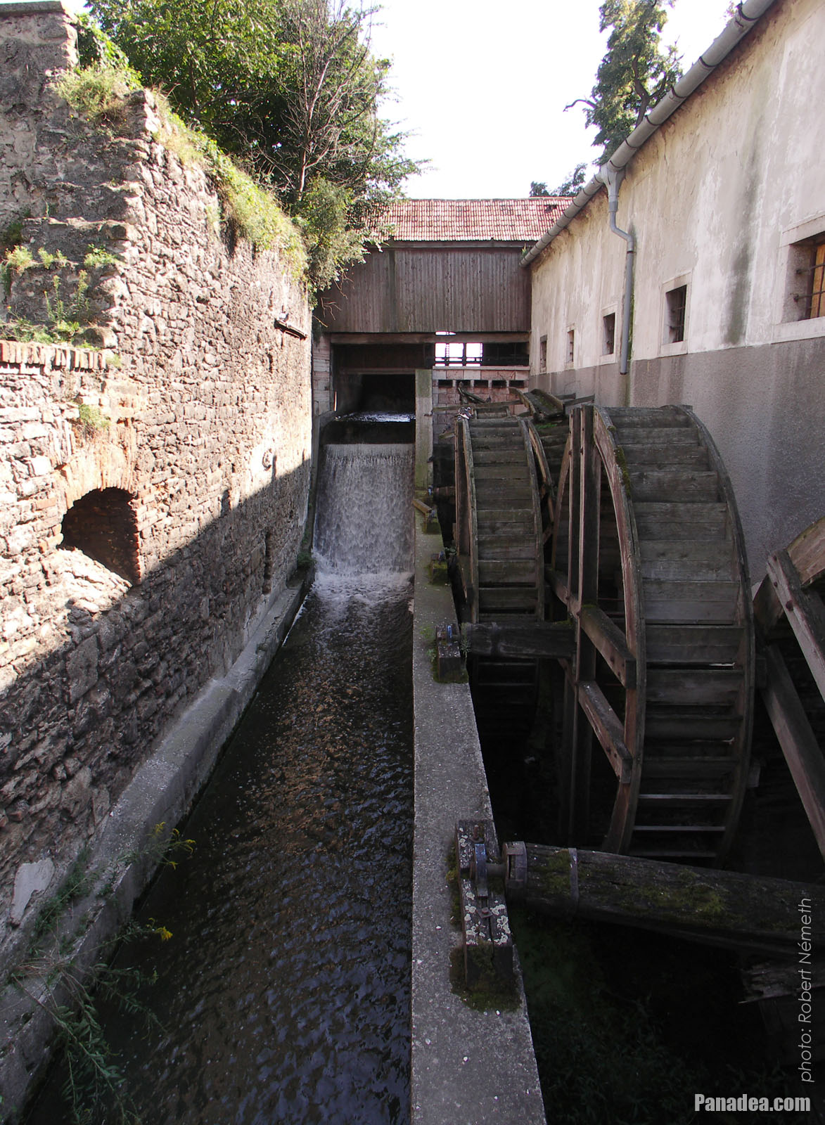
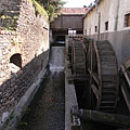
The water wheel system of the old Cifra water mill
Fotoğrafçılığın tarihi: 02/09/20062006
Tarafından yaratılan: Robert Németh
Fotoğraf makinesi model: Konica Minolta Dimage A200
Tata, Macaristan
The water wheel system of the old Cifra water mill - Tata, Macaristan -
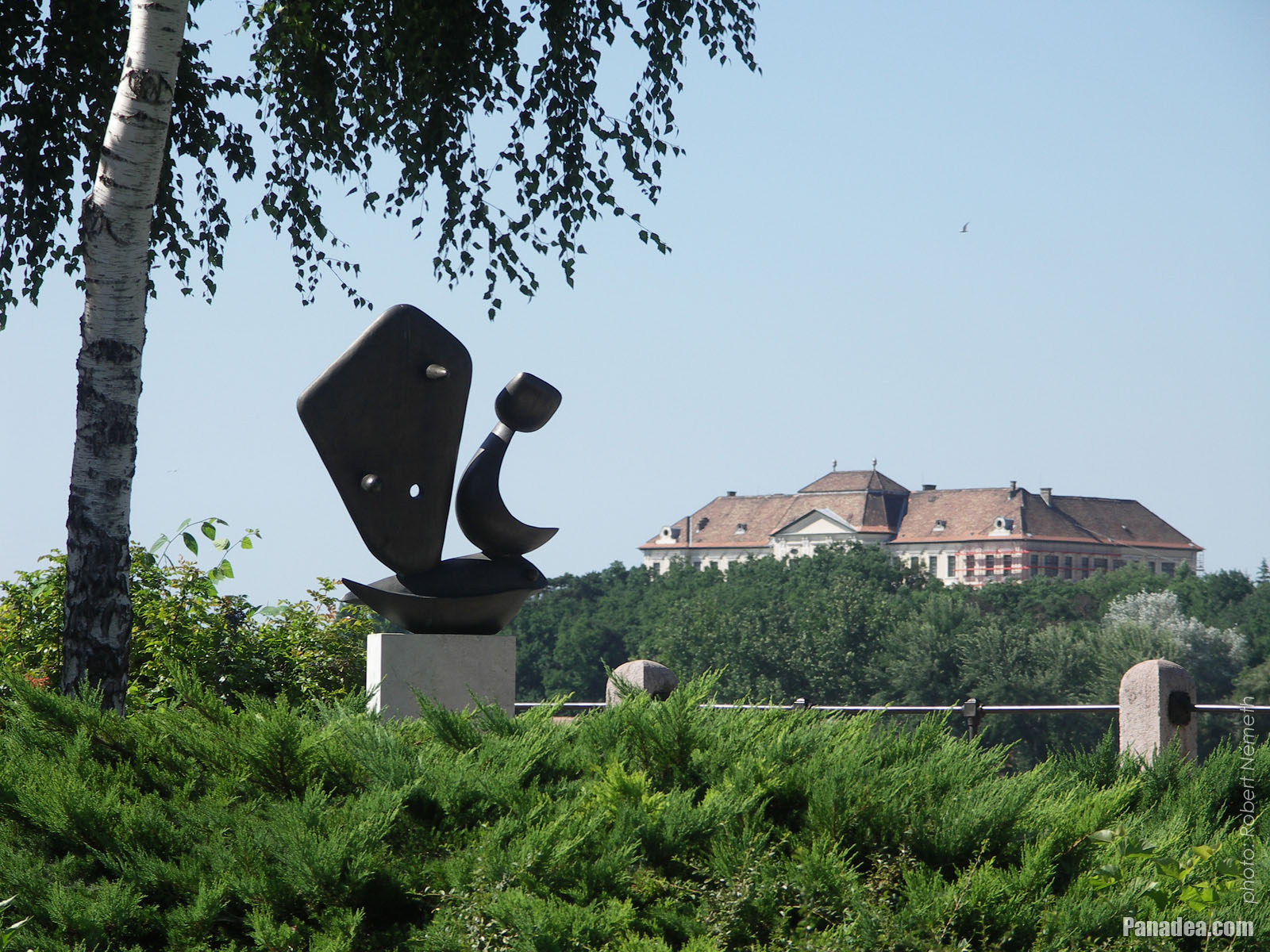
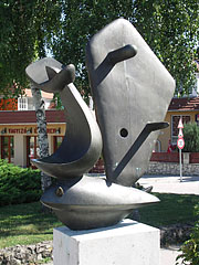
The contemporary sculpture called "Sailboat" in the park, and the Eötvös József High School (former Piarist High School) on the other side of the lake, on a hill
Fotoğrafçılığın tarihi: 15/07/20062006
Tarafından yaratılan: Robert Németh
Fotoğraf makinesi model: Konica Minolta Dimage A200
Tata, Macaristan
The contemporary sculpture called "Sailboat" in the park, and the Eötvös József High School (former Piarist High School) on the other side of the lake, on a hill - Tata, Macaristan -
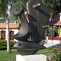
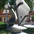
Bronze statue of a sailboat by the lake, represents a fishing boat and a fish in one
Created by Ferenc Friedrich in 1996, based on the work of Ferenc Martyn and in memory of the Breton fishermen.
Fotoğrafçılığın tarihi: 02/09/20062006
Tarafından yaratılan: Robert Németh
Fotoğraf makinesi model: Konica Minolta Dimage A200
Tata, Macaristan
Bronze statue of a sailboat by the lake, represents a fishing boat and a fish in one - Tata, Macaristan -
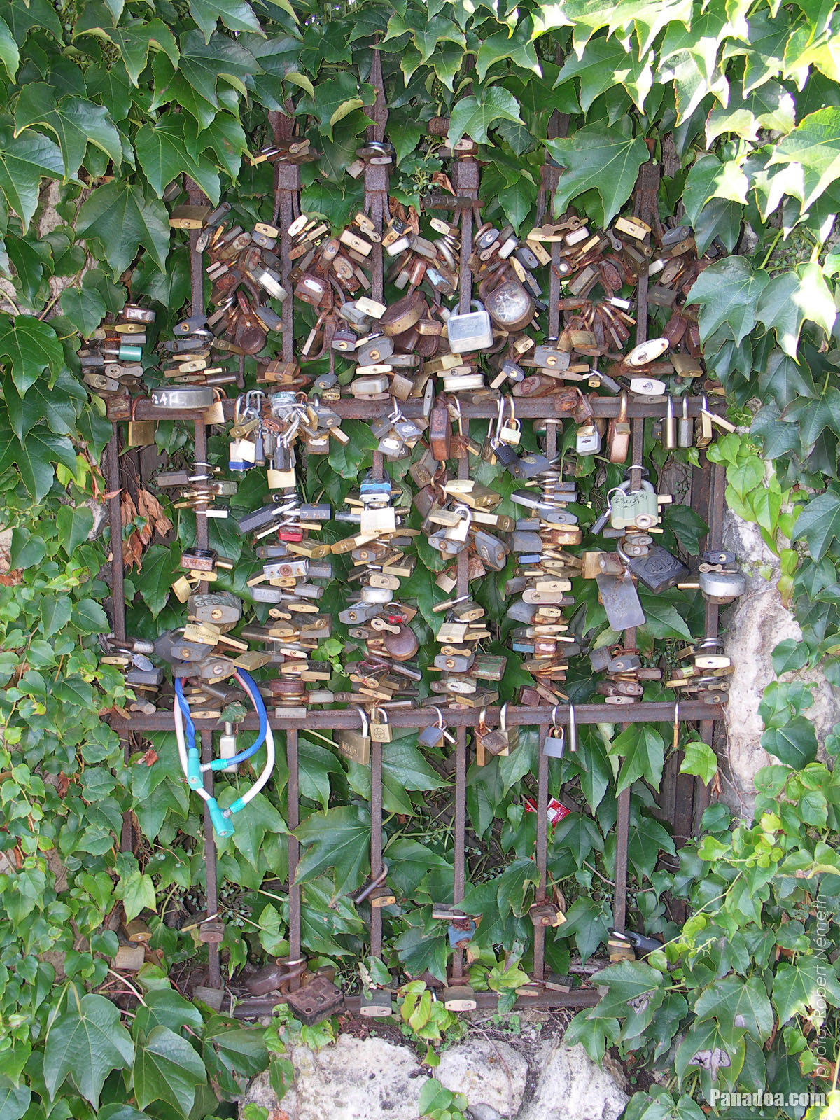
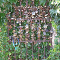
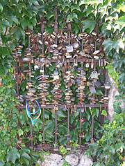
Love padlocks on the waterfront stone fence of a dwelling house in Alkotmány Street
Fotoğrafçılığın tarihi: 02/09/20062006
Tarafından yaratılan: Robert Németh
Fotoğraf makinesi model: Konica Minolta Dimage A200
Tata, Macaristan
Love padlocks on the waterfront stone fence of a dwelling house in Alkotmány Street - Tata, Macaristan -
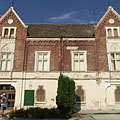
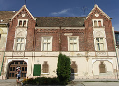
Facade of the historicist neo-gothic style Hamary House
This former tannery or leather factory was built around 1770, and it was extended with the red brick upper floor in the late 19th century.
Fotoğrafçılığın tarihi: 02/09/20062006
Tarafından yaratılan: Robert Németh
Fotoğraf makinesi model: Konica Minolta Dimage A200
Tata, Macaristan
Facade of the historicist neo-gothic style Hamary House - Tata, Macaristan -
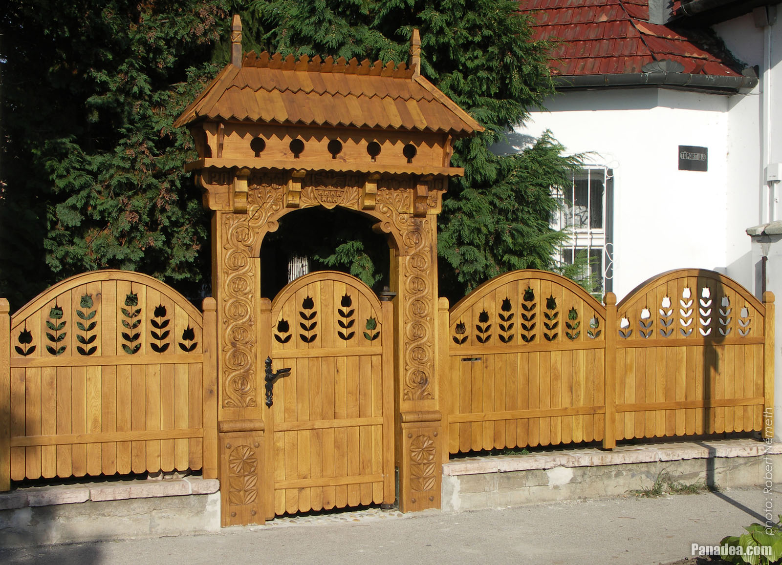
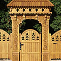
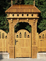
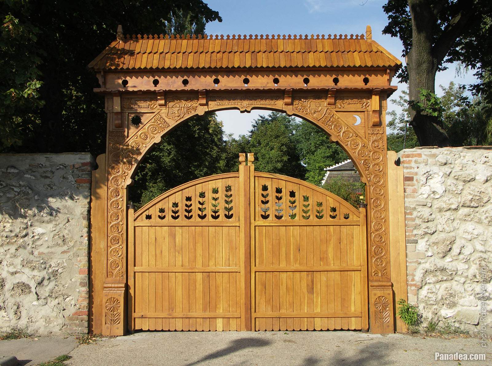
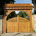
The wooden carved Székely gate and fence of a Lakeside dwelling house
Fotoğrafçılığın tarihi: 02/09/20062006
Tarafından yaratılan: Robert Németh
Fotoğraf makinesi model: Konica Minolta Dimage A200
Tata, Macaristan
The wooden carved Székely gate and fence of a Lakeside dwelling house - Tata, Macaristan -
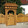
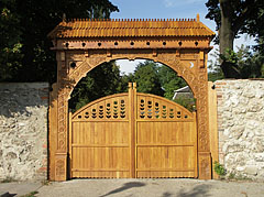
The wood-carved gateway looks like a Szekey gate
Carved by Ernő Cs. Kiss in 2005
Fotoğrafçılığın tarihi: 02/09/20062006
Tarafından yaratılan: Robert Németh
Fotoğraf makinesi model: Konica Minolta Dimage A200
Tata, Macaristan
The wood-carved gateway looks like a Szekey gate - Tata, Macaristan -
Wide wood-carved Székely gate
According to an inscription on the gate it was created by Hungarian wood carver folk artist Ernő Cs. Kiss from Tata in 2005.
Fotoğrafçılığın tarihi: 02/09/20062006
Tarafından yaratılan: Robert Németh
Fotoğraf makinesi model: Konica Minolta Dimage A200
Tata, Macaristan
Wide wood-carved Székely gate - Tata, Macaristan -
Ornate window grille of a nice white dwelling house
Fotoğrafçılığın tarihi: 02/09/20062006
Tarafından yaratılan: Robert Németh
Fotoğraf makinesi model: Konica Minolta Dimage A200
Tata, Macaristan
Ornate window grille of a nice white dwelling house - Tata, Macaristan -
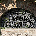
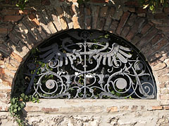
Wrought iron dragons and other motifs in an arched opening of a brick-wall fence
Fotoğrafçılığın tarihi: 02/09/20062006
Tarafından yaratılan: Robert Németh
Fotoğraf makinesi model: Konica Minolta Dimage A200
Tata, Macaristan
Wrought iron dragons and other motifs in an arched opening of a brick-wall fence - Tata, Macaristan -
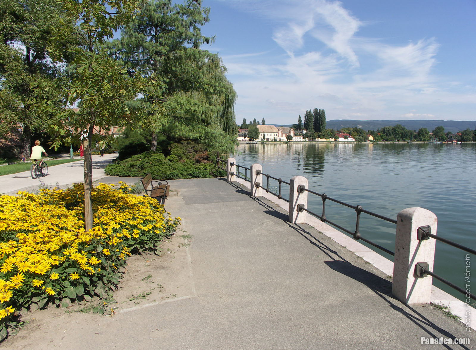
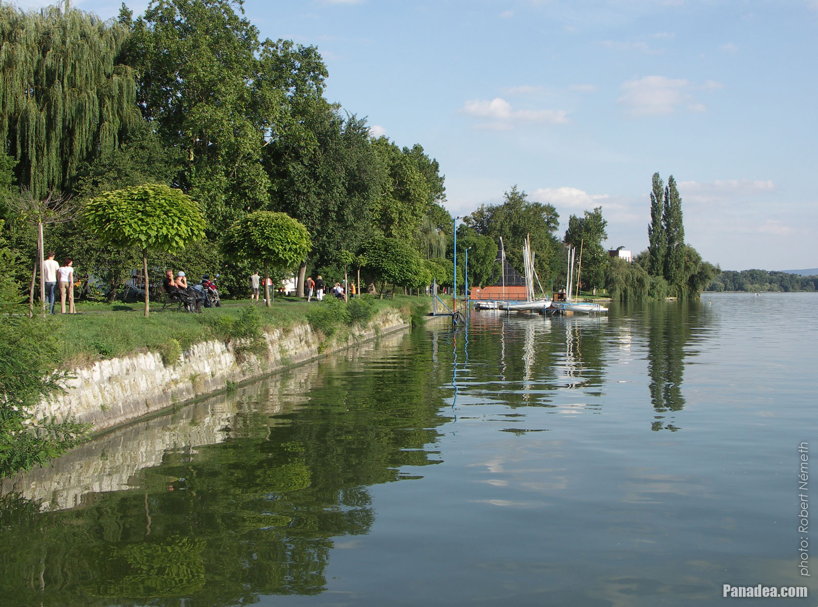
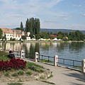
Lake Öreg (or Old Lake), with landscaped walkway on the shore and a small sailboat harbour ahead
Fotoğrafçılığın tarihi: 02/09/20062006
Tarafından yaratılan: Robert Németh
Fotoğraf makinesi model: Konica Minolta Dimage A200
Tata, Macaristan
Lake Öreg (or Old Lake), with landscaped walkway on the shore and a small sailboat harbour ahead - Tata, Macaristan -
The baroque style yellow-painted Pötörke Mill watermill
It was built in the late 18th century by Jakab Fellner architect, now it is the creative house of the Hungarian National Monuments Office.
Fotoğrafçılığın tarihi: 02/09/20062006
Tarafından yaratılan: Robert Németh
Fotoğraf makinesi model: Konica Minolta Dimage A200
Tata, Macaristan
The baroque style yellow-painted Pötörke Mill watermill - Tata, Macaristan -
Bench and sailboat harbour by the lake
Fotoğrafçılığın tarihi: 02/09/20062006
Tarafından yaratılan: Robert Németh
Fotoğraf makinesi model: Konica Minolta Dimage A200
Tata, Macaristan
Bench and sailboat harbour by the lake - Tata, Macaristan -
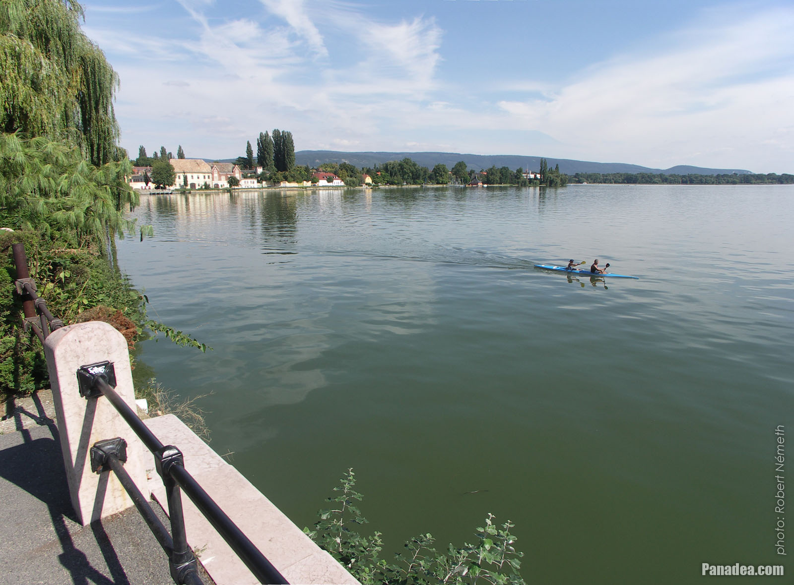
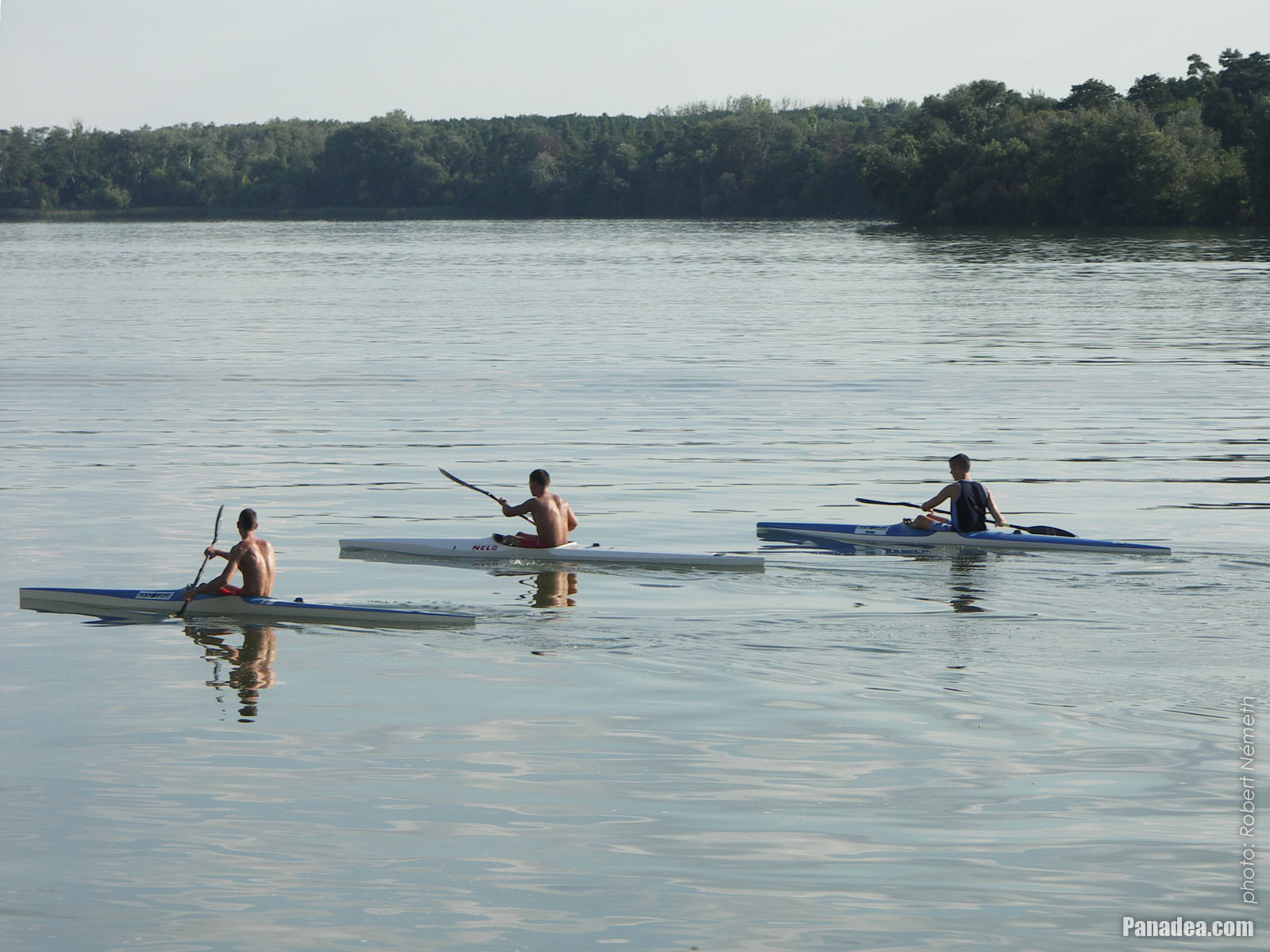
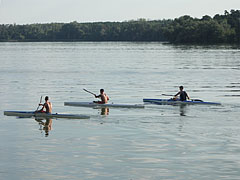
Three kayakers on the Old Lake (or Öreg Lake)
Fotoğrafçılığın tarihi: 02/09/20062006
Tarafından yaratılan: Robert Németh
Fotoğraf makinesi model: Konica Minolta Dimage A200
Tata, Macaristan
Three kayakers on the Old Lake (or Öreg Lake) - Tata, Macaristan -
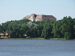
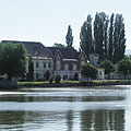
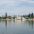
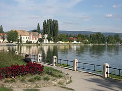
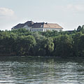
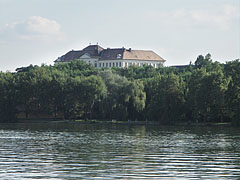
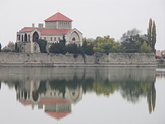
Lake Öreg and the Castle of Tata
Fotoğrafçılığın tarihi: 15/07/20062006
Tarafından yaratılan: Robert Németh
Fotoğraf makinesi model: Konica Minolta Dimage A200
Tata, Macaristan
Lake Öreg and the Castle of Tata - Tata, Macaristan -
The Axmann House (built in 1833) and the Hamary House on the shore of Lake Öreg
Fotoğrafçılığın tarihi: 15/07/20062006
Tarafından yaratılan: Robert Németh
Fotoğraf makinesi model: Konica Minolta Dimage A200
Tata, Macaristan
The Axmann House (built in 1833) and the Hamary House on the shore of Lake Öreg - Tata, Macaristan -
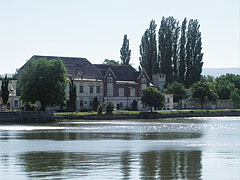
Castle of Tata by the lake
Fotoğrafçılığın tarihi: 15/07/20062006
Tarafından yaratılan: Robert Németh
Fotoğraf makinesi model: Konica Minolta Dimage A200
Tata, Macaristan
Castle of Tata by the lake - Tata, Macaristan -
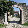
The western gate of Tata Castle
Fotoğrafçılığın tarihi: 15/07/20062006
Tarafından yaratılan: Robert Németh
Fotoğraf makinesi model: Konica Minolta Dimage A200
Tata, Macaristan
The western gate of Tata Castle - Tata, Macaristan -
An old plane tree by the lake near the castle
Fotoğrafçılığın tarihi: 15/07/20062006
Tarafından yaratılan: Robert Németh
Fotoğraf makinesi model: Konica Minolta Dimage A200
Tata, Macaristan
An old plane tree by the lake near the castle - Tata, Macaristan -
The survived central tower of the Tata Castle, these days it is the home of the Kuny Domokos County Museum
Fotoğrafçılığın tarihi: 15/07/20062006
Tarafından yaratılan: Robert Németh
Fotoğraf makinesi model: Konica Minolta Dimage A200
Tata, Macaristan
The survived central tower of the Tata Castle, these days it is the home of the Kuny Domokos County Museum - Tata, Macaristan -
A headboard, carved wooden column in the park, memorial of the Hungarian revolution and independece war of 1956
Fotoğrafçılığın tarihi: 15/07/20062006
Tarafından yaratılan: Robert Németh
Fotoğraf makinesi model: Konica Minolta Dimage A200
Tata, Macaristan
A headboard, carved wooden column in the park, memorial of the Hungarian revolution and independece war of 1956 - Tata, Macaristan -
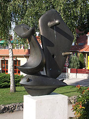
"Sailboat", an abstract modern style bronze sculpture on the lakeside promenade
Created by Ferenc Friedrich in 1996
Fotoğrafçılığın tarihi: 15/07/20062006
Tarafından yaratılan: Robert Németh
Fotoğraf makinesi model: Konica Minolta Dimage A200
Tata, Macaristan
"Sailboat", an abstract modern style bronze sculpture on the lakeside promenade - Tata, Macaristan -
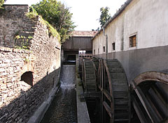
Water wheels of the Cifra Mill
Fotoğrafçılığın tarihi: 02/09/20062006
Tarafından yaratılan: Robert Németh
Fotoğraf makinesi model: Konica Minolta Dimage A200
Tata, Macaristan
Water wheels of the Cifra Mill - Tata, Macaristan -
The wall remains around the survived tower of the Tata Castle are now part of the park
Fotoğrafçılığın tarihi: 02/09/20062006
Tarafından yaratılan: Robert Németh
Fotoğraf makinesi model: Konica Minolta Dimage A200
Tata, Macaristan
The wall remains around the survived tower of the Tata Castle are now part of the park - Tata, Macaristan -
The north-western wall of the Castle of Tata with a circular bastion (roundel) at the water-filled moat
Fotoğrafçılığın tarihi: 02/09/20062006
Tarafından yaratılan: Robert Németh
Fotoğraf makinesi model: Konica Minolta Dimage A200
Tata, Macaristan
The north-western wall of the Castle of Tata with a circular bastion (roundel) at the water-filled moat - Tata, Macaristan -
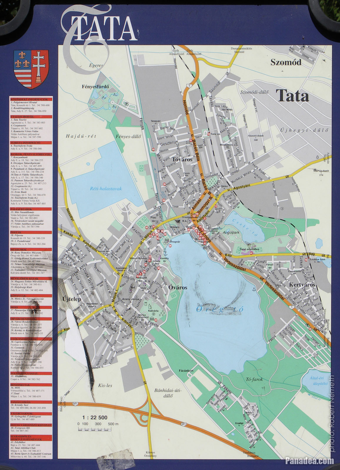
Map of Tata town
Fotoğrafçılığın tarihi: 02/09/20062006
Tarafından yaratılan: Robert Németh
Fotoğraf makinesi model: Konica Minolta Dimage A200
Tata, Macaristan
Map of Tata town - Tata, Macaristan -
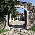
The arched stone gate of the Tata Castle, on the north-western wall
Fotoğrafçılığın tarihi: 02/09/20062006
Tarafından yaratılan: Robert Németh
Fotoğraf makinesi model: Konica Minolta Dimage A200
Tata, Macaristan
The arched stone gate of the Tata Castle, on the north-western wall - Tata, Macaristan -
Residental buildings on the northern shore of Lake Tata
Fotoğrafçılığın tarihi: 02/09/20062006
Tarafından yaratılan: Robert Németh
Fotoğraf makinesi model: Konica Minolta Dimage A200
Tata, Macaristan
Residental buildings on the northern shore of Lake Tata - Tata, Macaristan -
The famous old plane tree on the lakeside
Fotoğrafçılığın tarihi: 02/09/20062006
Tarafından yaratılan: Robert Németh
Fotoğraf makinesi model: Konica Minolta Dimage A200
Tata, Macaristan
The famous old plane tree on the lakeside - Tata, Macaristan -
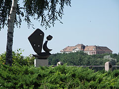
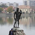
Statue of St. John the Baptist on a rock in the lake
Fotoğrafçılığın tarihi: 02/09/20062006
Tarafından yaratılan: Robert Németh
Fotoğraf makinesi model: Konica Minolta Dimage A200
Tata, Macaristan
Statue of St. John the Baptist on a rock in the lake - Tata, Macaristan -
Tatai Lake (also known as Öreg Lake, literally "Old Lake")
Fotoğrafçılığın tarihi: 02/09/20062006
Tarafından yaratılan: Robert Németh
Fotoğraf makinesi model: Konica Minolta Dimage A200
Tata, Macaristan
Tatai Lake (also known as Öreg Lake, literally "Old Lake") - Tata, Macaristan -
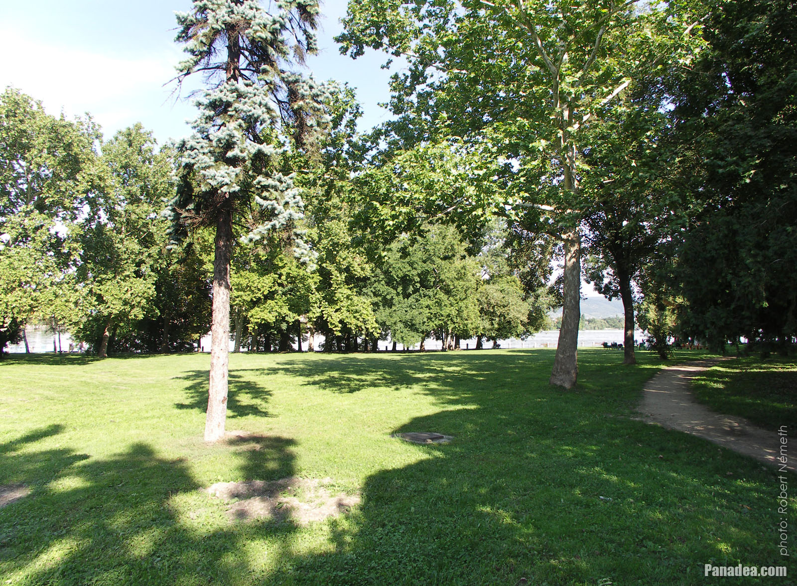
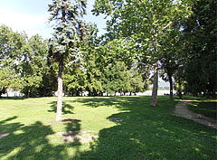
Park on the lakeside
Fotoğrafçılığın tarihi: 02/09/20062006
Tarafından yaratılan: Robert Németh
Fotoğraf makinesi model: Konica Minolta Dimage A200
Tata, Macaristan
Park on the lakeside - Tata, Macaristan -
Lakeside grassy park
Fotoğrafçılığın tarihi: 02/09/20062006
Tarafından yaratılan: Robert Németh
Fotoğraf makinesi model: Konica Minolta Dimage A200
Tata, Macaristan
Lakeside grassy park - Tata, Macaristan -
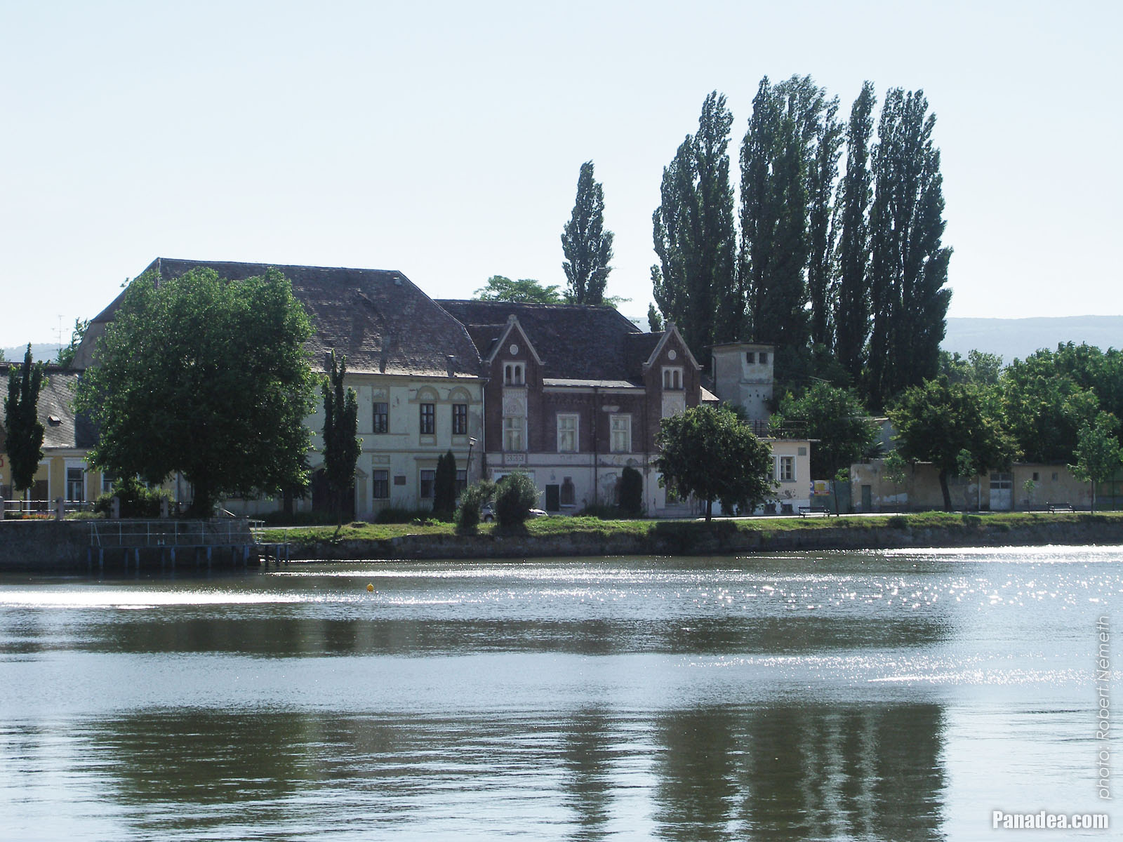
The Lake Öreg and the buildings of the the Tóváros quarter, viewed from the castle walls
Fotoğrafçılığın tarihi: 02/09/20062006
Tarafından yaratılan: Robert Németh
Fotoğraf makinesi model: Konica Minolta Dimage A200
Tata, Macaristan
The Lake Öreg and the buildings of the the Tóváros quarter, viewed from the castle walls - Tata, Macaristan -
Moody promenade by the lake
Fotoğrafçılığın tarihi: 02/09/20062006
Tarafından yaratılan: Robert Németh
Fotoğraf makinesi model: Konica Minolta Dimage A200
Tata, Macaristan
Moody promenade by the lake - Tata, Macaristan -
The Eötvös József High School (former Piarist Secondary School) on the other side of the lake on a hill
Fotoğrafçılığın tarihi: 02/09/20062006
Tarafından yaratılan: Robert Németh
Fotoğraf makinesi model: Konica Minolta Dimage A200
Tata, Macaristan
The Eötvös József High School (former Piarist Secondary School) on the other side of the lake on a hill - Tata, Macaristan -
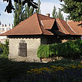
Stone walled dwelling house at the edge of the park
Fotoğrafçılığın tarihi: 02/09/20062006
Tarafından yaratılan: Robert Németh
Fotoğraf makinesi model: Konica Minolta Dimage A200
Tata, Macaristan
Stone walled dwelling house at the edge of the park - Tata, Macaristan -
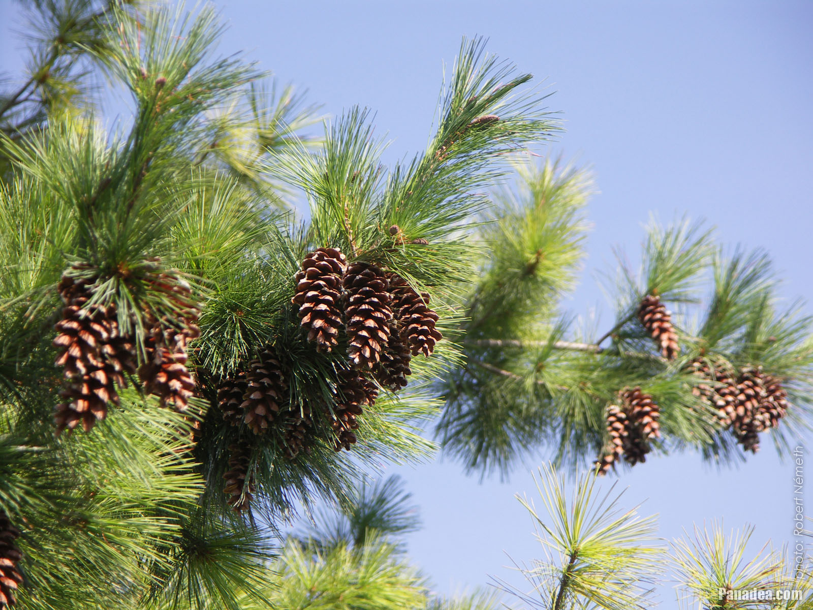
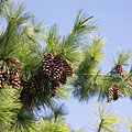
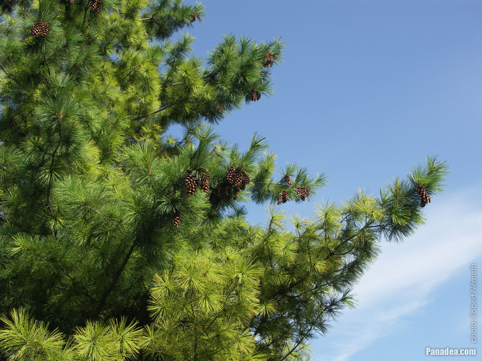
Cones on a lakeside pine tree
Fotoğrafçılığın tarihi: 02/09/20062006
Tarafından yaratılan: Robert Németh
Fotoğraf makinesi model: Konica Minolta Dimage A200
Tata, Macaristan
Cones on a lakeside pine tree - Tata, Macaristan -
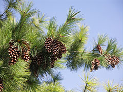
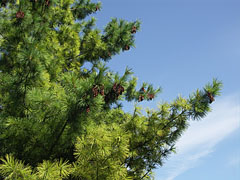
Verdant pine branches in the park
Fotoğrafçılığın tarihi: 02/09/20062006
Tarafından yaratılan: Robert Németh
Fotoğraf makinesi model: Konica Minolta Dimage A200
Tata, Macaristan
Verdant pine branches in the park - Tata, Macaristan -
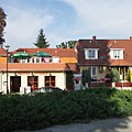
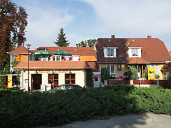
Albatrosz Restaurant and ice cream parlor near the lakeside promenade
Fotoğrafçılığın tarihi: 02/09/20062006
Tarafından yaratılan: Robert Németh
Fotoğraf makinesi model: Konica Minolta Dimage A200
Tata, Macaristan
Albatrosz Restaurant and ice cream parlor near the lakeside promenade - Tata, Macaristan -
Small sailboats in the harbour on the north shore of Lake Öreg
Fotoğrafçılığın tarihi: 02/09/20062006
Tarafından yaratılan: Robert Németh
Fotoğraf makinesi model: Konica Minolta Dimage A200
Tata, Macaristan
Small sailboats in the harbour on the north shore of Lake Öreg - Tata, Macaristan -
The Castle of Tata by the Öreg Lake (Old Lake) in autumn
Fotoğrafçılığın tarihi: 26/10/20082008
Tarafından yaratılan: Robert Németh
Fotoğraf makinesi model: Konica Minolta Dimage A200
Tata, Macaristan
The Castle of Tata by the Öreg Lake (Old Lake) in autumn - Tata, Macaristan -
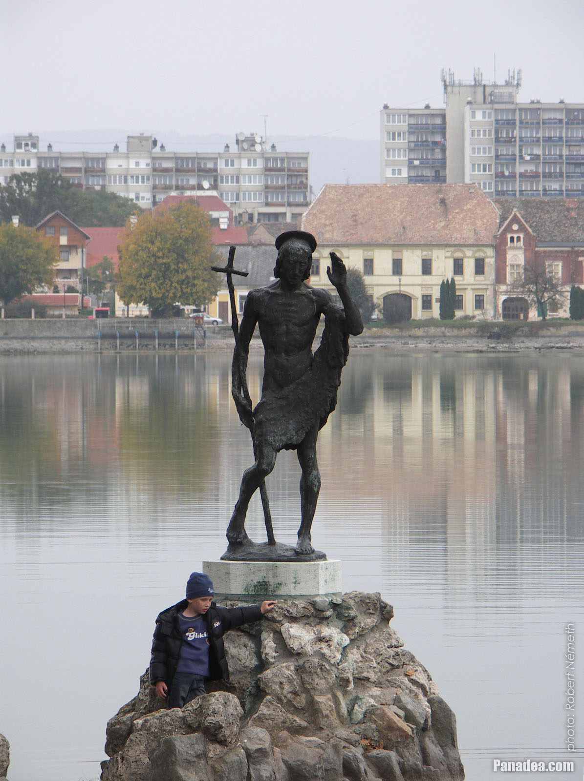
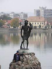
Statue of St. John the Baptist
The statue is usually stands in the water, but sometimes in autumn and winter when the water level is lowered it can be accessed even on foot.
Fotoğrafçılığın tarihi: 26/10/20082008
Tarafından yaratılan: Robert Németh
Fotoğraf makinesi model: Konica Minolta Dimage A200
Tata, Macaristan
Statue of St. John the Baptist - Tata, Macaristan -
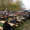
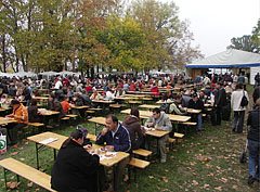
Canteen tables on the "Great Fishing on Lake Öreg" event, with among others fish food tasting
Fotoğrafçılığın tarihi: 26/10/20082008
Tarafından yaratılan: Robert Németh
Fotoğraf makinesi model: Konica Minolta Dimage A200
Tata, Macaristan
Canteen tables on the "Great Fishing on Lake Öreg" event, with among others fish food tasting - Tata, Macaristan -
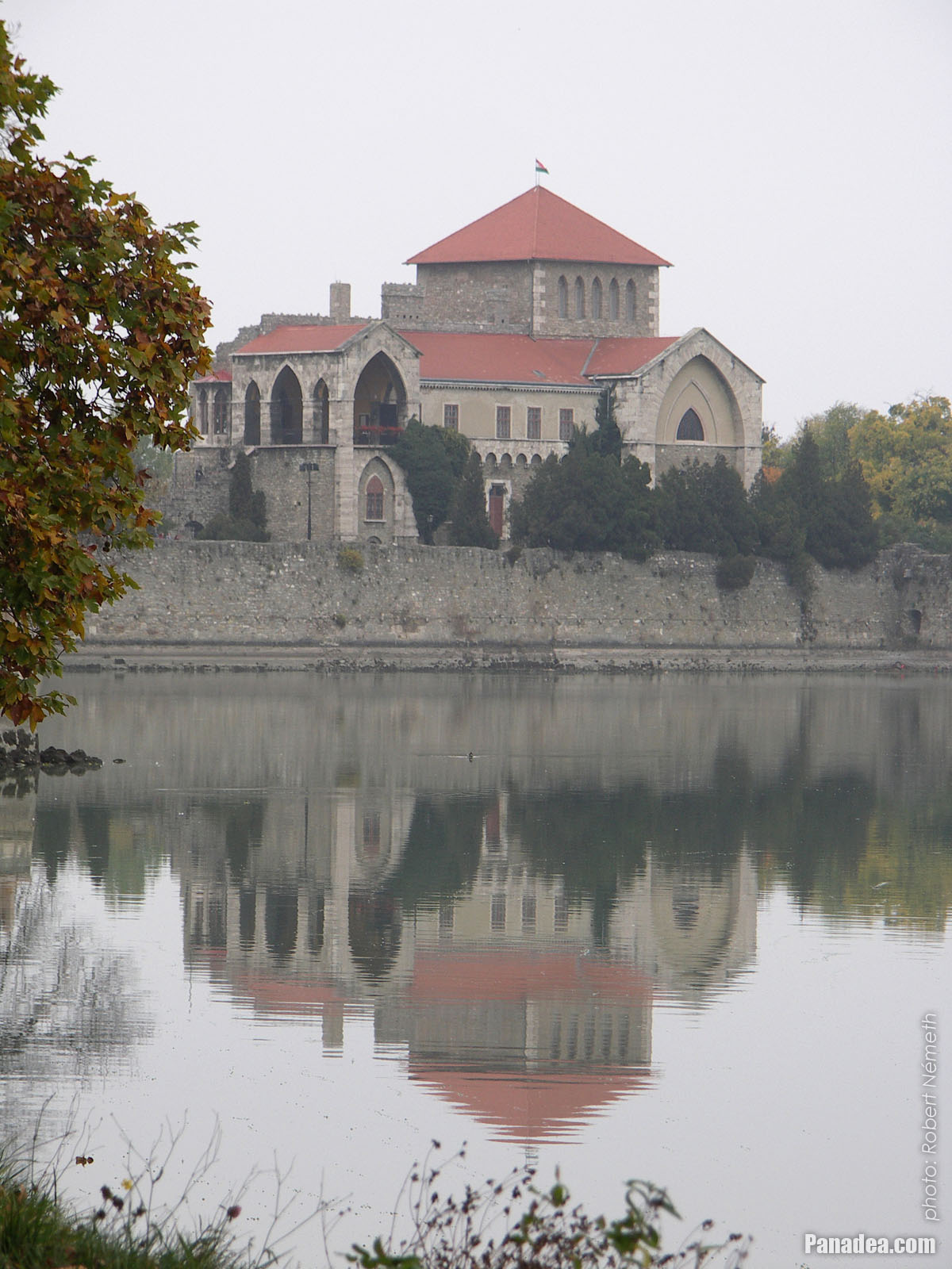
The Castle of Tata at Lake Öreg
In autumn the lake is an important location of mass bird migrations.
Fotoğrafçılığın tarihi: 26/10/20082008
Tarafından yaratılan: Robert Németh
Fotoğraf makinesi model: Konica Minolta Dimage A200
Tata, Macaristan
The Castle of Tata at Lake Öreg - Tata, Macaristan
Resimlerin üzerine tıklayın!
Özellikleri, nitelikleri
Konum:
GPS koordinatları: Enlem 47°38'54", Boylam 18°19'10" (N47 38.9 - E18 19.17)
Bilgileri, kısa hikayeler, İlginç Gerçekler
 The sunny southern side of the Tata Castle
The structure in the central part of the Tata Castle is not a true keep or residental tower, but the modified southern wing of the original rectangular inner castle that had four corner towers. The castle was blown up by the Ottoman troops in 1683. Leopold I, Holy Roman Emperor and King of Hungary ordered to completely destroy this castle together with many other Hungarian fortresses, but this further destruction was avoided thanks to the outbreaking Rákóczi's War of Independence in 1702-1703.
Then the castle was acquired by the Esterházy family who ordered to do major changes to the building in 1755, but mostly the surroundings of the northwestern wall was affected by these modifications (the new gate with a stone bridge over the ditch, the "prison chapel", etc.). There was a fire in the castle in the early-19th century, then in 1815 the remaining parts of buildings were altered and extended in neo-gothic style (gothic revival or romantic style). The most of the upper level of the current "tower" (the "Old tower") was built at that time, including for example the covered terrace, the small rounded closed balcony and the neo-gothic style windows as well.
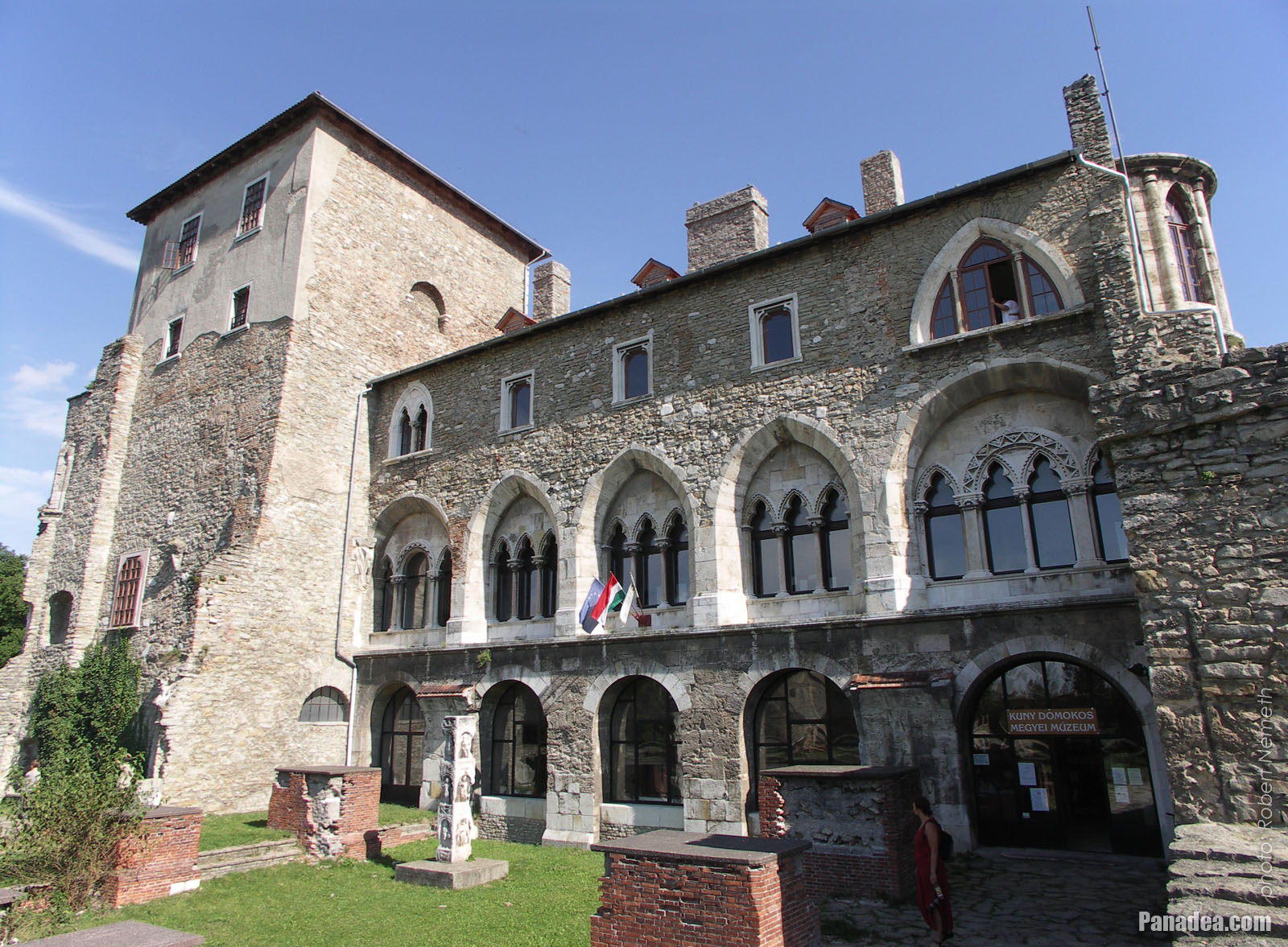 Tower of the Tata Castle (in reality it is the inner castle itself), including the Kuny Domokos County Museum
The remaining and rebuilt inner part of the Tata Castle received its current form at around the turn of the 1800s-1900s. At this time the windows were modified to the current style that reminds to the Italian gothic, as well as there were also some other minor modifications inside the building (e.g. stairs, vaulted ceiling, etc.). The castle remained in the possession of the Esterházy family until 1945, the end of the World War II. The Kuny Domokos Museum is operated in the castle since 1954, among others there is a historical and local history exhibition here, as well as a lapidary (stone collection) of the Roman Age and the Middle Ages. The major archaeological excavations of the castle were begun in 1964, and the monumental restoration works were finished in 1973 (however not fully completed, the exploration of some parts of the building, like for example the ditch, the casemates or the castle wells is yet to come).
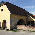
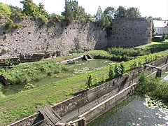
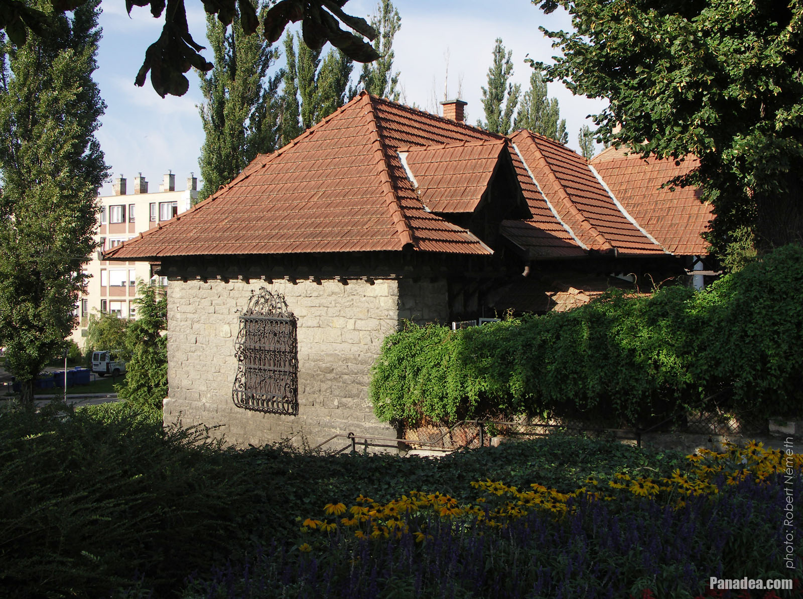
 The water wheel system of the old Cifra water mill
The oldest water mill of Tata town is situated at one of the northern sluices of the Old Lake ("Öreg-tó"), over the stream called "Által-ér". The first written record of the Cifra Mill is from 1587, then it survived the times of the Turkish occupation of Hungary (1541-1699) and in 1753 it was rebuilt in baroque style. It was used normally for grinding until the end of the 1960s. Today (in 2014) the building stands empty and without function.
Until 1938 the border of the two separate villages, Tata and Tóváros (literally "Lake Town") was situated here at the Által-ér ("Által Stream"). At that time these villages were united and the modern Tata settlement was formed, which then received the rank of town in 1954. In 1985 Agostyán village was also annexed to Tata, and today the former villages live in the names of the quarters of the town.
Tata - Daha fazla fotoğraf galerileri:
Şunlar da ilginizi çekebilir (İlgili sayfalar):
Seyahat rehberi noktaları:
Tata (120 resim + 8 panoramik resim)
Komárom-Esztergom megye (county) (703 resim + 10 panoramik resim)
Orta Transdanubia (Közép-Dunántúl) (1 409 resim + 20 panoramik resim)
Macaristan (27 287 resim + 163 panoramik resim)
ve ek olarak:
(burada içinde: Komárom-Esztergom megye)
Komárom (82 resim)
Esztergom (110 resim + 1 panoramik resim)
Tatabánya (275 resim)
Dobogókő (116 resim + 1 panoramik resim)
Her panorama fotoğraf burada:
Tata (8 resim)
Komárom-Esztergom megye (county) (10 resim)
Orta Transdanubia (Közép-Dunántúl) (20 resim)
Macaristan (163 resim)
Avrupa (165 resim)
Her sıradan fotoğraf burada:
Tata (120 resim / 2 galerileri)
Komárom-Esztergom megye (county) (703 resim / 13 galerileri)
Orta Transdanubia (Közép-Dunántúl) (1 409 resim / 31 galerileri)
Macaristan (27 287 resim / 462 galerileri)
Avrupa (30 494 resim / 523 galerileri)
https://www.panadea.com/tr/guidebook/tata/photos/gal-001

Favorilerime ekle Yer imlerine ekle
Arkadaşlarınla paylaş!
v.b.


Bizim seyahat rehberi içerir:
Çok sayıda bilgi ve ilginç gerçekler ile çok sayıda fotoğraflar ve panoramik görüntüler.
- 214 seyahat hedefleri
- 165 panoramik resim
- 30 494 diğer resim
Büyük fotoğraf koleksiyonları: mükemmel kalite, yüksek çözünürlüklü ve doğal renkler
Hakkımızda - Yasal Uyarı & Tekzip Hakkı -
Her hakkı saklıdır
- ©2010-2022
Neuronit Creative Studio - Mogyoród / Budapeşte / Macaristan