
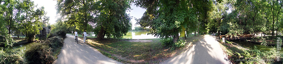
Tata, Lake Cseke
(Optimized for small screen devices)
Click on the image!
Click on the image!
Characteristics, features, properties


You may also be interested in (Related pages):
Destinations, locations in the travel guide:
Tata (120 photos + 8 panoramic images)
Komárom-Esztergom megye (county) (703 photos + 10 panoramic images)
Central Transdanubia (Közép-Dunántúl) (1,409 photos + 20 panoramic images)
Hungary (27,287 photos + 163 panoramic images)
and in addition:
(within here: Komárom-Esztergom megye)
Komárom (82 photos)
Esztergom (110 photos + 1 panoramic images)
Tatabánya (275 photos)
Dobogókő (116 photos + 1 panoramic images)
Every panorama photo here:
Tata (8 photos)
Komárom-Esztergom megye (county) (10 photos)
Central Transdanubia (Közép-Dunántúl) (20 photos)
Hungary (163 photos)
Europe (165 photos)
Every regular photo here:
Tata (120 photos / 2 galleries)
Komárom-Esztergom megye (county) (703 photos / 13 galleries)
Central Transdanubia (Közép-Dunántúl) (1,409 photos / 31 galleries)
Hungary (27,287 photos / 462 galleries)
Europe (30,494 photos / 523 galleries)
https://www.panadea.com/en/guidebook/tata/panorama/pano-20110

Add to Favorites Add to Bookmarks
Share with your friends!
etc.


Our travel guide contains:
Plenty of photos and panoramic images, with a lot of information and interesting facts.
- 214 travel destinations
- 165 panoramic images
- 30,494 other photos
Big collection of selected photos: excellent quality, high resolution and natural colors
About us - Legal notice & Disclaimer -
All rights reserved
- ©2010-2022
Neuronit Creative Studio - Mogyoród / Budapest / Hungary