
(Ottimizzata per dispositivi di piccolo schermo)
The surroundings of the Baradla Cave - Jósvafő, Ungheria
Quando si fa clic:
Clicca sulle immagini!
-

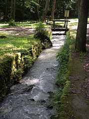
Small wooden footbridge over the Jósva Stream, close to its source
Data di fotografia: 21/05/20062006
Creato da: Robert Németh
Modello di fotocamera: Konica Minolta Dimage A200
Jósvafő, Ungheria
-
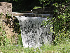
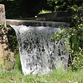
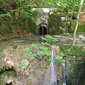
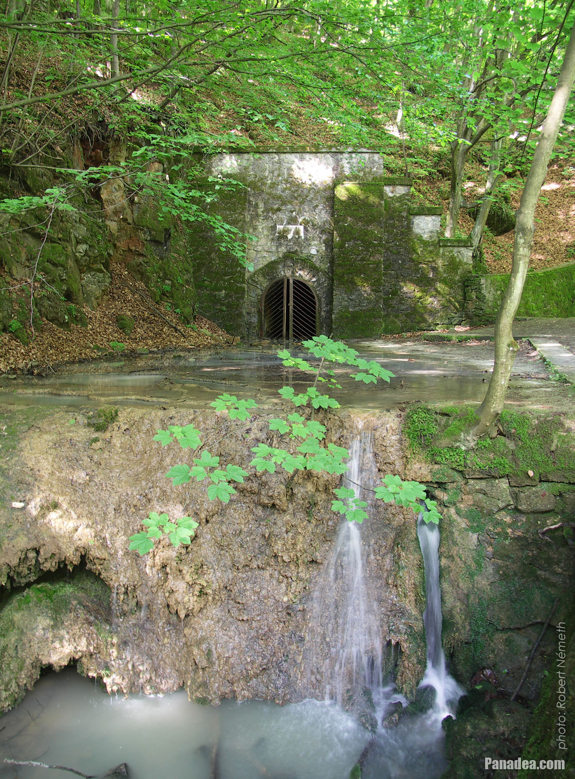
Artificial waterfall
Data di fotografia: 21/05/20062006
Creato da: Robert Németh
Modello di fotocamera: Konica Minolta Dimage A200
Jósvafő, Ungheria
-
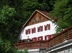
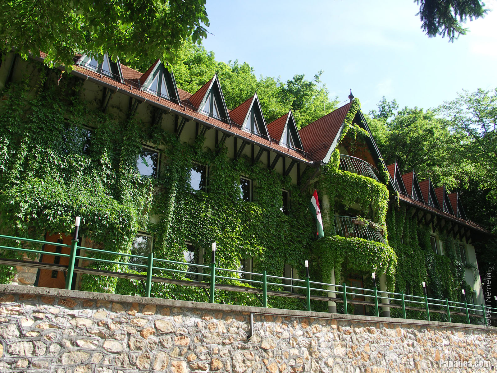
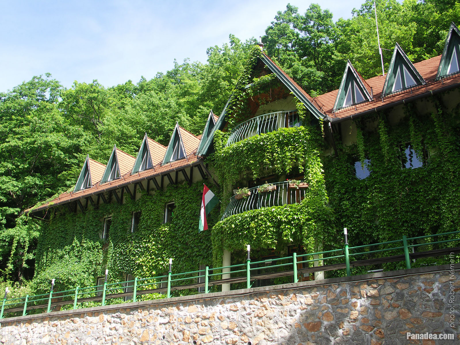
Tengerszem Hotel and Education Center, built in the 1930s
Data di fotografia: 21/05/20062006
Creato da: Robert Németh
Modello di fotocamera: Konica Minolta Dimage A200
Jósvafő, Ungheria
-
The Jósvafő entrance of the Baradla Cave System (also known as the Dripstone Cave of Aggtelek)
Data di fotografia: 21/05/20062006
Creato da: Robert Németh
Modello di fotocamera: Konica Minolta Dimage A200
Jósvafő, Ungheria
-

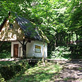
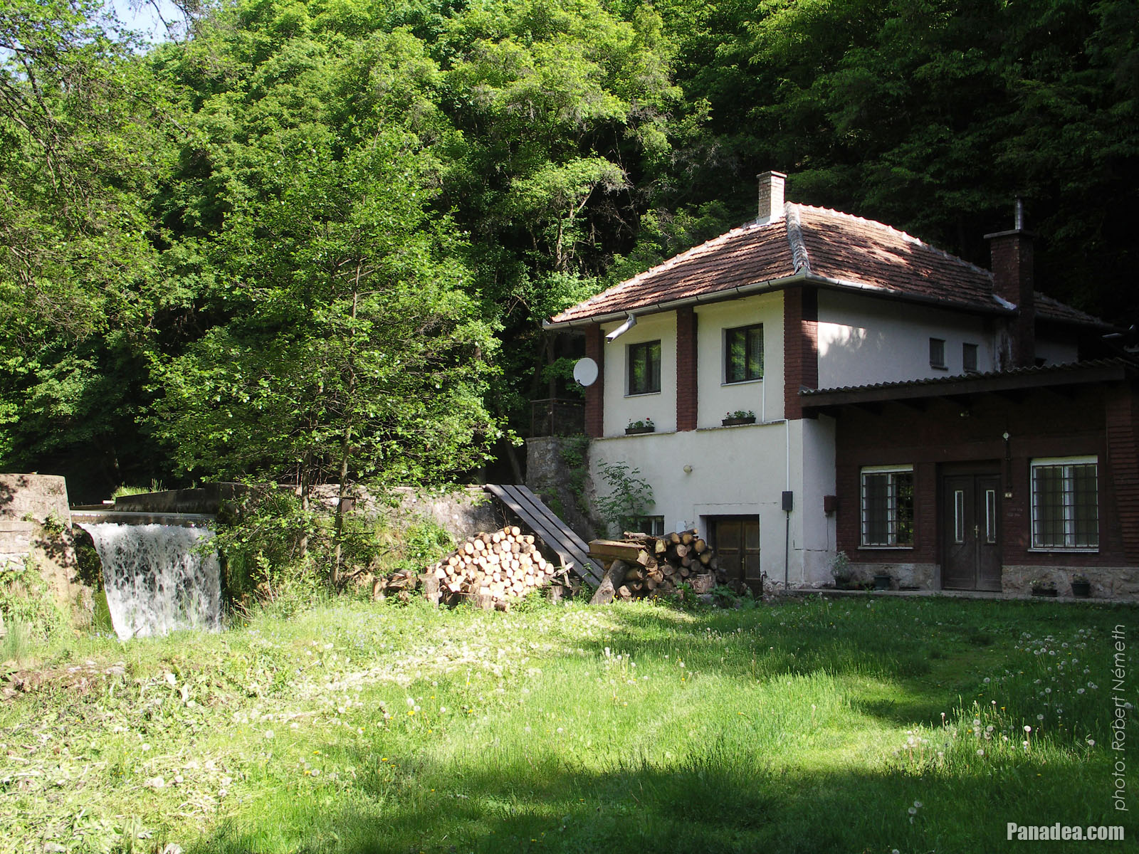
The so-called Forrás House ("Spring House")
Data di fotografia: 21/05/20062006
Creato da: Robert Németh
Modello di fotocamera: Konica Minolta Dimage A200
Jósvafő, Ungheria
-

The entrance of the Baradla Cave, and on the right it is the Kessle Hubert Memorial House
Data di fotografia: 21/05/20062006
Creato da: Robert Németh
Modello di fotocamera: Konica Minolta Dimage A200
Jósvafő, Ungheria
-

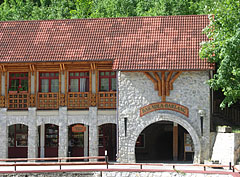
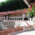
The reception building of the Baradla Cave (Aggtelek Cave) at Jósvafő, viewed from the terrace of the Tengerszem Restaurant
Data di fotografia: 21/05/20062006
Creato da: Robert Németh
Modello di fotocamera: Konica Minolta Dimage A200
Jósvafő, Ungheria
-

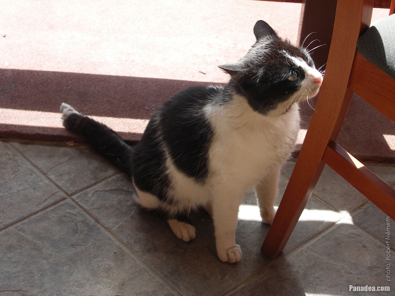
A cat is rubbing to the chair leg on the terrace of Tengerszem Restaurant
Data di fotografia: 21/05/20062006
Creato da: Robert Németh
Modello di fotocamera: Konica Minolta Dimage A200
Jósvafő, Ungheria
-

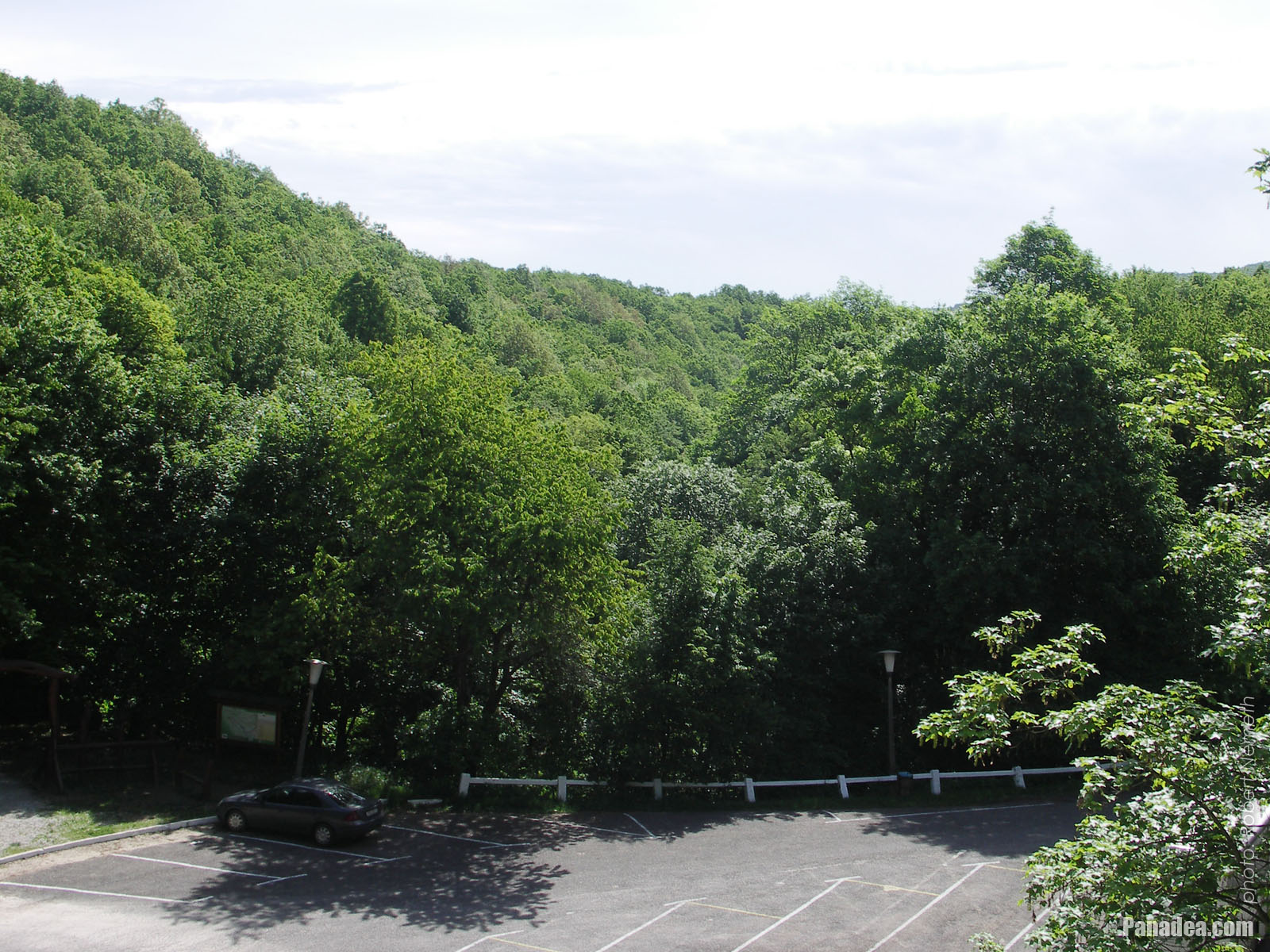
Parking lot in the valley
Data di fotografia: 21/05/20062006
Creato da: Robert Németh
Modello di fotocamera: Konica Minolta Dimage A200
Jósvafő, Ungheria
-

A building of the Aggtelek National Park
Data di fotografia: 21/05/20062006
Creato da: Robert Németh
Modello di fotocamera: Konica Minolta Dimage A200
Jósvafő, Ungheria
-
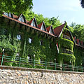
Aggtelek National Park, Jósvafő headquarters building
Data di fotografia: 21/05/20062006
Creato da: Robert Németh
Modello di fotocamera: Konica Minolta Dimage A200
Jósvafő, Ungheria
Aggtelek National Park, Jósvafő headquarters building - Jósvafő, Ungheria -
The section of the Jósva Stream after the Tengerszem Lake
Data di fotografia: 21/05/20062006
Creato da: Robert Németh
Modello di fotocamera: Konica Minolta Dimage A200
Jósvafő, Ungheria
The section of the Jósva Stream after the Tengerszem Lake - Jósvafő, Ungheria -
Small field with a waterfall at the Tengerszem Lake
In the house on the right there was a power generator hydro turbine, built to serve the illumination of the Baradla Cave for a while.
Data di fotografia: 21/05/20062006
Creato da: Robert Németh
Modello di fotocamera: Konica Minolta Dimage A200
Jósvafő, Ungheria
Small field with a waterfall at the Tengerszem Lake - Jósvafő, Ungheria -
Tengerszem Lake
The lake was created in 1935 by building a dam on the Jósva Stream. The main purpose was to produce electricity for illuminating the Baradla Cave.
Data di fotografia: 21/05/20062006
Creato da: Robert Németh
Modello di fotocamera: Konica Minolta Dimage A200
Jósvafő, Ungheria
Tengerszem Lake - Jósvafő, Ungheria -
Here the Jósva Stream is between stone walls and creek bed
Data di fotografia: 21/05/20062006
Creato da: Robert Németh
Modello di fotocamera: Konica Minolta Dimage A200
Jósvafő, Ungheria
Here the Jósva Stream is between stone walls and creek bed - Jósvafő, Ungheria -
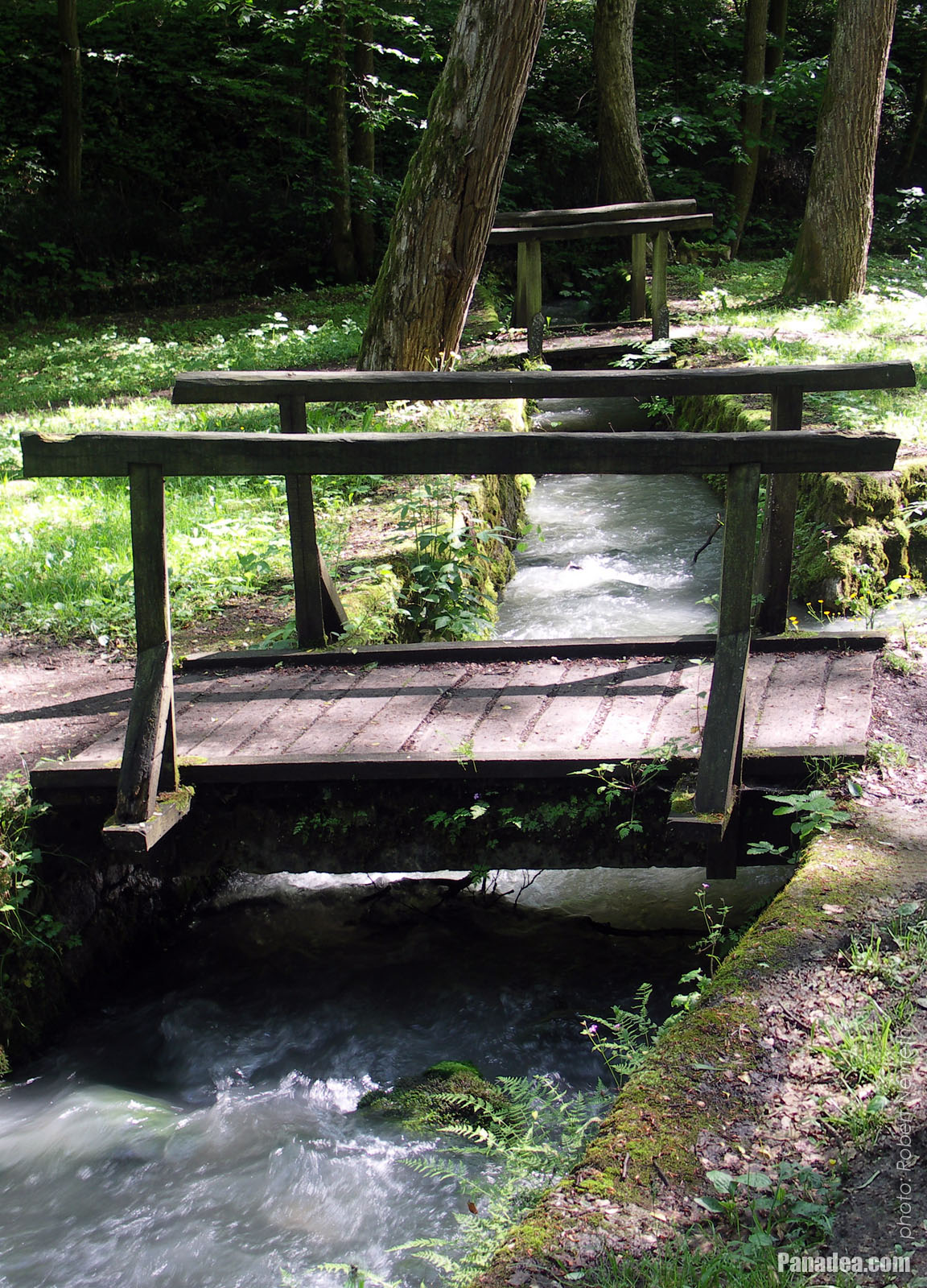
Small wooden bridges cross the flowing water
Data di fotografia: 21/05/20062006
Creato da: Robert Németh
Modello di fotocamera: Konica Minolta Dimage A200
Jósvafő, Ungheria
Small wooden bridges cross the flowing water - Jósvafő, Ungheria -
One of the two sources of the Jósva Stream: the Táró Spring
Data di fotografia: 21/05/20062006
Creato da: Robert Németh
Modello di fotocamera: Konica Minolta Dimage A200
Jósvafő, Ungheria
One of the two sources of the Jósva Stream: the Táró Spring - Jósvafő, Ungheria -
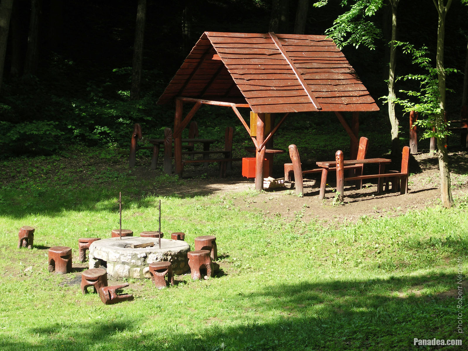
Picnic site with wooden seats, rain shelter and of course with open fireplace
Data di fotografia: 21/05/20062006
Creato da: Robert Németh
Modello di fotocamera: Konica Minolta Dimage A200
Jósvafő, Ungheria
Picnic site with wooden seats, rain shelter and of course with open fireplace - Jósvafő, Ungheria -
Small playground, jungle gym made of tree trunks, with slide and swing seat
Data di fotografia: 21/05/20062006
Creato da: Robert Németh
Modello di fotocamera: Konica Minolta Dimage A200
Jósvafő, Ungheria
Small playground, jungle gym made of tree trunks, with slide and swing seat - Jósvafő, Ungheria -
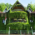
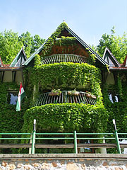
The Jósvafő headquarters building of Aggtelek National Park is almost fulli overgrown by wild grapes
Data di fotografia: 21/05/20062006
Creato da: Robert Németh
Modello di fotocamera: Konica Minolta Dimage A200
Jósvafő, Ungheria
The Jósvafő headquarters building of Aggtelek National Park is almost fulli overgrown by wild grapes - Jósvafő, Ungheria


Clicca sulle immagini!
Caratteristiche, proprietà
Posizione:
Coordinate GPS: Latitudine 48°29'3", Longitudine 20°32'24" (N48 29.05 - E20 32.4)
Informazioni, racconti brevi, fatti interessanti
 Here the Jósva Stream is between stone walls and creek bed
The Jósva Spring has the highest water discharge in the present Hungary among the cold water springs. Its water comes from the lower caves of the Baradla Cave System, as well as from the infiltration of rainwater on the surrounding karst fields. Mostly because of the latter the water discharge is varying: usually it is between 70 and 8,000 liters/second, but sometimes it is the record high 20,000 liters/second (for example in 1955). The drainage basin (or catchment area) doesn't care the country borders and deeply extends to Slovakia, too. The same is true for the Baradla Cave System as well, which has a 5-kilometer-long branch in the neighbouring country: it is the Domica Cave that is famous of its beautiful dripstone formations, the cave entrance is near Kečovo (in Hungarian Kecső) village.
 One of the two sources of the Jósva Stream: the Táró Spring
The way of the Jósva Stream on the surface begins very interestingly. It has not just one, but two sources, and on top of that just about 10 meters distance from each other. So the Jósva Stream begins with two different sources, namely the Táró Spring and the Medence Spring. It was explored just about half a century ago that the two springs belongs to two separated water systems. These have no any connection to the other, at least before the Jósva Springs.
Jósvafő - Altre gallerie fotografiche:
Potreste anche essere interessati a (Pagine correlate):
Destinazioni, località in la guida turistica:
Jósvafő (46 foto)
Aggteleki karszt (134 foto)
Parco nazionale di Aggtelek (134 foto)
Borsod-Abaúj-Zemplén megye (county) (1 088 foto + 7 fotografie panoramiche)
Ungheria del Nord (2 817 foto + 17 fotografie panoramiche)
Ungheria (27 287 foto + 163 fotografie panoramiche)
e in aggiunta:
(entro qui: Ungheria del Nord e Borsod-Abaúj-Zemplén megye e Parco nazionale di Aggtelek e Aggteleki karszt)
Monti Mátra (288 foto)
Aggteleki karszt (134 foto)
Monti Zemplén (270 foto + 2 fotografie panoramiche)
Parco nazionale di Bükk (387 foto + 4 fotografie panoramiche)
Parco nazionale di Aggtelek (134 foto)
Aggteleki karszt (134 foto)
Monti Zemplén (270 foto + 2 fotografie panoramiche)
Parco nazionale di Bükk (387 foto + 4 fotografie panoramiche)
Parco nazionale di Aggtelek (134 foto)
Aggteleki karszt (134 foto)
Miskolc (307 foto + 3 fotografie panoramiche)
Eger (239 foto + 8 fotografie panoramiche)
Salgótarján (449 foto)
Miskolc (307 foto + 3 fotografie panoramiche)
Demjén (251 foto)
Egerszalók
Hollókő (41 foto)
Ipolytarnóc (114 foto)
Olaszliszka (13 foto)
Tolcsva (8 foto)
Füzér (46 foto)
Háromhuta (95 foto)
Komlóska (26 foto)
Regéc
Hatvan (58 foto)
Szécsény (93 foto)
Sárospatak (59 foto + 2 fotografie panoramiche)
Sátoraljaújhely (23 foto)
Szerencs (168 foto)
Tokaj (209 foto)
Bánkút (57 foto)
Lillafüred (137 foto)
Ómassa (54 foto)
Ogni foto panoramica a:
Jósvafő ( foto)
Borsod-Abaúj-Zemplén megye (county) (7 foto)
Ungheria del Nord (17 foto)
Ungheria (163 foto)
Europa (165 foto)
Tutte le foto normali a:
Jósvafő (46 foto / 2 gallerie)
Aggteleki karszt (134 foto / 3 gallerie)
Parco nazionale di Aggtelek (134 foto / 3 gallerie)
Borsod-Abaúj-Zemplén megye (county) (1 088 foto / 26 gallerie)
Ungheria del Nord (2 817 foto / 58 gallerie)
Ungheria (27 287 foto / 462 gallerie)
Europa (30 494 foto / 523 gallerie)
https://www.panadea.com/it/guidebook/josvafo/photos/gal-001

Aggiungi ai Preferiti Aggiungi ai Segnalibri
Condividi con i tuoi amici!
ecc.


Nostra guida turistica contiene:
Numerose foto e le immagini panoramiche, con un sacco di informazioni e fatti interessanti.
- 214 destinazioni di viaggio
- 165 fotografie panoramiche
- 30 494 altre foto
Grande collezione di foto selezionate: ottima qualità, alta risoluzione e colori naturali
Chi siamo - Avviso legale & Dichiarazione liberatoria -
Tutti i diritti riservati
- ©2010-2022
Neuronit Creative Studio - Mogyoród / Budapest / Ungheria